I just completed another journey on the Lewis & Clark trail. A journey filled with hooligans, storms, washouts, and all things cycling. Check it out at: TwoWheelPhilosophizing.wordpress.com

I just completed another journey on the Lewis & Clark trail. A journey filled with hooligans, storms, washouts, and all things cycling. Check it out at: TwoWheelPhilosophizing.wordpress.com
Thirty Days Later…
It has been a month since I traded in my touring bike for my car, my tent for my house, and my wanderlust for reality. I have spent time this month assess the journey, trying to put into words what I learned about myself and what this journey has added to my life and would like to share those thoughts with you.
History: I was enamored with the history in Virginia and Kentucky. To see the open fields where the Revolutionary and Civil Wars were fought, knowing that thousands died on those very fields for a cause they believed in was powerful and sorrowful. Crossing the country I felt pain for the indigenous tribes that were slaughtered or ripped from their mother earth and culture in the name of Manifest Destiny.
In addition, I was in awe of pioneer history; the men, women, and children that scratched their way across thousands of miles on foot, in wagons, on horseback, or pushing hand carts to create a better life for themselves, something people continue to do to this day.
Crossing the country I know my heart belongs to the west and felt “at home” in Colorado. I enjoyed reading the historical road signs about the Native Americans of the area, the early trappers, and could only gain a small understanding of what the early explorers and settlers felt observing the cathedral mountains with eagles flying overhead.
Physical: Climbing hills for miles, the incessant headwinds, long hours in the saddle, humidity, bug bites, and exhaustion were ever-present, but do-able. There were a handful of times, especially in the Appalachians that I had to dig-deep past the aching legs, past the tears that wanted to form in my eyes when I had hit my physical limits. In these moments I had to move past the pain and exhaustion, laugh out loud and mutter, “Are you going to stop, or are you going to find it within yourself to get up this damn hill?” There were times I had to get off my “steed” and walk when the grades rose past 16%. I did climb a 17% once when I found myself committed to the hill and there was no way to get off without rolling backwards. There were some grades that were over 20% and I would often quip, “Really? Hasn’t anyone heard of dynamite?” And believe me, it is an arduous task to push a 30 pound touring bike loaded with 50 pounds of gear up that kind of grade.
When faced with these challenges I always chose to move forward and in doing so, found that victory truly does taste sweet. From this I learned I am a “fighter”, I guess I have always been. Life experiences have taught me that if change is going to occur, it has to come from me and no one else. There is harshness to that statement, but for me, it holds true.
Bugs: I am surprised I did not contract West Nile Virus. We had mosquitoes from Virginia to Montana. The vicious little monsters showed no mercy and bit through Deet, herbal repellents, and didn’t seem to care if Bounce sheet were flapping in the breeze from the waistband of one’s shorts. I don’t know how the indigenous population handled mosquitos. Someone recently told me that some tribes used a formula made from cattails. Rest assured, there is a reason I live on the west coast, no humidity and fewer bugs.
Gear: I sent approximately 5 lbs of gear home, things I was not using consistently, or had no use for after we got over the Rockies such as cold weather gear (booties, gloves). All-in-all I think I packed well. The 1 lb 12 oz chair was used but could have done without. Food was heavy to carry but generally carried food and snacks for a couple of days. I brought 2 lightweight pans for cooking but one would have been sufficient as I found I cooked and ate out of the same pot. I packed the right amount of clothing and stayed warm most nights. When it was cold I layered up. My netbook computer and plethora of cords added some weight but one does need to stay connected. There is a fine line between carrying enough gear to be comfortable on the road and being a minimalist. There is a middle ground and every touring cyclist must find it.
Pondering: Riding 8-10 hours a day one does think about one’s life. I pondered where I am in mine, and where I want to go. Most often I engaged with the environment, the beauty as well as the harshness of the physical world. I recall the turtle I was attempting to save on the road when a motorist ran it over. Life is fragile, especially for turtles it seems, and for people. Living with purpose each day is hard to do, but something to strive for. I found it pretty easy, maybe too easy, to forget about “real life” as my focus was on the basics, food, shelter, and riding.
People: We had numerous trail angels along our way which restored my faith that there is still some altruistic behavior in the world which reminded me to work on my altruistic skills that have hardened over time. Interestingly, I found people in the east showed more interest in where we were going, how our bikes were set up, our journey, and our ongoing travels. Are west coasters less interested in others? Who knows, I certainly can’t draw any real conclusions, but I thought it was an interesting observation.
Exercise: I found many seniors were amazed that I would be riding across the country at “my age”. I often heard, “I could never do that”. When I asked what they did to keep fit, this is where things tended to unravel. Many people shared they had tried this or that exercise but “it hurt”, or “I got tired so I stopped”. Sometimes I would ask, “What’s the alternative?” People could see the logic in my question, but did not necessarily have an answer. For many there seemed to be a real disconnect between the lack of movement (exercise) now, and how it will affect them in the months or years to come as loss of muscle tone leads to falls, and falls lead to walkers and wheelchairs.
Camaraderie– There is a camaraderie among cyclists. There is a “code of the road”. Cyclists help each other out, share stories, are interested in the challenges and the rewards of cycling, will invite one to dinner, buy them a meal, put a cyclist up for the night, and wish them well on their journey. I never felt afraid on the road and never felt threatened. I worried more about cars, coal trucks, bears, or the badger that scared me as much as I scared him when we encountered each other on the road. Occasionally people would ask, “Aren’t you afraid to travel by yourselves”? My reply was always, “No”.
Environment: Respect for the natural world. Crossing the country by bike one is able to become one with the environment; feel the wind and rain, shiver in the dampness, try to out run the predators (bugs and dogs), observe the critters in their natural habitat, and morn the critters that fell to cars and trucks only to be picked clean by buzzards or bleached by the sun leaving only bones to remind the observer of their previous existence. As I journeyed I found myself seeking and gathering artifacts from the natural world, symbols of my accomplishments and geographical location. I gathered feathers, a hawk’s talon, a few small token pebbles, and a goat skull. In the natural world, these are the only symbols available, and they all carry meaning for me. Through this gathering I was better able to understand an aspect of Native culture and the adornment of feathers, and other symbols of the natural world.
Food: I was able to remain gluten-free without much trouble. My main shopping list when we hit a town with a full grocery store was: nuts, bananas, GF crackers, dried cranberries, corn tortillas, canned clams, salmon, or tuna, peanut butter, rice noodles, dried soup. On the road I could not resist: soft-serve ice cream and root beer. I brought my own stash of vitamins and herbal supplements to fill in the cracks.
I had more difficulty when we ate out. Breakfasts were easy as I could have an omelet and hash browns. Lunches were nearly impossible as most everything was red meat on a bun. I found traveling through the East and Midwest “gluten-free” was either unheard of or misunderstood. I eventually gave up telling the order takers I was “gluten-free” as many did not know what that meant so I began to say, “I was allergic to wheat”. That too had its problems as waitresses would often respond, “We have sourdough or white”. Some would think about it for a few seconds and make the realization that it still all comes from wheat. For others, the realization never came. One day Lisa said, “Maybe when you order you should just say, “I’m allergic to toast”. It wasn’t until we made our way to a restaurant in Yellowstone that we found a menu that had gluten-free and vegan items. It felt like home!
Weight loss: I lost 12 pounds and a whole clothing size. I am working hard not to gain it back; so far, so good. I have also developed great muscle tone which I am also trying to maintain by continuing to bike until winter hits. I am also back to running and swimming which is my “drug of choice” during the low-light winter months to keep melancholy at bay. I am still cycling 2-3 days a week and am enjoying my light weight road bike.
Diverting to Spokane– It was a tough call to divert to Spokane rather than continuing on to Oregon, but we simply ran out of time to make it there by our pick up date. I wrestled with that reality for a while, but came to terms with it. I have had people ask, “Will you finish it next year?” The answer is, no. To “finish” the trip would suggest the journey was incomplete and I want to see the journey as complete rather than lacking in some way. Yorktown, VA to Spokane, WA included 10 states and I rode 3,065 miles. I am good with that. In addition, I have ridden eastern Oregon and the Oregon coast before so I am not missing anything there. My focus is now on the next journey.
Returning Home: As you know from the last blog entry Lisa was bit by a dog on our last day out of Newport, WA. She is fully recovered and her tattoo is intact. It was bitter-sweet riding the last miles back to my house. I pulled up to my front door like I have done so many times before with my bike. I was greeted by my “abandoned” cat that was so very glad to see me and instantly forgave my absence. She continues to be “lovey” which was not her previous disposition. I guess time changes people, and cats. Driving my car for the first time in 3 months felt odd and fast even at 25 mph since my average speed most days was 8-9 mph. It was also very nice to sleep in a real bed, have food readily available in the fridge, hot water on demand, and a washer and dryer. As for TV, we rarely watched any for 3 months even when available in a hotel room. I have since gone “cable-free”.
Interestingly, about a week after my return we had a severe windstorm blow through my neighborhood which knocked down pine trees crushing some cars, roofs, and snapped some trees in half. Many homes were without power. I had no power for 2.5 days but was glad I had my solar panel (charging my phone), headlamp, and camping stove. So there I was, camping in my house. The following week another storm blew through and I lost power for 1.5 days. Fortunately, the large pine tree in my front yard kept its feet on the ground, and I had no damage.
The Worst Things on the Journey: mosquitos, humidity, ticks, steep grades, hills after hill, after hill in the Appalachians, chasing dogs, bad drivers, truckers that don’t like cyclists.
The Best Things: Generosity of strangers, Yellowstone, the Tetons, visiting the retirement communities, trail angels, cycling hostels, historic buildings and cabins, the mountains and crystal streams in the west, courteous drivers and truckers, antelope, bears (at a distance), cows with personality, thunderstorms, cloud formations, lush green hills, honeysuckle, historic towns, Wind River Reservation, Adventure Cycling headquarter (Missoula, MT), Newton Bike Shop (KS), Native American and Civil War history, pioneer history, Cave-in-Rock, and the beauty of the American landscape.
Philosophizing: Many have told me they enjoyed my “philosophizing”, I in turn enjoyed sharing with you some of my thoughts and perspectives. If I had my way I would retire now and spend my days traveling and philosophizing.
Thank you for following: Throughout my journey I knew you were out there, following along with me, laughing with me, feeling my pain, wondering where I was or if I was safe when I “disappeared” from the blog. My disappearances were mostly due to the lack of internet or the lack of time to get an entry posted before my weary body demanded sleep. Thank you for sharing this journey with me, I truly felt surrounded by friends.
What’s Next: I already miss “the road” and am thinking about the Northern Tier in 2016. If I can’t find someone to journey with, I would have no qualms doing it alone. I will most likely start a new blog to let you know of current and future adventures so check back and I will post the new blog title and address, and yes, there will be more “philosophizing”.
“Journeys never end, they just take a new direction”- Melinda
STATS
Miles: 40.28
Calories: 2,960
Top speed: 23.4
Average speed: 11.1
Elevation: 1,774
TOTAL MILES: 3,065 (Yorktown, Va to Spokane, WA)

The day began early for me, perhaps it was anxiety, eagerness, or it was that damn bird chirping its head off at 4:30am! Unable to sleep I climbed out of my tent at 5am. Later, Jodee said she was surprised to see me up at that hour. That is true I was never the first one up. But today, I was the early bird due to the “early bird’s” big mouth.
I put water on to boil for coffee, grabbed my sleeping bag from my tent and wrapped it around me as there was a chill in the air. It dragged on the ground but I didn’t care, it would be in the washer by evening. That thought started the process of adjusting to the idea that this was it, the last day of an 11 week journey. It didn’t feel like 11 weeks, maybe half that time.
Jodee stirred and came out from her tent, then Lisa who generally was up before me. We drank our coffee and waited for the caffeine to take effect. None of us seemed to be ready to pack up, end the journey, except maybe Jodee who was ready, I think, to get back home and into a real bed by evening.
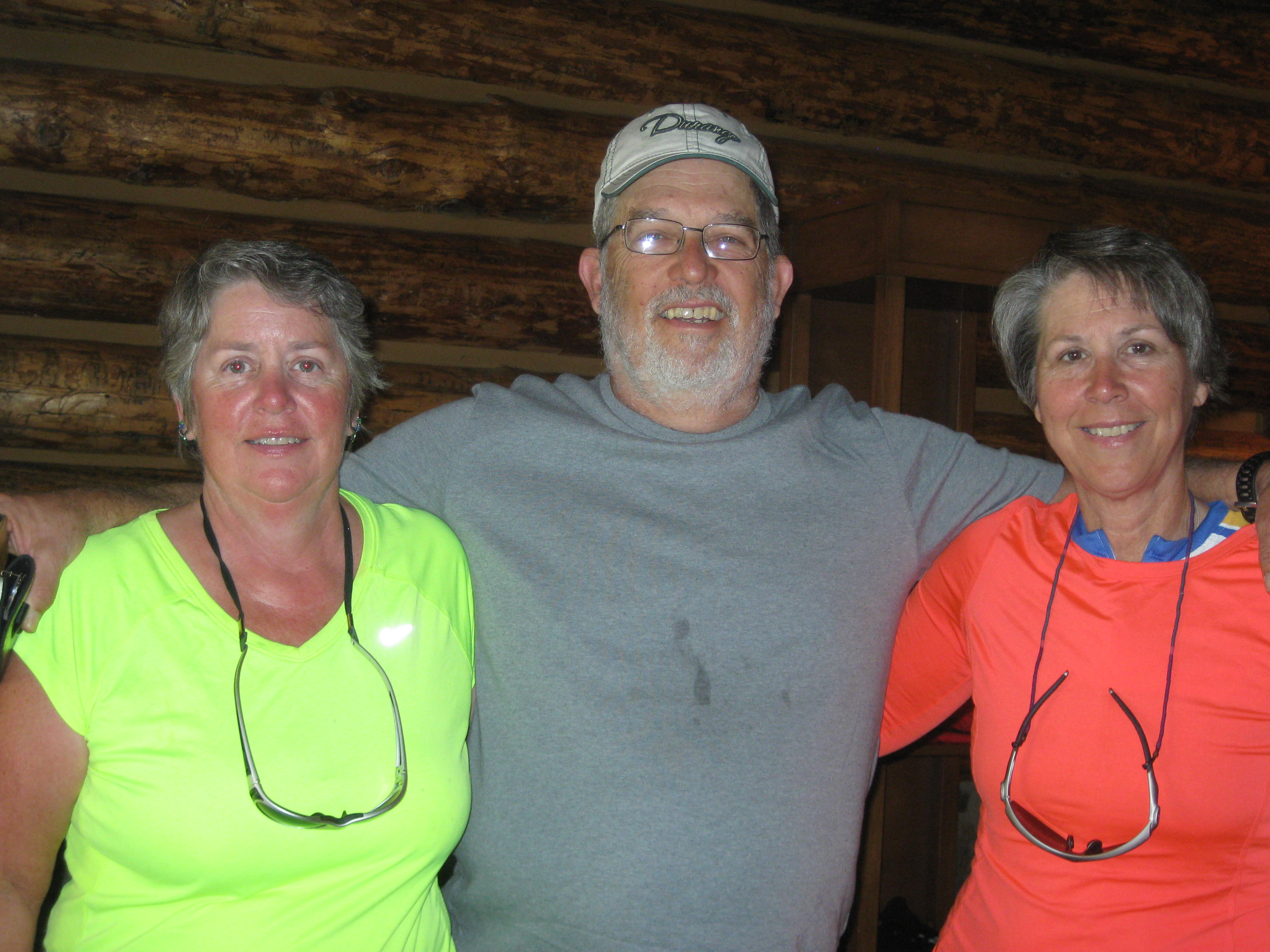
Eventually we could not postpone the inevitable and for the last time, broke camp. Jodee took our picture as we got ready to leave.

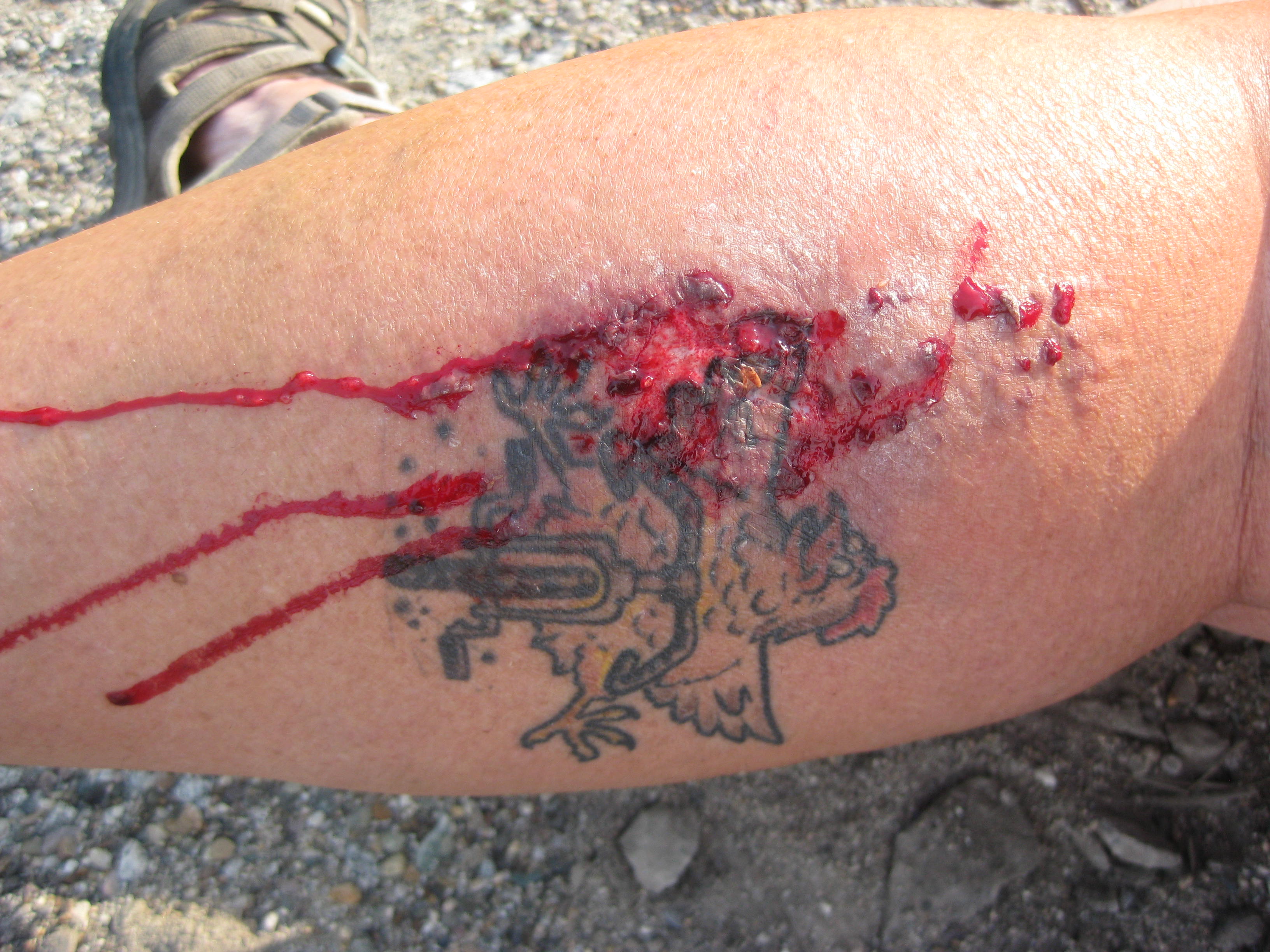
When completing a journey such as this one wants to have a memorial last day. I think we did that as 4 miles out of Newport heading west on Hwy 2 two large dogs bolted from a driveway, ran across the highway and began chasing us down the road. The normal protocol is to ride fast and hope the dogs give up the chase. These dogs were not giving up that easy. I was about 30 feet in front of Lisa and the dogs appeared to give up on me but Lisa was not so lucky. The dogs surrounded her, then I heard, “Help! He bit me!! After the dog (a pit-bull mix) took his flesh, both dogs retreated back to their yard.
We got off our bikes to assess the damage. Lisa was shaky so told her to sit down.
Note: I have posted a picture of her wound below my sign off. If you are squeamish don’t scroll down, if you want to see it, scroll away.
The wound was bleeding heavily especially from the puncture wound, and the dog nailed her right on her “bikerhen” tattoo. I pulled out my first-aid kit and applied a large pad so Lisa could apply pressure. Then I called 911.
“We are two cyclists heading west on Hwy 2 and one of us was just bitten by a dog”.
Do you need an ambulance?
“No, but we need to make a report”
“A Sheriff will be dispatched”
I called Jodee but she didn’t pick up. In the meantime, Lisa called her husband, told him what had happened and that Jodee would be giving her a ride to Urgent Care . I tried Jodee again and got her on the line. I explained the situation and she stated she would be there in a flash.
A Sheriff’s car pulled up, “You two OK”? We explained about the dogs and within a minute the dispatched Sheriff also pulled up. He got out and took a picture of Lisa’s leg and we began to fill out an incident report. The other Sheriff went to the house with the dogs. Shortly the man at the house came over. He felt horrible about the situation and related that the dog that did the biting was not even his dog, it was his daughter’s dog and he was dog sitting while she moved into a 4-plex. I kindly expressed my opinion, “This dog attacked. He was unprovoked, he now has a history as a biter, and your daughter is going to take this dog to a 4-plex where children will most likely be? Bad idea!
The Sheriff reported the man was given 2 citation regarding the dogs, and the dogs would be quarantined for 30 days.
(I guess I can sit back and see if Lisa gets rabies…ha! Then I’ll have to “put her down”).
Jodee arrived and couldn’t believe this had happened on our last day and the last 40 miles. Jodee and I joked about the saying of being chased by a bear, “one only has to be faster than the last person”- I think I did that!
We loaded Lisa and her bike in Jodee’s car and off they went to Urgent Care. I asked the remaining Sheriff if he needed me for anything else, “No, you’re still going to ride after all this? Hummm, how do I explain this. “Yes, I’m going to ride. I have ridden over 3,00o miles across the country, I’m on my last day, I’m riding home“. He smiled, “Well, be careful“.
The Sheriff drove away and there I was alone on the Hwy ready to complete this journey. The shoulder was wide but like most highways littered with glass, debris, and gravel. I hoped my tire would make it as this was the tire that had been seriously punctured by glass in Pueblo, Co and had a candy wrapper as a boot. “Come on tire, just 35 miles, I know you got it in ya“.
I was enjoying my ride and realized I was getting pretty close to Lisa’s house when I felt it. The rear of the bike felt sluggish. I stopped and looked at the tire, “NOOOOOO!”, as I watched it deflate before my eyes. “Oh, come on, really?” I stood there for a while taking it all in then started to shed my gear so I could change the tire, then I realized. “Oh no, Lisa had the spare tube, now what?” I texted Jodee to see if she could bring me a new tube. Within minutes I see Jodee waving at me on a side street down the road. She may be quick, but not that quick! I wheeled the bike to the side road and discovered that she was all ready on her way to check on me and had instinctively brought a tube with her. Grateful for her presence I began to shed my gear again to change the tube. However, this tire was so compromised I feared I would change the tube and get another flat if I didn’t take a close look at the cause. While it is against my nature to take a ride, I packed my bike into Jodee’s car and we drove the 8 miles to Lisa’s house. Arriving at Lisa’s I was greeted with a sign on the garage done by her daughter and husband.

Lisa, bandaged, hobbled out of the house and we both took a very close look at the tire. Finally, we found it, a tiny piece of amber glass (someone’s discarded beer bottle) that had barely punctured the kevlar lining. I put in the new tube and loaded my gear back on the bike. I said my goodbyes to Lisa and Jodee and headed home to complete this journey. “Ok tire, just 10 miles, don’t fail me“.
The ride was bitter-sweet as I rode along arterials and then through neighborhoods I had not seen in nearly 3-months. Blocks from home a tear came to my eye knowing I had completed over 3,00o miles. I was proud of my accomplishments, proud of my riding, grateful to have Jodee as a friend who began the journey with us and had our backs since Yellowstone, and grateful I was able to do this ride with my sister Lisa; for as we live out our lives we will always have this journey to talk about, laugh about, and reminisce.
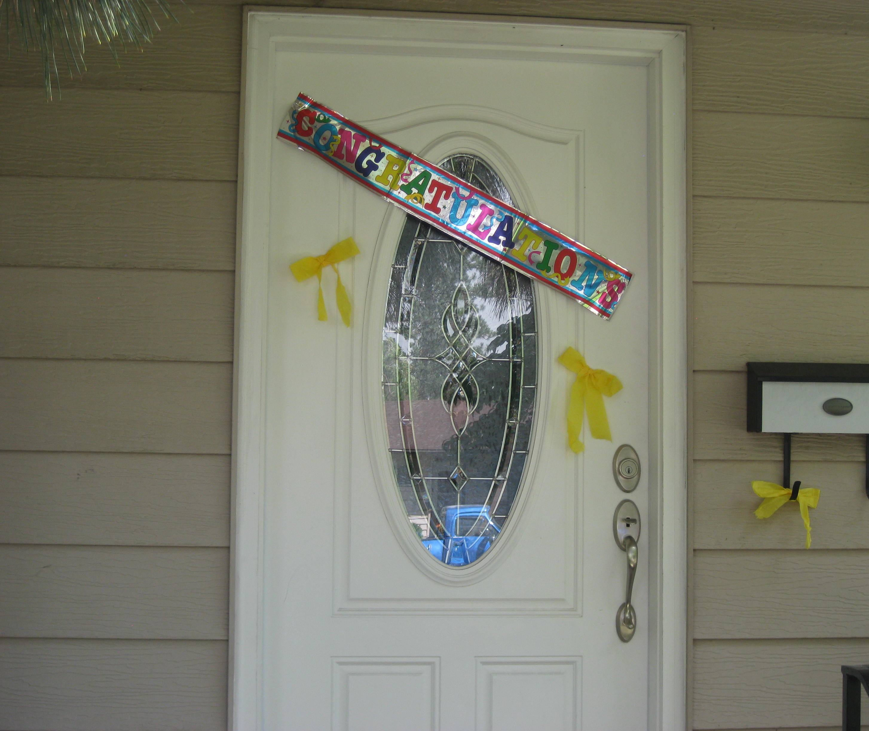
I turned down my block and was greeted with my house decorated with yellow ribbons and signs of congratulations thanks to my neighbor Karrie, (thanks Karrie).
I parked my steed (bike) and got off for the last time of this journey. Digging into my handlebar bag I found my key which I had placed there 11 weeks earlier. I opened the door and there was my kitty who welcomed me. There was no hostility and no punishment for my blatant desertion. She plopped herself down on the floor, I grabbed her brush, and her purr told me all was forgiven.
I retrieved my steed from the front porch and wheeled it into the spare bedroom. I unloaded the panniers propped it against the wall and stared at it for a while. We had gone through a lot and I silently thanked my steed for helping me out run feral hogs, dogs, thunderstorms, and swarming mosquitoes. I thanked my steed for being steady as I barreled down hills at 35 miles an hour, and for being strong as we cranked up the Appalachians, Ozarks, and Rockies. Together we had withstood pouring rain, skewered tires, glass, side-winds, head-winds, and the baking sun. We had found the strength to make it through the tough times and celebrated the good times.
I would like to thank all the people who followed and viewed this blog, I knew you were out there, cheering me on, feeling my pain and joys, and wishing me well. I would also like to thank the jersey sponsors for Senior Retirement Project at (cyclingforseniors.org), those who pledged per mile to provide counseling to seniors, and the retirement communities that hosted us along the way.
As with all journeys through life one often needs closure. In the next few weeks I will “philosophize” about what this experience has meant to me, what I have gleaned about myself and others, and will post those thoughts.
I have already been asked, what’s next? Where will you ride? There will be more journeys, more philosophizing,
as journeys never end, they just take a new direction.
… I’ll keep you posted
Note: Lisa’s bite wound below, only scroll down if you want to view it.
X
X
X
STATS
Location: Idaho
Miles: 55.66
Calories: 4,387
Top speed: 25.5
Average speed: 11.7
Elevation: 2,129
It’s official, we are now in Idaho (panhandle). With only 2 days left on this journey I am eating through what I have left in my pannier. I found more GF oatmeal so chowed that down. Lisa is riding today so we got ready and headed out about 8am. The skies were smoky and grey from the fires in central Washington which seriously affected picture-taking. It’s too bad as we were now entering Lake Pend Oreille which, under normal circumstances, is beautiful.
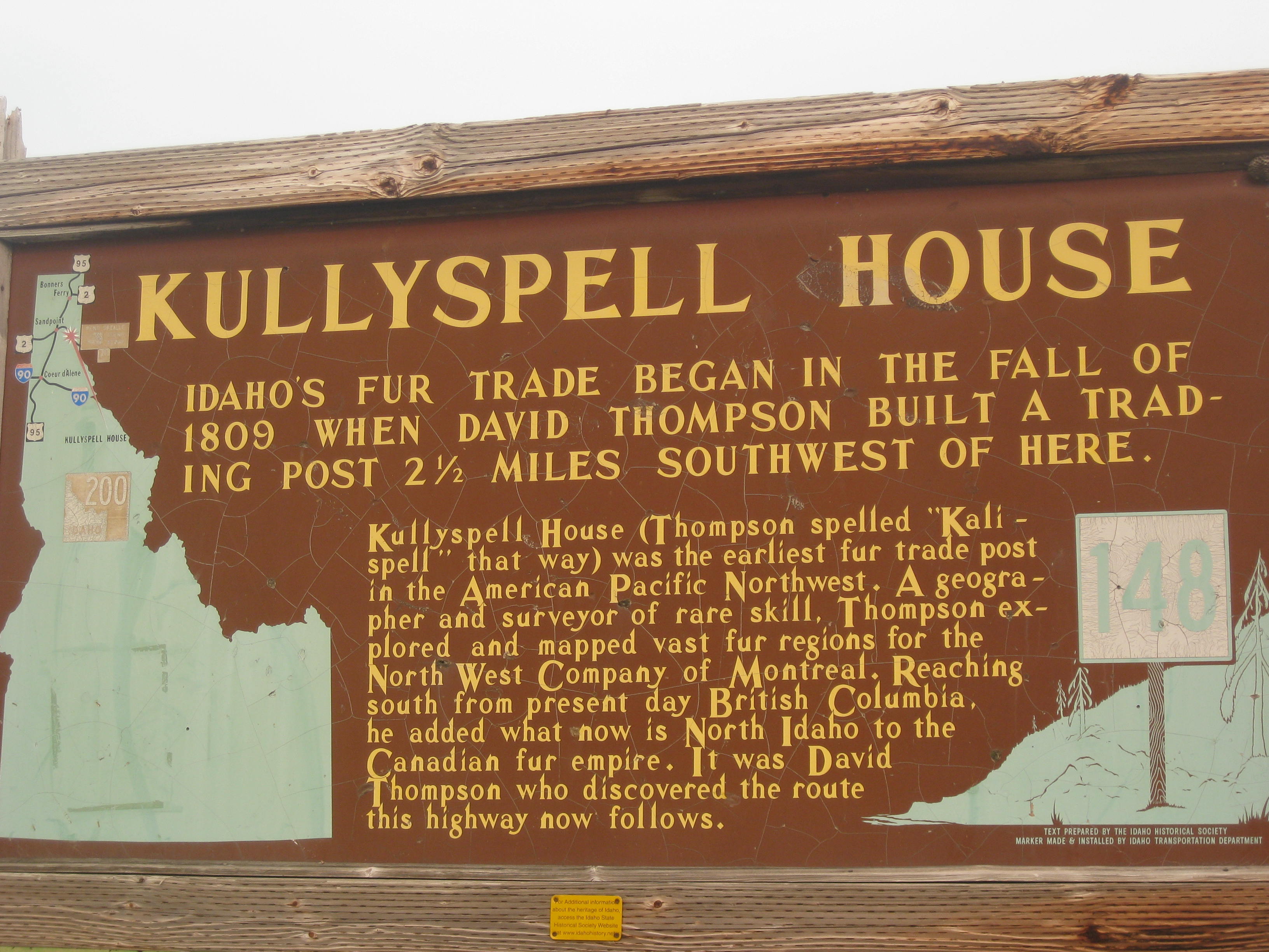
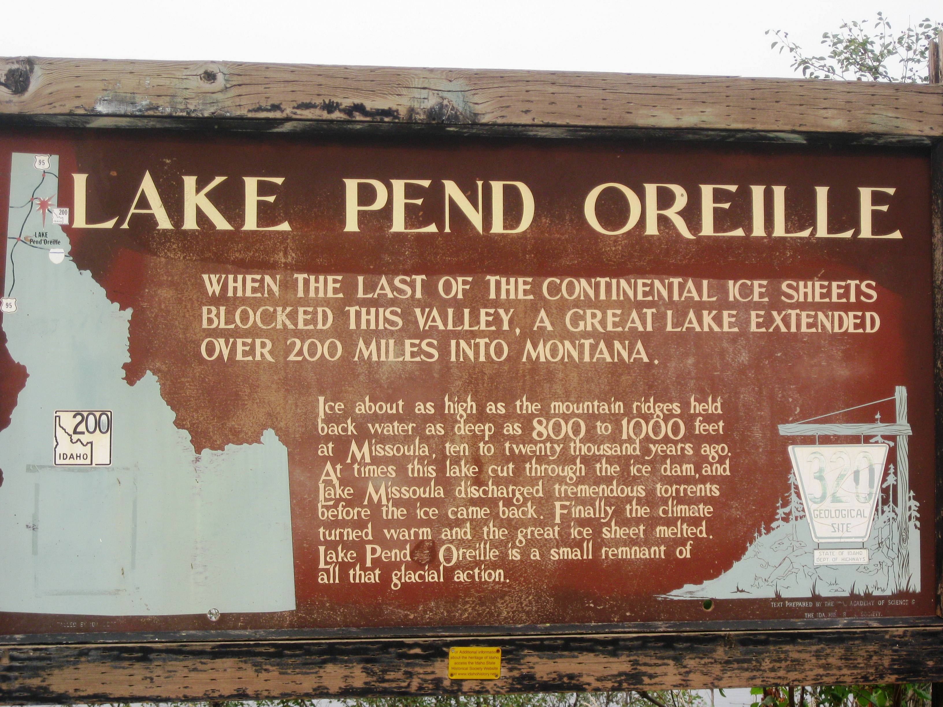
Since I don’t have a lot of picture today (smoke), I guess you’ll get a history lesson. Actually, I find it all quite fascinating. At one time (12,00 yrs ago). the glacier lake in Missoula broke free flooding 3 states and forming many distinct geological areas in Montana, Idaho, and Washington state. I have added a link if you would like to learn more about it.
Artist rendering: This link is very informative: http://hugefloods.com/LakeMissoula.html

History: “About 12,000 years ago, the valleys of western Montana lay beneath a lake nearly 2,000 feet deep. Glacial Lake Missoula formed as the Cordilleran Ice Sheet dammed the Clark Fork River just as it entered Idaho. The rising water behind the glacial dam weakened it until water burst through in a catastrophic flood that raced across Idaho, Oregon, and Washington toward the Pacific Ocean. Thundering waves and chunks of ice tore away soils and mountainsides, deposited giant ripple marks, created the scablands of eastern Washington and carved the Columbia River Gorge. Over the course of centuries, Glacial Lake Missoula filled and emptied in repeated cycles, leaving its story embedded in the land.”
Flood Facts:
Another link for you history buffs: http://www.glaciallakemissoula.org/story.html
It was a pretty easy ride following the river. Our only real excitement was when we were stopped due to construction. The flag holder said, “You’ll need to put those bikes in the pilot car and be driven the 2 miles.” What? Driven? That is counter intuitive to any cyclist! And, one cannot just “toss” two loaded touring bikes in a small pick up truck and call it good. These are our babies, what if my wood fenders get scratched? I could see she was not going to budge. “It’s one lane and we need to keep traffic flowing” she said. “Like we couldn’t ride fast enough”, I mumbled under my breath. The pilot-truck showed up and we gently loaded our bikes. There was no room for us so we got to sit on the tailgate. The driver did not creep along. she was driving at a good speed. I hung on for dear life as Lisa laughed at me. I’m sure by riding on the tailgate we broke about every DOT rule there was. We made it through, unloaded our bikes and had about 3 miles of freshly paved asphalt to enjoy. Around 10 am we entered Sandpoint, ID. Jodee met us at the Visitor Center where we had snacks to get us to Newport, WA about 30 miles away.
We arrived in Newport around 2pm. Jodee had secured a camping site in town and not too far from a Safeway. We set up our tents, had a shower, and walked over to Safeway for to get some dinner.
Melinda’s Philosophizing– Dinner was like “the last supper”. Knowing that tomorrow we would be riding into Spokane touched on a lot of emotions. After 11 weeks on the road, the journey was winding down. My emotions? Sad, yet eager to see if my cat would be happy to see me or “punish” me for my blatant desertion. Happy, to have been successful and ridden well. Eager to get back to teaching some classes, as income is always good, and working with my seniors. It will take me some time to “digest” this ride and explore what it has meant to me on many levels, which I will post.
Dinner under our belts, and the evening closing in, the campground offered free ice cream. We thought that would be a good celebratory dessert (and my last ice cream!) so we walk over to the club house and loaded our bowls with ice cream. To make it the best ice cream ever, we drizzled Lisa’s cinnamon whiskey (Fireball) on top (for medicinal purposes only of course)
….I’ll keep you posted.
STATS
Miles: 57.83
Calories: 4,442
Top speed: 27.7
Average speed: 11.1
Elevation: 2,129
I had a good night’s sleep and we all got up about 6:30am which has been the status quo.
I ate my last 2 packages of GF oatmeal for breakfast and got ready to head out to Newport, ID. Lisa was not “feeling the vibe” to ride so I went solo again.
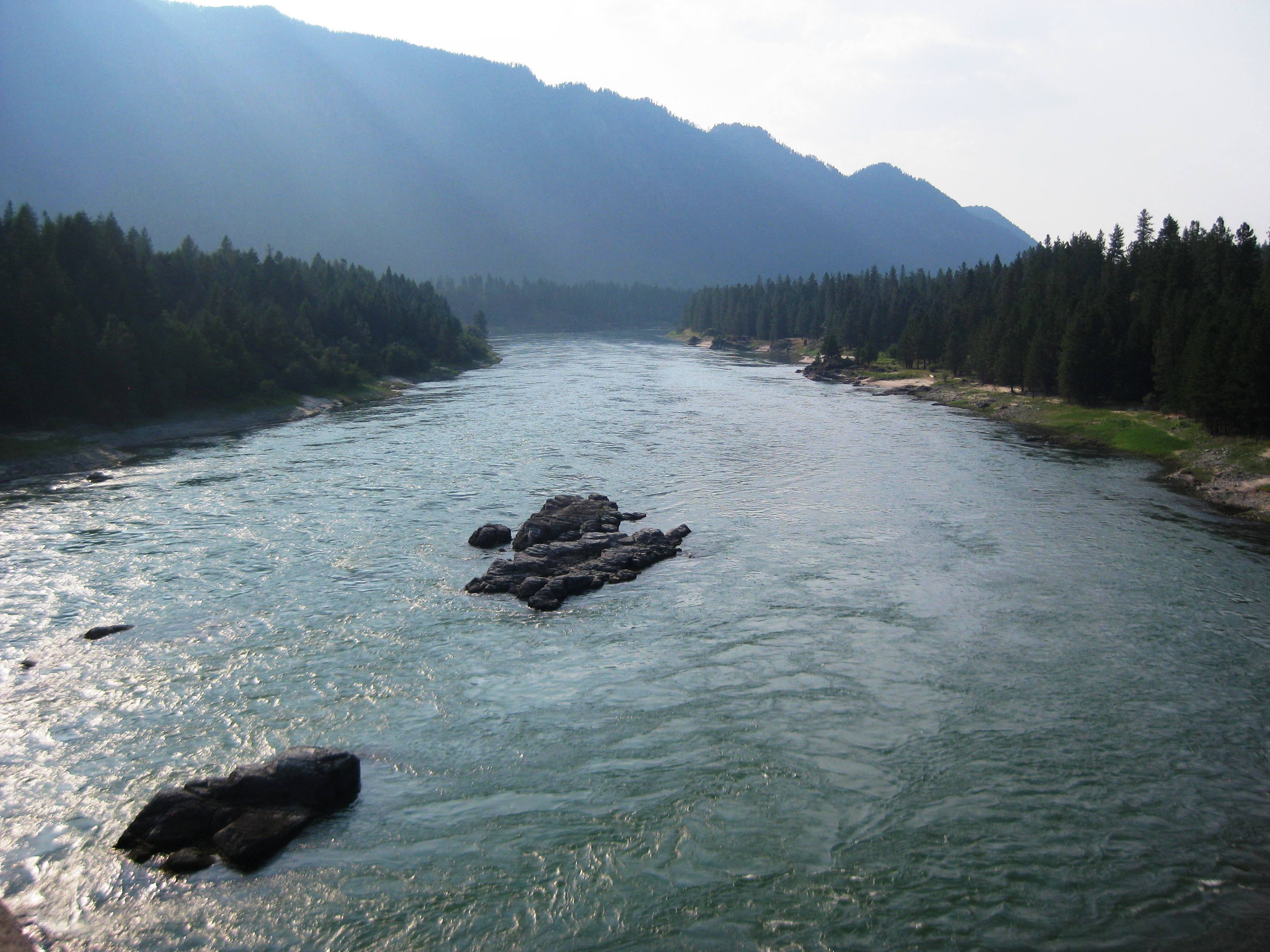
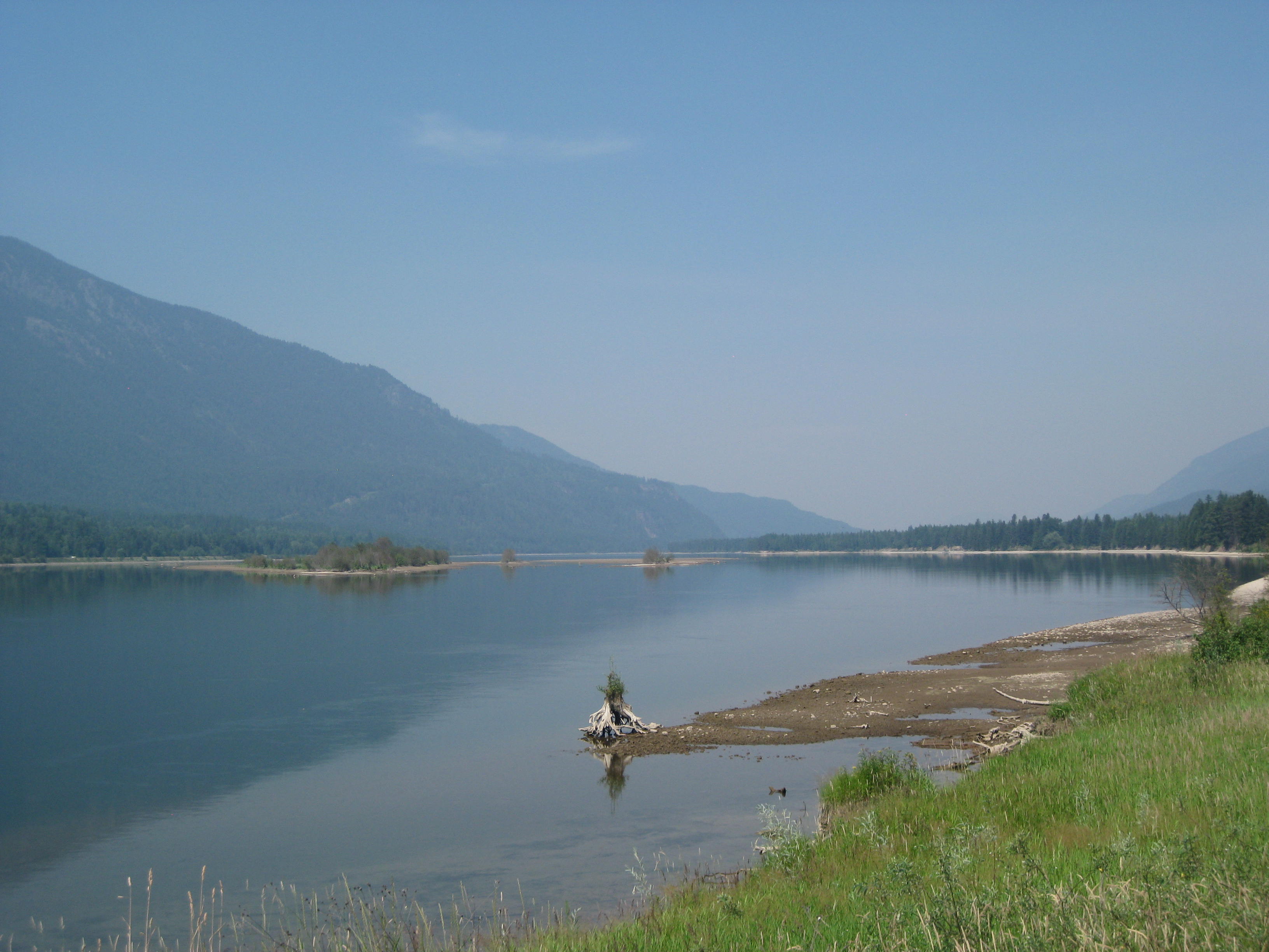
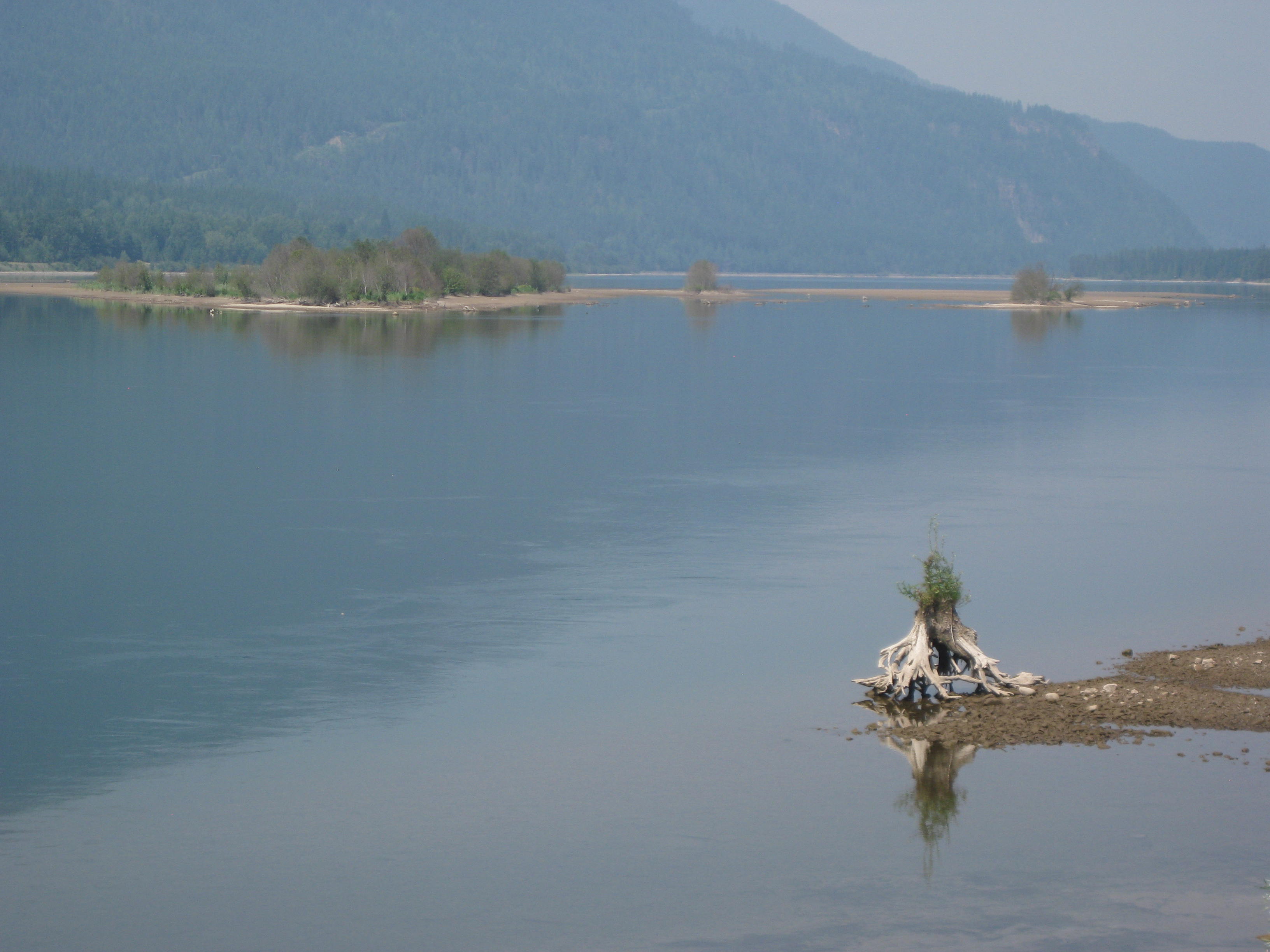
Taken from bridge in Thompson Falls
The road was great, pretty flat and I made good time. My goal was to ride 25 miles before Jodee and Lisa caught up with me, I rode 20 miles, so almost met my goal.
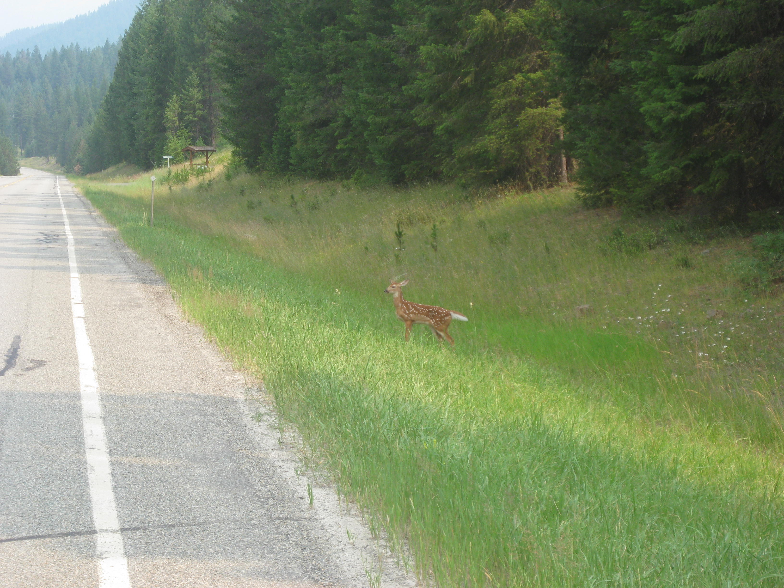
As I rode along I spotted 2 fawns running down an embankment. I quickly snapped a picture then shooed them away as I heard traffic coming. (Click to view picture)
The terrain was beautiful but you can see the haze from the central Washington fires.

I followed the Clark Fork river all day. I arrived in the town on Noxon around noon. I did not actually go into Noxon as it was across the river. This shot is from the bridge. I love the second picture of the tree roots growing in the river.
By afternoon I arrived in the Idaho Panhandle Forest. I saw Jodee drive up in her car. She said Lisa was taking a nap and she came to check on me. She informed me that she and Lisa had gotten a hotel. They had stopped at a campground and they stated the mosquitoes were terrible. We visited a few minutes and then I continued on to Clark Fork. The rock cliffs were beautiful with colorful rock and what looked like slate which is part of the Prichard as discussed in the previous post.
Finally, I officially reached Idaho. The last 10 miles the wind kicked up and there were some hills into town. Because today’s ride was only 57 miles I got in about 3pm. The hotel room was nice and included a kitchenette. The only negative was they stated they had Wi-Fi but it would not work. That is so frustrating when that happens on the road, so I couldn’t post my blog.
After a great shower I settled on the bed to do some typing, at least I could type up some of the blogs. Lisa and Jodee decided to go out for dinner, I decided to save a few bucks and ate my GF crackers and hummus.
As I settled my mind for the night I was experiencing a variety of emotions as the journey would soon be over after 11 weeks of traveling the country; the experiences, the people, the countryside, the riding, and most important the personal strength I gained pushing myself to the limit and coming back again.
Some historical signs from the area:


…I’ll keep you posted.
STATS
Location: Montana
Miles: 71.59
Calories: 5,087
Top Speed: 29.7
Average speed: 10.7
Elevation: 2,755
We lucked out as there was a Durango restaurant across the street from the motel. We got packed up and walked over to have breakfast. I got to tell you, this may have been the best breakfast of the whole trip. While not on the menu I ordered a veggie omelet which came with hash browns and they REALLY made my morning by offering me a gluten-free roll instead of toast. The omelet must have been 3 eggs and had mushroom, green peppers, olives, and jalapeño’s (as requested). There must have been 2 cups of veggies in it! I couldn’t eat it all so I took half of it with me. Jodee had an ice chest in the car so I put in “on ice”.
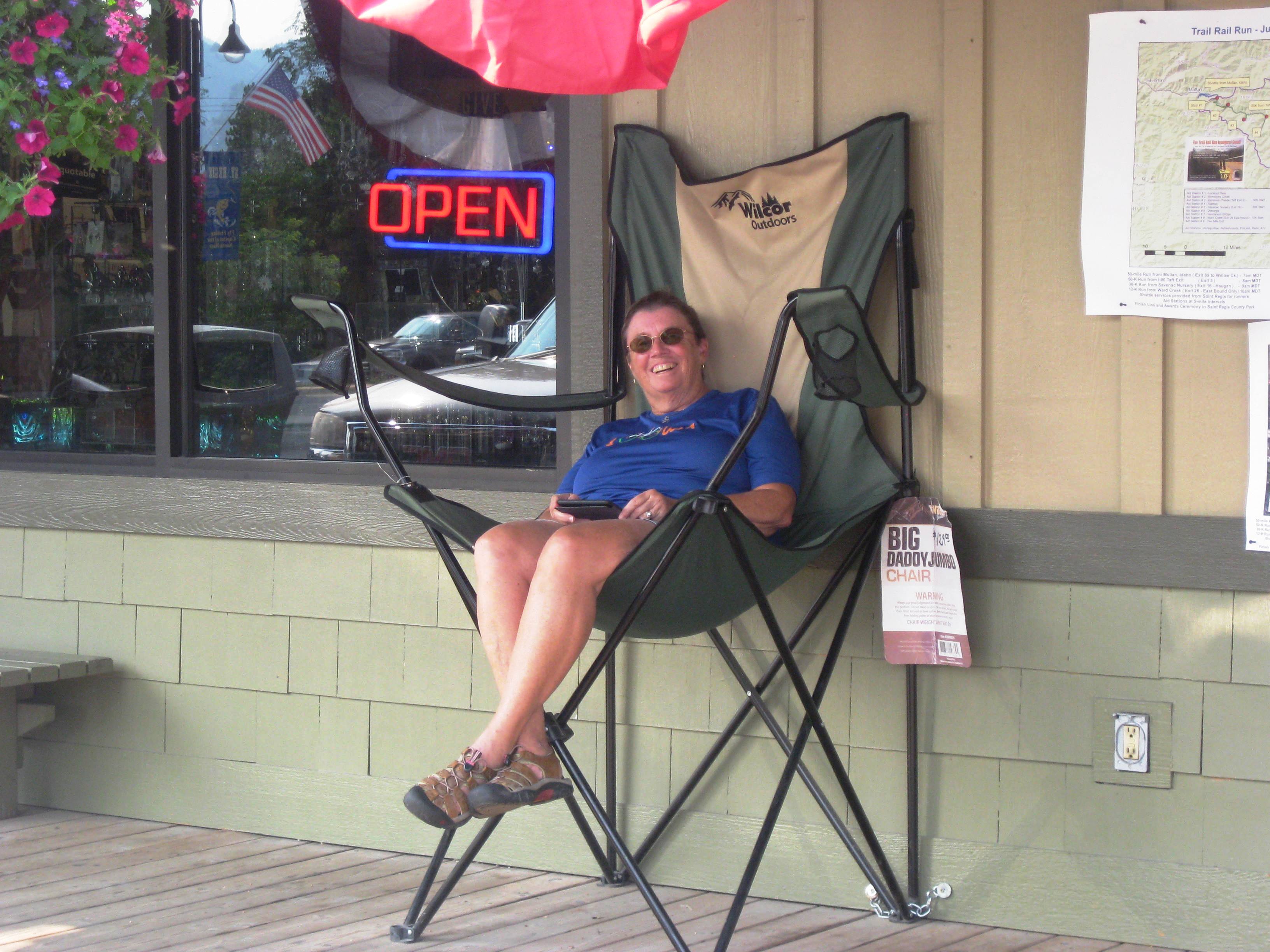
We started the day riding on the freeway. There was a wide shoulder so we could be stay clear of the semi-trucks. We were able to exit the freeway after 13 miles when we entered the town of St. Regis. We found Jodee sitting in this huge chair. She looked like comedian Lilly Tomlin’s “Edith Ann” (I’m dating myself here).
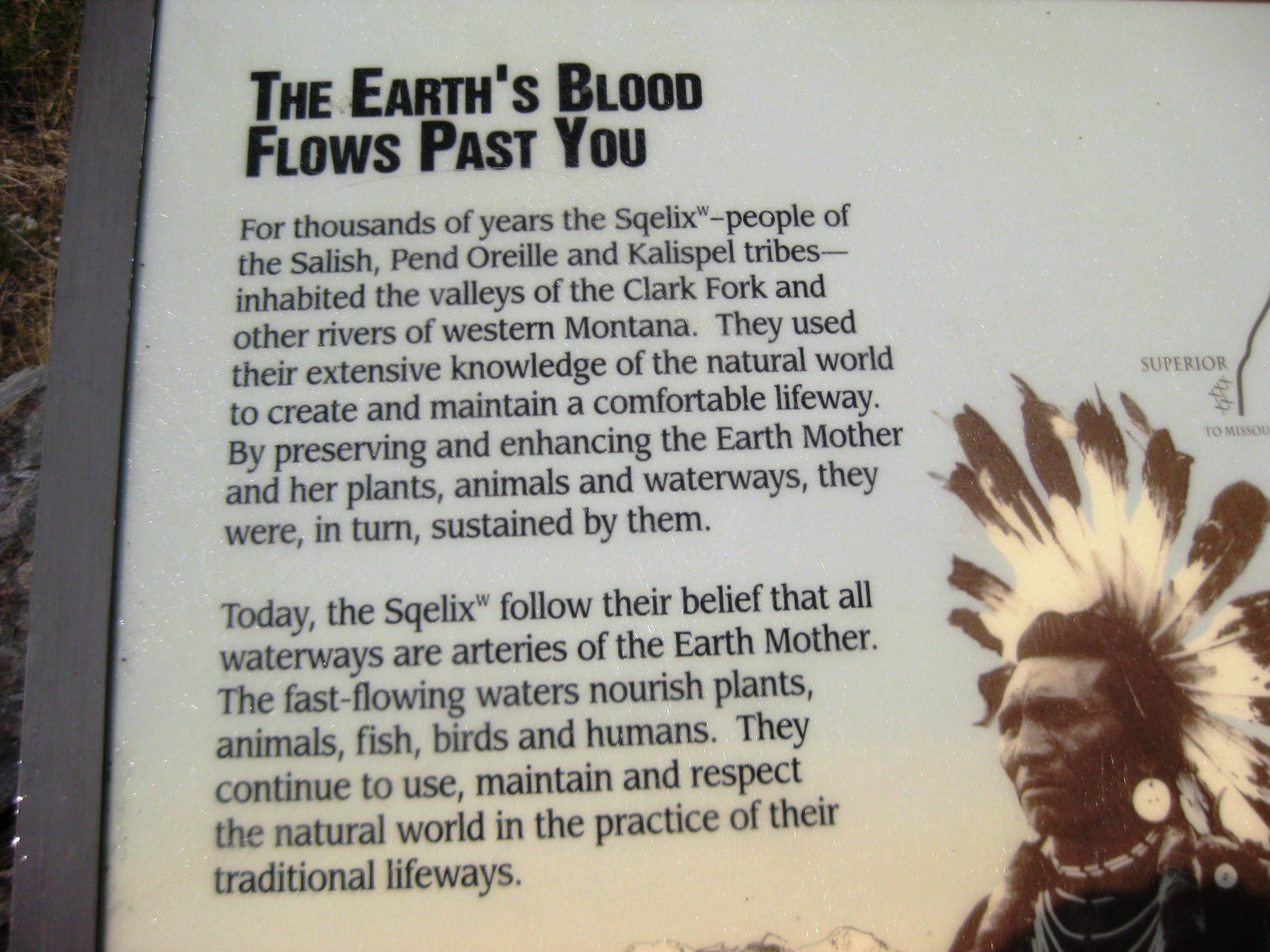
Today we continued to follow the Clark Fork river for most the day and entered into a very interesting geological area dating 1.5 billion years.
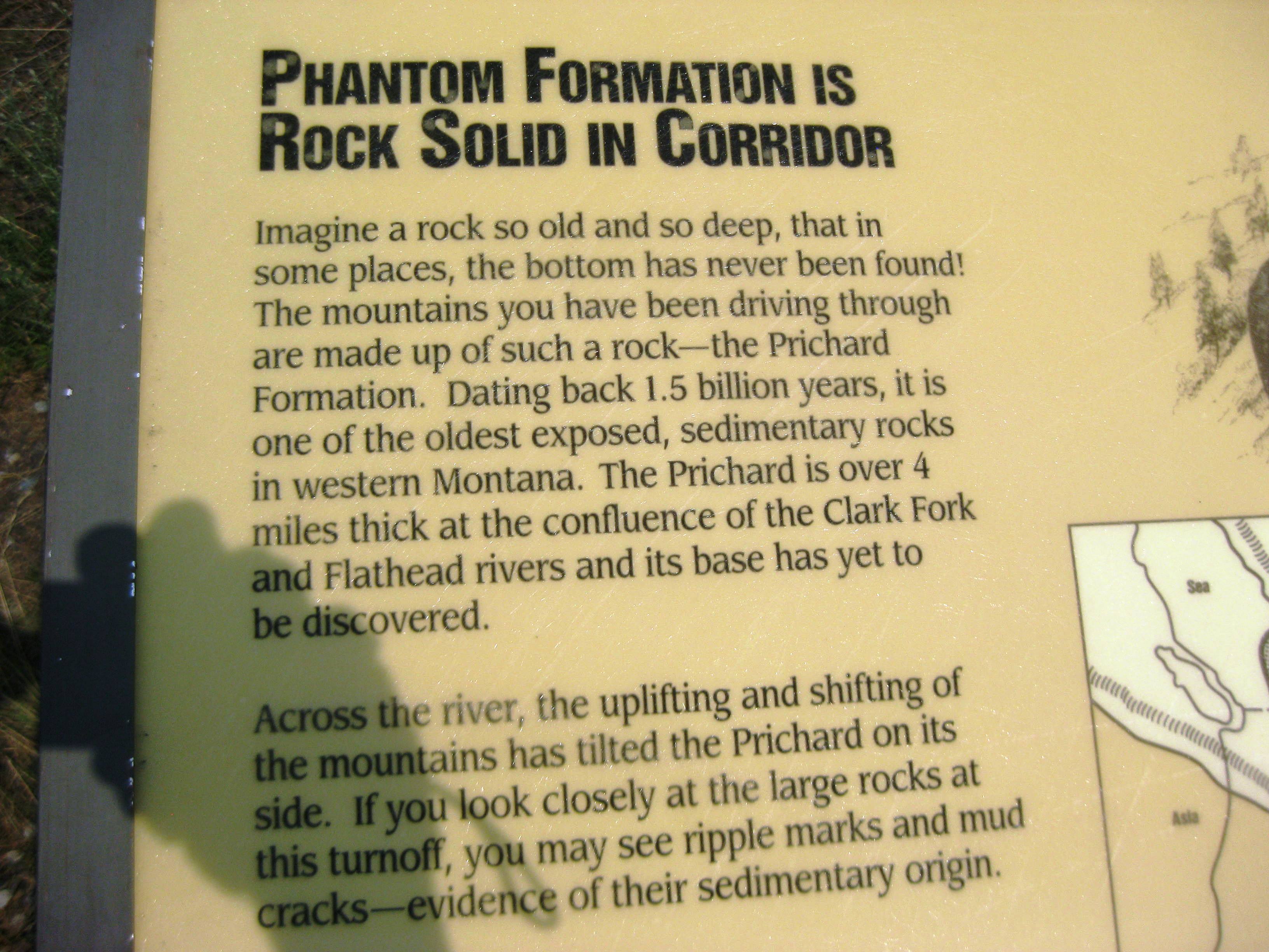

This is an area that is also rich in Native American history.

We passed a very large boulder that shows the height of the water levels in the spring.

Around noon we saw Jodee parked at a Hot Springs Resort. We met her and decided to stop for lunch a bit further down the road along the Clark Fork River. After we ate we continued on our way enjoying the beautiful rock cliffs. Along the route I spotted a mountain goat skull. It had been there for a while so it was clean and bleached by the sun.Lisa spotted an elk skull and picked it up as well, it was not so clean and sun bleached.
After we passed the small town of Plains the winds hit. We then had 15 miles of head winds, uggh! Can we every catch a break with the wind?
It was a long day, Jodee met us on the road to see if we needed water and Lisa decided she needed a lift so Jodee loaded her up and they went to the campground. It was hot but rode the rest of the way into Thompson Falls with my mountain goat skull mounted on my rear bike rack.
The campground was a few miles past Thompson Falls, at first I thought I had missed it but I finally arrived. After a cold GF beer and a shower I retrieved my breakfast from the ice chest, heated it up and it made a delicious dinner.
Tents pitched, we dove in as soon as the mosquitoes arrived.
…I’ll keep you posted.
Stats
Miles: 66.37
Calories: 5,087
Top speed: 29.7
Average Speed: 10.9
Elevation: 2,755
We broke camp in Missoula and headed over to Adventure Cycling headquarters. We made a wrong turn but quickly got back on track, however, we had a delay. As I went over an overpass, BAM!!! There goes my rear tire again. This one was a doozie, a 3 inch nail skewered the tire. Why is it always the rear tire? This type of flat means the tire is “toast”, no way to patch it as it went through the sidewall. There goes $60 bucks, yep, that’s how much a good touring tire costs.

Skewered!!!!
We had to call Jodee as I put my already damaged “spare” that I had been hauling with me since Pueblo, Colorado in her car. I put in a new tube put the tire back on and again we tried to get to Adventure Cycling. Adventure Cycling promotes tour cycling and create routes and maps for cyclists.
Check out their website: http://www.adventurecycling.org/


We arrived at their headquarters; they were a great bunch of people and offered us an ice creams bar. As they do with all touring cyclists that come by they took our picture and put it on the wall with hundreds of others. We are on the top right.
We got a late start with the flat and visiting Adventure Cycling but Lisa and I were finally on our way to Superior, MT. We had a pretty easy ride but it was hot! I’m not sure why I didn’t take pictures of the terrain. We ended the day at a hotel as Jodee discovered the closest place to camp was in national forest land and was miles off the route.
…I’ll keep you posted.
More calculations of miles vs. time and we did not have enough time to ride to Missoula as Lisa’s husband had plans to meet her there Sunday and Monday. So, we packed bike, panniers, “BOB” and all of our stuff into Jodee’s car and she drove us to Missoula.
Do you think we could have crammed any more in the car?

We made it fit!
It felt a bit odd being in a car after being on 2-wheels for so long. The drive was beautiful with some nice long downhills and I wished I could have ridden it.
On the way we stopped at the Battle of Big Hole Historical Museum. The battle was a tragic event in which Nez Perce attempting to escape soldiers by moving through the Bitterroot Valley were attack.
“On August 9, 1877 gun shots shattered a chilly dawn on a sleeping camp of Nez Perce. By the time the smoke cleared on August 10, almost 90 Nez Perce were dead along with 31 soldiers and volunteers. Big Hole National Battlefield was created to honor all who were there.”
To read more about the battle: http://en.wikipedia.org/wiki/Battle_of_the_Big_Hole
http://www.elklakeresortmontana.com/BigHoleValley.htm
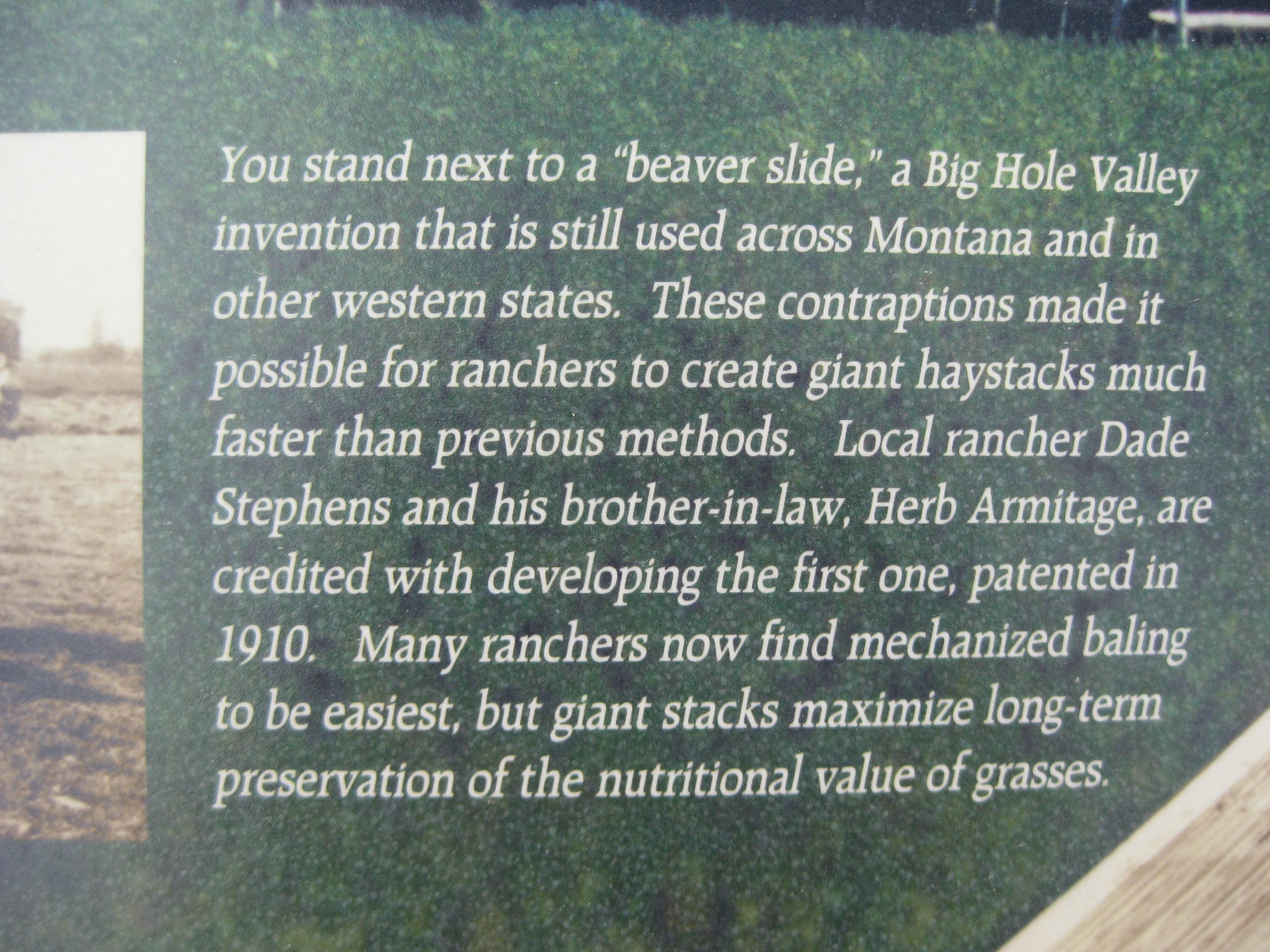
On route we also stopped at a historical marker and it provided us information about the area and haystackers or a “beaver slide” (no, it’s not for real beavers).

It might have been at the same historical marker there was a letter written by Meriwether Lewis (Lewis and Clark). I find the words could have been written today rather than over 200 years ago.
“This day I completed my thirty-first year, and conceived that I had in all human probability now existed about half the period which I am to remain in this Sublunary world. I reflected that I had as yet done but little, very little, indeed, to further the happiness of the human race, or to advance the information of the succeeding generation. I viewed with regret the many hours I have spent in indolence, and now soarly feel the want of that information which those hours would have given me had they been judiciously expended. but since they are past and cannot be recalled, I dash from me the gloomy thought, and resolved in future, to redouble my exertions and at least endeavour to promote those two primary objects of human existence, by giving them the aid of that portion of talents which nature and fortune have bestowed on me: or in future, to live for mankind, as I have heretofore lived for myself.”
History of Lewis and Clark link
Melinda’s Philosophizing– The letter written by Lewis is a “what have I done with my life” letter. In reality, Lewis, along with Clark, were becoming an integral part American history, and yet interestingly, in the letter, he does not refer to his journey as a journey of great importance. As I complete my journey from Yorktown, VA to Spokane, WA (the re-route), I see the last 12 weeks as a wonderful grind across the country that has pushed me physically, mentally, and has allowed me to learn more about our country and meet some wonderful people. Like Meriwether, I can not yet see the impact this trip will have on me down the road. Will it influence me, change me in some way?
I think most people have “what have I done with my life” moments. We analyze our deeds, actions, behaviors and compare them to our dreams, ambitions, and desires and come up with some measurement to determine success. The results tend to determine what we have done with our lives. I empathize with Meriwether, I feel his concerns and it seems to weigh heavy on his heart and mind. I think the key to making ones’ life feel like “it counts” is to be open to new experiences and embrace them without having to know the outcome.
We arrived in Missoula in a few hours which would have taken us 3 days to ride. Once in Missoula Jodee and I settled into a campground and had time to sit and do nothing which felt odd as the past months have been non-stop moving. Lisa and husband enjoyed a hotel. The following day Jodee and I did some shopping at REI and picked up some groceries. Lisa arrived later in the afternoon and her husband tweaked the gears on my bike and brakes and headed for home. We spent the evening blogging, chatting, and hit the sack early as tomorrow we were riding to Superior, MT, but not before stopping at Adventure Cycling whose headquarters are in Missoula.
…I’ll keep you posted.
STATS
Miles:74.02
Calories:5,602
Top Speed: 27.4
Average speed: 10.6
Elevation: 4,949
It’s a good thing nothing was left out during the downpour. I did leave two of my panniers on my bike but they are waterproof and came through with flying colors. We broke camp a bit lazily and finally left around 9am. It was an easy ride out of Ennis then came, “the hill” and it was a climb. Lisa started the climb but ended up getting in the car with Jodee. I continued the climb up the hill, all 10 miles of it reaching 8 % grades. Whew! Jodee and Lisa met me at the top with water. The downhill on the other side was not spectacular at first but it turned into a 2-3 miles downhill that dropped me into Virginia City and then to Nevada City (yes, I am in Montana, not Nevada)


Both of these historic western towns were like walking into the past. Boardwalks, historic building and homes. Apparently these were pretty wild towns with Vigilantes, hangings, and gold mining. Here is a link to more history of Virgina City
http://www.legendsofamerica.com/mt-virginiacity.html
The piling left by the mining from 1890-1940 is an ecological disaster. The pictures below show only a sample. These pilling go on for miles, 30 feet high, and literally destroyed the rivers leaving stagnant pool of water. If this were to happen today, it would be considered a superfund site.

However, one must try to understand the thinking of the Virginia City miners of 1890’s-1940. The land was to be possessed and used up as there was plenty more land to rape and pillage. Conservation was not a word in anyone’s vocabulary. And when the gold dried up, the town dried up as well and became a ghost town. The real losers were the Native Americans who lost their rivers, land, and way of life.
One couple in 1940 saw value in the history of Virginia City and began to buy up buildings in this old western town which ultimately preserved the town. Sure, it’s a bit touristy but who cares? The historic building left as they were are fascinating. Peering inside I expected a Vigilante to come around the corner any minute to question my snooping. The next town as few miles down the road was Nevada City; it too has a history.

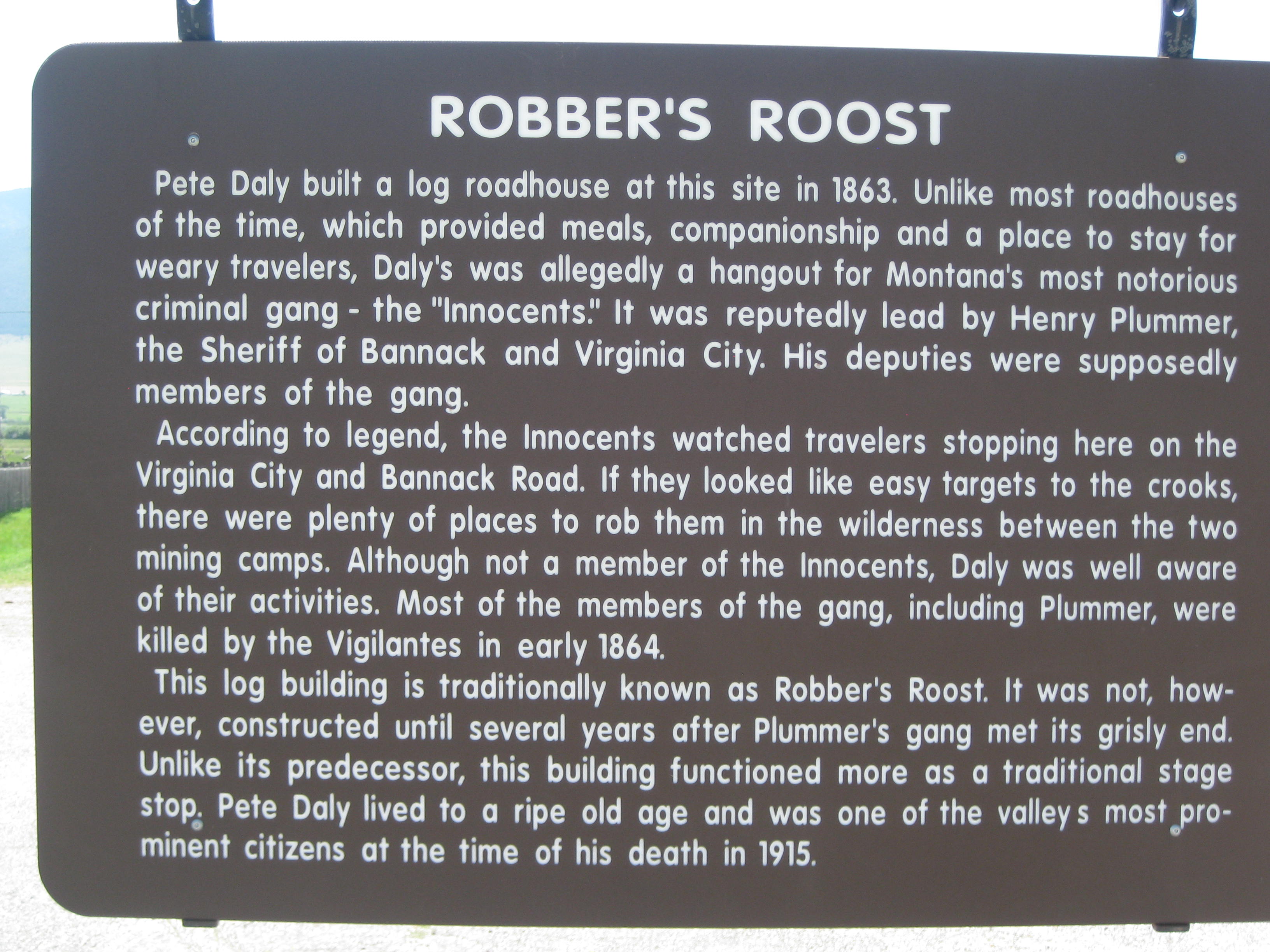
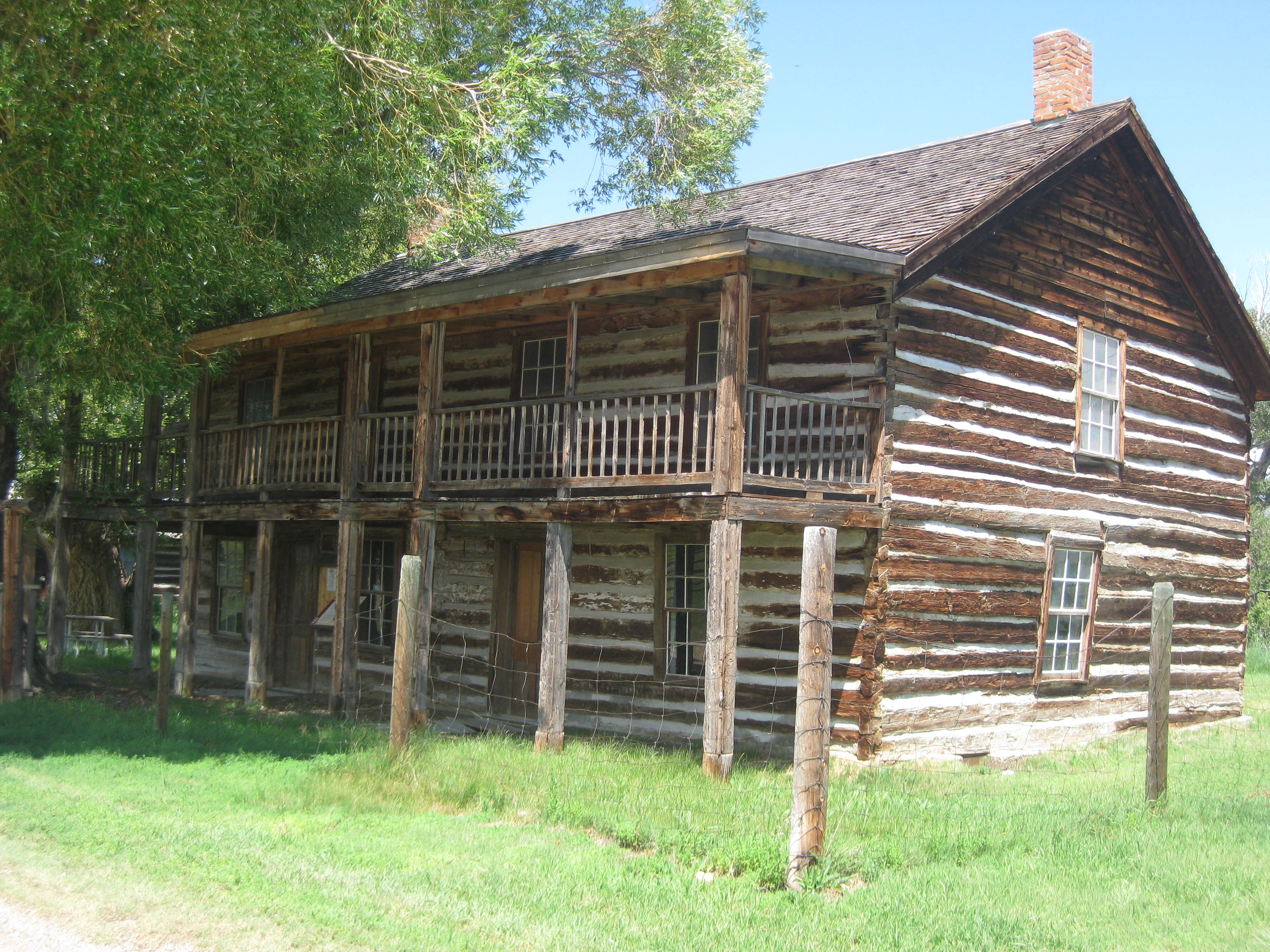
The Robber’s Roost
I passed through a variety of small towns on my way to Dillon; people were friendly and often waved at the lone cyclist. The last leg into Dillon was pretty flat but I getting pretty tired. Jodee texted me to tell me where the RV park was located. When I arrive in Dillon I stopped to check my phone to get the directions, but my battery had died!! Oh no, how was I going to find them? I rode further down the road and saw a Best Western. My plan was to borrow their phone to call Jodee or Lisa. Before going in I checked my phone once more. It came on! The screen was dark (energy saving mode) and was hard to read but I was able to make out the directions in her text.
Hungry and not knowing what I had left in my pannier for dinner, I first stopped at McD’s to get a salad, bungeed it down on my bike, and rode to the (KOA). The campsite was great, in the shade , and we had time to casually put up our tents, relax, and enjoy “an adult beverage” before we went to battle with the mosquitoes.

…I’ll keep you posted.
Stats
Location: Montana
Miles: 73.96
Calories: 4,904
Top Speed: 28
Average speed: 11.6
Elevation: 4,949
I left the campground in West Yellowstone by 9am. Lisa decided not to ride to I went solo today. It was a wonderful road, quiet, which lends itself to lots of thinking, pondering, and questioning of life issues. I rode about 10 or so miles out of town and turned west on another highway. A few miles down the road Jodee and Lisa came by in the car. I was good on water so told them to go on.
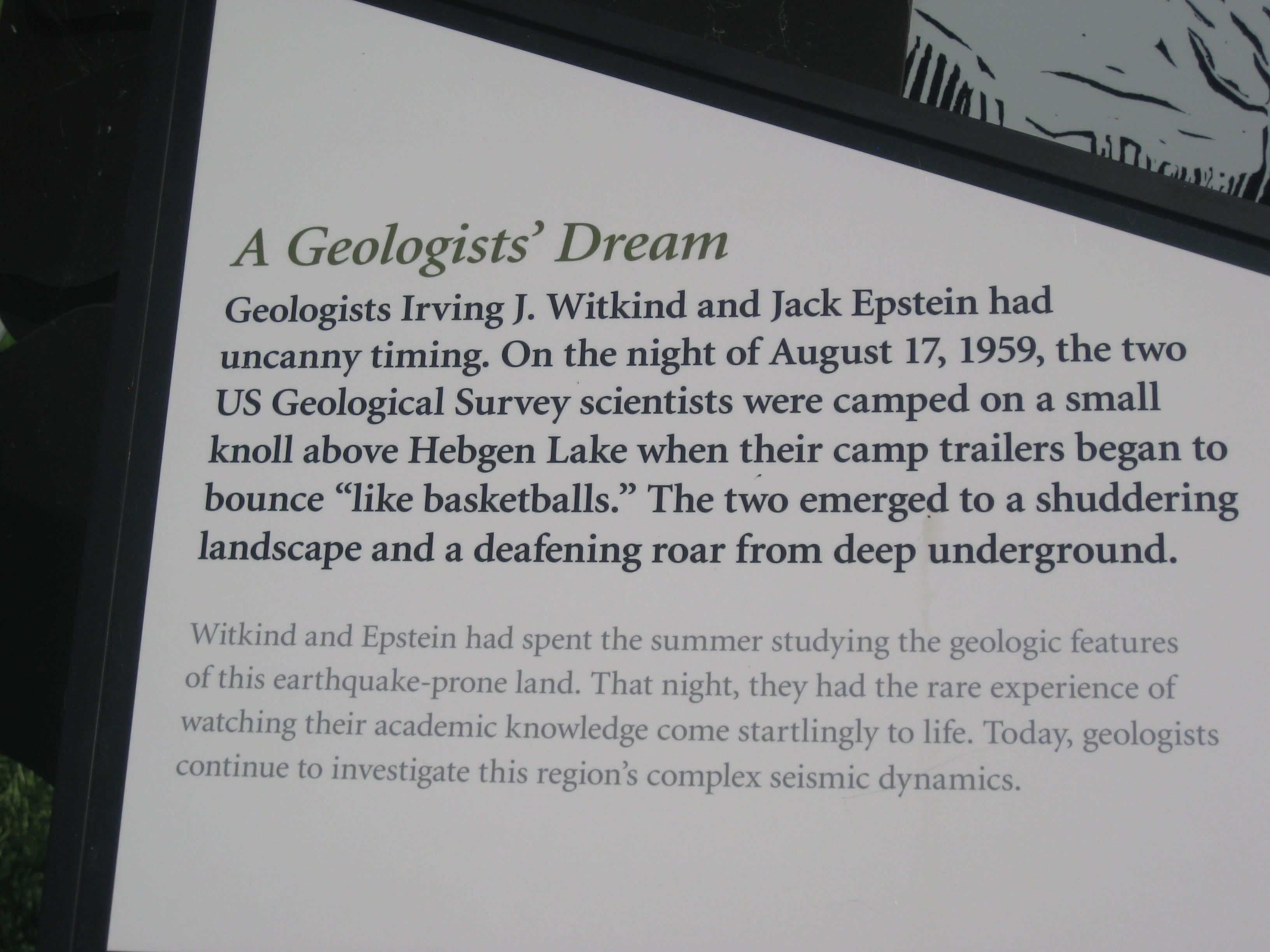
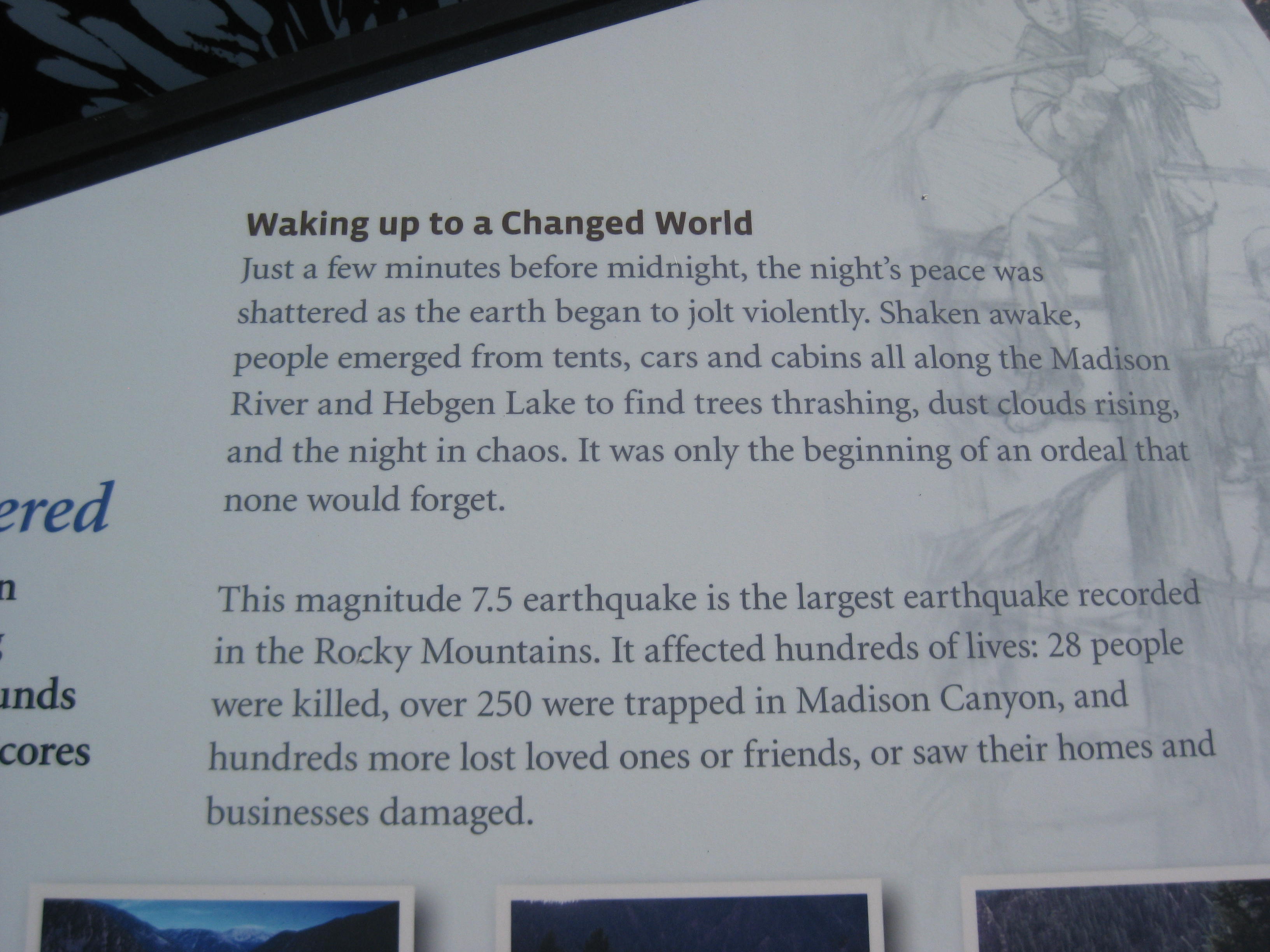
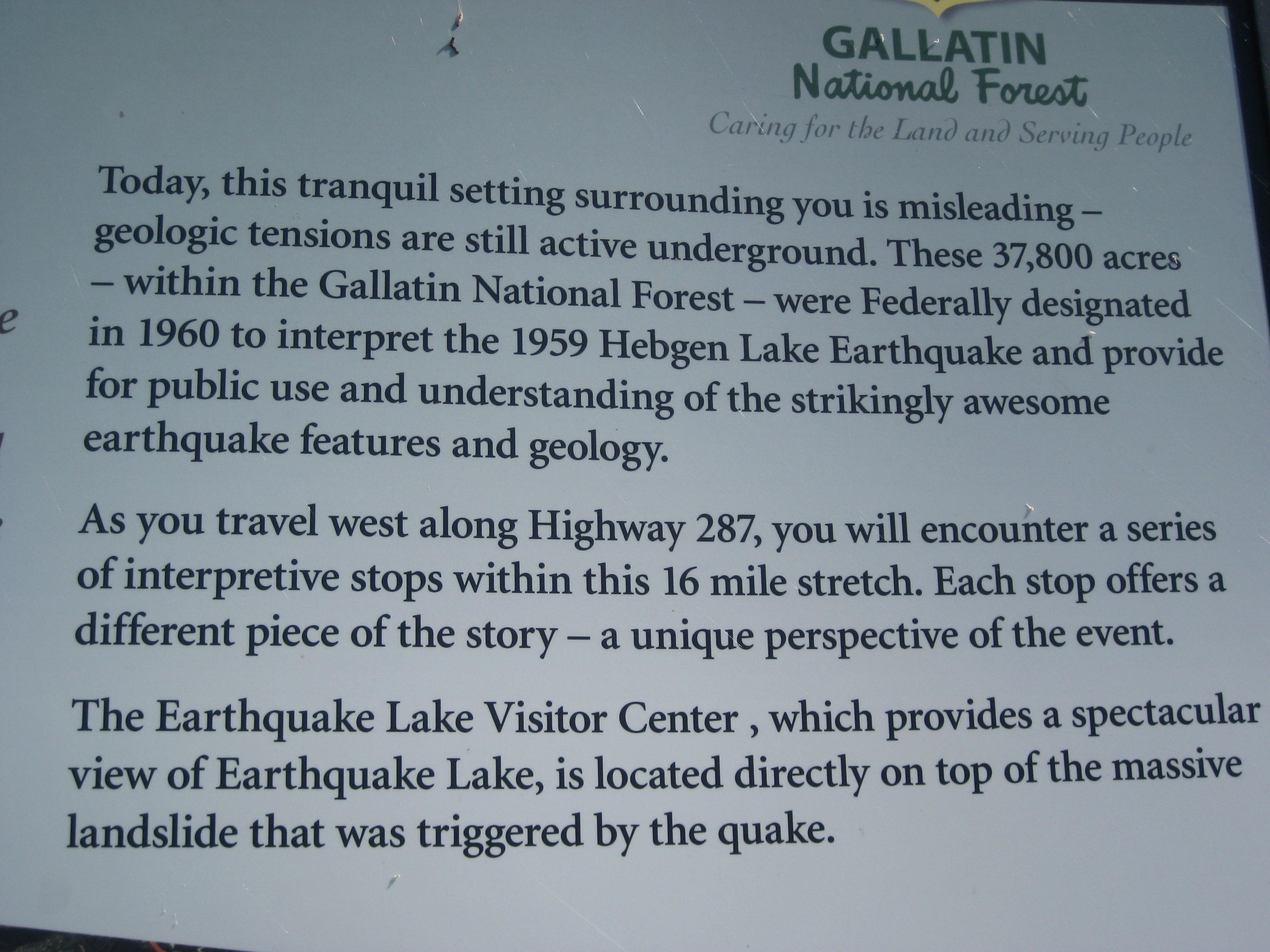
Soon I came upon Hebgen Lake, a very pretty “spot in the road” but it has a unique and tragic past. In 1959 there was 7.5 earth quake that tilted the lake dropping it 16 feet. In addition, twenty-eight died when a near by mountain gave way burying campers. Most were never found.
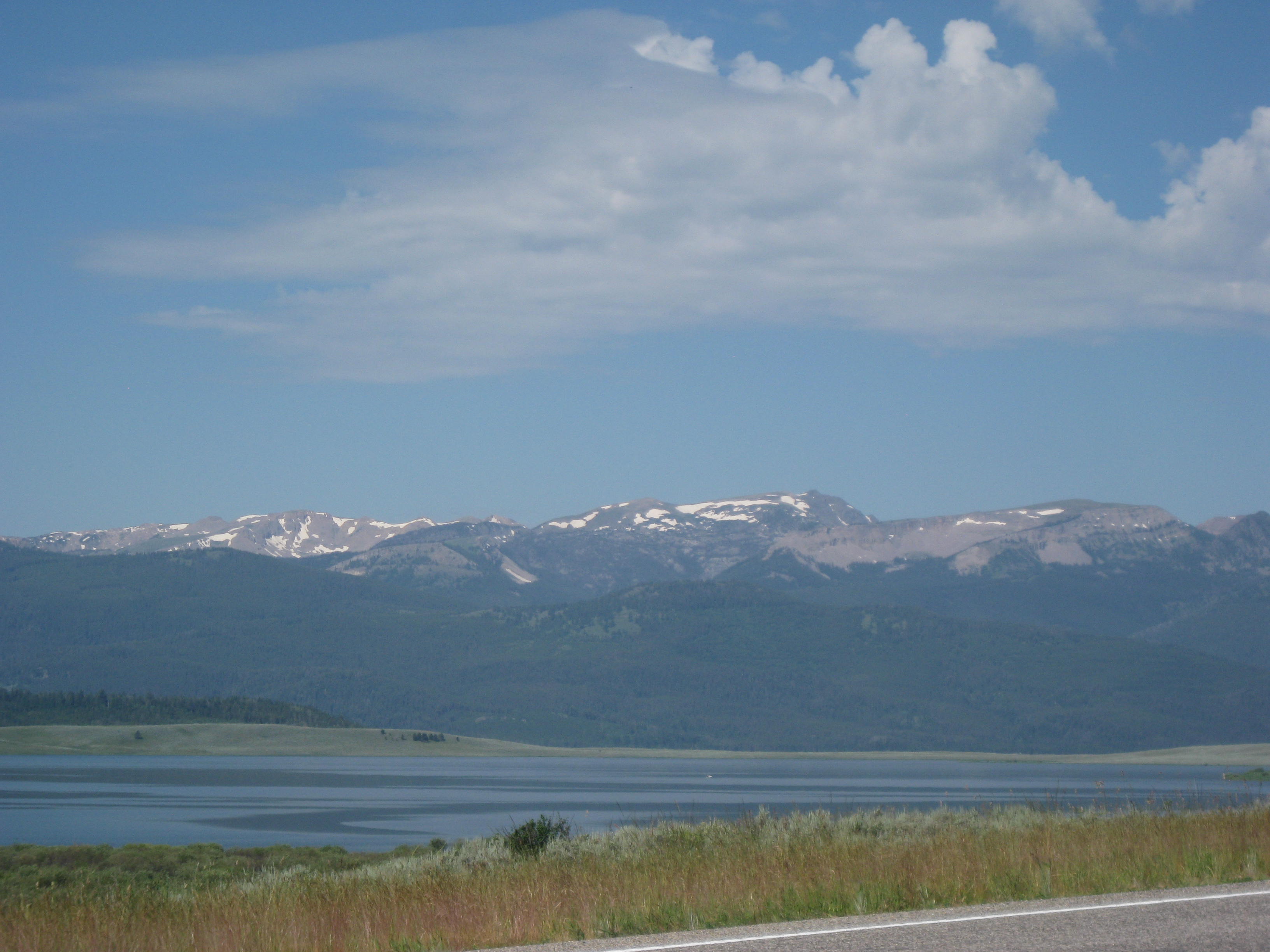
Melinda Philosophizing– It took 20 seconds for a mountain to bury campers and change the landscape at Hebgen Lake. Isn’t it interesting how we, I’m including myself in this, get “our panties in a bunch” over the little things in life. One’s life can change in seconds and yet hours, days, and even years are spent in turmoil over insignificant things. I’m working to live life in the present. Not the past, not the future, but the present.
In the photo below, trees stand like soldiers in Earthquake lake, swallowed up by water when the earth shook. Further down the road a memorial building looks over the hillside that swallowed up campers in 1959.
Miles and miles I rode today, thinking, looking, enjoying the Madison River which is a busy place for fly fisherman I even stopped to give 3 horses a scratch on the nose.
I am most definitely a cloud person as I stated earlier, I am a Libra which is an air sign and I am always looking for and at clouds. (No air-head jokes, I’ve heard them all).

A passing thundercloud seemed to think it was necessary to dump some rain on me but I dried off quickly. The wind started kicking up and I had to really work hard to get into Ennis. With about 14 miles to Ennis I saw Jodee’s car coming down the road. “You OK?, you want a ride”. “No, I’m fine, I’ll see you in Ennis”. I arrived about 6:30pm after a quick stop at an ice cream shop for soft-serve (medicinal purposes). Jodee and Lisa were already set up at the campground and were having a good time with the neighbors, a group of Canadian cyclists on holiday.
The night sky was showing signs of a storm but it looked like it was moving out. We went to bed when about 30 mins later all “hell broke loose”. I haven’t been in a storm like that in years. The lightning was so bright it looked like daylight and the thunder crashed outside. The wind blew so hard our tents were shaking but they held.
The storm lasted about an hour and a half and it was impossible to sleep during the mayhem. Lacking sleep, but happy to have made it through the storm we crawled out of our tents about 7:30am.
…I’ll keep you posted.
STATS
Location: Wyoming and Montana
Miles: 75.35
Calories: 6,850
Top speed:30.9
Average speed: 10.2
Elevation: 6,670
We heard from Jodee last week and she told us she would enjoy rejoining us, not as a rider, but as a “Sherpa” with a car. We are glad to have her back in our midst and looked forward to meeting up with her later in the day.
We got an early start leaving the campground as we wanted to get to that canyon in Yellowstone with no shoulder early in the day. We entered the canyon and the uphill in the late morning. The traffic was minimal and actually, to me, the road was not as steep and winding as was reported. However, as with everything it comes down to perception. Perhaps I have become a “road warrior” and a road has to be pretty chewed up for me to take a second glance.
I hate to bring up the mosquitoes again, but there they are, AGAIN. I stopped near the top of the pass, and while there, doused myself with more Burt’s Bee’s repellant. I also had a rag that I use for wiping my hands after applying sunscreen, repellant, or chamois butter and used it like a horse’s tail to keep shooing the biters away. I saw Lisa making the last climb and decided I couldn’t stand the skeeters anymore and took off. The downhill was great and stopped many times for photo opts.

The shower cap on my helmet makes such a fashion statement, don’t you think?
We got a text from Jodee that she was near Old Faithful as we were nearing Grant’s Village which had a store, gas station and gift shop. She was about 30 mins away by car so it was decided we would wait for her. Right on time she arrived and it was great to see her. Lisa was happy to give Jodee her BOB Trailer and bag to lighten her load. I decided it was too much effort to “unlatch” everything at the time so kept my gear for the day. Jodee headed back to West Yellowstone to secure a campsite for the night while we pedaled in to town. It was a good ride. As we passed Old Faithful we were doused by a passing thunder-cloud. Fortunately it didn’t last long and a few miles down the road we had to take off our rain jackets.
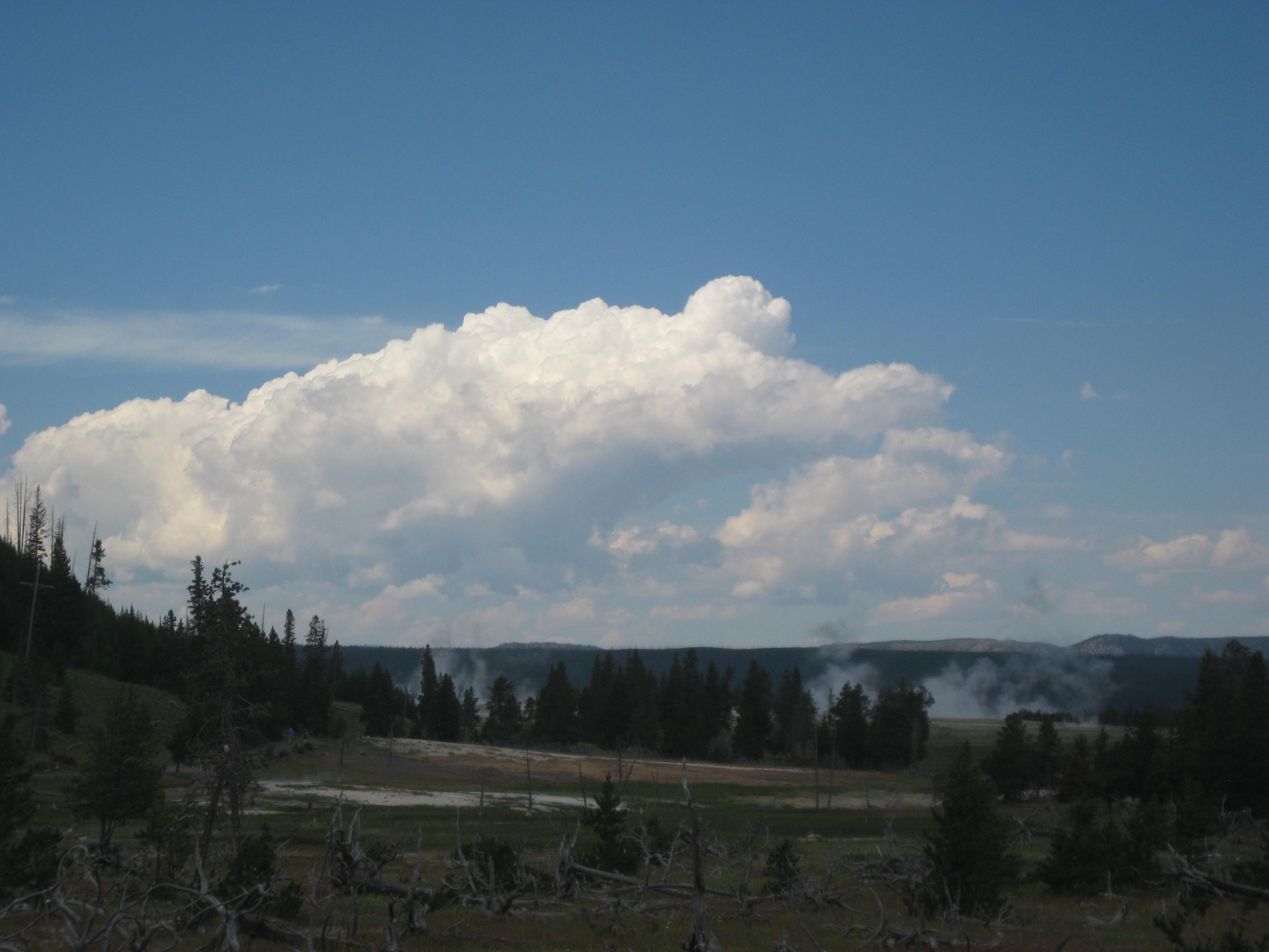
The hot pools and geysers were flooded with tourists and the road busy with cars. Being on bike it was nice to weave in and out of traffic continuing our journey in to West Yellowstone but was able to take a few pictures.
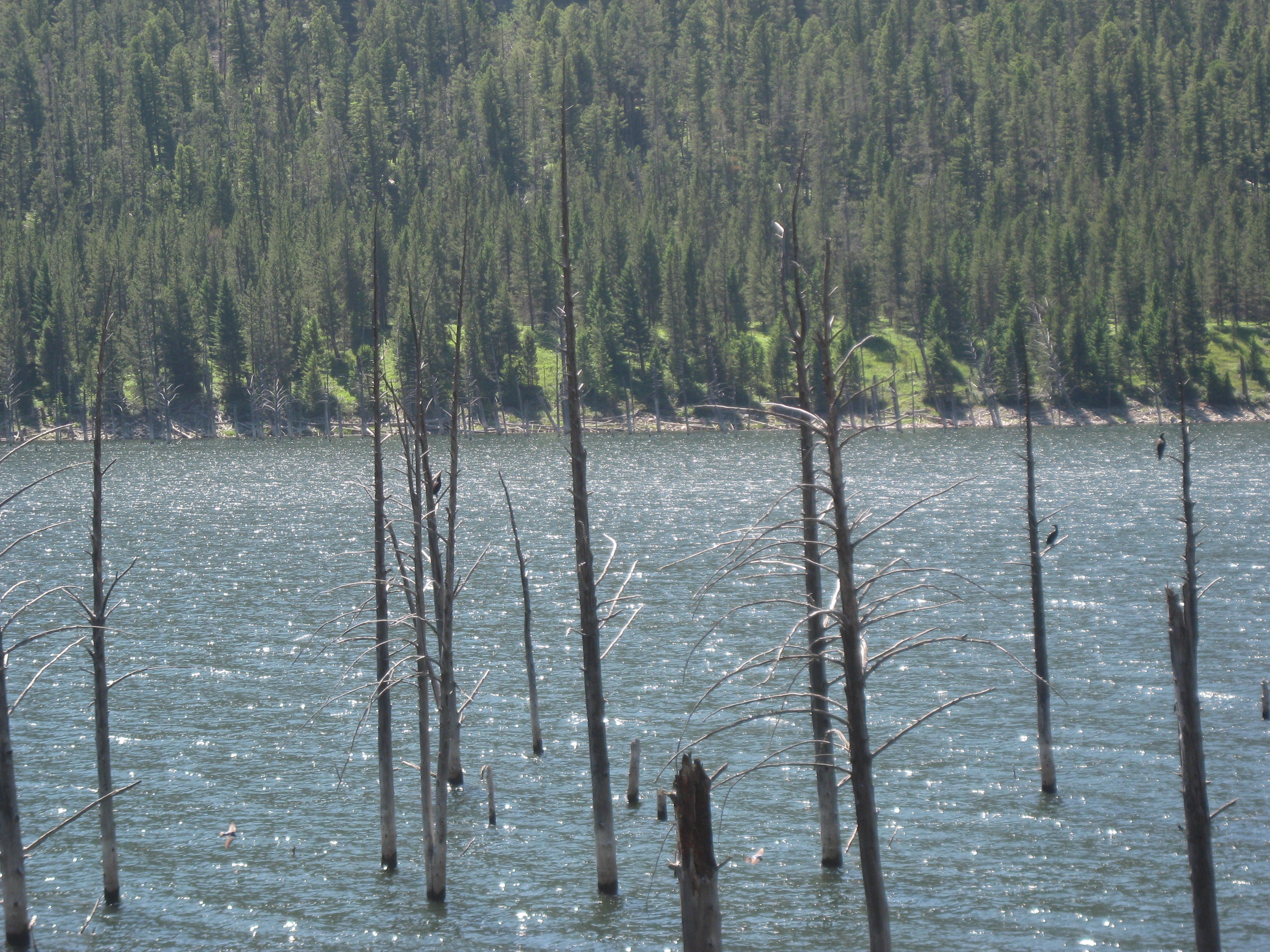
Geysers in the foreground

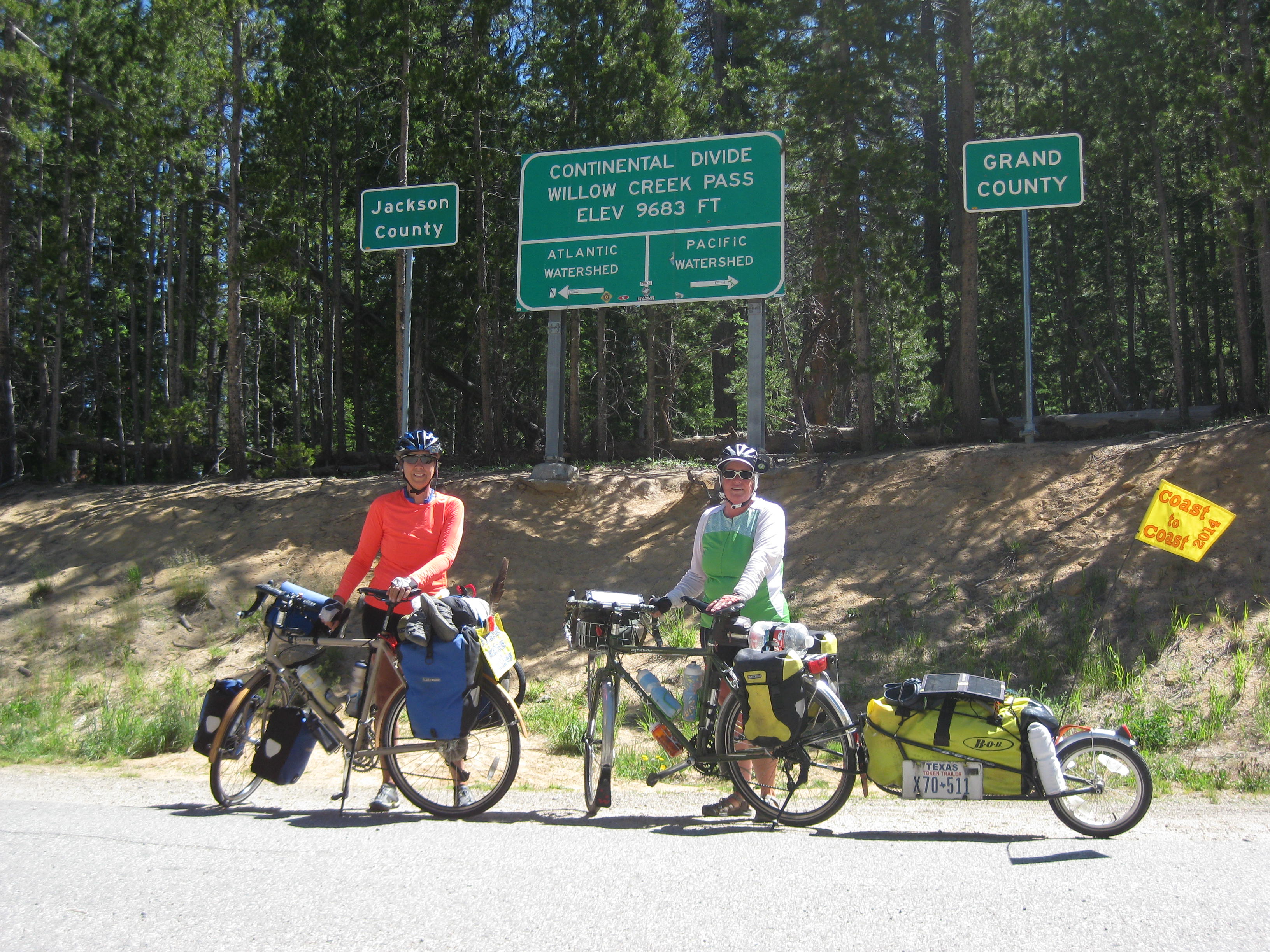
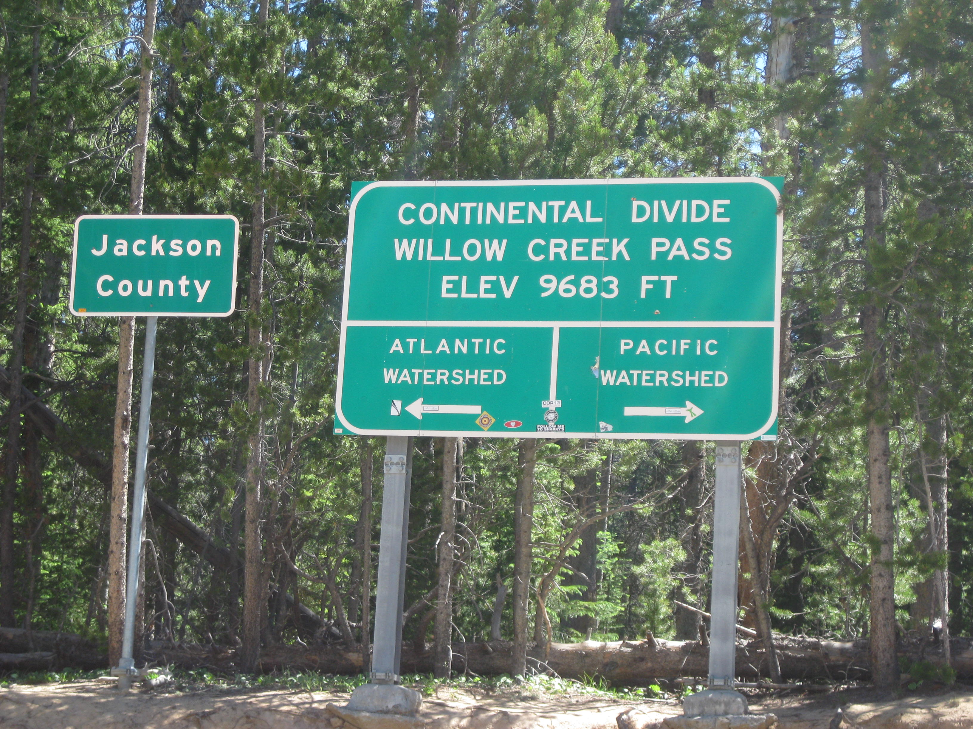
Note: We crossed the Continental Divide 3 times today!
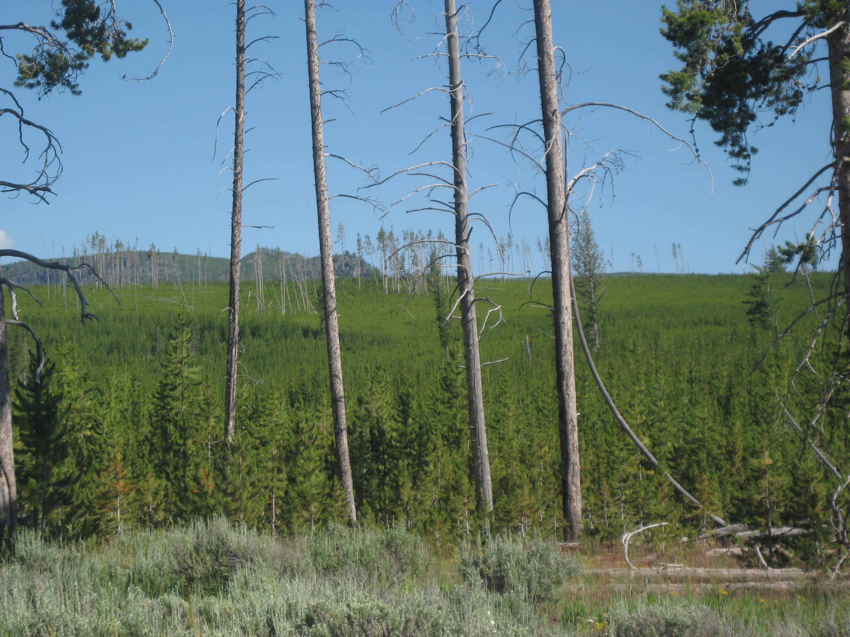
If you recall Yellowstone had a devastating fire in 1988 it was good to see that the mountains have come back with trees as tall as 20-25 feet!
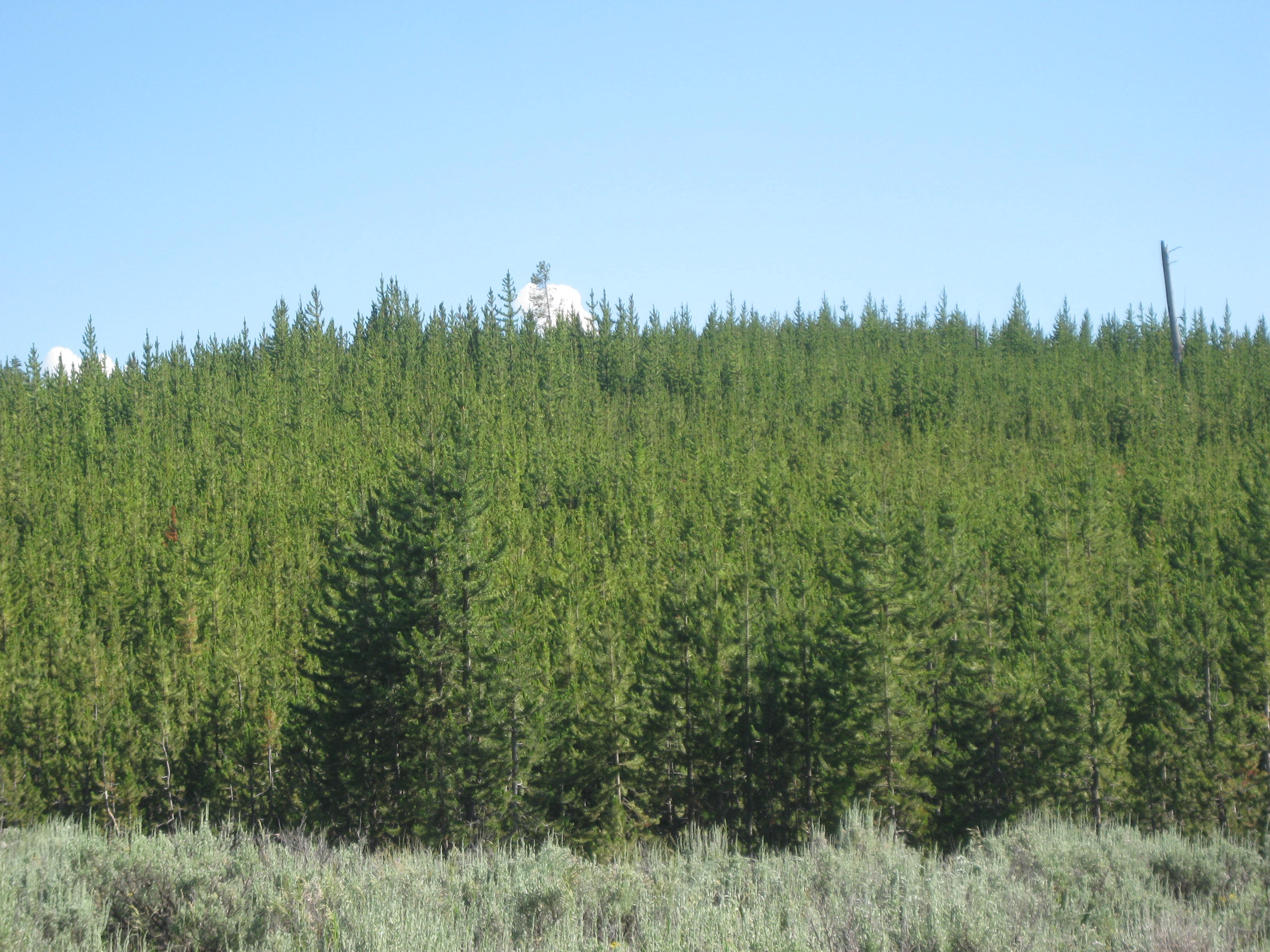
In the picture below you can see new growth along with some old burned and dead trees.
We eventually made our way to West Yellowstone and found the campsite. Jodee did a great job finding a place! We set up camp and went to dinner at a nearby bar and grill.
Changes are Afoot….again!
We are behind schedule, again, and having enough time to make it to Oregon by 8/8 has disappeared. Chatting about our situation, me with a “stiff drink” in hand, reviewing the maps, counting days, and calculating miles per day there was no choice but to reroute our journey back to Spokane rather than continuing on to Oregon.
When we original discussed this adventure that had been an option we would keep open depending on how the ride went. There are many factors that one can not foresee in the planning stage of such a journey: the tough arduous hills in Western Virginia, Kentucky, low mileage days, riding styles, and weather delays. In addition, a trip like this can easily become a “mileage fest” cranking out the miles with little time to smell the roses, take pictures, and rescue turtles, which changes the ride from fun to “work”. We want to keep having fun so we will make this change.
Tomorrow I will ride to Ennis by myself (solo) as Lisa’s legs are bothering her, so she will ride in the car with Jodee.
Hang in with me, the journey is not over yet! …I’ll keep you posted.
STATS
Miles: 30.36
Calories: 3,128
Top speed: 32.0
Average speed: 9.4
Elevation: 6,945
We slept well despite scratching our wounds (bites) and got up early to get out of the mosquito hell. As I packed up my tent and gear I noticed I was talking in a hushed voice as if not to wake the mosquitoes…too late, they found us! Lisa gave me her mosquitoes pants as she was still wearing her long sweats which saved me from more bites. We were not the only ones grumbling about the skeeters, campers with trailers and RV were openly complaining about the price they were paying for their sites and the influx of skeeters made sitting outside impossible. We were happy to be on our way brushing skeeters off us as we hit the road and gained some speed to out run them.
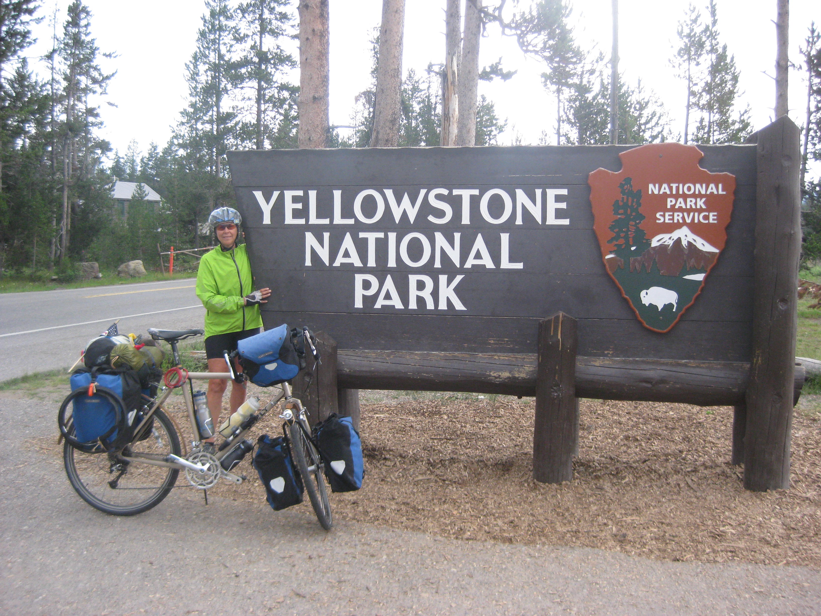
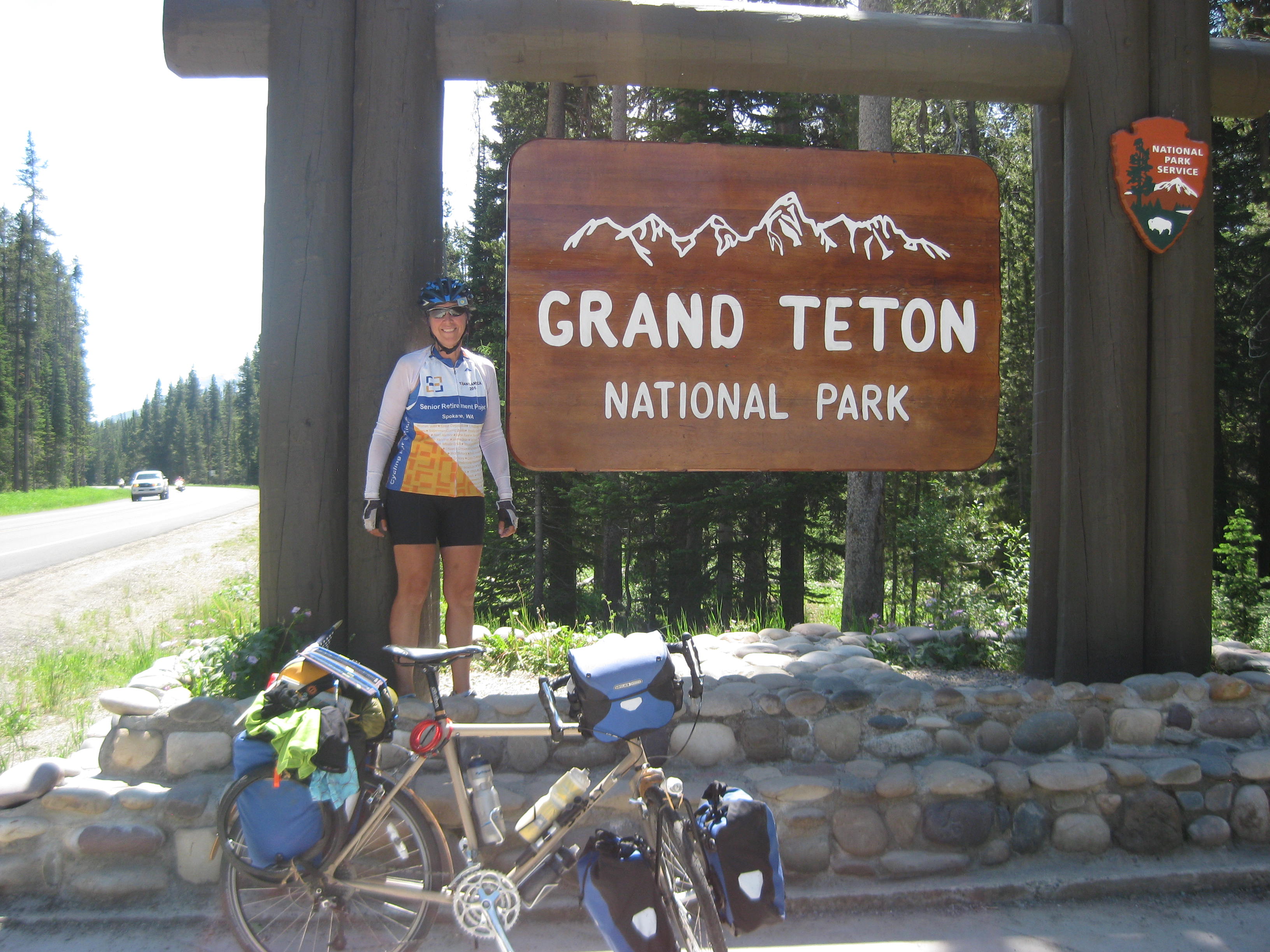
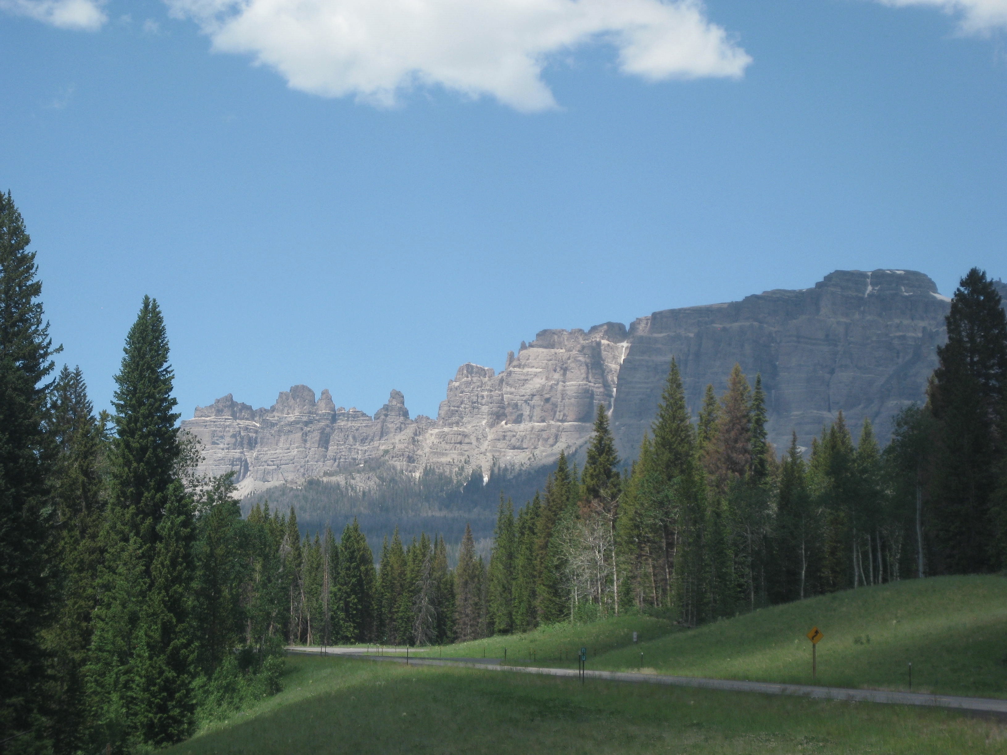
I knew today would be a beautiful ride as we were traveling through Teton National Park. We started the climb and I was awe-struck by the beautiful mountains before me.


Since we left camp early we got ahead of the influx of traffic (motorcycles, trailers, trucks, and RV’s). made our way to the park entrance, paid our $12 fee (cyclist rate for Teton National Park and Yellowstone)
I was struck by the beauty and enjoyed the historic and informational signs along the way. One such sign described the Shoshone who dug Camas root for a food source. The sign stated they would wait for the flower to bloom for identification as there is another type of Camas that is poisonous. The Camas bulb would be dried and ground in to flour or roasted.

By 10am the traffic had increased significantly; it was nearly non-stop and loud. Occasionally there would be a break, a pause, and I could hear the birds chirping in the forest, I clung to their song as long as I could. If people were hoping to spot a Bison, Moose, or Elk, they were nowhere to be found as I suspect any respectable Bison, Moose, or Elk would have run for dear life to get away from the traffic noise.
We stopped for a late breakfast/early lunch at the Teton Lodge; a beautiful setting with the Teton’s making a strong presence through the full glass windows of the lodge. The café/grill has an interesting set up of counters and stools winding much like a snake. Old pictures and paraphernalia from early trappers and mountain men lined the walls. The menu was more like what I am used to with Hot Quinoa with honey and some GF items. The best part was they carried Seattle’s Best Coffee, I think we drained the pot as most often the coffee we have had along the way in restaurants has been more like coffee from reused grounds.
By mid-afternoon we were at a midway point having ridden 30 miles and the next campground was 20 more miles down the road and into a canyon with a winding up hills. Some caring employees at the Teton Lodge suggested we wait until the morning when there would be minimal traffic to tackle the canyon as it had no shoulder. We agreed and called it a day around 3pm at the Flagg Campground..
We set up camp, started a load of laundry and walked over to their lodge that included a bar, restaurant, and gift shop. Lisa decided to stay for a drink and dinner so I walked back to put the clothes in the dryer. Back at camp I met a woman at a neighboring site. She and her husband had a motor home and I discovered, it really was their home, at least for now. Not sure as to where she wanted to lite, they traveled to and fro sometimes staying in parks for a few months.
My food option for dinner was to scrape from the bottom of my bag and ended up with: a handful of GF crackers, a small cup of peanut better, and a small can of mandarin oranges. An odd combo, but it worked.
As the evening wore on the mosquitoes made an appearance so we took to our tents and welcomed sleep.
….I’ll keep you posted.
Day 62 Dubois to Moran Junction 7/7/14
STATS
Miles: 56.68
Calories:4,363
Top speed: 30.4
Average speed: 8.4
Elevation: 6,863
We made an attempt to get out of Dubois early but didn’t happen. I was packed up first so headed over to the local market to pick up some food supplies. I headed back to the motel and Lisa was ready to go so off we went toward Moran Junction. Soon we were back into the pine trees and I began to see some hawks soaring through the sky. I had missed the hawk.
I rode fast out-of-town as any meandering meant the mosquitoes would find me and attack. I finally Googled, “how fast can a mosquito fly” and found they could fly 1.5 miles per hour. “Then why do they seem to be following me”? I think I finally discovered their trick. After they swarm, and as I take off, they attach themselves to the panniers and hold on, then when I stop, they swarm me again, the little %$*%*%$ !!
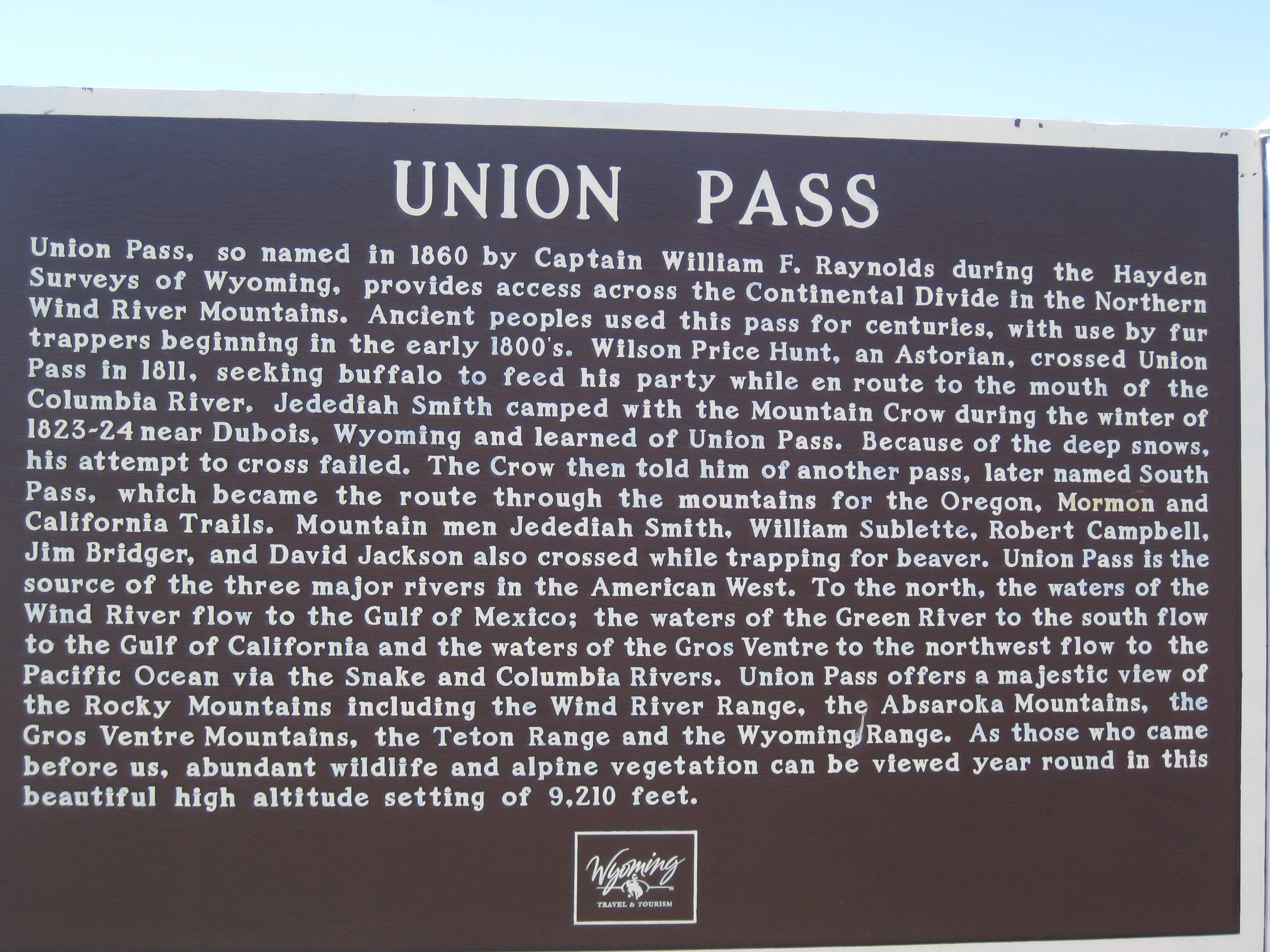
We stopped for lunch at a rest stop, filled our water bottles and learned a bit about Union Pass. (click to enlarge)
Soon we were climbing Togwotee Pass. It was a gradual up hill at first and the beautiful mountains kept me distracted as I spun my way forward. On one of the uphills we met two fellows riding the Great Divide (a mountain bike trail). They were impressed with some of our gadgets like the Click Stand and we were impressed by how little gear they were carrying.
The last 6 miles up the pass were tough at a 7% grade. There were times I had to dig deep and say, “you can do this!”, and I did as what’s the alternative? (elevation 9,584)

As I waited for Lisa at the top a fellow came by in his car. He introduced himself and stated, “I was next to you at the motel and heard you talking about your trip”. Phil and I chatted for a while and learned he had recently been discharged from the military, was experiencing some personal life changes and decided a road trip was in order. Phil asked me about traveling by bike across the country. I told him it is very different than by car. “How so?” he asked.
Melinda’s Philosophizing– I don’t think I gave Phil a quality answer at the time but thought about it during the day. Phil, here is your answer. Riding a bike across the country, or any long journey, ignites one’s senses. One smells the prairie grass, the dust blowing off the valley floor, the sweet smell of honeysuckle, and the smell of rain and the wet leaves. One hears the birds belt out their songs, the scurry of a lizard into the brush, the squeak of the prairie dog announcing one’s presence, and the call of a long-horn steer. One sees the world go by at a slower pace, a pace that allows one to see: the twisted branches of a pine tree, the fireflies as they dance at dusk, the intricate layers of sediment in the ancient rock formations, and the billowing clouds as they change in to animals marching across the sky. Beyond the senses one feels the history of the land pass through one’s being like ghosts. One can feel the tragedy of the Civil War, the pain of Native American tribes as they slowly lost their way of life, and the strength and determination of the pioneers. Traveling by bike lets the senses soar like the hawk that floats on the wind.
Lisa arrived and we wished Phil and good journey and enjoyed a long and gradual downhill and our first view of the Tetons.

Out of the higher elevations we cruised downhill for miles and arrived at a campground a few miles from Moran Junction. Lisa ordered a burger at the campground while I went and found the tent site and to my horror it was right next to a nearly stagnant stream, in other words, a mosquito haven! I put up my tent as fast as I could dancing around like a prancing pony trying to keep them off me but it was no use. Within minutes I had 20 more bites on my legs not to mention arms and rear end. My only protection was to get to the shower and then in to my tent ASAP, but they were even in the restroom/shower. Lisa donned her mosquito pants and head net as soon as she saw what we were up against. It was like a B rated horror movie. Later, as I laid in the tent, I counted dozens of the little buggers that had made their way under my rain fly but a careful check revealed, in the tent, all was clear. Lisa however found 8 in her tent and they soon met their maker.
… I’ll keep you posted if I have enough blood left in me by morning.
More PICS:

STATS:
Miles: 77.26
Calories: 5,793
Top Speed: 28.5
Average speed: 9.4
Elevation: 6,947
We left Lander early as we knew we had a long ride today. We traveled through the town of Lander, it was quaint and seemed to have a variety of coffee shops, restaurants yet maintained a “western” feel.
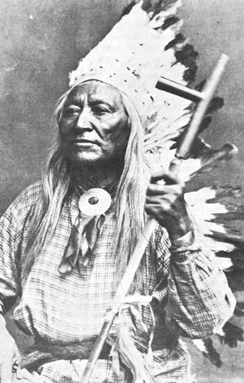
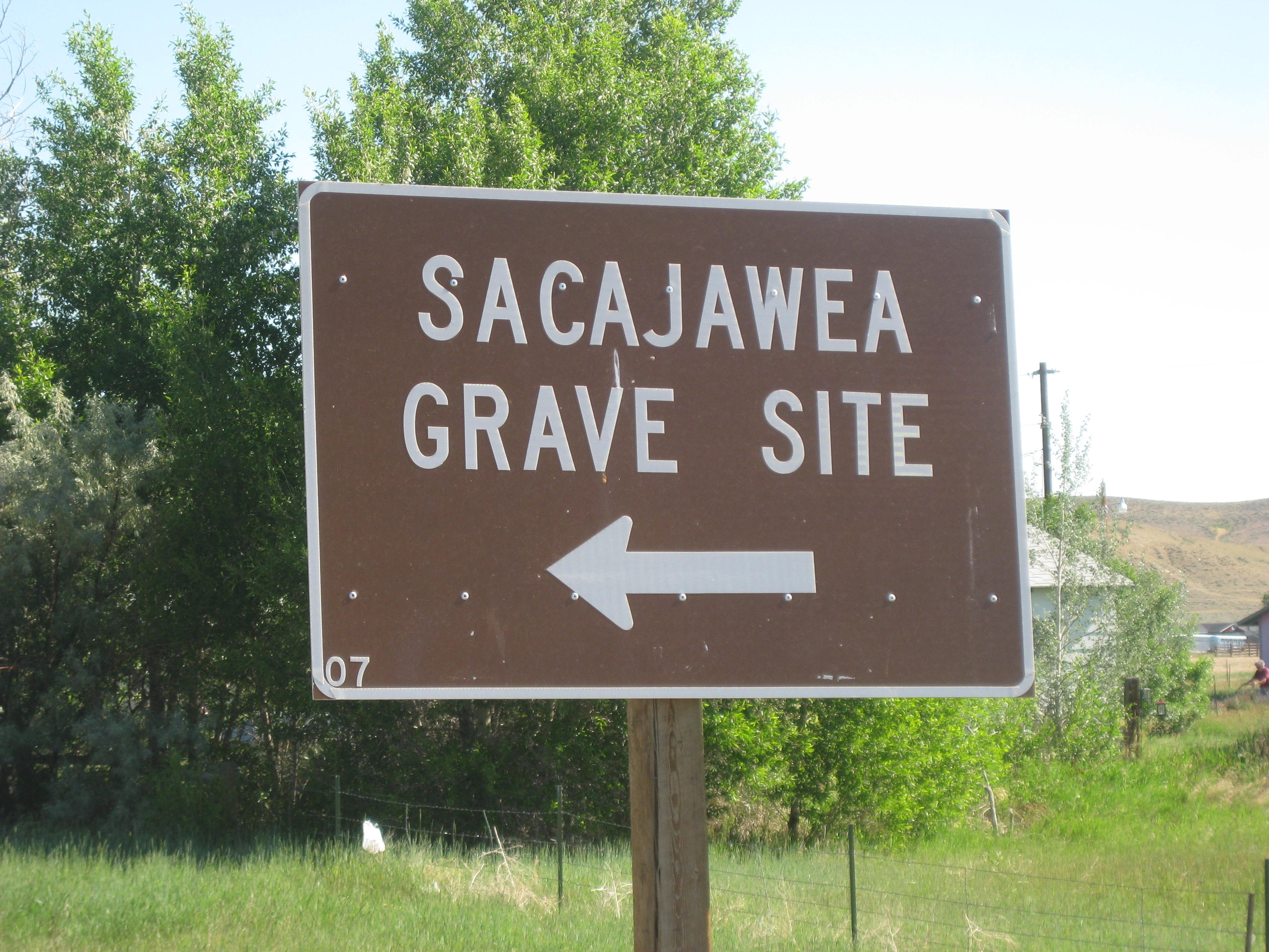
The road was flat yet heat of the day began to rise from the black asphalt telling me it was going to be a scorcher. Soon we entered the Wind River Reservation of the Shoshone, a reservation that included beautiful mountains, lakes, and of course, the Wind River. Stopping at an Indian Art and Gift shop along the route I learned that Sacajawea was from a band of Shoshone and it is believed that after she left Lewis and Clark she returned to her people in this very area near Fort Washakie (Wash-a-kee).
Chief Washakie was an amazing chief, to read more click in the link.
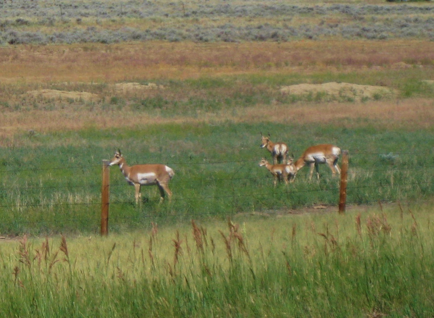
The landscape seemingly desert-like, gave way to life with a family of antelope grazing near the road.
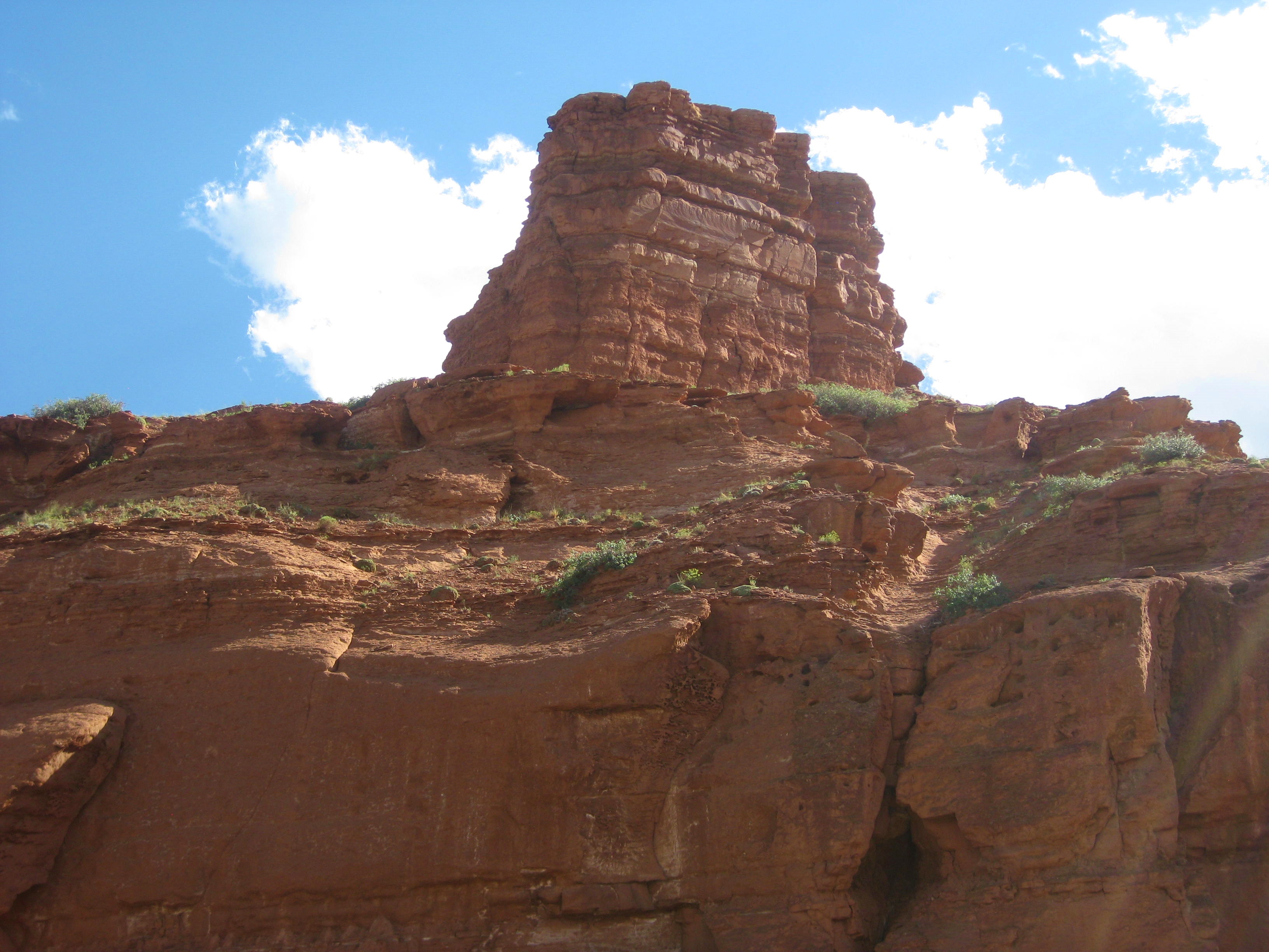
One of the enjoyable aspects of traveling by bike is one sees the subtle changes of the terrain. This was apparently as we rode through the reservation. Soon mountains and buttes rose from the flats.

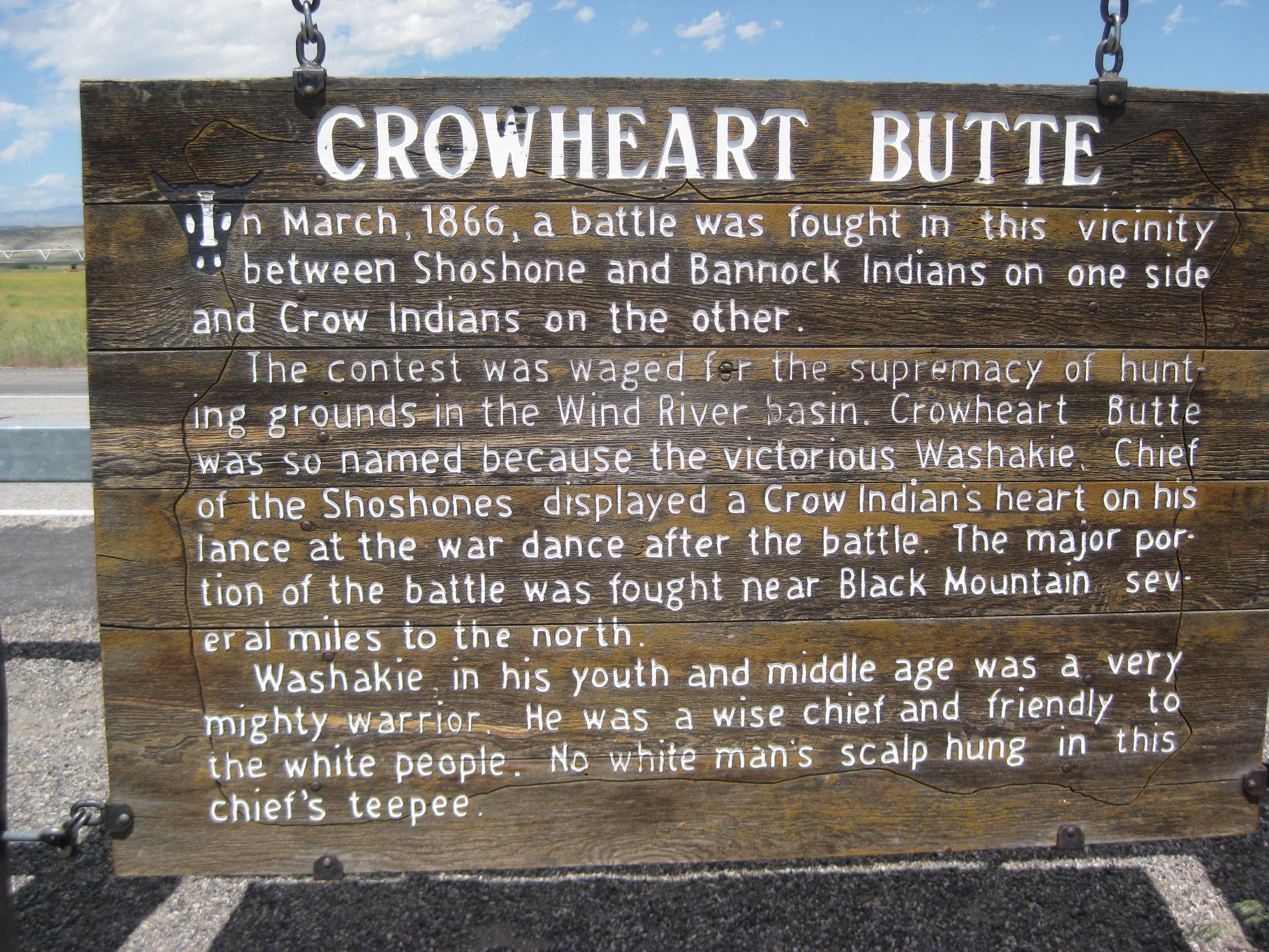
One butte, “Crowheart Butte”, seen above, had a significant history that involved Chief Washakie (click picture to read inscription)
The heat of the day was searing, low on water, I was delighted to see a gas station coming up. Lisa and I stopped for a cold drink. Soon we entered the canyons of the Wind River (still reservation land).
The photos speak to the beauty.

The long ride, long day, and heat had taken its toll. Good ‘old Dad had offered to get us a hotel room, we didn’t resist. As we rode into Dubois I saw a sign for the Super 8 and it said there was a restaurant next door. I waited for Lisa near the sign and when she arrived we rode the extra 2-3 miles to the Super 8. I walked in and found they wanted $139 for a room. “Are you kidding”?, I thought to myself. I put on my rug merchant hat and made an attempt to do some negotiation, but to no avail. He suggested a place back down the road for $ 79.99, better. Lisa was not so happy we had to head back into town with a strong headwind, but it was a good choice. The motel was quaint with a log cabin feel. We were able to squish our bikes and us into the room. Lisa went next door for dinner while I made GF noodles and threw in a can of chicken.
It didn’t take long for us to collapse into bed…zzzzzzzzzzzzzzzzzzzzzzzz
…I’ll keep you posted.
STATS
Location: Wyoming
Miles: 43.89
Calories: 2,797
Top Speed: 27.1
Average speed: 8.1
Elevation: 6,572
It reminded me of the movie “Castaways”. Tom Hanks has built his raft and is waiting for the wind to change so he can make his getaway off the island.
At 3am, our tents behind the shrub at the Wyoming DOT building began to jostle in the wind. The wind has shifted. Previously the shrub had protected us from the wind, now it was practically blowing us over. At 5am I hear Lisa say, “You awake”? “ Yes”, I reply. “I think we have a tailwind, should we get out of here”? “Let’s go”. We packed up in record time hoping the “odds would be in our favor” (Hunger Games). The wind was blowing so hard it was difficult to take down our tents. My new ($269) tent blew into the shrub and I got a hole in the netting. Oh well, it is what it is, it is now patched with a clear tube patch and it works quite well. At 6:15am we were on our way.
We had a tailwind for about 20 miles then it shifted to a side-wind. As we rode I saw Prong-Horned Antelope prancing across the hills. We arrived in Jeffery City for breakfast. At one time Jeffery City was a hopping place subsisting on mining, now there are 50-ish residents.
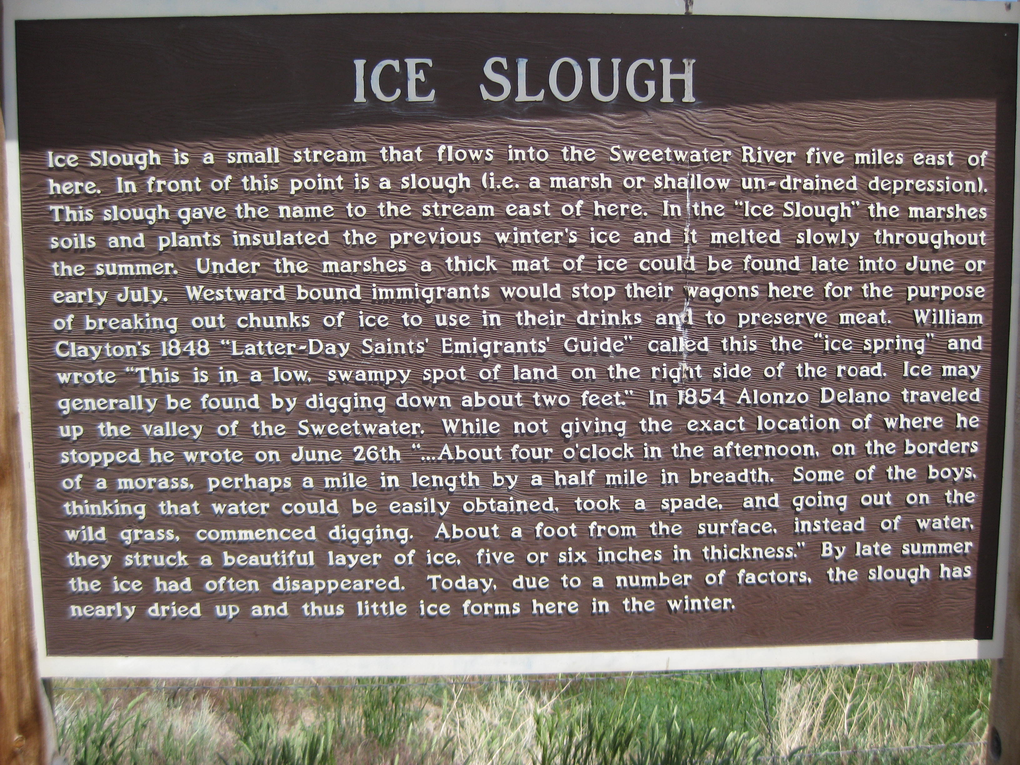
As stated in the previous posting this area is rich in pioneer history. One geographic marker is Split-Rock

History: “Without highway markers or signs to lead the way, Indians, trappers and pioneers watched for natural landmarks to guide them along the trails. One such landmark was Split Rock, east of present day Jeffrey Cit. Split Rock, as its name implies, is a cleft in the top of a string of low of low hills and buttes called the Rattle Snake Range. Near Split-Rock are the remains of an ice slough. A foot of peat covering the slough once kept water frozen until late in the summer”. (TransAmerica Trail Map)
SPLIT ROCK

(Click picture to enlarge)

(the green area is the ice slough)
Ready for some breakfast since we split the DOT at 6:15 am, we had an interesting experience at the only restaurant in Jeffery City. I walked in and there was no one to greet me. A woman with a male were eating breakfast. “Is this the restaurant”? I asked. “Yes” stated the woman. I was not sure if she was a customer, a ‘regular’ or something else. I sat down and Lisa soon joined me. There was a large coffee pot on the counter. I said, “Should I help myself to coffee”? The woman, still eating breakfast, “Sure, or I can get it”. I finally figured out the woman was the waitress. We sat there perusing our menus wondering if we should place the order ourselves. Eventually the woman finished her breakfast and came over to get our order. Lisa and I joked, “Do you think we will have to cook the food ourselves”? We continued to help ourselves to coffee and the waitress finally gave us our breakfast which was plentiful and tasty. When we were ready to be on our way we wondered if we should leave the tip for the cook rather than the waitress as all she did was take our order and collect our money.
THE 6th CROSSING
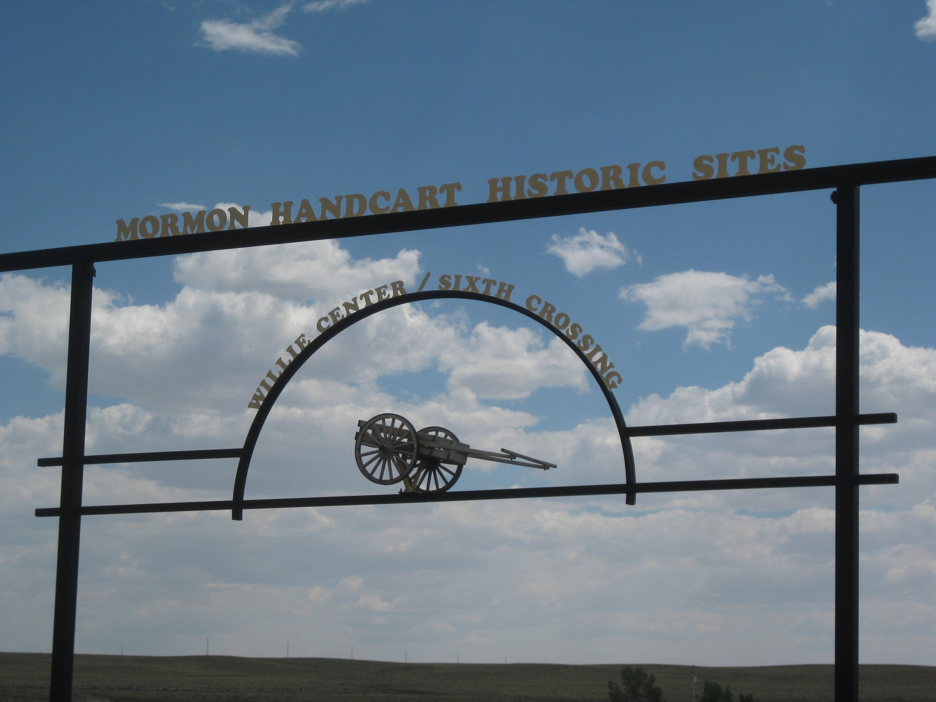
We arrived in Sweetwater late in the afternoon. We stayed at the “Mormon Handcart 6th Crossing” where there was a large campground/visitor center. The center allows cycling tourist camp at no charge (a plus in my book!) The history of the area was fascinating. We set up camp and headed over to the museum. The couple (Mormon Missionaries) gave us a history lesson of the area. The area in which the campground sets is called the 6th Crossing as it was the 6th Crossing of the Sweetwater River made by Mormon pioneers on their way to Salt Lake City.
History: Mormons arriving from Europe, mostly poor and persecuted for following Mormon philosophy, (approx 30 thousands) made their way across the seas. They then ventured to Iowa City. There, they were met by other Mormons who helped them build handcart as many could not afford oxen to pull their carts. Apparently handcarts are very effect as a means to travel. Each person was allowed to bring 15-17 lbs of personal items. Not having to carry water for oxen, the families could push the handcarts more quickly and effectively. However, two groups, the Willie and Martin Company, named after their leaders arrived late in the year. Most groups left Iowa City by early spring. The Willie and Martin Companies left late in June as they did not have the supplies or means to winter in Iowa City. Mostly European and unaware of the winters in Wyoming the companies pressed on thinking they would arrive before the winter hit.

In Salt Lake City, wagons filled with food and supplies typically met the travelers at the 6th Crossing (of the Sweetwater River). Those in SLC did not think the Willie and Martin Company would try to make the crossing so late in the spring, but they did.
It was at the 6th Crossing when winter hit at the end of October with 3 feet of snow. Out of food, but needing to keep pressing forward sixty-nine died. The missionaries told us of some touching stories, kept in journal. One of a 12 year old boy who carried his 4 year old brother across the Rock Ridge, a rock strewn mountain. When they got across the ridge he sat down in camp and died, most likely from exhaustion and exposure. Another touching story was 10 year old girl who was in-charge of a 4 year old, they somehow got away from the group and both died from exposure.
When the group in SLC learned that 2 more companies were passing through Wyoming they sent out search and rescue parties. Eventually they found both groups starving and near death.
There was a listing of all the survivors and those who perished. We were surprised that many of the young children made it, one was 1 year. Some were also in their 60’s, old for the time.
For more information about the 6th Crossing: Website
One of the most interesting aspects of the campground is they have hundreds of replica handcarts. Mormons, and I assumed some non-Mormons, come to this campground every year and can actually follow the trail of the Willie Company across the 6th Crossing of the Sweetwater River. Pushing handcarts, adults, children and teens are able to experience the hardships of those who came before them, of these children and teens are some of the ancestors of these Mormon pioneers. Whether one is Mormon or not, it would be a wonderful experience as a component of American history for children and teens to experience pushing these carts across the river and even the Rocky Ridge. It is certainly a hands-on experience for anyone.
I would like to thank the Missionaries for educating us on this historic area and the interesting history of those who survived the hardships and those who succumbed to them.
Melinda’s Philosophizing– As I drifted off to sleep I am in awe of the history of this section of Wyoming. Looking back from a 21th Century perspective, one can only be inspired by the perseverance of these pioneers. They must have known that crossing the west had inherent dangers, attacks from Indians (I am not going to place any blame here as they were trying to hold on to their livelihood, their culture, and traditions), death from exposure, disease, or physical hardship. For many of these families it was a desire or hope for a better life in the west. In a similar way people do the same today; people come to the US from other countries seeking a new life, something better for their children and themselves. Ultimately, these choices are based in survival, a deep aspect of human nature.

(interesting rock formation)
…I’ll keep you posted.
Sorry for the delay in posting we have had little to no internet.
STATS
Mile: 48.13
Calories: 2,826
Top Speed: 29.2
Average speed: 8.9
Elevation: 6,344
We stopped at a diner in Rawlins before heading onward. I tend to eat faster that Lisa I finished breakfast and headed across the street to the grocery store. I loaded up on food since I have had little for days: GF oatmeal, foil packed salmon, peanut butter, GF cookies, GF noodles, corn tortillas, apples and peaches. Ahhh, to have some real food again! I also picked up 2 American flags, since it is 4th of July, so we could attach them to the back of our bikes.
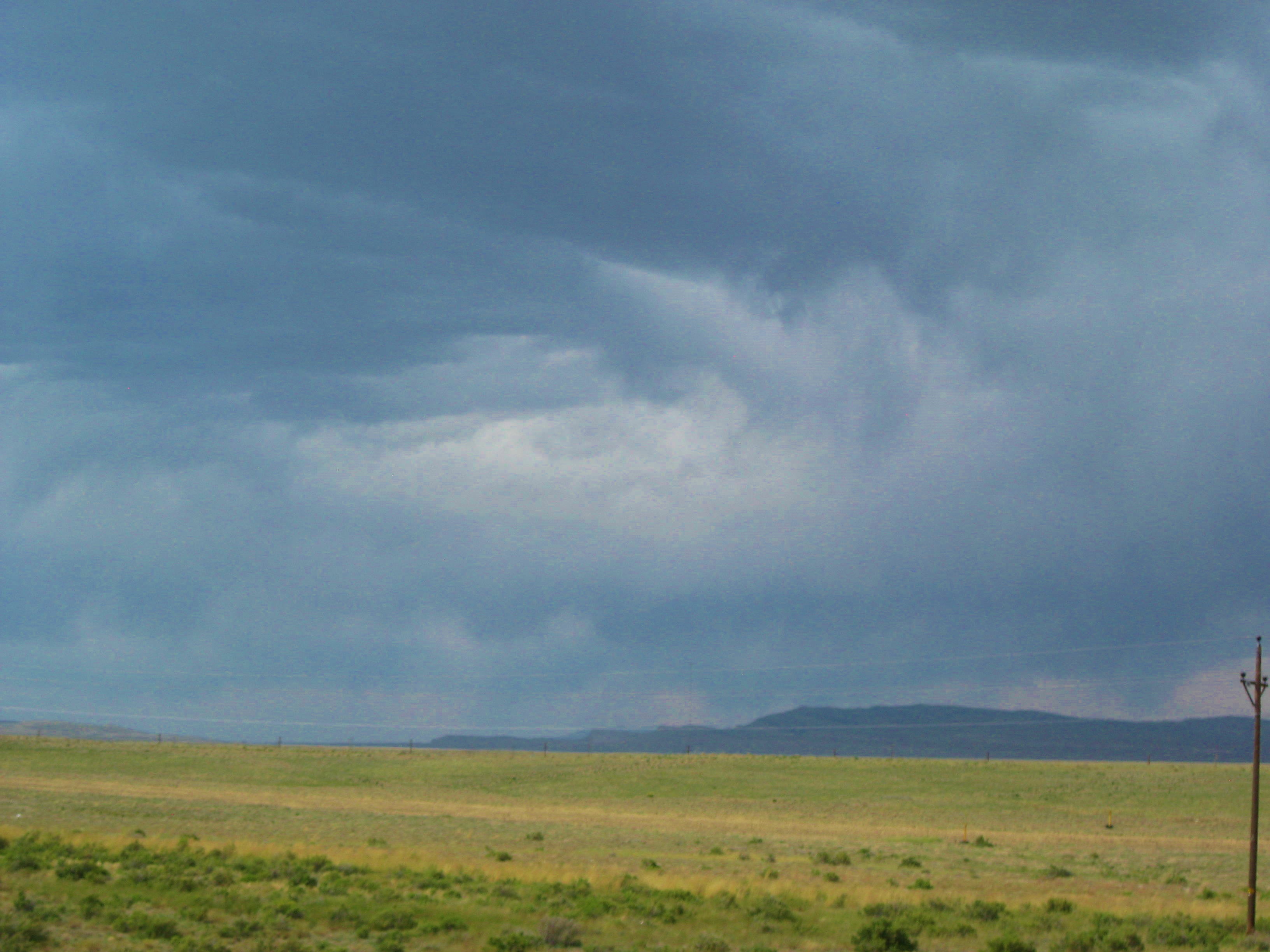
We headed out of Rawlins. The terrain has changed to high desert and I find interest in the rocks and sweeping cloud formations.

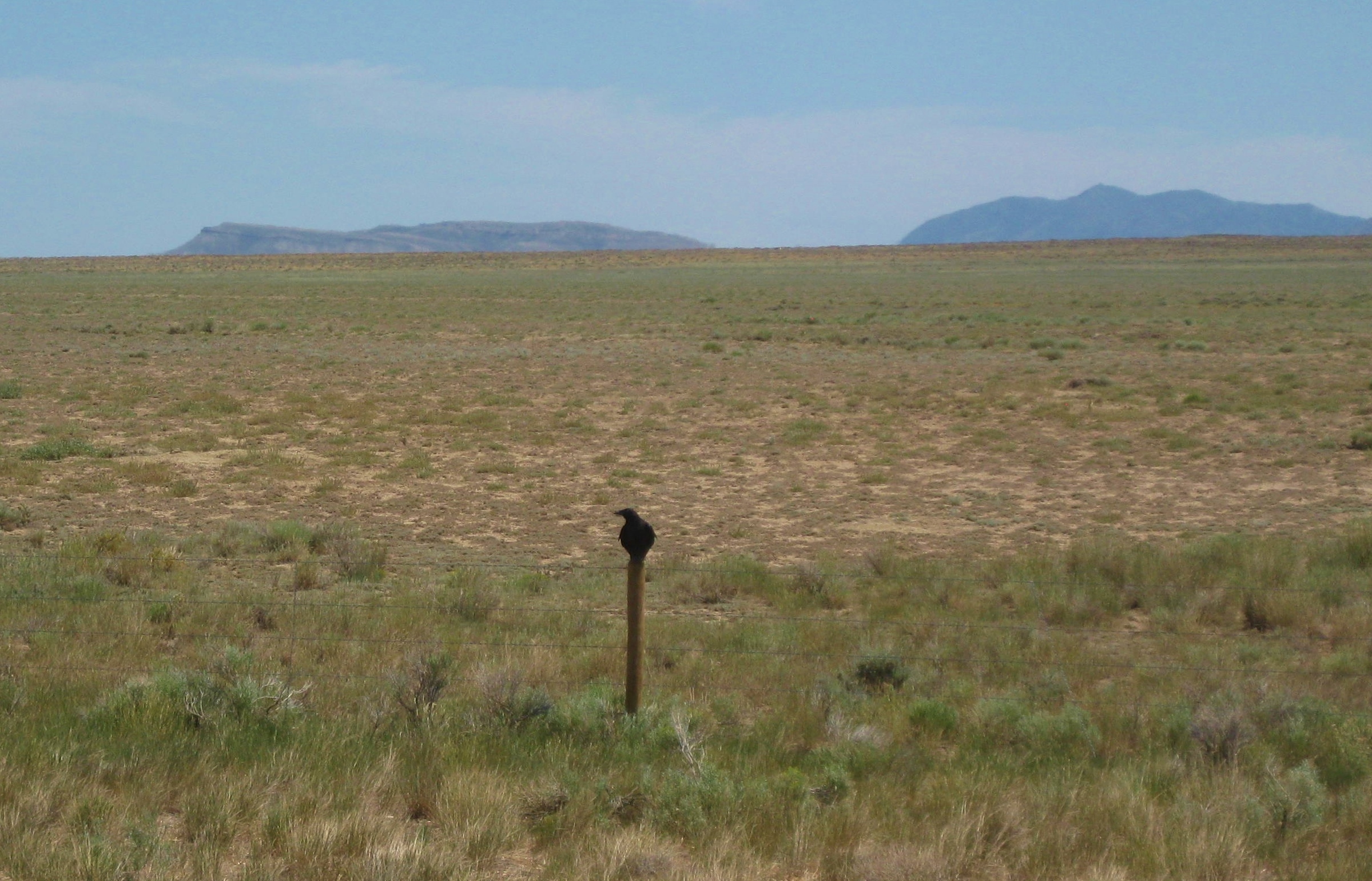
I love this picture of the single crow on the fence post. In a way, it symbolizes the starkness of the Wyoming plains.
Today we met 3 or 4 east bound riders, some wanted to know what was in store for them ahead. We try to keep it positive but do warn them about the mosquitos.
Melinda’s Philosophizing– I have noticed that many cyclists want to inform us of the “horrors” ahead: no shoulders, horrific wind, the monster hills, and other challenging conditions. It is as if it is a badge of courage to inform others what they were up against and how they were victorious. I have caught myself, on more than one occasion doing the same. I have decided I don’t want to know what is ahead, I want to meet those challenges as they arrive. In addition, in the future, I will focus my comments to other TA cyclists on the positive. It is an interesting component of human behavior that one feels they need to relay the challenges of life such as, “It’s going to be really hard”, “You probably won’t make it”, “Good luck with that”, rather than focusing on the positive. Perhaps it is like the peacock displaying his fancy feathers, “I was victorious battling the wind, the hills, and the heat”. Humans are interesting.
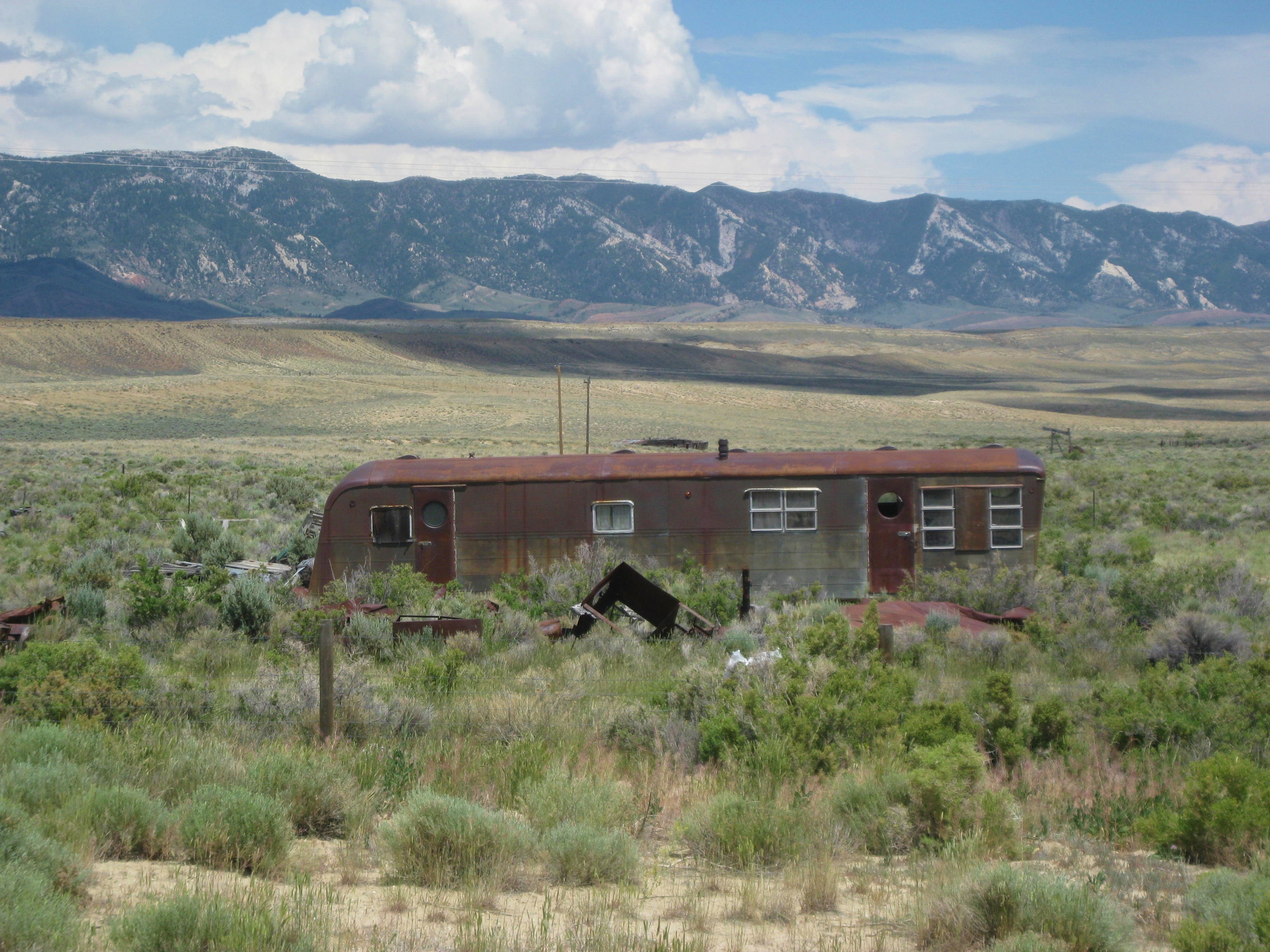
It was a hot day, well into the 90’s. By mid afternoon we arrived in Lamont. This abandoned trailer was about all there was in Lamont.
We continued on to Muddy Gap (I don’t make up these names). However, historically Muddy Gap is an important place in the western movement. CLICK TO ENLARGE TO READ>

The town of Muddy Gap consisted of the DOT for Wyoming, a convenience store, and a house where no one was home. Lisa went over to the convenience store and bought some Root beer for us and we then decided where we would camp. We opted to “stealth camp” behind the bushes at the DOT. It was Friday and a holiday weekend so we figured we had the place to ourselves. We set up our tents and actually slept pretty well. No one knew we were there and it was kind of fun being so “stealthy”.

…I’ll keep you posted.
Location: Wyoming
Miles: 57.69
Calories: 3.693
Top speed: 25.8 z
Average speed: 9.8
Elevation: 6,813
We left the RV park at 8:00am and walked our bikes across the street to the local diner. I had a wonderful omelet that I could not finish and yummy hash-browns. After breakfast we added air to our tires and I stopped at the local convenience store for some ‘road snacks”. Not finding a real grocery store I have been eating peanuts and bars as a main meal, not good, but it is all I can find on the road that is gluten-free. Although today I found a bag of almonds and Fritos!
We started toward Rawlins, Wy. Early afternoon we entered Saratoga and enjoyed an ice cream at a gas station. I guess there was nothing too exciting about the ride as I made no notes. I guess some days are like that.
Leaving Saratoga I saw a dead hawk alongside the road. Not that I am into plucking, but I took a few feathers. In some tribal cultures it is important to leave a gift when one is given something. I forgot, yet left a gift further up the road at a unique rock monument. Don’t want any “bad medicine”.
Today we had no mosquitoes but we had the wind! Will we ever get a break with the wind?
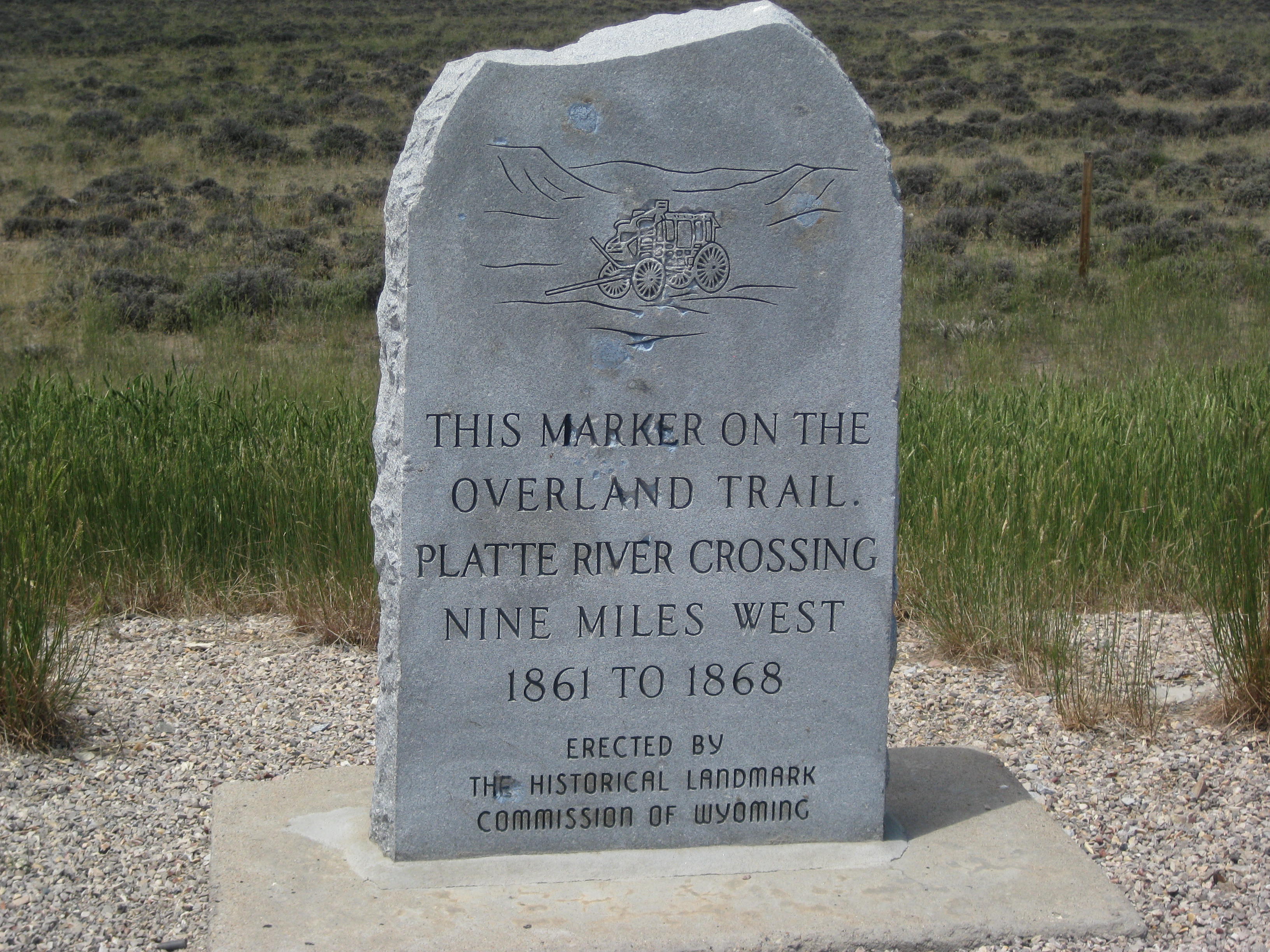
Here is a marker for the Overland Trail, it was used as an alternative route to Oregon, CA, and Utah and of course by the Overland Stagecoach Company.
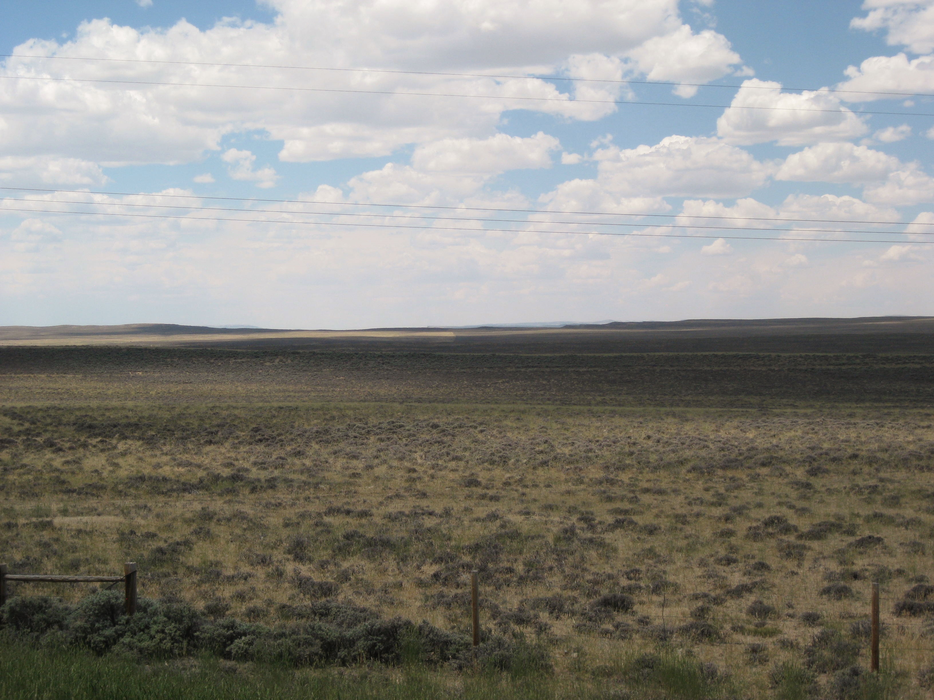
The view at the marker:
Here in Wyoming there is a “whole lot of nothing”. That said, it is much prettier than Kansas (sorry Kansas). Thinking of the thousands of people who came west to start new adventures in their lives is inspiring.
Melinda’s Philosophizing– In a way, on a much smaller scale, I have gained an understanding of the tenacity and hardships the pioneers must have experience to come west. Pioneers typically traveled 10-15 miles a day. While we are typically traveling 40-50 miles we experiences every incline, roller, and mountain. We are feeling the hot sun, and the need for water and food. We see the bleached remains of antelope and deer as we press on. There must be some adventuresome DNA in me to push me toward such an adventure and more DNA that is expressed in tenacity. I can only thank my parents James (Jay) and Bettye and their lineage for that tenacity and strength.
I feel a kinship with those early pioneers was I drag myself, bike and gear through the valleys and up the mountains. In a way it seems familiar, perhaps in another lifetime I was a pioneer. However I have always had an affinity of the Native American culture, Perhaps that is why, as I ride, I seek totems symbols of my journey and am somehow appalled by the fences that shout “ this is my property”, as in Native culture there is no concept of owning property, that is a “white man’s” perspective. I imagine what the land looked like with no fences and am enveloped by its beauty.
After battling the wind all day we were glad to finally make it into Rawlins. Not a large town, but a population 9,259. We found the KOA, a bit off the beat’in track. Our space was gravel but next to us was a covered pavilion with a stove and tables. We set up camp and cooked some GF Mac n Cheese and I pulled out my last bit of food from my pannier, instant brown rice that I got from our stay in Farmington, Missouri. Tomorrow I will find a grocery store and stock up, I am really missing fruit!
Off to sleep as tomorrow we are off to somewhere further down the road.
…I’ll keep you posted.
STATS
Location: Colorado into Wyoming
Miles:48.47
Calories: 4,245
Top speed: 35.5
Average speed: 13.9
Elevation: 7,172
We enjoyed breakfast with Jules and talked, talked, talked. We bid our goodbyes around 8:30am, Jules heading home to California and we pushing forward toward Wyoming.
We rode into the basin which the Ute’s called the “Bull Pen” as it held most likely thousands of buffalo. Here is some history about the North Park basin and Walden.

A few miles past Walden we stopped to view a house with hundreds of swallows swarming around. From the looks of it they had made mud nests in the eaves of the house. I don’t know why more people in this area don’t make use of swallows for mosquitoes. In the south it was not uncommon to see swallow gourds handing outside of homes to keep the mosquitoes down.
Needless to say we battled skitters all day. Stopping, even for a few minutes meant 10 or more bites
The terrain is getting notably dryer, sage and scrubrush are plentiful and pines are diminishing. We are passing more cycling tourists heading east sometimes we gather to chat other times we just pass and wave. Sometimes one just does not have the energy for pleasantries.
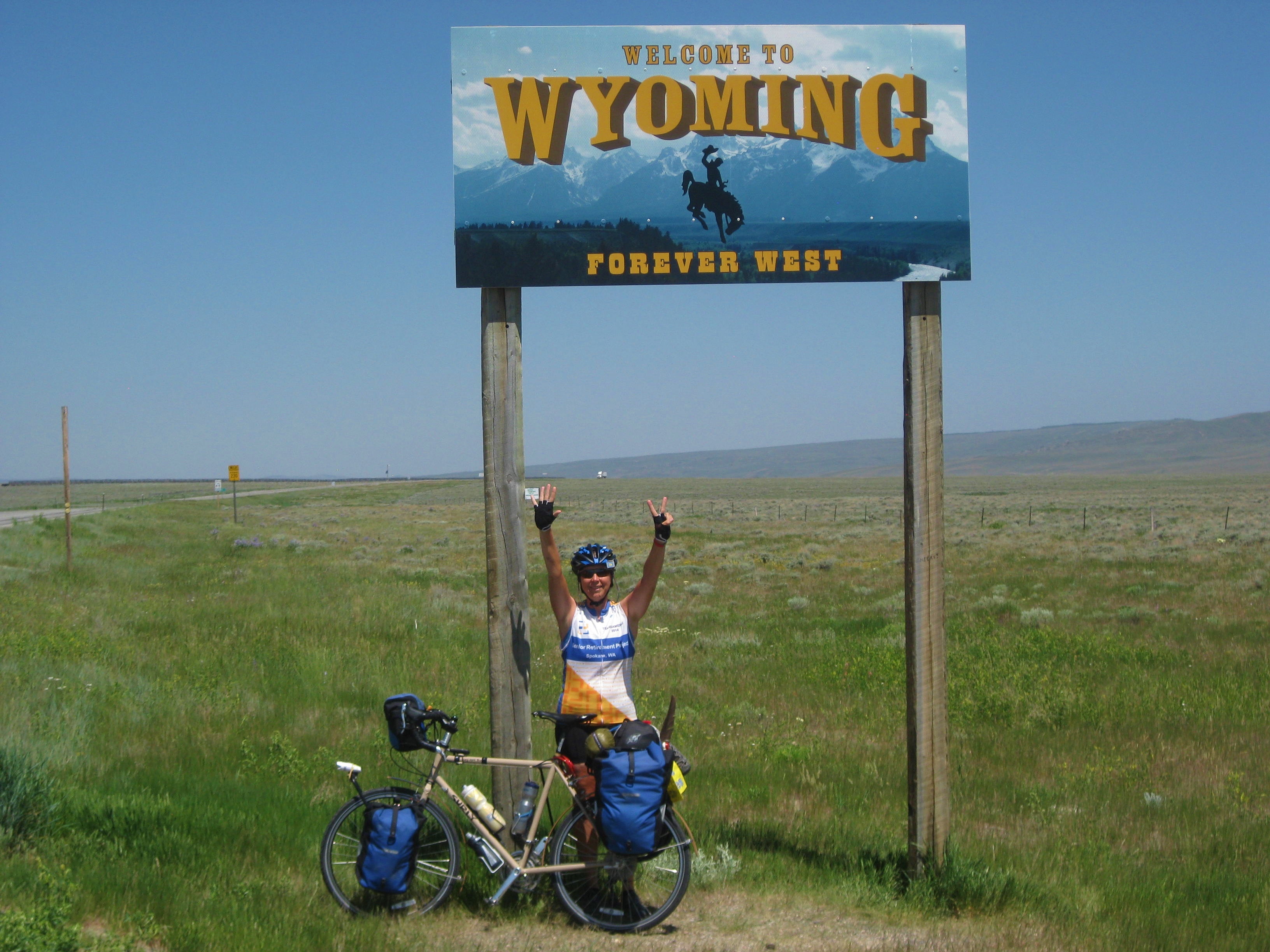
We finally reached the Wyoming border. We have now completed our 6th state and beginning our 7th.
I had a couple of interesting animal and bird sighting. We saw a bald eagle soaring and floating on the wind and a badger and I had a “sort of “close encounter. I was riding along when out of the sagebrush; about 25 ft away was a very large badger. He saw me and said, “Oh, $*&@$%”. I saw him and said,” Oh, #%&$#@”. He turned and headed down the gully. Not wanting to miss this shot and was able to get his face in the brush. He was big the size of a dog and in the picture you can see his stripped face. (Click to view larger)

We had a nice downhill into the town of Riverside which sits next to the town of Encampment. Or should I say mosquito heaven. We camped at an RV park, on the grass, and we might as well put a sign out that said, “Eat Us”. We quickly put up our tents, headed for the showers, then headed across the street to the local lodge/diner/bar to get away from the bitters. Lisa ordered dinner but unfortunately there was nothing on the menu that I could eat so after I downed 3 glasses of root beer I headed back to the RV Park to make some noodles mixed with instant potatoes topped with dried cranberries. I gulped it down, washed the dishes and dove in to my tent. I counted 27 bites on one leg! We tucked Bounce (dryer sheets) near the tent doors and it seemed to help keep them at-bay.
…I’ll keep you posted.
STATS
Location:Colorado
Miles: 41.62
Calories: 3,139
Top Speed: 27.0
Average speed: 10.1
Elevation: 8,188
I awoke at 6am. The sun was peeking over the mountain but I stayed snuggled in my sleeping bag waiting for it to rise higher and flood my tent with warmth, for I had been cold during the night. By 6:15 the chill in the air had subsided and Lisa and I emerged from our tents. We reclaimed our panniers from the bathroom and were glad we had no bear visits during the night. Lacking water, yet hungry and needing coffee, we decided to use the water from the campsite after we boiled it to kill off any “bugs”. However, the spigot had froze during the night, so Lisa used a lighter to warm it up. We brought the water to a full rolling boiling and then simmered it for 10 mins. Not sure if that was enough time but the need for coffee won over potential bugs. We had our coffee while I ate my last 2 packets of grits topped with dried cranberries. We used the remaining boiling water to fill our water bottles .
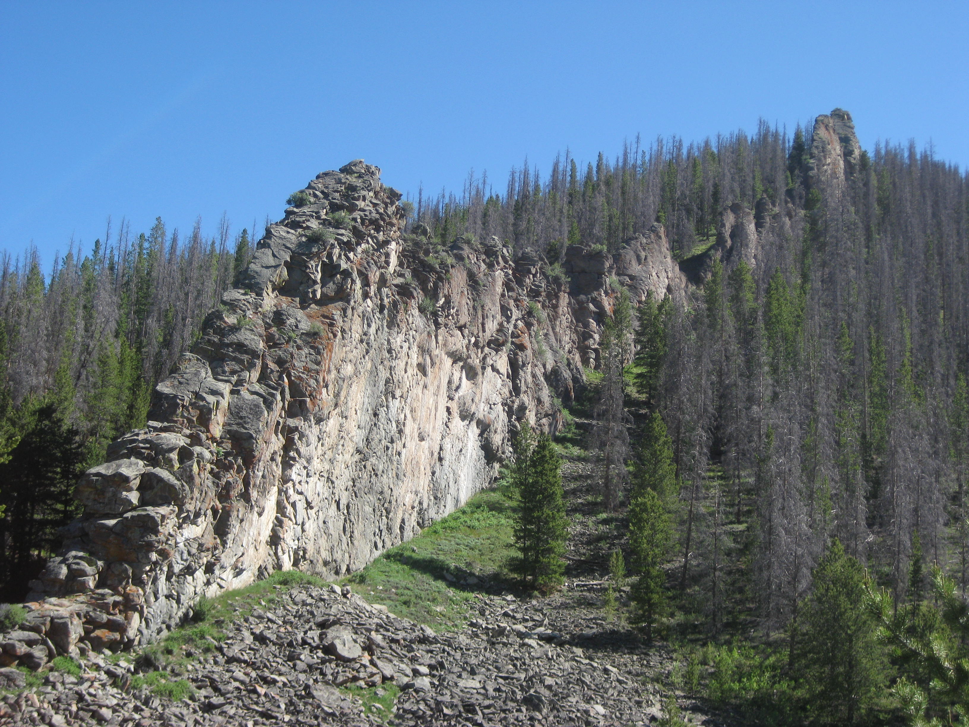
The next 5 miles were beautiful and an easy ride. We passed some fascinating rock formations. In the picture below note the small hole in the first rock at the top. You may have to click on the picture to make it bigger to view the hole.

Further down the road we met George from Loveland, CO who was out on a road bike ride. We enjoyed telling him about our trip and decided to meet at the top of the mountain for pictures. The top of the mountain was the Continental Divide. The climb was steady and 7-9% which was pretty easy compared to what we had completed in the east.
We said our goodbyes to George and as we got ready for our downhill Lisa spotted a large fox crossing the road. I would say it was the size of a large coyote.
It was chilly at the top so we put on jackets and gloves and headed downhill. The downhill wasn’t as steep as we had hoped and over the next miles we had some rollers and flats. Soon we entered into the North Park which is a flat basin of grasslands surrounded by mountains. The basin was literally miles long in each direction.

We had learned from a local that this was once home to buffalo who grazed on the grasslands and also the hunting grounds for local tribes. The basin had one more thing, mosquitos due to its high water table. We did not dare stop or we would be swarmed by the hungry monsters.
Eventually we entered a small town (which consisted of about 5 houses) and sought water from a kindly senior. He invited us in. He obviously had some hoarding issues but his home was filled with collectables from a hundred years ago . We thanked him for the water and we pushed on.
We entered Walden our stay for the night. Walden is the “Moose Viewing Capital of Colorado’… who knew?

The skitters were bad so we opted for a hotel room and our cousin Jules had planned to met us here. He had recently completed a road bike ride near Denver and was just a few hours away by car. Crazy, what took us a week to ride took him a little over 3 hours in a car!
Jules was another Trail Angel for us. He treated us to the hotel room and bought us dinner. We enjoyed a wonderful evening catching up on our adventures and his ride. THANKS JULES!!!!!!!!
…I’ll keep you posted.
Stats
Location: Colorado
Miles: 38.04
Calories: 3,618
Top speed: 28.3
Average speed: 8.5
Elevation: 8,532
Leaving the Kremmling RV park we stopped at a local diner for breakfast as we didn’t have any breakfast food left. The food was good, the coffee was hot and plentiful, no complaints. At the diner we met two other cyclists who were riding the Great Divide (a mountain bike route that runs from Canada to Mexico). Another fellow in the diner was walking the Great Divide. He spoke of his encounter with moose and a grizzly bear. He had to wait while the moose and bear left the area before he could proceed. We also met a nice family, father and two young sons. I gave them my card so they could follow the blog over the summer.
We had a nice straight road and a tailwind for perhaps 10 miles, it was wonderful. Up ahead I saw a truck and a fellow waiting by the truck, he flagged me down. I stopped and I met John and son Ben. They had just returned from a mountain bike ride and had a bag full of “shot blocks”, Via coffee, and other electrolyte goodies. They were so kind and generous they offered the bag to us. It was needed as we were running low on emergency electrolytes which we need when we “run out of steam”. THANKS JOHN & BEN!!!!
The road turned left and the sign said we were entering “Windy Gap”. The sign didn’t lie, it was windy and it was a gap between two mountains which meant…head wind. Soon we saw a sign for the head waters of the Colorado River.

A few more miles down the road we arrived at an amazing canyon with unique rock formations.

Entering the canyon I felt a sense of deep respect for the ancient rocks. The cliffs were old and weathered by a million year. Tall pinnacles stood as if they were watching my every move. I should enter and leave quietly, as not to anger the ancient ones, the grandfathers, that watch over all who enter.

Occasionally cars would disrupt the silence and soon a train whistle rattled through the canyon followed by a slow-moving train carrying coal.


Note how small our bikes look compared to the rocks
The train and cars passed. I continued to move with respect through canyon for it was surely a sacred place. As I left the canyon I thanked the ancient ones for allowing me to view its beauty.
We made our way to Hot Sulfur Springs. We did not partake of the springs but I did partake of an ice cream and Lisa had lunch. The road continued and so did the wind, a headwind. We were hoping to make close to 50 miles today but the wind would not let us meet our goal.
We climbed the mountain and finally sought refuge in a forest service campground just off the road. We were the only ones in the campground so it was a bit eerie. A sign informed us it was bear country so we decided not to cook a meal as we did not want to attract any hungry bears. For me dinner was the remnants of potato chips, a can of clams, which I ate 2 campsites away from ours, and a snacksize box of cranberries. Sounds horrible but it was all I had with me. Grocery stores have been hard to come by but our main concern was a lack of water. We had filled our water bottles before we left Kremmling but there had been no place to refill. The campsite did have a water pump but a sign said, “Not potable, water being tested”. We set up camp, ate what we had, used the non-potable water to wash up, put our food, lotions, and anything smelly in panniers and stored them in the nearby bathroom just in case we had a visit from a bear we didn’t want any food in camp. As soon as the sun went behind the mountain it got cold. I thought I was prepared, I put on kickers, wool tights, 2 pair of wool socks, 2 long sleeve shirts, a cycling vest and my cycling jacket. Around 3 or 4 am I awoke cold. The next few hours I spent trying to sleep while feeling the chill of the air surround me.
….I’ll keep you posted.
Stats
Location: Colorado
Miles: 49.19
Calories:3,324
Top Speed: 29.5
Average speed:7.3
Elevation: 9,879
We left Frisco about 8:30am after saying goodbye to Shelly, John and the dogs. Arnie rode out-of-town with us to show us the beautiful Dillon reservoir and the surrounding areas of Silverthorne and Dillon.
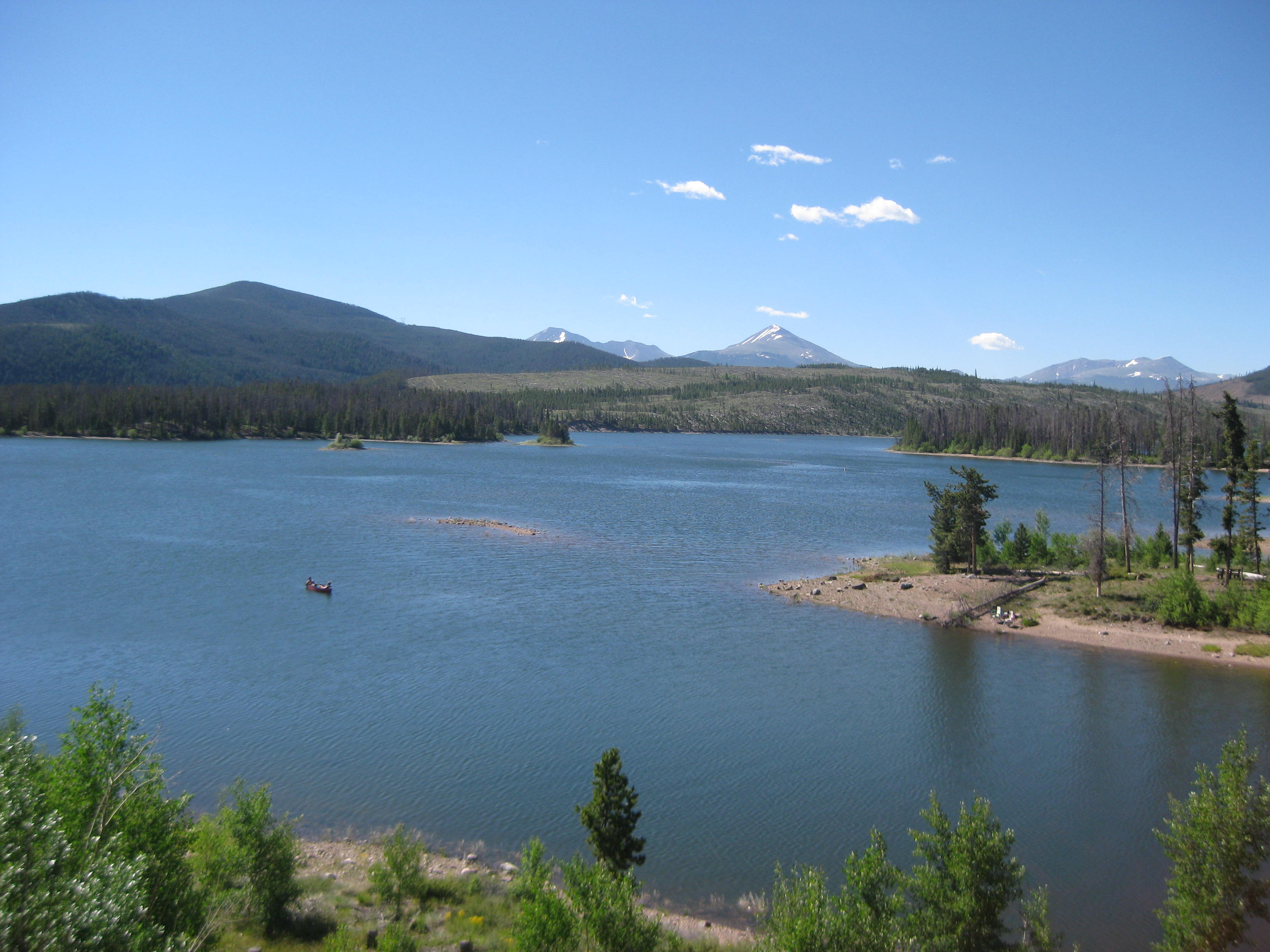
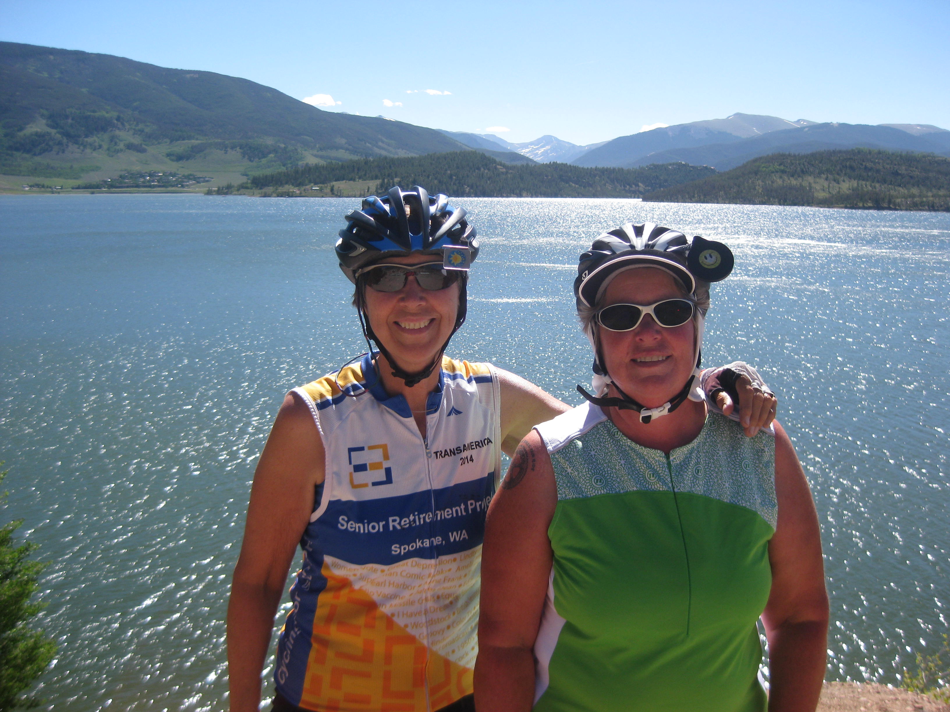
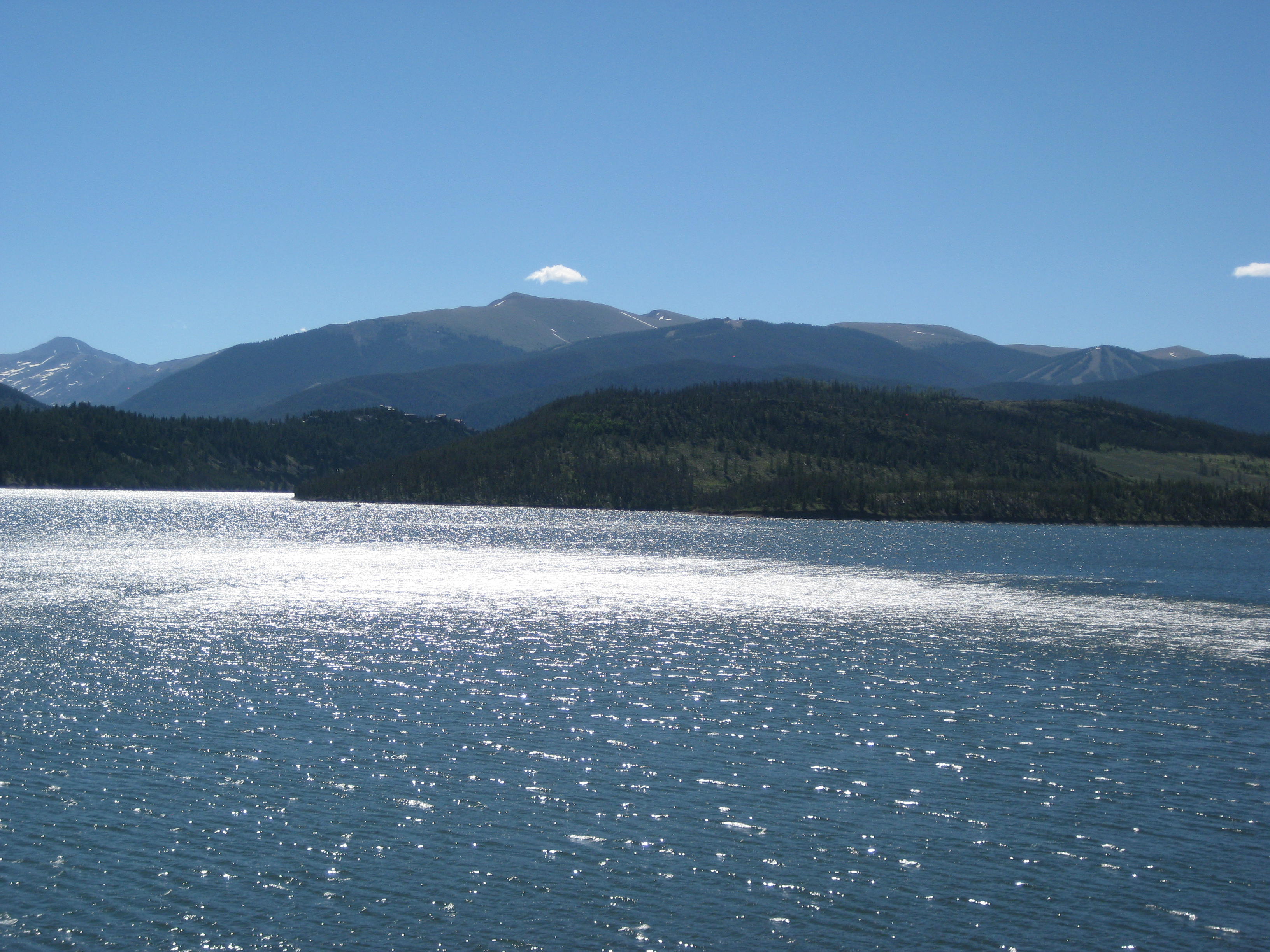
We said goodbye to Arnie in Silverthorne at the outlet mall for Pearl Isumi. While Lisa shopped, I sat in the sun enjoying the beautiful mountains and warmth. We decided to eat lunch before we left as it was getting close to noon and we had nearly 50 miles to ride. After lunch at McD’s we headed toward Kremmling on a flat gentle road that followed the river. We stopped at a bridge to watch the river rafters go by.
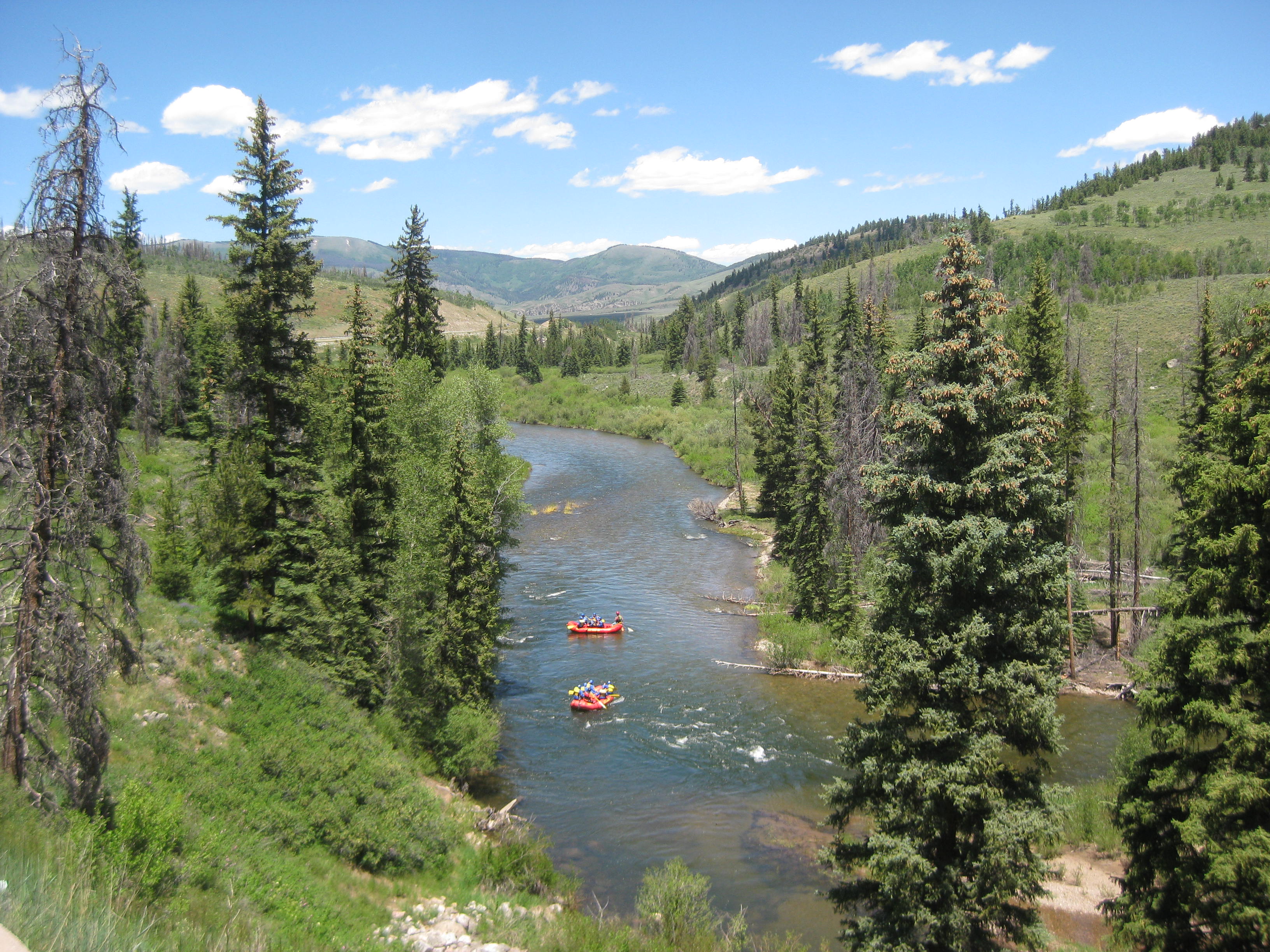
The road out of Frisco was absolutely beautiful with the mountains to the west. Eventually we turned off the road toward Kremmling. The area was filled with huge boulders on top of the nearby mountains and along the road. Some sat very precariously and felt a little anxious as I road by them.

Lisa speculated that perhaps the boulders were pushed off the mountain by a glacier, sounds plausible to me. The road took us around a large reservoir. The following picture I just love. I spotted a doe in the field, she is off to the right in the picture.

The road ended at the reservoir/dam and we continued around the dam. The road eventually took us to a highway which would take us to Kremmling. The highway had no shoulder so we had to contend with the holiday traffic. We finally made it into town, in one piece. Kremmling was a small town but it had an RV campground. They had tent sites available to we found a spot and began to set up camp with the mosquitoes. When we were in Colorado Springs Lisa bought mosquito pants at REI. When we get to Rawlins, WY, I plan to get some if Walmart carries them. The mosquitoes have been horrid, and we have heard from Eastbound cyclists it does not get any better.
After we set up camp we dove into our tents and tried to hide for the mosquitoes with some luck.
…I’ll keep you posted..while I nurse my mosquito welts!!!
STATS
Location: Colorado
Miles: 33.36
Calories:2,844
Top Speed: 25.5
Elevation: 9,089
Staying in a hotel has its benefits such as not having to take down one’s tent, but it is also easier to stay in bed longer, however, we got up about 6:45am and were ready to leave before 8am. Today is the big day, the “right of passage” on the TransAmerica Trail. Today we climb Hoosiers Pass with an elevation of 11,542 ft, the highest point on the TransAmerica Trail. It was a cold morning so I put on layers knowing we would be gaining altitude.
After we left the hotel we stopped a half mile down the road for breakfast then began our trek to the pass. Leaving town we had a wonderful bike path, approximately 6 miles to the town of Alma, the “highest incorporated town in North America” (I guess ya got to be proud of something). The town was actually quite cute and reminded me of a place a lot of hippies might have wandered into in the 60’s.

Whether I was intentionally delaying the climb or simply needed some hot chocolate to warm me up, I stopped at a coffee shop in Alma. Lisa, having sinus issues went down the street to get Kleenex. She met me at the coffee shop and we downed our drinks. Warmed up we began the climb. The climb to Hoosiers Pass was only about 6 miles and I soon discovered it was not difficult at all. Nothing is difficult after Kentucky! I did make some stops on the way up the mountain to take some breathtaking pictures.
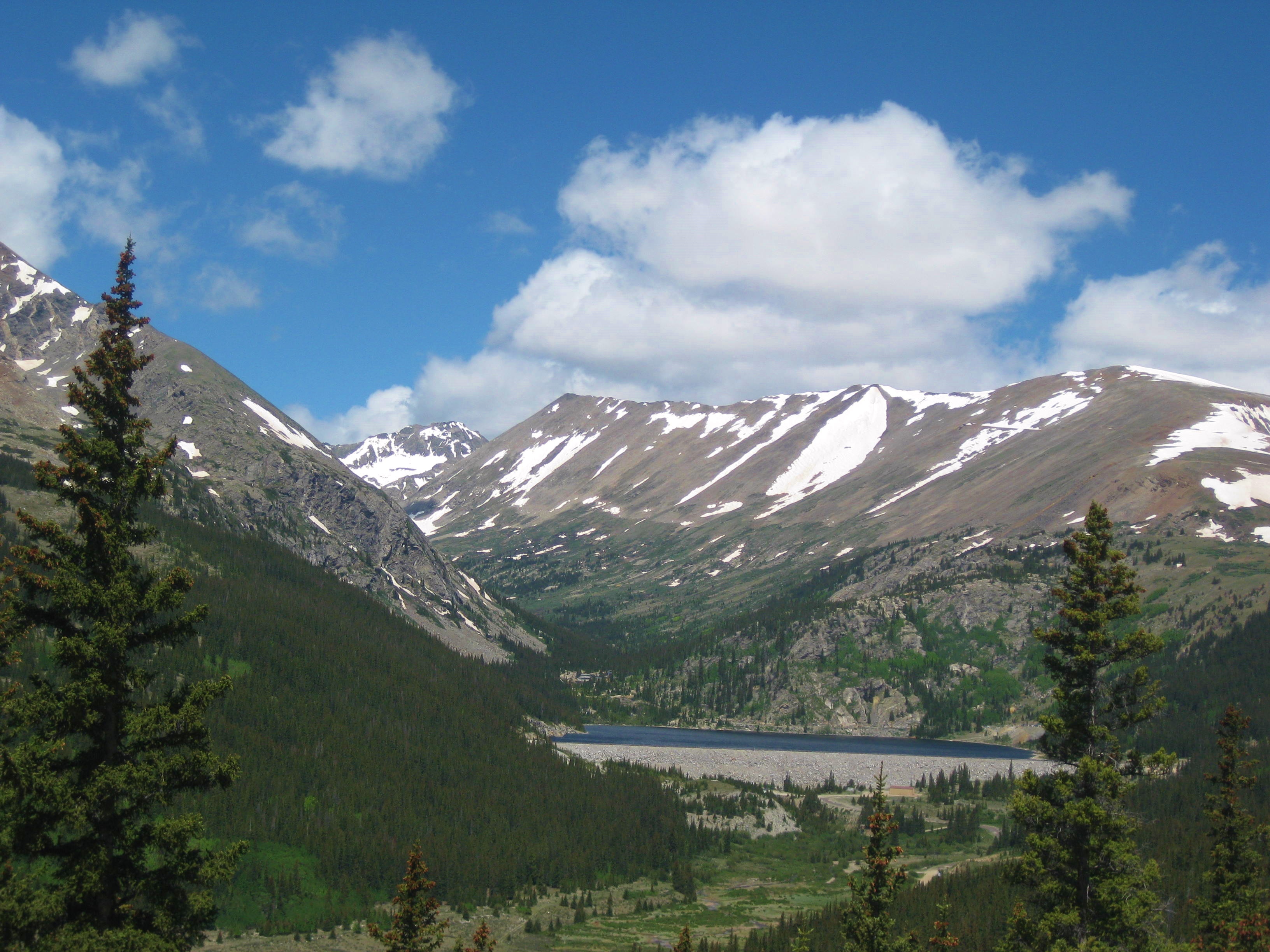

Keeping an eye on my Garmin that shows altitude I knew I was close to the top, I rounded the bend and there I saw it, the Hoosiers Pass Monument. I couldn’t help it, I began to tear-up. I had made it! I had completed my “right of passage” with flying colors!
I climbed on top of the monument enjoying the warm sun. The monument and I were one, I didn’t want to get down. I waited for Lisa so we could have a “photo op”.

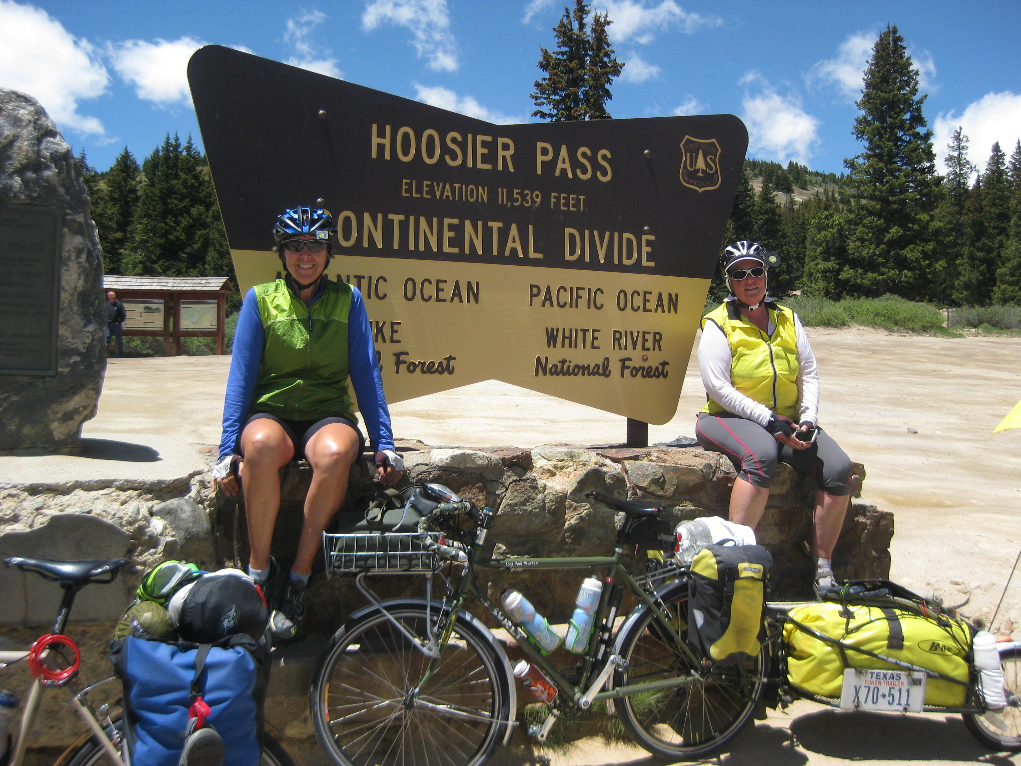
Victory was ours and now we had to continue on to Breckenridge and the bike store to pick up my new tire. The backside of the mountain was a “screaming downhill” that we took cautiously enough. Our wheel rims heated up and we had to pull over to let them cool. Lisa said, “We had better hurry as we need to get to the post office in Silverthorne before it closes so I can pick up my new shorts”. We scurried as fast as we could, on loaded touring bikes, and made it in to Breckenridge where we were impressed by the beauty of this town.
I made a quick stop at the bike store and took the tire with me rather than waiting for them to put it on as we were in a hurry. We found the bike path and off we went. The trails were so well maintained and heavily used by locals and tourists. Apparently this area has a strong cycling community, road and mountain. Time was passing quickly and we soon realized we would not make it to Silverthorne so Lisa would have to call them and have them forward the shorts to a town down the road, sounds like a familiar story.
We continued on the bike path which led us to Frisco, a delightful town, with a strong tourism and residents population yet not as posh as Breckenridge and I get a sense the residents are quite happy about that. We stopped by the Visitor Center to get the “lay of the land” and information about camping. Sitting outside studying the map we were approached by Arnie and Abby his Golden Retriever.
Arnie offered his assistance then announced, “Why don’t you just come to my house, you can spend the night in the basement”. I don’t think we missed a beat, “We’d love to”! Arnie and his wife Shelly were terrific and let us showers and do laundry. We were planning on going out for dinner but they invited us to stay. We really enjoyed their company and their visiting friend John. We also enjoyed the dogs, Abby, Frisco (a Portuguese Water Dog), and Pepper.
Both Arnie and Shelly are avid cyclists and were our Trail Angels for the night! THANK YOU for your hospitality and helping me get that new tire on!

…I’ll keep you posted.
STATS
Location: Colorado
Miles: 36.72
Calories: 3,672
Top Speed: 29.3
Average Speed: 7.3 (Ugh..wind…again)
Elevation: 7,416
We left Guffey by 8 am and the ride toward Fairplay was wonderful. The road was pretty flat with some gradual incline, nothing too tough, in addition, after a good meal the night before, a pretty good night’s sleep in the “Assay Office”, and an adjustment to the altitude, I felt great. Lisa on the other hand felt lousy she seemed to be having more problems with the altitude and even had a nose bleed. But, we carried on. The scenery was beautiful. We passed an old sod house. I suppose it could have been used as a root cellar or perhaps it was lived in. If it hadn’t been behind a fence I would have explored it.
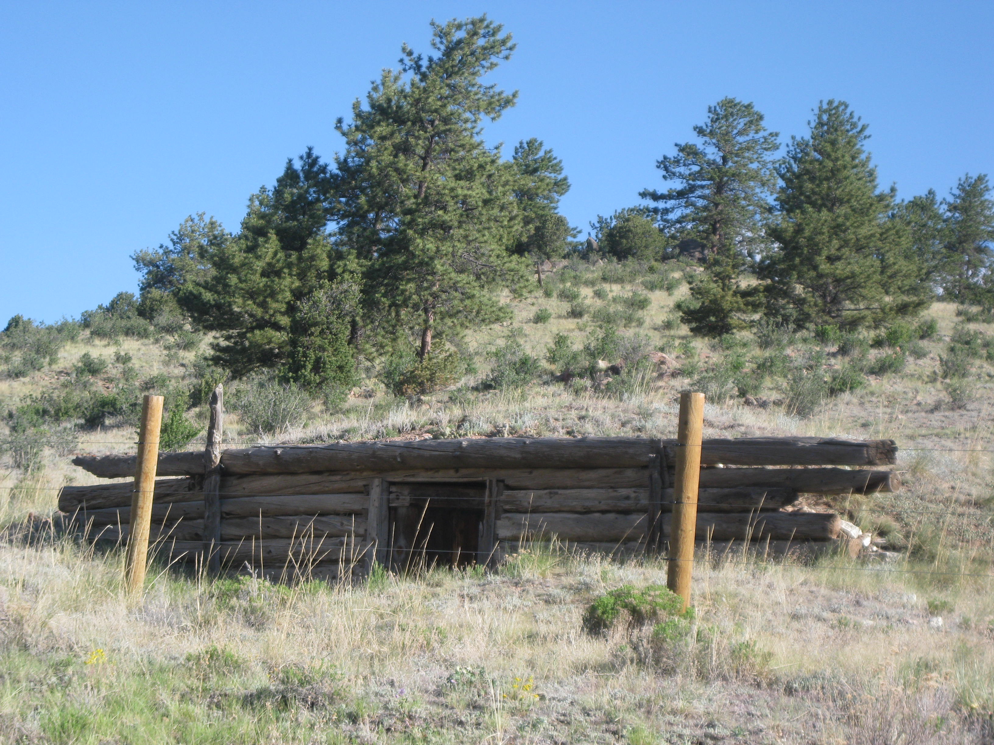
We continued our gradual climb when I came upon a “cow on the loose”. ‘Ol Bessie here had found her way out of the fence and was enjoying the tender grass and flowers on the other side. Eventually, she meandered across the road to see what goodies were over there. A little unnerved by my riding behind her she finally crossed the road back to her pasture. She walked along the fence looking for where she had escaped so she could “sneak ”back in.

Melinda’s Philosophizing- ‘Ol Bessie is a reflection of human behavior, people often escape the confinds of their life in the hope to discover what is on the other side of the road. Some find a new path or journey and never go back, others taste the splendors of the other side but eventually meander back to the herd. This journey has allowed me to think of things on “the other side of the road”. Do I have the courage to follow a new path, a new journey? Or, will I meander back to what I know, to what is comfortable, back to the herd.
I climbed a hill and there it was in all her splendor, the “Rockies”. How beautiful, I couldn’t keep my eyes off them. The next 5 miles was a gradual downhill. I could have enjoyed it more if I wasn’t worried about my patched tire failing, but fortunately it didn’t, but all the time I kept my eye on the mountains in awe of their beauty.

At the bottom of the hill was the small town of Hartsel. We had lunch and then we headed toward Fairplay, more beautiful scenery but were faced with an awful side wind and headwind. The last 12 miles into Fairplay was arduous. Blowing wind, with strong gusts surged down from the mountains. We had to stop every few miles to quench our dry mouths.
Fairplay was finally in sight. Late in the day and exhausted, we opted for a hotel room. The internet would not work in our room so we decided to, just go to bed, a good choice after a tough day.
Note: Fairplay has an interesting history. If interested, check out this link- http://en.wikipedia.org/wiki/Fairplay,_Colorado

…I’ll keep you posted.
Location: Colorado
STATS
Miles: 48.00
Calories: 3,790
Top speed: 33.0
Average speed: 8.9
We were packed up and ready to head for Guffey, CO at 8:15 am. There was no local diner so we made a small breakfast which for me, as a package of grits with honey.
We began the climb. It wasn’t very steep and the first 10-15 miles were quite nice including some nice down hills. Then the gnats arrived. They were horrible. Finally, Lisa and I put on our mosquito head nets. They actually worked quite well and should be a must for any long distance touring. I’m sure we looked pretty silly riding with mosquito nets over our helmets and heads but it was better than gnats in one’s eyes, nose and mouth.
We stopped for a moment for a drink of water and BOOM! My rear tire blew. This was the same tire that got the flat from the glass the day before. There we were on the side of the road at the bottom of a hill, in the hot sun, running low on water and changing a rear tire which means everything had to come off the bike. Lisa and I inspected the tire and found a gash it was a little more than a quarter of an inch and the gash was all the way into the Kevlar layer.
We pulled out the tube and could easily see the cut. I don’t recall running over anything that morning, so I wondered if we missed a piece of glass previously and it worked its way into the tire. We put a couple of tube patches on the inside of the tire, put in a new tube, put the wheel back on, pumped up the new tire, reloaded everything on the bike then I saw it. NOOOOO! The tube was bulging through the tear in the tire. Everything had to come off the bike AGAIN ! This time we placed a granola bar wrapper inside the tire and held it in place with 2 patches we then put in the tube, put the tube on the wheel and held our breath while I pumped it up. Whew! So far so good it seemed to be holding yet I cringed every time I hit a bump fearing the tube would blow again.
We continued on our way to Guffey. We were so exhausted by the climb, changing the tire, twice, and were low on food. It was not my best day, to say the least. Out of water, we started to look for homes along the road. We stopped at a one. No one was home and I couldn’t find an outside faucet, the next house had a pump but it didn’t work. We got lucky at house number three. They had a pump with a hose connected. No one was home so we helped ourselves to water.
The gnats seemed to vanish as the altitude increased. However, we had only gone 22 miles and I couldn’t figure out why we were having such a hard day. We were out of breathe and the hills seemed overly difficult, then it dawned on me. We had climbed 3,000 feet! The altitude was 8,681 when we neared Guffey.
Hungry, tired, and struggling with the change in altitude we finally saw the sign for Guffey. It was another two miles into town which consisted of 2 blocks. I arrived first and saw a restaurant which was open. We had a great meal for such a small town. After eating we felt much better and went off to find the cycling hostel.
This is where things get interesting. We met Bill, the owner of “The Garage” which is not a garage, but an odd curio shop. Bill bought half the town of Guffey, about 2 blocks, in the early 70’s. At the time the population was 6, today it is whopping 31. They do have a school, kindergarten through 8th grade.
All the buildings owned by Bill are original dating back to the late 1800’s.
Here is a picture of me and Bill.

Spread out over an acre or so, one can find the original City Hall erected in 1896.

City Hall 1896
There were various building converted into cycling hostels. We stayed in this one which was the original Assay Office.
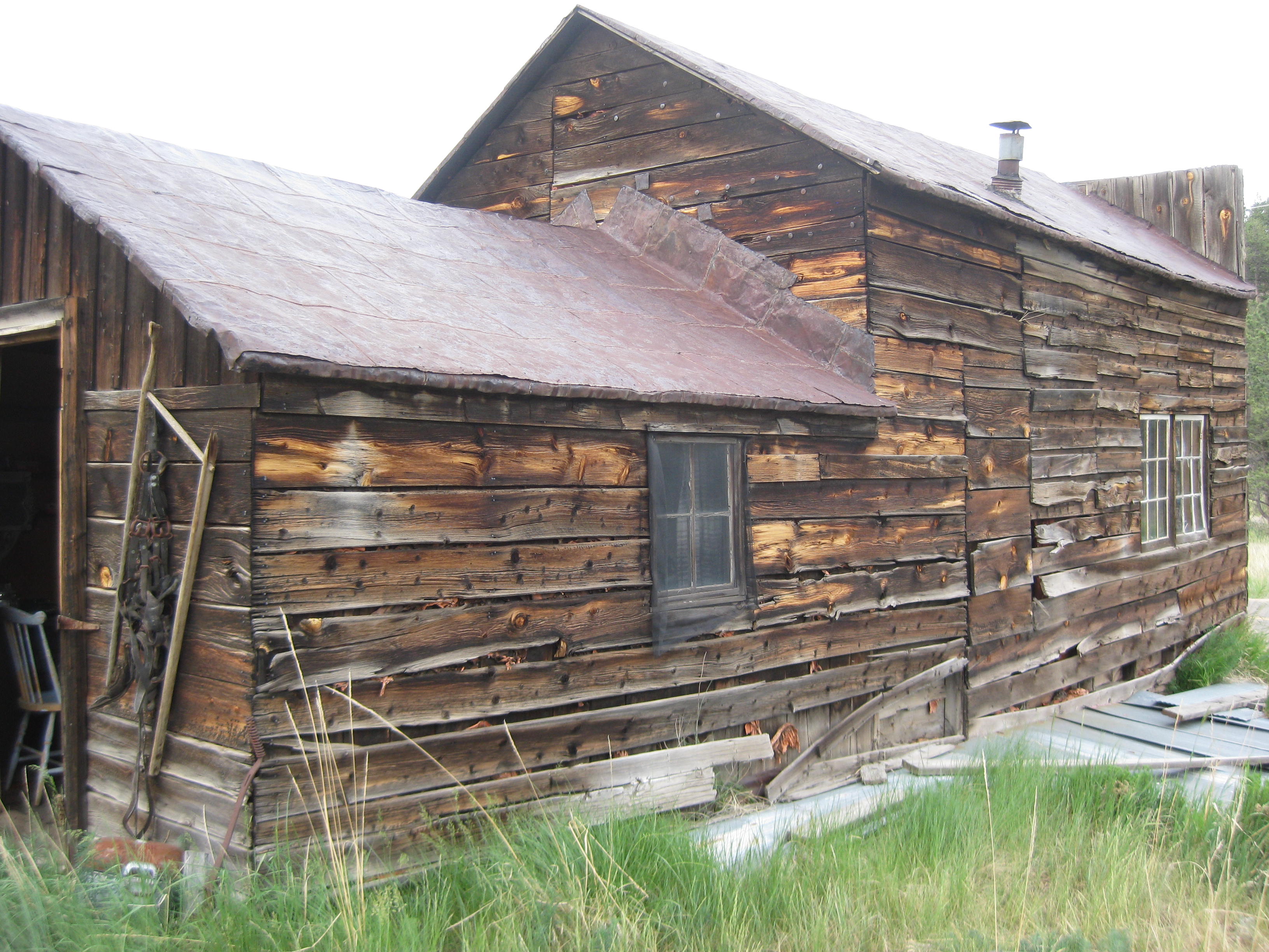
Here is our own personal OUTHOUSE ! And yes, we used it.

Get a load of this picture!

Needless to say it was an interesting evening and night. The inside of the Assay Office was full of antiques. It had no electricity so we used our headlamps to maneuver and there were a couple of jugs of water for our use. One certainly got a sense of what it was like in 1896.
When the sun went down, we went to sleep, when the sun came up we awoke and were ready to ride to Fairplay, CO.
Sorry for the delay in posting, we have not had internet for 3 days.

We had a nice breakfast at Primrose Retirement Community, said our goodbyes and we began our journey to the Royal Gorge which is about 10 miles northwest of Canon City. Ten miles into the ride I thought I should give my tires a squeeze as it has been 4 to 5 days since we pumped them up. WHOOOA! My front tire was terribly low. I used Lisa’s pump as hers is easier to pump than mine, and continued on. We decided it must be a slow leak as we could not find any hole in the tube.
Ten miles later on a nice down hill…KABOOM…my rear tire blew out. At the bottom of the down hill there was a lot of strewn glass and pottery, I was in the midst of it before we knew it. Lisa was ahead so I wave and whistled but she didn’t hear me or see me. I figured she would eventually realize I wasn’t behind her. I started unloading my bike so I could start changing the tire. I turned the bike upside down on the saddle and started to take the rear wheel off. About that time I saw Lisa coming down the hill. I guess she knew something was up.

We probably spent 40 minutes changing the tire and then I had to reload my gear. There was a quarter inch slice in my tire; to be on the safe side, we put a patch on the inside of the tire and put in a new tube. Ready to go again, I walked my bike through the debris. The new tube and tire held and I thought I was done with flats for the day. However, ten more miles down the road the front wheel felt sluggish. Sure enough, it was losing pressure. We were nearing the small town called Primrose and it was time for lunch so we pulled off the road and into a Subway. Rather than mess with trying to find the leak I put in another new tube then we had to wait out a passing thunderstorm.
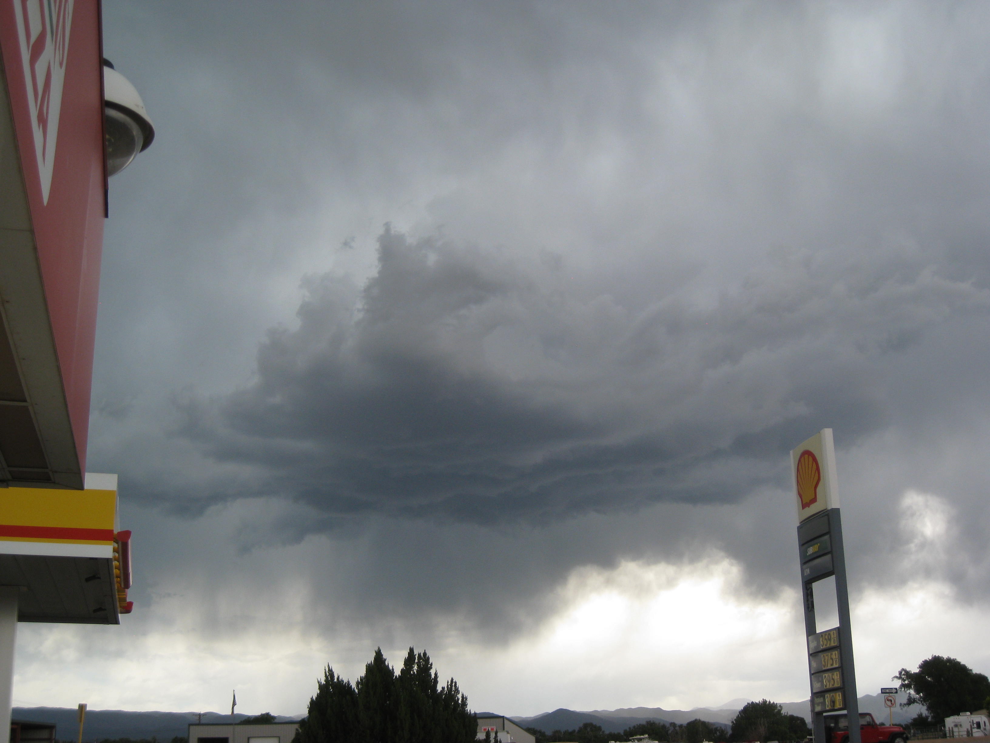
Two flats in one day and the first flats on the whole trip, “when it rains it pours”.
With all the changing tires and not drinking enough water, I got dehydrated. Lisa had pulled over to look at a sign about some of Colorado’s history, I pulled over as well feeling very squeamish. I drank a full bottle of water and began to feel much better.
We arrived in Canon City around 4pm and of course had to stop for soft-serve at McD’s. We proceeded to the Royal Gorge fighting gnats the whole way. Swarms of them. One couldn’t stop or they would be everywhere. The worst part is they would try to get in ones eyes, mouth , and nose. I can’t tell you how many I swallowed. The ride to the Gorge included some hills but nothing like Kentucky. These were about 6 to 8 percent grades. Between the gnats I was able to take some amazing pictures of a thunder cloud.
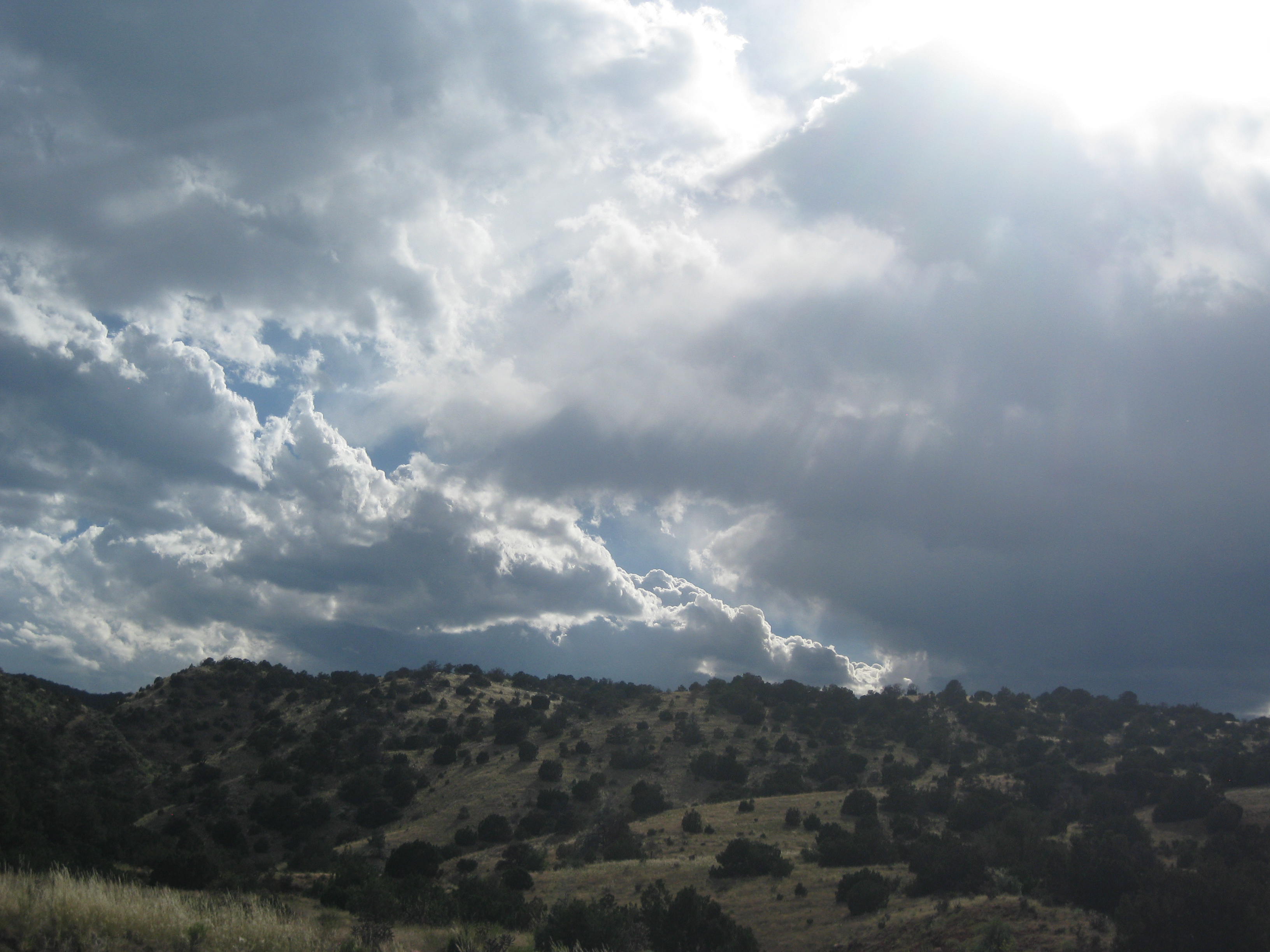
We found our campsite at the Royal View Campground near the Royal Gorge, a very nice and well maintained facility.
Picture below is from the campground.
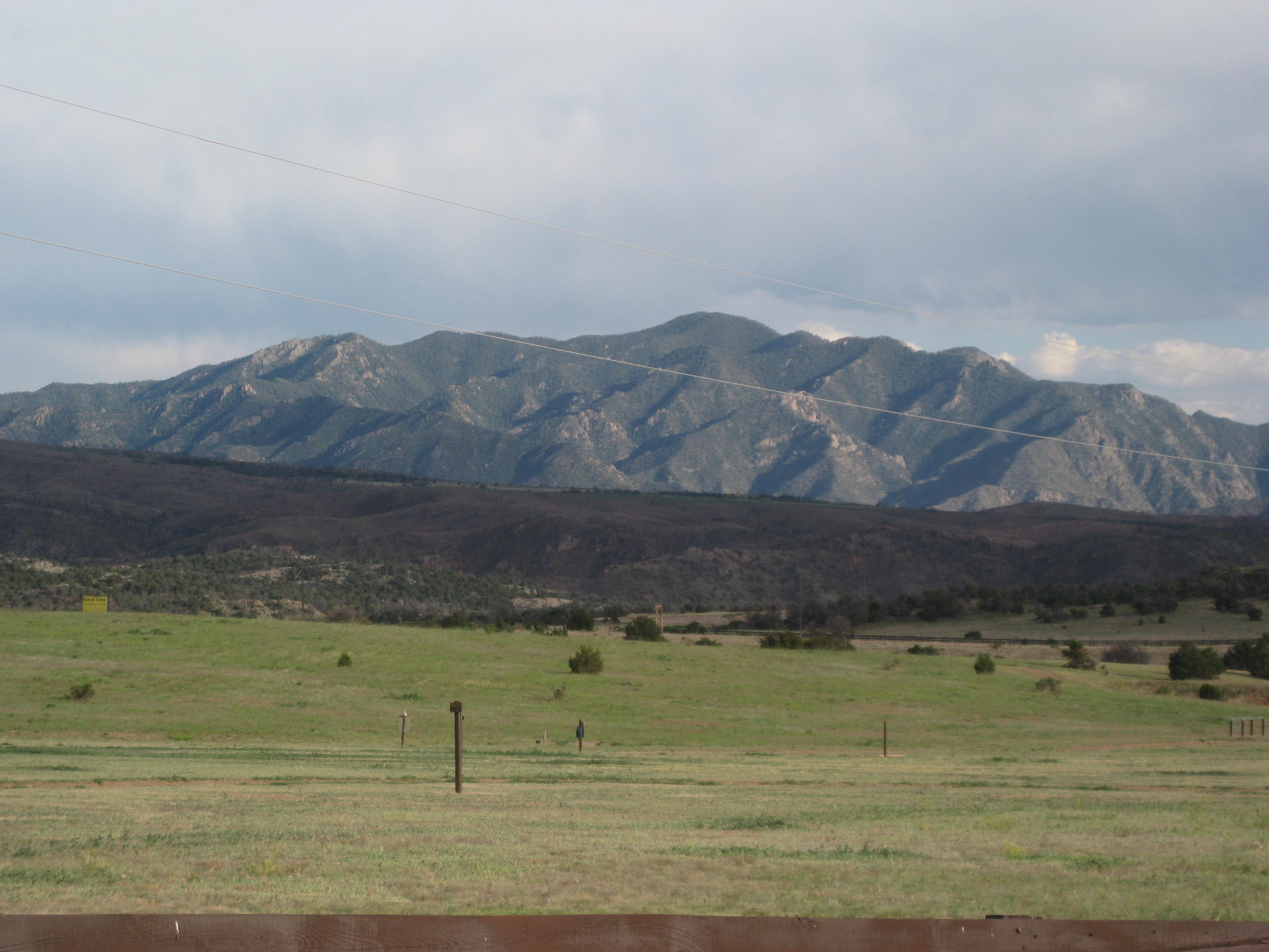
It was getting late so we quickly set up camp and took warm showers, While Lisa started some laundry I made some dinner. We ate and headed to bed…exhausted.
We enjoyed a relaxing morning with Nancy, Amiee, and Oliver. Gradually we got ourselves dressed and out the door. Nancy dropped up east of Pueblo and we rode to the Primrose Retirement Community.
What a wonderful greeting. Residents were cheering, waving and there was even a banner!
I can’t tell you how that warmed our heart. We were ushered in and met a lot of the staff and residents then proceeded to the dining area and giving a delicious lunch.
At 4pm we met residents and staff in a commons area and shared our adventure, tales from the road, and answered questions. I want to personally thank Primrose staff and residents for making us feel so welcomed.


Timelines do matter and are essential on a journey such as this one. Early on it was easy to do less miles, and enjoyed more rest days. In addition, the hills in western Virginia and Kentucky made it slow going. The problem is, those fewer miles and extra days gradually catch up over 7 weeks and before one knows it one is 8 to 9 days behind schedule.
A hard look revealed we are on day 49 and are not half way (Pueblo is considered half way). We do have a deadline to be picked up in Oregon and I need to get back to work so we decided to catch up by accepting a ride from Dodge City to Colorado Springs and fit in a planned visit with Lisa’s in-laws. After our visit we will be dropped back on the trail east of Pueblo. We estimate we will save 4-5 days which will put a dent in our delayed schedule.
It was a tough decision to sheer miles off Kansas but one thing is certain, on a trip like this, flexibility is key. Rigidity only breeds resentment and discontent, so I have come to terms with catching up.
Perhaps that is the lesson from the Hawk and the Owl whose feathers I picked up yesterday.
“ The hawk symbol is believed to represent a bringer of messages and warnings of change. When you feel the presence of the hawk totem, avoid distractions and focus on the task at hand. At the same time, hawks can soar and fly high in the sky. This animal has the power to provide support in gaining a higher level perspective on any issue or project you undertake. When the hawk appears in your life, it’s perhaps time to be less distracted by the details and focus on the higher perspective. Relying on the hawk power, you can see what’s ahead clearly and defy any obstacles that may be on your way”.
“The owl guides you to see beyond the veil of deception and illusion; it helps see what’s kept hidden. It also symbolizes the ability to cut through illusions and see the real meaning of someone’s action or state of mind. When the owl is one of your power animals, you have a strong intuition and can access information and wisdom that’s usually hidden to most. The spirit of this animal encourages you to look beyond deceiving appearances into the true reality of a situation or a person’s motives. The owl is a guide for discernment and making decision based solid foundations. Call on the owl totem when you have to assess a situation or are going through confusing times.” http://www.spiritanimal.info/animal-meanings/
Before our ride to Colorado Springs arrived we had time to ride through Dodge City. It was a bit of a “tourist trap”, and one had to really hunt for anything that actually connected to the Old West.
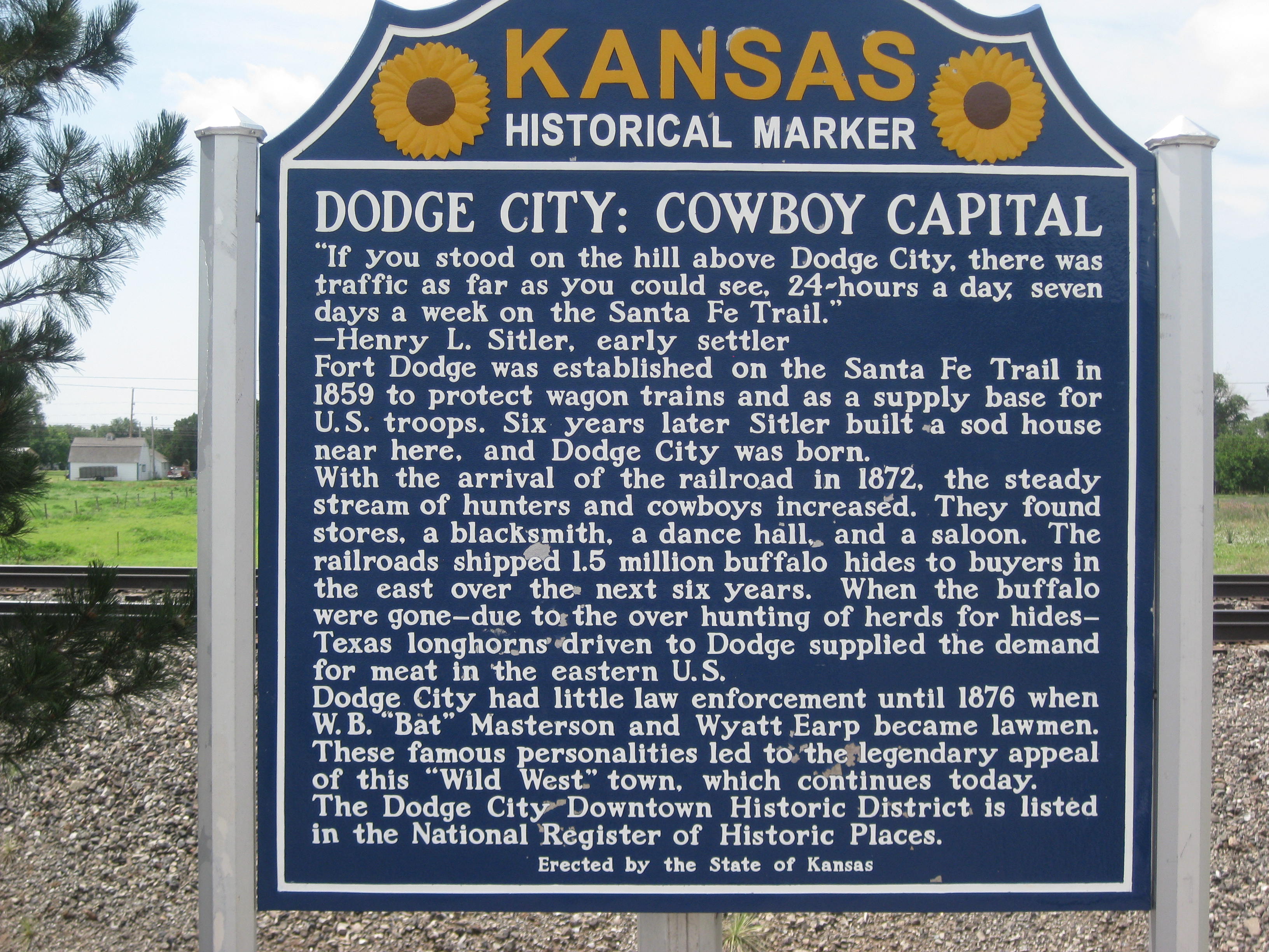
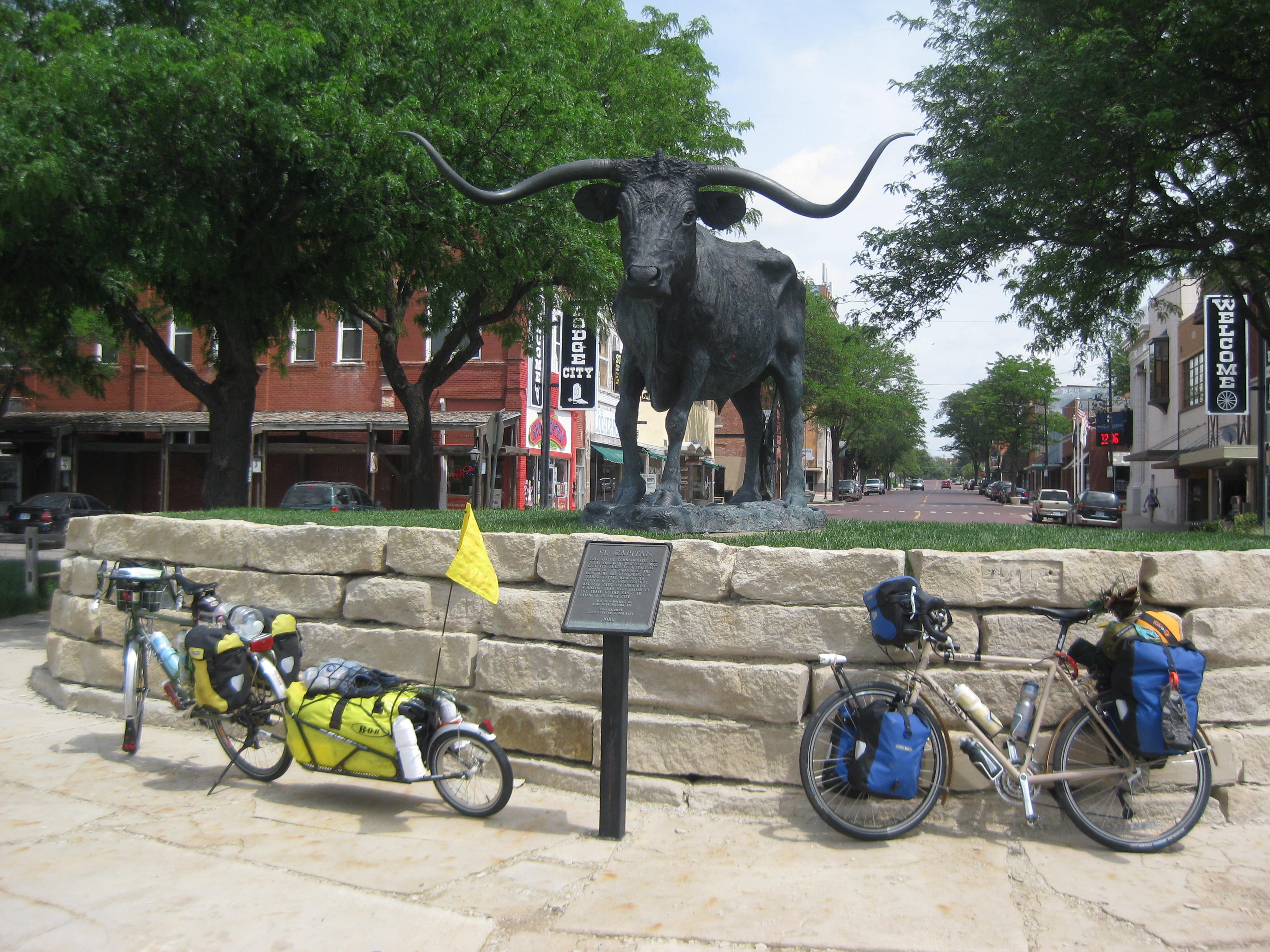
Long horn steer sculpture
We were picked up by Nancy and Aimee around 1pm and had a 5 hour drive to Colorado Springs, north of Pueblo. We passed another touring cyclist and felt his pain with the growing side wind. Later we experienced a very strong thunderstorm, from the radar map we were in “yellow”.
Colorado Springs is a very pretty area with Pike’s Peak to the west. We are enjoying Nancy, T.J, and Amiee’s hospitality, and get a kick out of Amiee and T.J’s 3 yr old son Oliver.

In addition, our legs and sit-bones are enjoying the rest. Tomorrow we will go into town for an REI “fix”. For those of you who aren’t familiar, REI carries everything for the outdoor enthusiast.
6/23/14
I slept in until 7am, I tried to sleep longer but it wouldn’t take, my internal alarm clock seems to be stuck on the early morning hours. Nancy fed us a delicious breakfast and off we went to REI. I behaved myself and got out of there with a new pair of cycling socks, as I am wearing holes in my other ones, and picked up some sports gel (goo). We spent the rest of the day relaxing, eating, and enjoying an “adult beverage”.
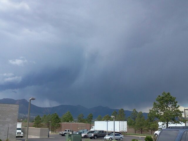
Storm brewing near Pike’s Peak in REI parking lot
Tomorrow, we have an exciting day. We will be riding to the Primrose Retirement Community in Pueblo meeting residents, giving a talk about the importance of exercise, at any age, and telling tales from our trip.
…I’ll keep you posted.
Additional information about Dodge City:

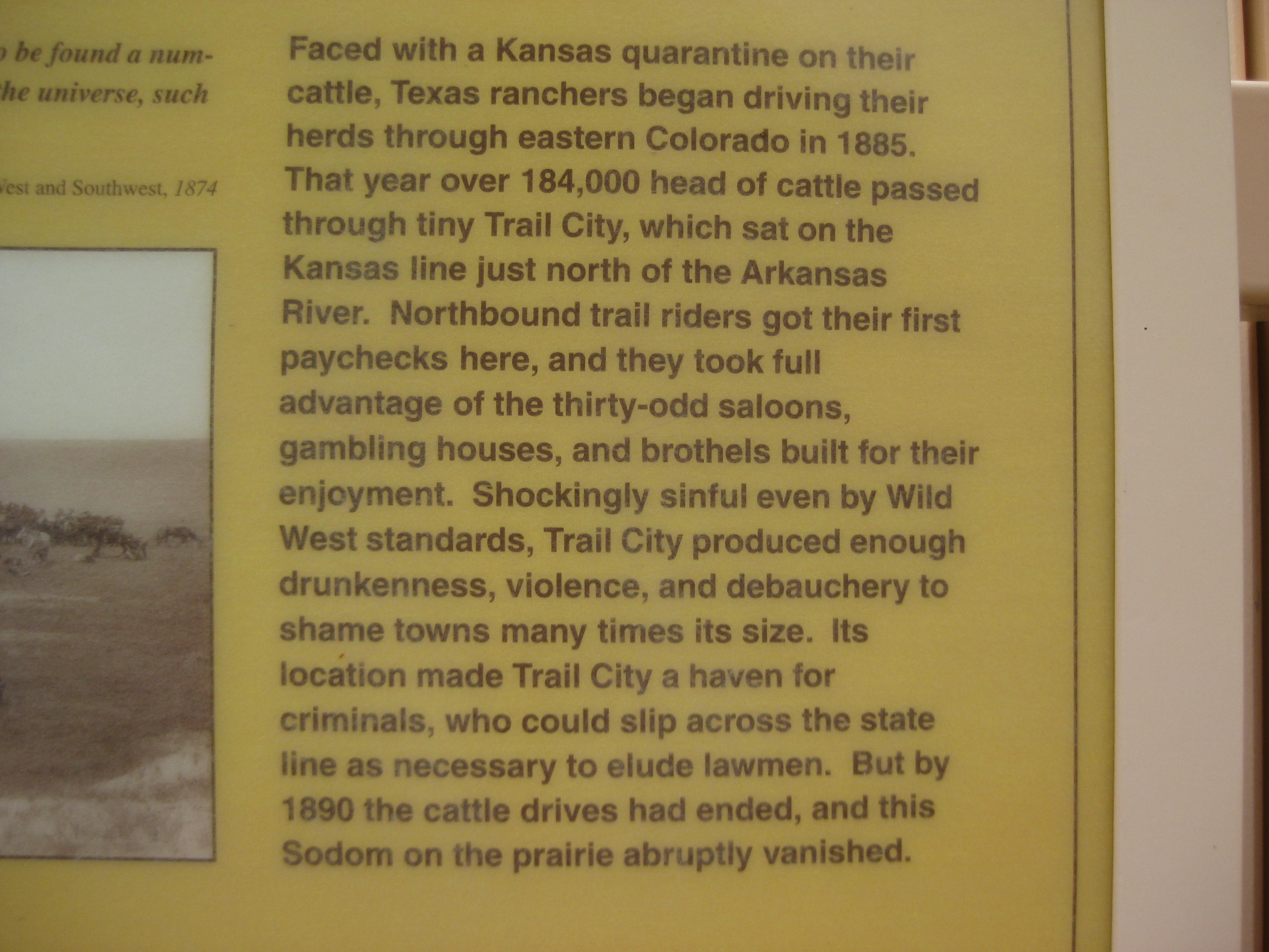

STATS
Miles: 38.65
Calories: 2,264
Top Speed: 14.6
Average speed: 6.6 (WIND!)
It was a short mileage day (38 miles) which offers so much promise to get into camp early, maybe do some exploring around town or just sit and relax in camp, but Murphy’ Law kicked in.
We left the B&B at 7:30am and rode to a local diner, had breakfast and began our ride to Dodge City.

Sure enough (Murphy’s Law) before long the wind started. It was blasting from the south again as we headed west. Still on Route 50, the truck and semi’s would blow past creating such a strong back draft it would toss us around. Fortunately the shoulder was 15 feet wide so we had plenty of room.
There must be something with the aerodynamics while on a bike while pushing against the wind on flat ground that creates such an uncomfortable ride. Our hands hurt, our butt bones hurt to the extent we both had to stop every mile to half mile to relieve the pressure.
We knew we were, “in for it” when we saw the wind farm. There was no getting around it, we were in a wind tunnel.
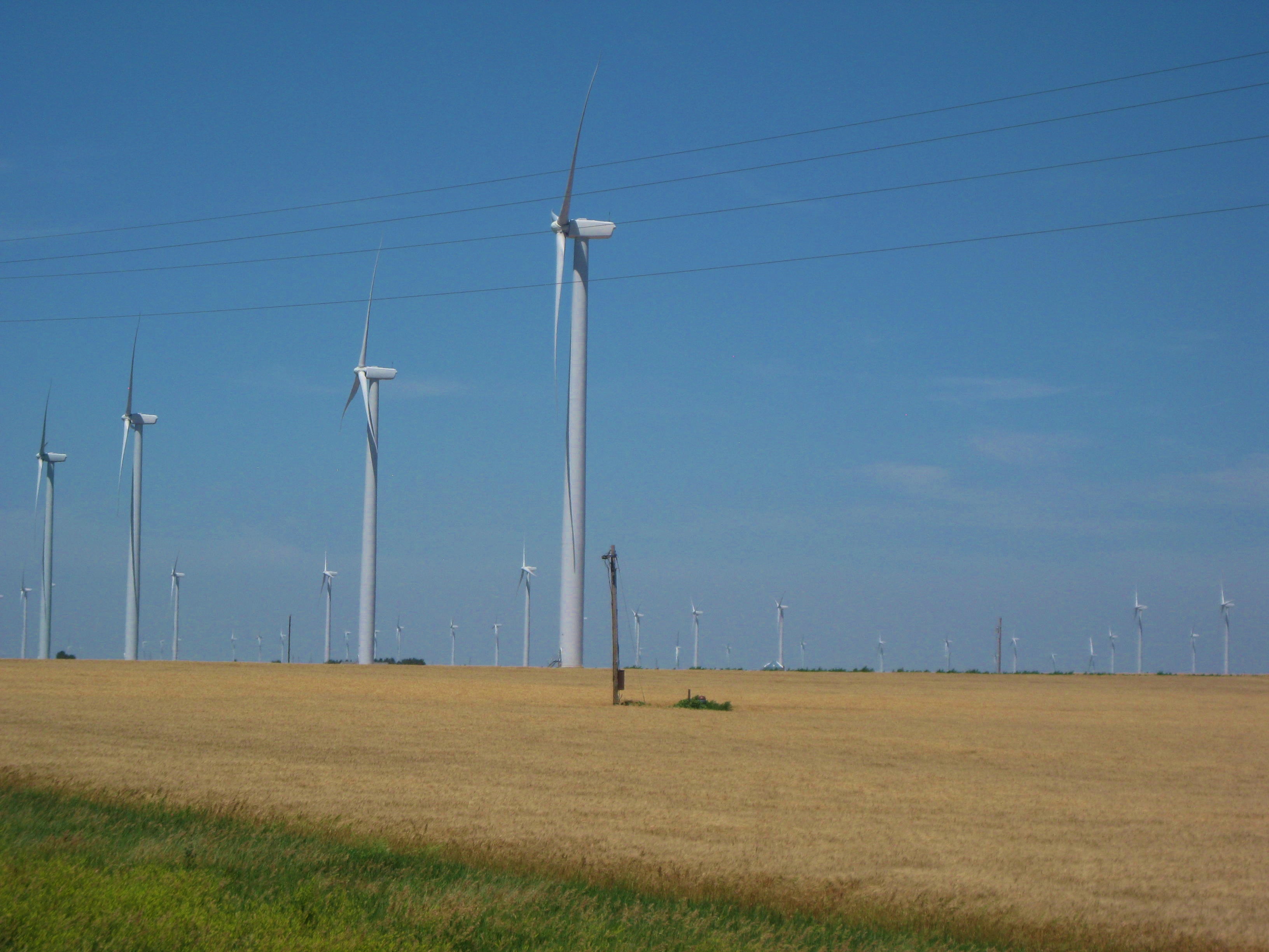
Bodies hurting, being tossed by traffic, but what’s the alternative? There is none, one just presses forward, so we did. With little landscape to divert my attention for the first time since the beginning of this journey I put on some tunes. Listening to music seemed to help.
I had been hoping for a hawk feather; and they were provided. The poor fellow was a road kill, not recent, but there were still feathers around. We picked up a few and continued on our way. I also found a talon, I won’t explain how I got that one.
We moved forward, grain elevator to grain elevator. Soon I saw more feathers, this time they were from an owl. So, I collect the feathers. I need to send them home as my collection is growing too large to carry.
Eventually we arrived in Dodge City, a historic town of the Old West. The essence of cattle drives, saloons, cowboys, and lawlessness struggles to hang on among the modern world of fast food business and hotels.
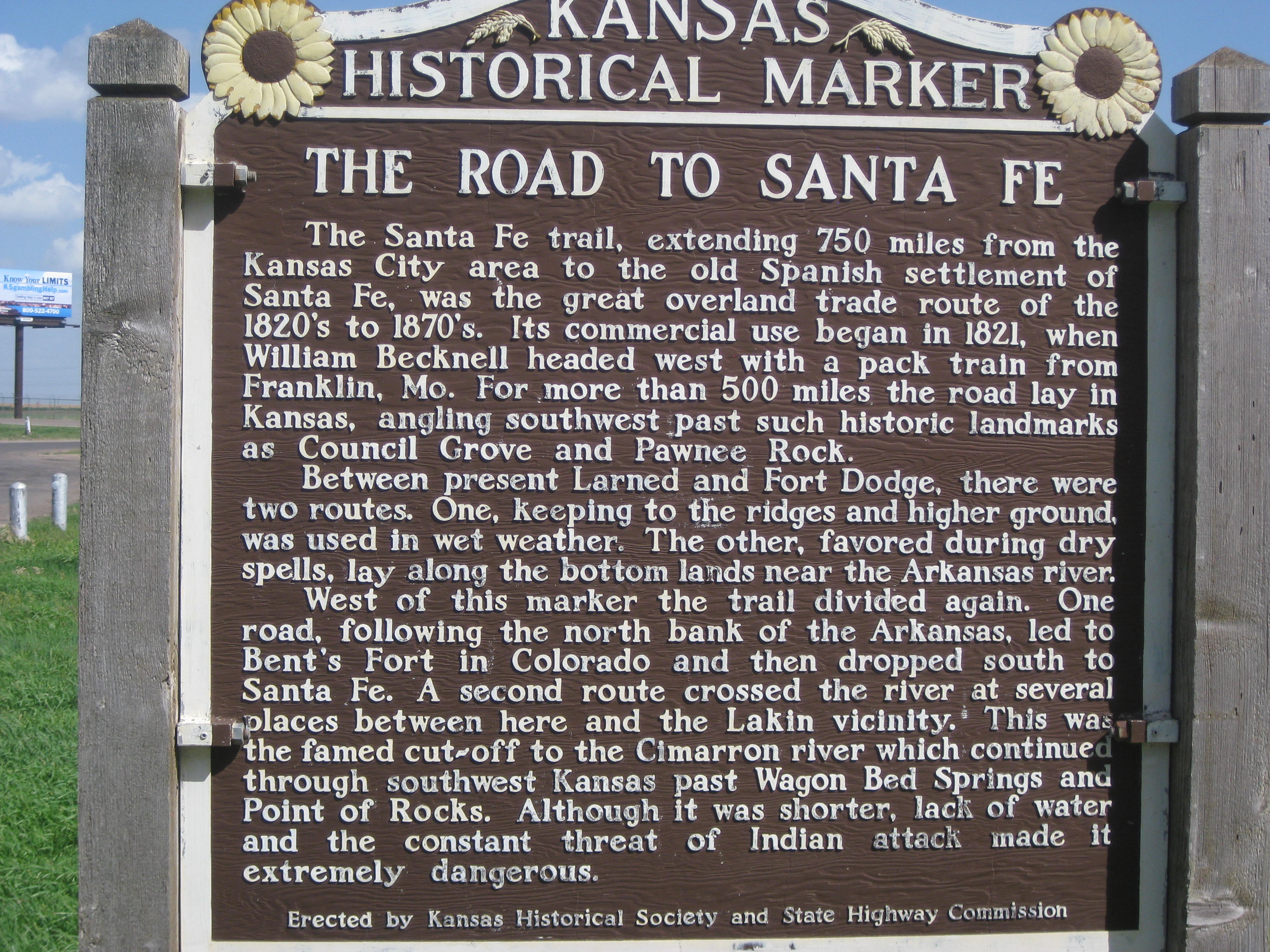
We camped at the Gunsmoke RV park. Arriving late, a 12 hour day, we set up camp quickly. Lisa dove into her tent as soon as possible to keep the skitters off her. I cooked myself some dinner and took to my tent as well.
Tomorrow will be a diversion from the trail, first to visit Lisa’s husband’s family in Colorado Springs and second, as an attempt to catch up, as we are far, far behind schedule.
…I’ll keep you posted.
STATS
Miles: 38.65
Calories: 2,264
Top speed: 14.6
Average speed: 6.6 (Wind!)
At the church in Abbyville we had coffee and left the church at 7:00am. We saw Shirley a mile down the road. She wished us well and a safe journey. The first paved road north we took which dropped us back on Hwy 50. Back with the traffic and semi’s but away from the mosquitoes. Having not had a proper breakfast we were on the lookout for a diner, but the small towns with grain elevators and dusty road would not provide us with one until we arrived at the outskirts of Stafford and discovered Joan’s Diner.
I enjoyed a veggie omelet with hash browns sans the toast. I always ask for a few more hash browns since I don’t order the toast. Some would not dare to ask, I do, and all have obliged. The waitress could commiserate with Lisa over the gluten-free issue. “My sister is GF too”. The sister walked in and we discussed GF bread recipes.
A full belly made getting back on the bikes easier. The wind, again, raging from the south zapped our time and energies. The flatness of Kansas is beginning bore me. I am a person that need visual stimulus. I work to find interest closer to the ground. I’m an air sign, a Libra, my eyes tend to seek enjoyment from the clouds and mountains-there are none. I need something to distract my weary body and bored mind. Wheat, corn, road-kill, and birds in the ditches is what I see.
And yet, there is simplicity about Kansas. As an observer, little seems to change; a few trees dot the landscape mostly in shallow crevasses where the water flows after a storm, but the trees are sparse, offering little shade to the road traveler. There are people who seem to need a life of simplicity and little stimulation. Perhaps they are weary souls needing a rest.
I work to notice the little things. I notice the lack of buzzards and see more hawks searching the flat terrain for a meal. The blowing winds keep them aloft, floating on the air like kites.
I look in my mirror attached to my helmet. What is that! Remember in the movie Jurassic Park when the T Rex is bearing down on the jeep and the camera focuses on, “Objects in the mirror are closer than they appear”. What I see is a huge combine (wheat harvester). He is taking up his lane, plus the shoulder, plus 4 feet beyond the shoulder. I have nowhere to go, surely he sees me! He keeps coming. I can’t go off the shoulder as it is a big ditch; my only option is to cross the road. I finally turn and face him, lift my arms as if to say, “Just where do you expect me to go?”, as he continues coming toward me. When he is about 100 ft from me he turned out in to the next lane and weaved around us.
Again, the wind had taken its toll. We arrived in Kinsey about 7pm. Lisa wanted to “hotel it” but there were few options. We found one on the other side of town but they wanted $70 and it shouted 1-star. I worked my “rug merchant skills” with no success- it happens. Lisa’s husband had texted her some other options. I tried another hotel, $60. I tried a B&B. “We have 2 twin beds, no TV for $60. She stated, “I won’t be able to serve you breakfast as we need to leave in the morning”.
Again, I begin to “channel” the rug merchant. “Since you don’t have to serve us breakfast and we are leaving early, can’t you drop the price”? There’s a pause, “Yes, I guess I could do that, how about $50.” “We’ll take it”!
Eventually we found the home; a, nice home that had 3 rooms designated for travelers. In the future I am going to consider B&B’s as they only had a 1% room tax. Even at their going rate of $60 for 2 people it was less expensive than a hotel. The room came with a complementary glass of wine; I did not turn it down. A shower to clean off the extensive grit, wine, and a comfy bed, I was soon out like a light.
…I’ll keep you posted.
STATS
Miles: 52.32
Calories: 3,356
Top Speed: 16.7
Average Speed: 8.8
We got up at 6am, packed up and were ready to leave Newton Bike Shop at 7:15am. We rode to a referred restaurant for breakfast. It was a buffet with lots of meat, biscuits, gravy. The upside, they did have nicely cut fresh fruit and some potatoes. Ummmm, $7.99 for a breakfast and I can only eat a few items. Being the “rug merchant” that I am, I asked the fellow, “I can’t eat wheat and don’t eat red meat, all I can eat is fruit and potatoes, can you knock a bit off the price”? “Sure, how about $5.00”. See? Never hurts to ask. I know some would be mortified to ask such a question. Maybe its age or experience, but negotiating is always an option. LIfe is always about negotiation whether it be in relationships, friendships, or business. We continued our conversation and he said he is starting to get customers asking for gluten-free. I suggested grits to add to his buffet. I gobbled down my fresh fruit and potatoes. At 8:15am we headed over to the post office to mail things we are not using or are barely using. I crammed my 3.2 lbs of stuff into a priority box; Lisa crammed her 4 lbs. in a priority box, later we thought, “Why didn’t we just put it all in 1 large box and save some money”? I guess the caffeine hadn’t quite made it to our brain cell yet.
Following a suggestion from Newton Bike Shop we decided to take route 50 which drops us south toward Pueblo rather than north as there are a few more services (towns). There was only a 2 mile difference in the routes. Our goal today was to ride to Stafford.
Around noon we stopped at a McDonalds along the highway near the small town of Hutchingson. There we met the “Moody Boys”. These 5 young men were on their own cycling adventure. All attending the Moody Bible Institute in Chicago and interestingly one was going to be attending Moody in Spokane, WA in the fall. Best Wishes on your travel boys!
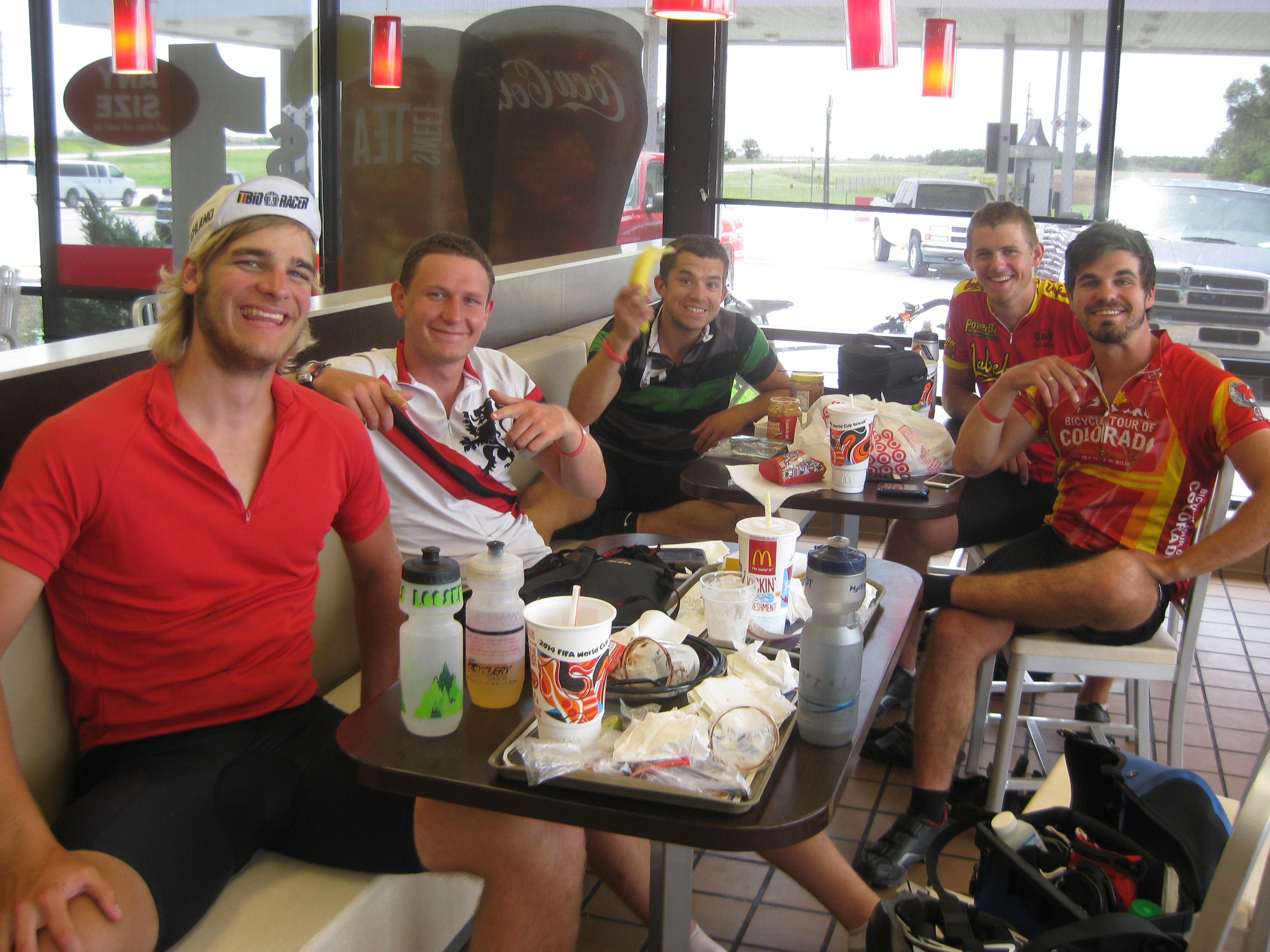
It was another day of side winds, again from the south. Winds always effects speed. Our hope to make it to Stafford was dwindling as fast as the side wind was blowing. The afternoon light was also dwindling. On the map we noted another route that paralleled Hwy 50 yet was dotted with four small towns. We decided to take it. We no longer had the roar of the traffic and semis but we had a new problem. Mosquitoes! We were in an agricultural area and they were out for blood, our blood. They tend to like Lycra because they can hang on and feast! Lisa was getting eaten alive. I was getting eaten too, but not a viciously as Lisa. Hoping to find a place to lite for the night was fading as these small towns on the map were mostly agriculture with no place to camp. We arrived in town #2, Abbyville. Something had to be done as Lisa was being feasted upon. As we rode by some homes a woman going into her house waved. “Where are you going”? “Eventually to Oregon, say, does your town have a community center or church where we could spend the night? We can’t make it to Stafford and we are getting eat’in alive by mosquitoes.” “We have a church; the person to ask is Shirley, two doors down.” I called out to Lisa, “wait, I’ve got something going”. I knocked on Shirley’s door introduced myself and explained our situation. Being a board member, she agreed to let us stay. Yeah! Just a block away we were ushered into a beautiful Community Church built in 2008 with AC and a full kitchen. We thanked her repeatedly. Shirley came by a bit later with some fresh fruit, medicine for our bites, and a bag of peacock feathers. How did she know I needed a Kansas feather? We nursed our mosquito bites; Lisa put clear fingernail polish on her Chigger bite (it suffocates the little devils) and we settled down for cool and bug-free might.
Was detouring off Route 50 a mistake or opportunity?
“Melinda’s Philosophizing” – I rely heavily on my intuitions. There are times when, faced with a choice, my red flags fly, other times there is only a sense calm, which for me, suggests an opportunity or positive experience. This journey, thus far, is a blend of flags, calm, and opportunities that entwine into life experiences. Taking the parallel route was an opportunity; the neighbor waved, I waved, and we spoke. Shirley, our rescuer, was literally 2 doors away. While we benefitted from an air-conditioned building away from the “skitters”, Shirley benefited as well as she had the opportunity to provide service to two weary travelers which supported her religious values, it was a win-win. An experience that benefits both parties, it is the best kind of human interaction and exchange
…..I’ll keep you posted.
Picture Time:
Swallows emerging from under a bridge:
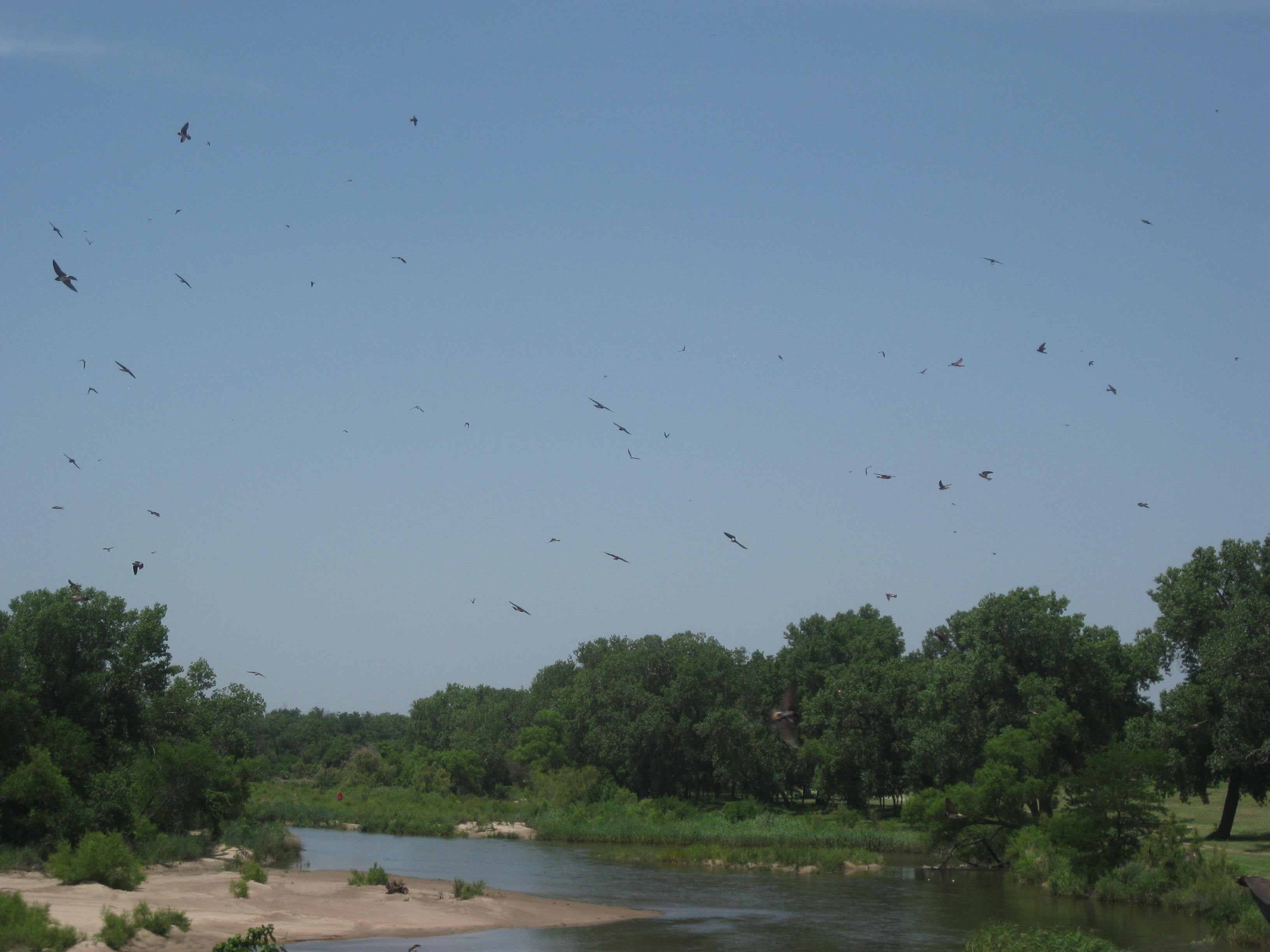
Arriving at the Newton Bike Shop last evening. Heather, co-owner with husband James, drove us up to the community center to take a shower. That evening we chatted with other cyclists, also at the shop. The atmosphere is very casual with cyclist coming and going. The first night at the shop hostel is free the second $9.95, can’t beat that price!

We slept in until 7am then had coffee next door at Norm’s, a very comfortable coffee bar.
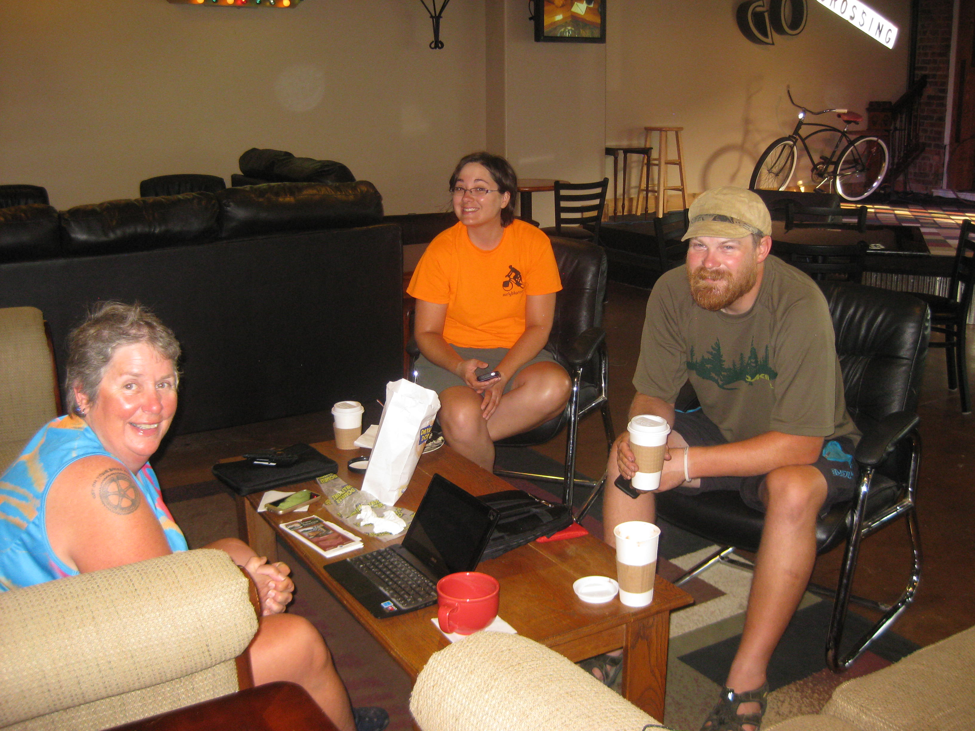
Coffee at NORM’s, Lisa, Linda, and fellow from Oregon.
We must have spent a few hours there. Finally we got around to getting organized and road our bike about 10 blocks to the laundry. Laundry complete, we headed to the grocery store (Dillons, aka Fred Myer). One of the employees asked Lisa about our ride and 10 mins later hunted us down in the store and gave us each a $10 dollar Gift Card.
Thank you Dillon’s!
Our bikes were in line to get washed so we hung out the rest of the day, catching up on blogging, and of course, grading papers.
Here’s a picture of my bike getting a bath which included a chain cleaning and lube.

We decided to splurge and have dinner at the local Mexican Restaurant. It was good and we rode back to the shop. James, the owner, was there all evening waiting for the number 3 guy on the Trans Am Race to arrive. He finally arrived about 1am, we were of course sound asleep.
Here is a picture of his bike, talk about traveling light!

James and Heather, quickly washed his clothes, fed him well, and pulled out a air mattress so he could get some sleep.
In the evening we went through all of our stuff to see if we could mail anything home. We found some items that we had not used or we had two, for example, we only kept one cook stove.
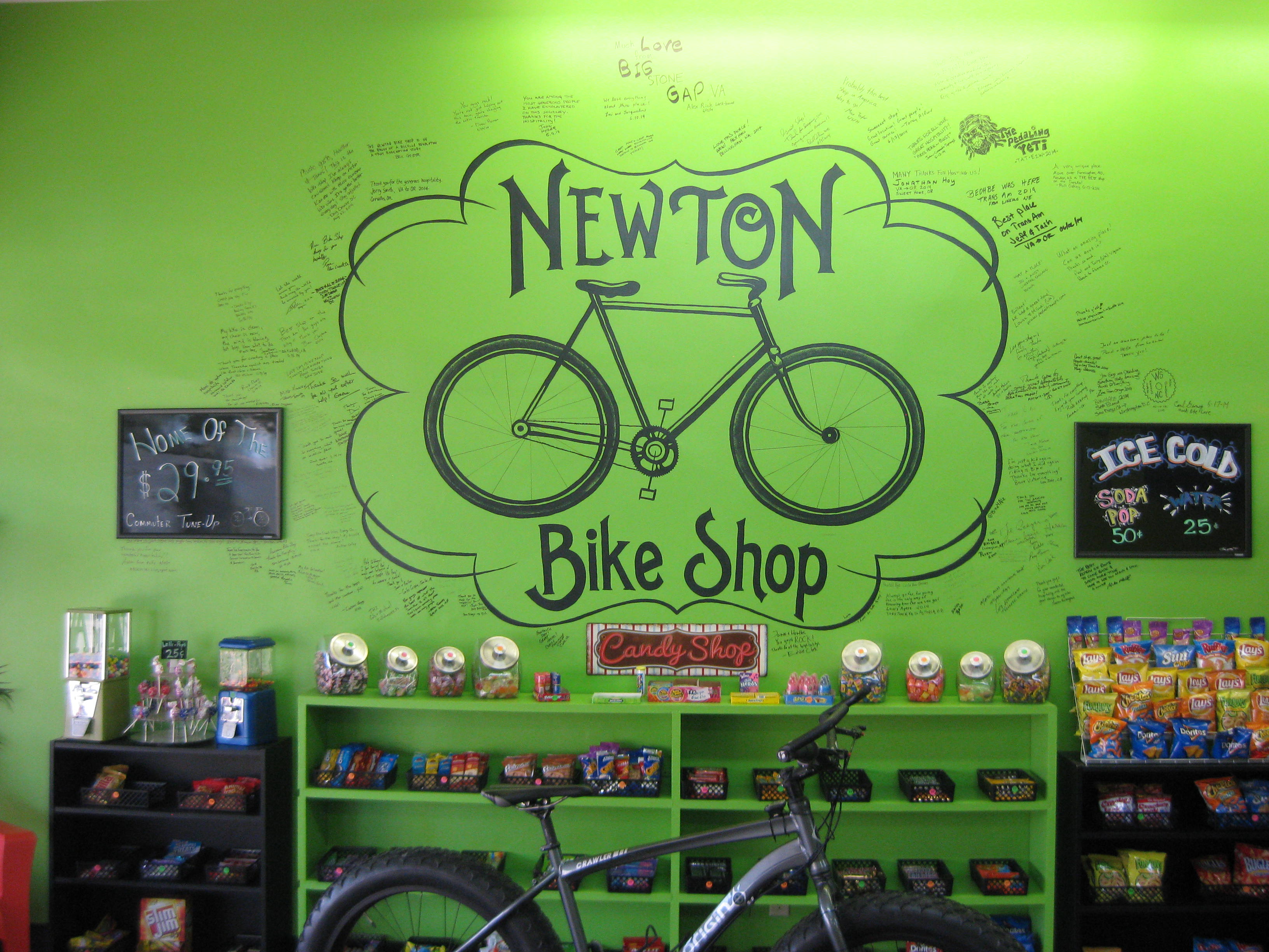
Before we went to bed we signed the wall. I wrote: “James and Heather, You are visionaries, keep dreaming”.
Newton Bike Shop will grow and expand because James and Heather know what cyclists want and need. They run their business based on the needs of the cyclist, not their needs. For example, they know a cyclist wants a hot shower, food, a kitchen, a bed, and plugs, and that is what they provide in addition to the bike wash, beds, a bathroom, and excellent mechanics.
Tomorrow we head to Stafford.
I’ll keep you posted.
The Newton Bike Shop mascot, Harley.
STATS
Miles: 43.96
Calories: 3,112
Top speed: 21.4
Average speed 6.3 (Wind) 8.3 (tailwind)
This may have been one of our most challenging days, not because we were struggling over mountains, but because we were struggling against harsh winds, semi trucks and being literally blown off the road.
The day began with breakfast at a local restaurant. We enjoyed chatting with some locals about our trip and as always, enjoyed their well wishes.
Leaving Eureka we passed the “Fall River”, what do you know? There’s a fall.

For the next 20+miles we were blasted by wind from the south as we traveled west. We had a decent shoulder (2.5 feet) but the wind blew us everywhere. The worst was the semi-trucks and the back drafts. One could feel the truck try to “suck you under”. Semi-truck coming toward us practical stopped us in our tracks when the draft hit us. In addition, when trucks or cars passed we were doused with road grit. Lisa suggested we were getting a “micro abrasion” treatment for free!
For hours we struggled to hold our ground with our hand, wrists, and bodies feeling the pressure. Eventually, when we saw a semi in our rear view mirror, we stopped and moved over as far was we could and ducked down as the blast of back draft and road grit hit us. Our average speed plummeted to 6.3 mph
Finally our route made a turn to the north, TAILWIND! This was a true tailwind as it was silent, no buffeting wind, just pedaling along at 25-31 mph.
WARNING: SNAKE PICTURE
Passed by this unfortunate snake. Look at its length! Must have been at least 4 ft. long.

We also passed by a wild horse ranch. From what we heard the ranch serves as refuge for Kansas’ remaining wild horses. We were fortunate to see them.

Wild horses
Now this fellows had a different agenda. Either they were looky-loos, or were watching TV through the window.

Another fortunate event, actually two. We started to see some riders from the RAAM ride (Race Across America) . This is a supported ride with support vans following the riders with food, an extra bike, and supplies. Riders take brief nap or sleep for a few hours then are back on their bikes. Here are some coming down the hill. We would offer a cheer and the support vans would wave and shout out for us. We also saw the Trans Am Riders. These crazy bunch have no support and ride 200 to 350 miles a day; eat, sleep (very little) and ride, 36 hours riding, 6 sleeping…crazy!

We arrived in Cassoday our goal for the day. The only available camping was at the city park. We stopped at a small country store as root beer and peanuts were calling my name. It was then I got a text from Phil and Linda. They were 6 miles down the road and had plans to camp at the home of a local. We decided to join them. By the time we arrived we were pretty beat mostly from being tossed by the wind. The homeowners were not home only the teenage girls so we were not sure if everything was OK with the parents for us to stay using their outside water, and electricity. Being only 32 miles from Newton (our next stop and rest day), Phil and Linda toyed with the idea of getting a ride into Newton, a quick call brought a Newton Bike Shop mechanic “ART”, to pick us up. We decided not to let a short ride to Newton pass us by. We all piled in the trucks and our bikes, panniers, and BOB nestled in the back.
We arrived at this amazing bike shop about 7pm. Run by husband and wife, James and Heather, this shop has everything for a touring cyclist. Bunk beds, sheets, bathroom, bike wash (yes, one’s bike is washed in a big cattle trough). One can get their bike worked or they will loan one tools to do-it-yourself. Cyclists come and go all day long. If you are a touring cyclist stopping at Newton Bike Shop is a must! www.newtonbikeshop.com
FYI- This evening the 3rd place fellow from the Trans Am Bike Race came to the shop for a bike tune up and to eat -then be on his way.
Tomorrow will include: A bike wash, laundry, and some relaxing.
…I’ll keep you posted.
STATS
Miles: 68.99
Calories: 4,734
Top speed:35.6
Average speed:9.5
A stop at McDonald’s for breakfast. I have noted the McDonald’s in no bargain. When we find these local diners a huge omelet, coffee, and hash browns is generally $6 to $7 with tip $9-ish. My bill at McD’s is generally close to $8 for 2 eggs, 2 greasy hash browns and coffee, and the food can’t compare.
Leaving McD’s we took the “scenic route” meaning we turned the wrong way and added a couple of miles to our morning. Back on track we were off to Eureka (not the one in California).
More wind and gusts today and some rollers (more like inclines). We are not into ” flat as a board” terrain quite yet, but soon.

Should I mention the wind, again? Note the leaning power polls!!

I was surprised to learn that Kansas has quite the output of oil and gas. These “oil donkeys” are small compared to the ones Texas. We stopped at an isolated gas station so I buy a bag of peanuts as I was out of snacks. The owner and another fellow were “shooting the bull”. They explained that Kansas is a top producer of gas and oil…who knew?

And, I can’t take you through Kansas without a picture of corn. Corn fields are everywhere!
When we left the gas station, we again, whet the wrong way. About 3 miles down the road, having fought tough winds we realized our mistake. It had taken 15-20 mins to ride those 3 miles against the wind. On our way back, I timed it, it took 6 mins with a tailwind!!
The rest of the way to Eureka we pushed against a side wind of 26 mph with gusts at 33mph even the birds were struggling. One event was hysterical. A red-winged blackbird flapped hard against the wind about 5 feet above me. He must have been there for 30 seconds fighting furiously. Finally, he cried “UNCLE”. He swooped down landing in the middle of the road and walked across. It was as if he was saying, “Ahh the heck with it…I’m WALKING”.
Here he is across the road:
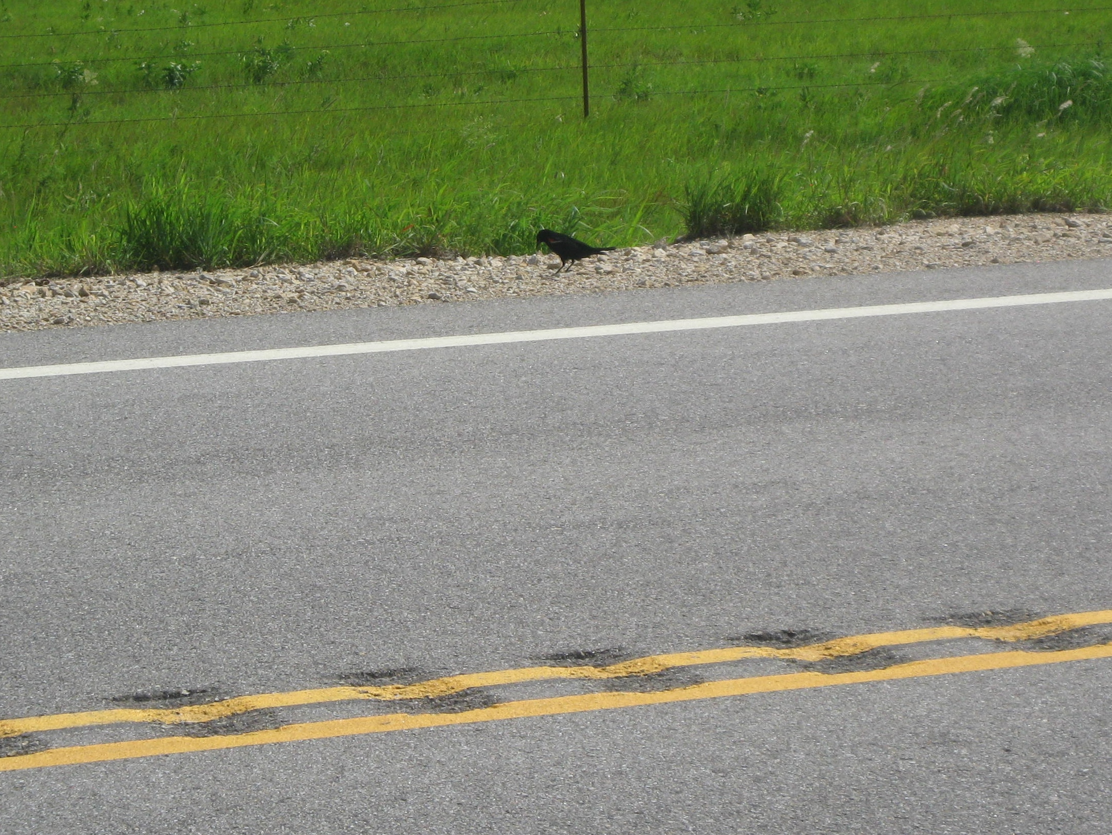
We were now entering the grass plains of Kansas. It was explained by a local fellow that the thousands of acres can not be used for farming as there is a rock layer of flint that lies about 18 inches or less below the surface, but its perfect for grazing.

We arrived in Eureka about 5:30pm, tired, and wiped out from the heat in the mid-80’s I spotted a store for soft-serve and had not one cup but two. Camping was in the city park. The park was well cared for and we found a picnic shelter that we could set up under. The shower were cold but after riding nearly 60 miles, one “just deals with it” to get the salt, grit, and sunscreen off. After showering and setting up camp it was nearly 7:30pm. My hotspot worked so I spent the next hour grading student papers. Dusk approached quickly but fortunately the strong wind kept the bug away. The magical fire-flies were out; it is easy to become mesmerized by them as they dance in the fading light. Let’s just say, I got little sleep! The last time I checked my clock it was 1:20am and we got up at 5:30am.
…I’ll keep you posted.
STATS
Miles: 58.80
Calories: 3,972
Top speed: 24.1
Average speed: 10.1
We enjoyed a good night’s sleep at the Super 8. We woke to a thunderstorm with lightning and thunder. The only smart thing to do was to say snug in our beds, right? Checking the weather we knew the storm would pass soon and it did. By 9am we were packing up and ate some apples and peanut butter from the hotel. We headed to the nearby Wal-Mart to get some bottled water for our water bottles, and a few snacks for the road. We finally hit the road at 11am.
We battled the wind all day making our way to the town of Girard. I knew the name sounded familiar and it finally hit me I had a friend that I had known when both our kids were little. Her name was Jolene. My oldest son was buddies with her son. We had kept in contact, never letting too many years to pass before a letter or call. About 5 years ago I “goggled” her to get a contact number and discovered she had passed away. It saddens me that she is gone, so passing through Girard was bitter sweet.
We continued on and arriving at a small, very small town, called Walnut (pop. 291). They had a small city park for camping that did not look very inviting; long grass which means ticks, a locked scruffy bathroom, no covered shelter, and no outlets for charging. Even though we were tired we pushed on to the town of Chanute (more people, more services).
Not many pictures today as it was a battle with the wind. I am struggling to find interesting pictures. Not that Kansas is not pretty it’s just flat with slightly rolling inclines. But, here are some cute cows.
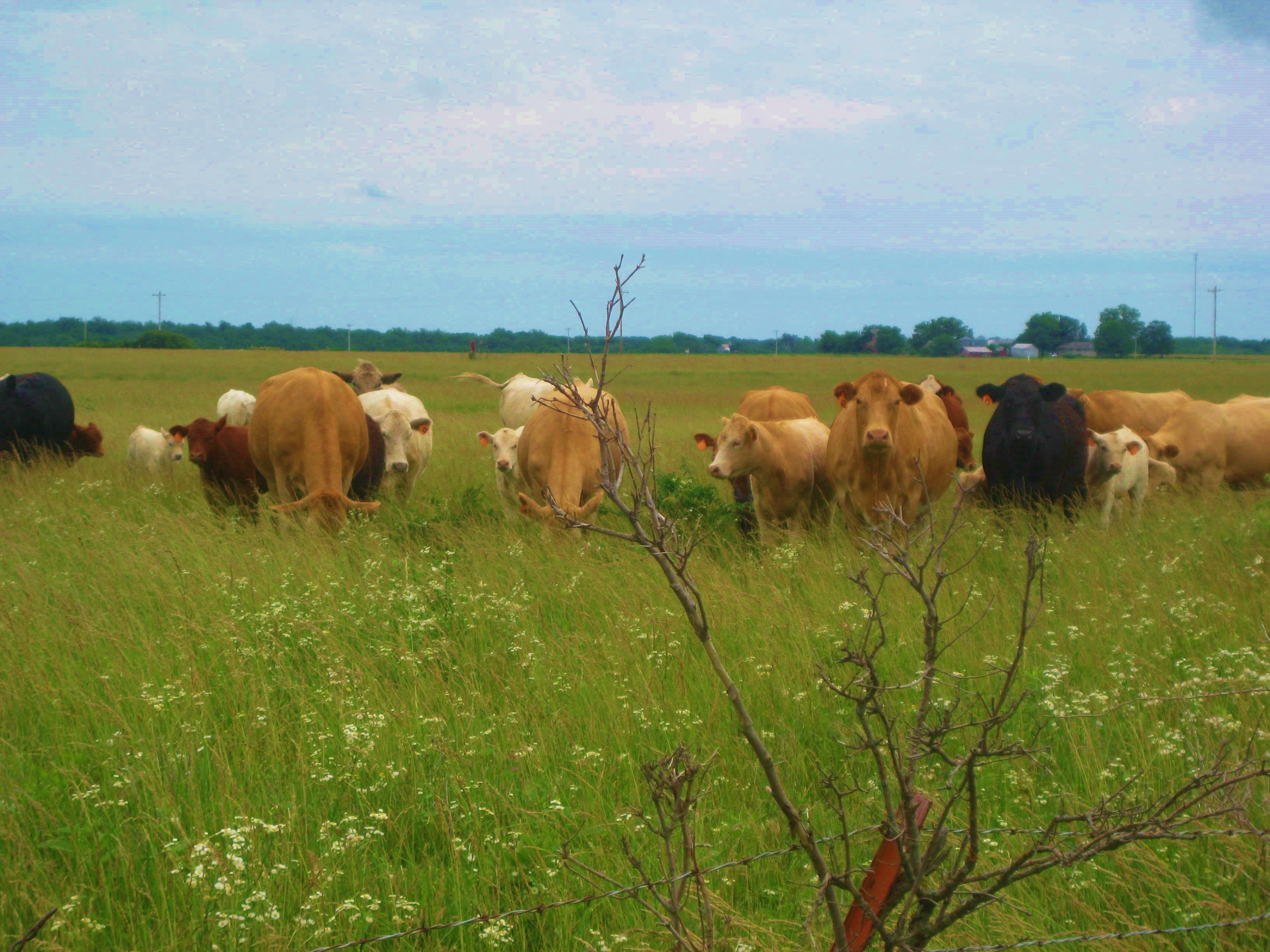
We rolled into Chanute feeling pretty beat up by a high mileage day and the wind. We headed for the city park/campground. We were getting ready to pick a spot in the grass when Phil and Linda showed up on their bikes. They were at the hotel across the highway and reported a good price for TransAmerica cyclists. Note: Showers are often the deciding factor between camping and “hoteling it”.
Feeling sweaty, gritty, tired, and needing to do laundry, Lisa and I looked at each other, “Yeah, let’s do it.” So, we shelled out our $28 buck each and had another night of needed sleep.
…I’ll keep you posted.
Stats
Miles: 72.86
Calories: 5,687
Top Speed: 34.5
Average speed: 10.4
It was a day of many adventures. We left the community center in Ash Grove early and rode 2 blocks into town and visited the local diner.

Community House in Ash Grove.
Again, the omelets were huge but I was able to eat it all plus the hash browns. The local men were having their coffee, talking shop, politics, and farming. They seem to do that.
We had an easy ride out-of-town and enjoyed the countryside. I’m not sure how we do it but we seem to be pretty good at starting stampedes, that would be cattle stampedes. As we rode along we greeted the cattle with “good morning girls”. We must make some nervous as off they go, pretty soon they all start running. It’s fun to get them all excited.
Missouri and her rollers were not quite done with us yet! That dot on the first roller is Lisa.
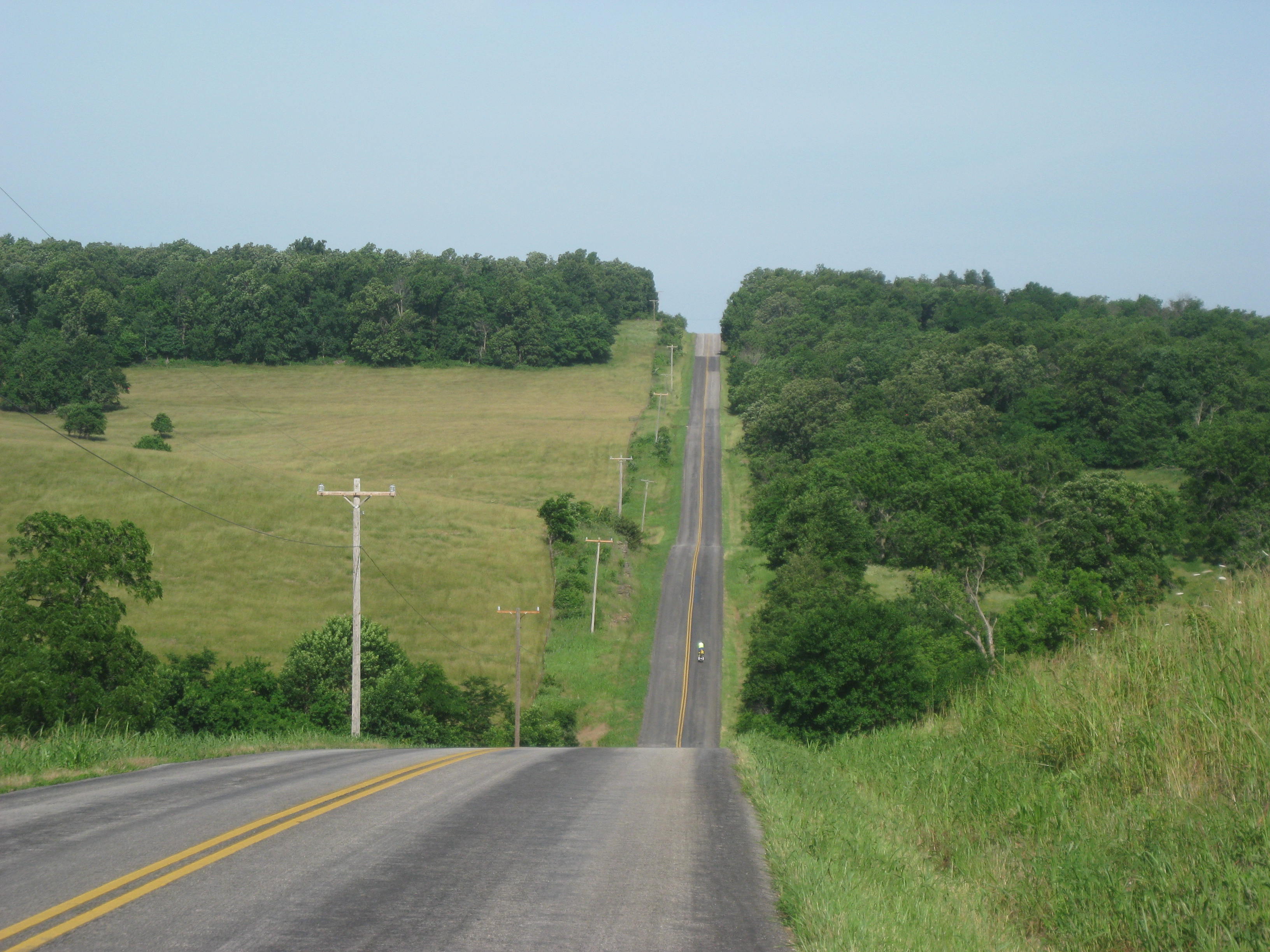
Half way through our ride I stopped to get a picture of “Turnback Creek”.
I pondered its name, turn back or what? I kept hearing water and went to investigate down a small road under the bridge. What I found was the remnants of an old mill. It looked like the same kind of mill we saw in Abbey Mill State Park as it had the wall for a turbine. It was a fun discovery.
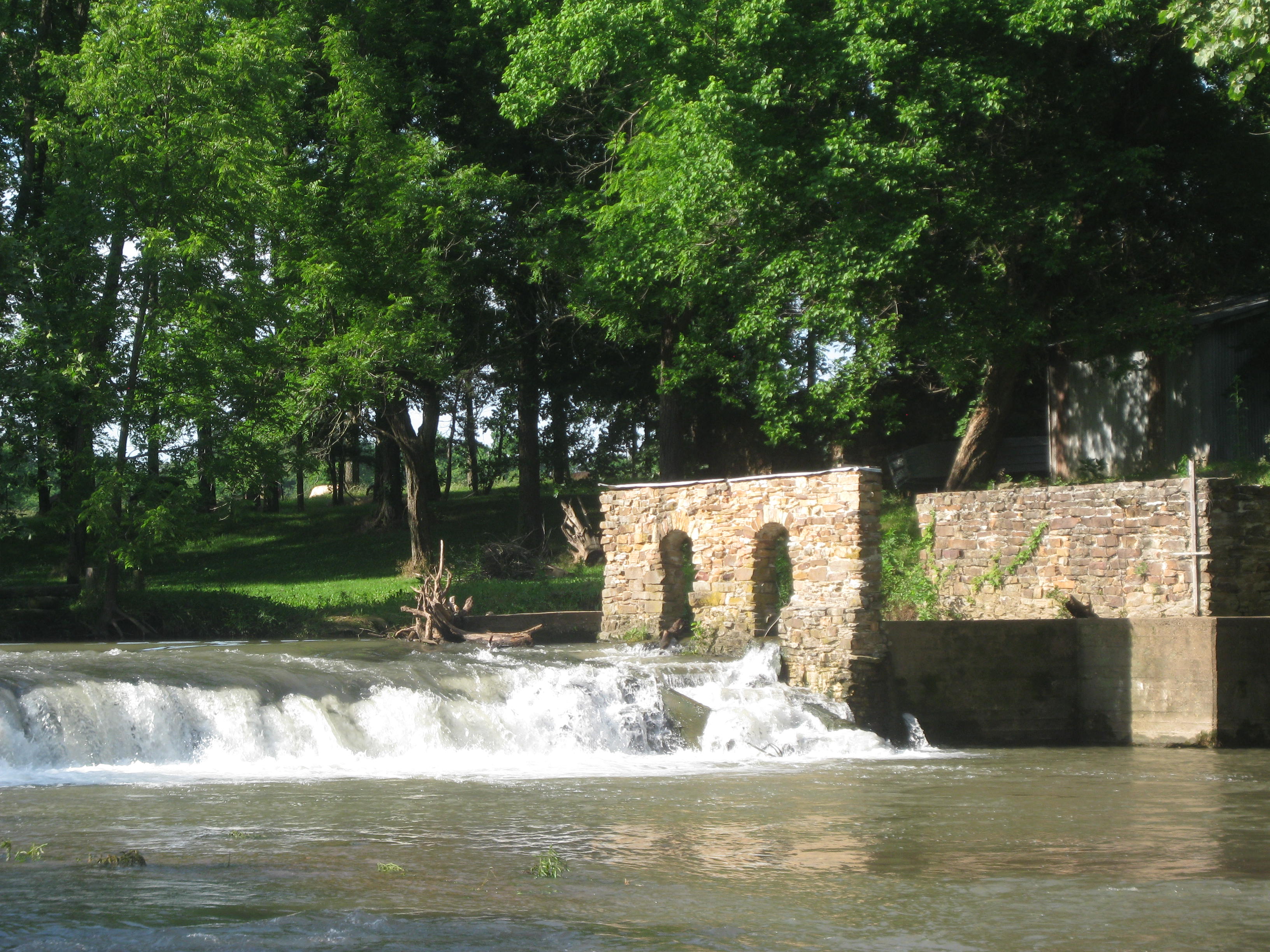
Missouri, with Kansas undertones, is what I would call the afternoon weather. We had tailwinds! We made great time to Cooky’s a restaurant in Golden City, well-known by cyclists on the TransAmerica trail. Basically it is a hamburger joint that also makes pies. Unfortunately there was nothing GF so I had a Root Beer and snacked on my corn tortilla and cheese.
The wind was really blowing hard. We had to go over a freeway overpass and I noticed a sign for Joplin, didn’t a tornado wiped that town out a few years ago? I had stopped to take a picture so I didn’t see it happen; Lisa had parked her bike off the side of the road on the overpass, the wind caught it, knocked it over and it rolled! It did a 360! Fortunately the bike and BOB were unharmed.
We ‘blew into town”. At one point I clocked my speed with the tailwinds at 30.2 mph. We arrived in Pittsburg, Kansas, tired and worn out from the miles and wind. We made our way to the city park where we were going to stay but the Park and Recreation Dept was closed and we didn’t feel comfortable just pitching our tents. We found a McDonald’s to get out of the heat and try to find a place to stay. We finally ended up at the Super 8 thanks to our Dad that paid for the room. It was so nice and comfortable and they had a special rate for cyclists.
Now a quick update on the rash. It is getting longer but I have been putting anti-fungal cream on it.
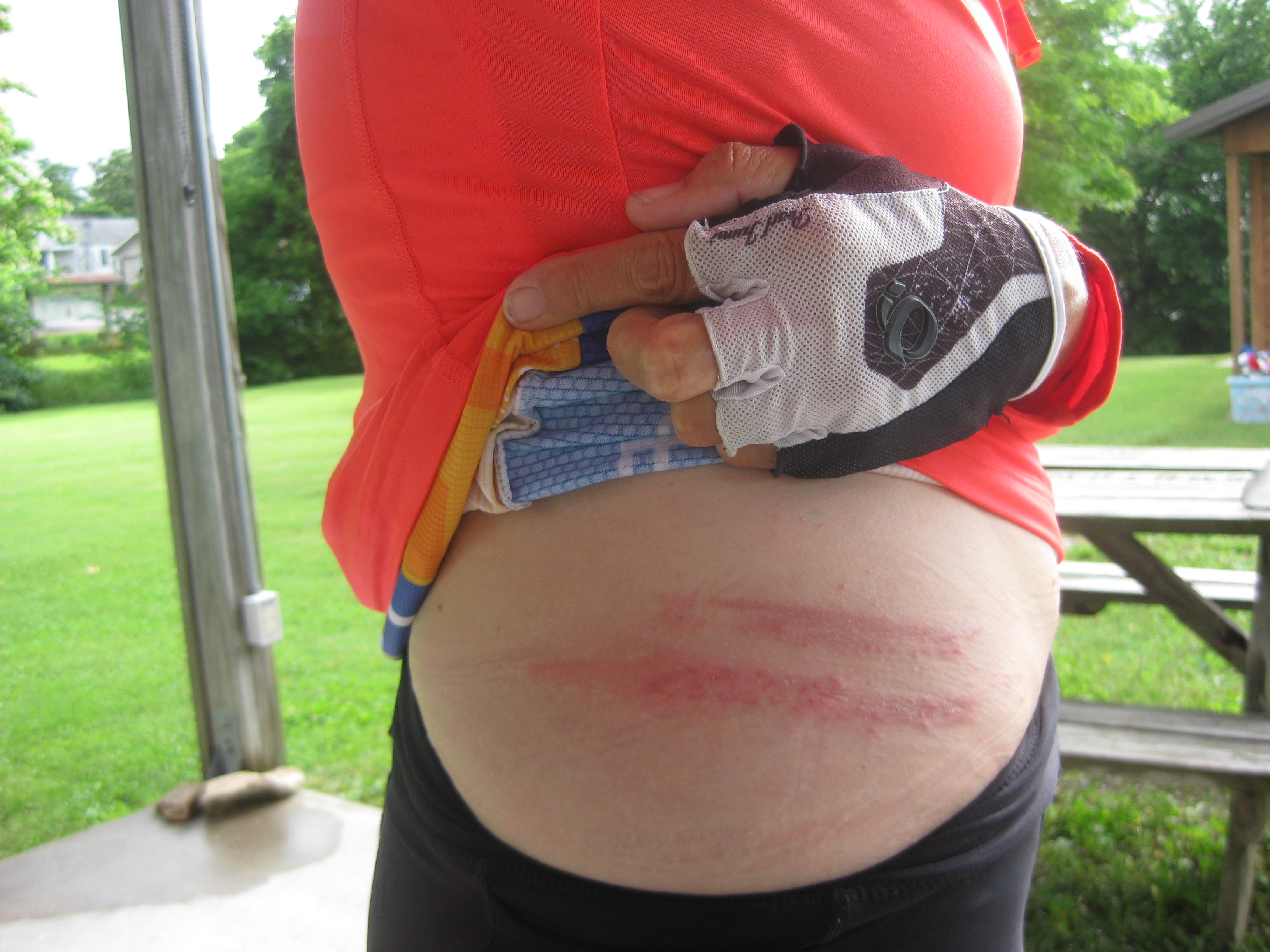
Beginning yesterday I thought it was a great idea to expose the rash area to the air and away for sweat, so while I ride I have kept the waistband down and my jersey up a bit. Yesterday morning I thought the rash looked worse, more red and spreading, so I again kept the rash exposed to the air with my jersey up. All day Lisa and I kept saying, “Wow, that is looking bad”. I had visions of me rotting in half, and again, Lisa has volunteered to put me out of my misery. As we rode into Kansas, Lisa said, “Ahhhhh, I think I know what is going on with that rash”. What? “It’s not spreading, you’re getting a really bad sunburn!” Now I had considered that early on but I am almost always riding with the sun on my left. On the positive, the sun seemed to have “nuked” the rash but now I am left with a horrific burn. I know the picture’s gross, the white stuff is cream…not pus!

Lesson learned -Do not expose skin, that has not seen the light of day, to the sun for any reason.
PICTURE TIME:

Dade County’s First Courthouse 1837
Kansas has some BIG cows!
We have now completed, Virginia, Kentucky, Illinois, and Missouri, hello Kansas.
…I’ll keep you posted.
Day 41 Fair Grove to Ash Grove 6/13
Stats
Miles: 31.79
Calories: 3,205
Top Speed: 35.9
Average speed 9.0
We left the pavilion and found our way to the local diner. We had a great breakfast and left about 9am. Missouri was not done with us yet, and provided lots of rollers.
As you can see I have accumulated more turkey feathers. I am hoping for a lift off with the Kansas winds.
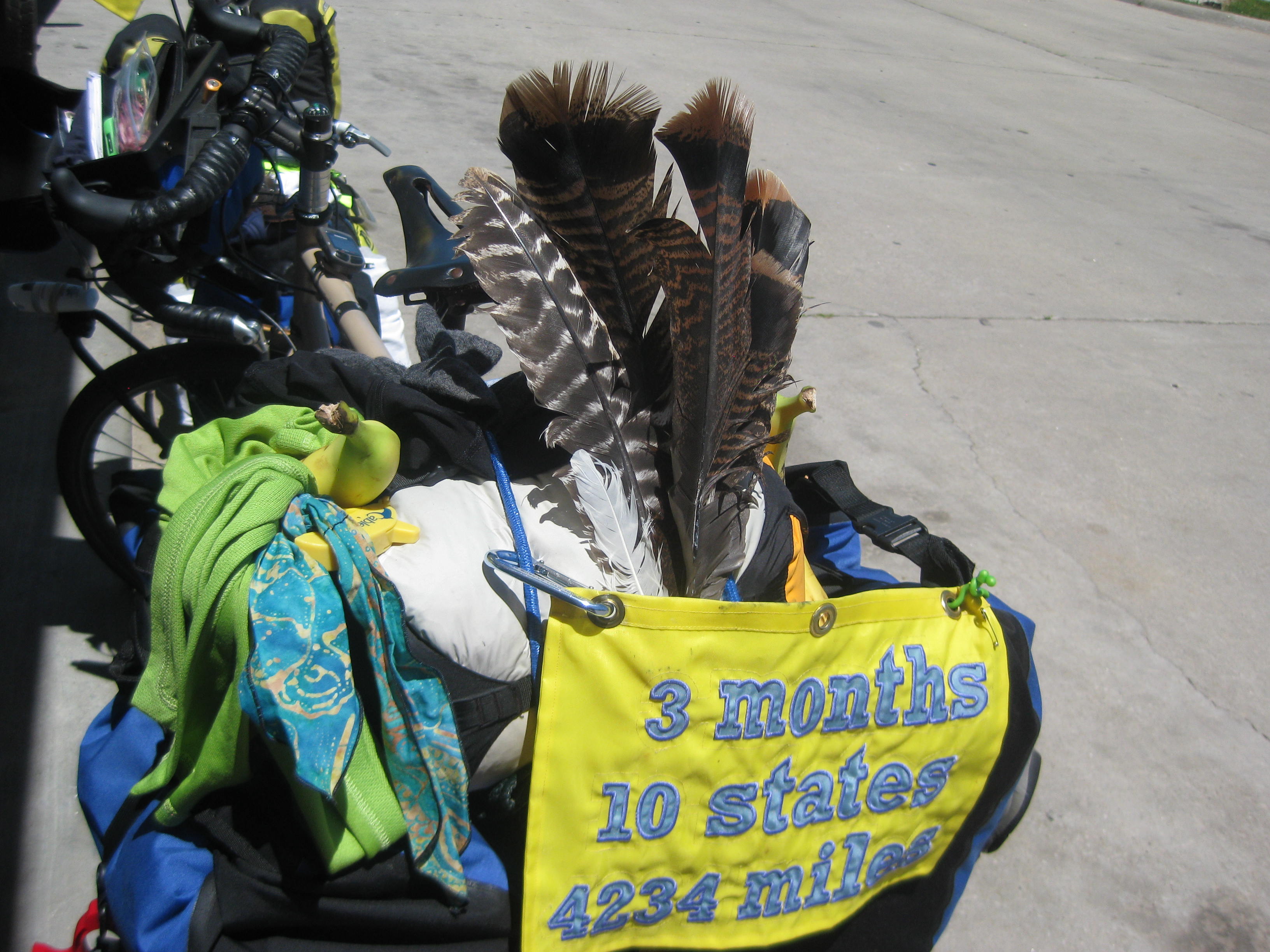
We passed the homestead of Nathan Boone, the youngest son of Kentucky frontiersman Daniel Boone.
“Two other southwestern Missouri towns settle in 1830s were Marshfield and Ash Grove. Both grew as agricultural centers, with cattle grazing and dairy farming being most important. Ash Grove was settled in 1837 by colonel Nathan Boone, the youngest son of frontiersman Daniel Boone” (TransAmerica map)
We arrived in Walnut Grove (not the Laura Ingalls, Walnut Grove) and I had soft-serve at the local convenience store.
Arrived in Ash Grove, a cute little town. They have catered to cyclist by allowing them to stay in their community building. The building was next to the local pool so we were able to shower. We had the place to ourselves. Lisa went to the local restaurant for dinner while I graded paper.
Ash Grove Community Building
Not much else exciting happened today, we will arrive in Kansas tomorrow.
…I’ll keep you posted.
Stats:
Miles: 42.23
Calories: 3,574
Top speed: 33.5
Average speed: 9.6
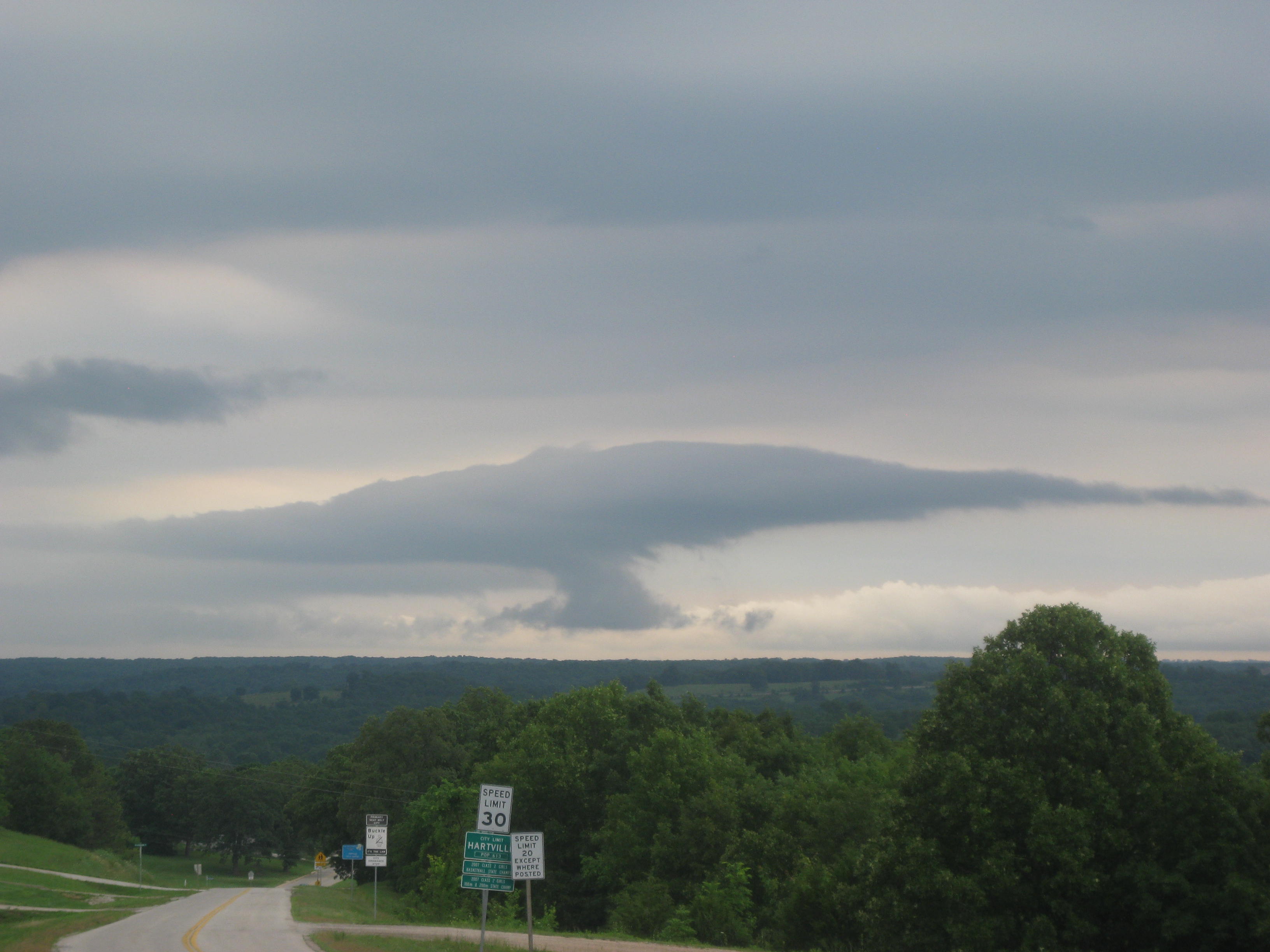
We left the courthouse lawn by 7:30am and rode 2 blocks to the local diner. We enjoyed breakfast and our caught up on our blogs. We finally left about 9am with thunderstorms looming. A few miles out-of-town we passed a small house with an emaciated horse (a Paint) and cow. I can only hope they were rescues and the new owner was fattening them up. But I think that is what I want to believe. At the bottom of the hill was a feed store. How ironic, starving animals just a short distance from a feed store. Further down the road a ewe, dead in a fence, her head trapped in the wire. Some harsh visuals for the morning.
As we headed to the town of Marshfield on route to Ash Grove, thunderclouds gathered. It was looking very dark when the storm opened up. With lightning in front of us we decided to head for cover; a home down the road had a covered carport. We tucked in and began to wait it out. I knocked on the door to let the owner know we were “learking about”. A few minutes later the door opened and we met Robert and senior that raises cattle for market. Robert invited us in and set us up with good cup of coffee. We talked cattle and learned one of his “girl’s” is 20 years old and still has a calf every year. Others in his herd are ten years old and he keeps one “lucky bull”. They have names and I can tell he cares for “his girls”. The calves stay with their mothers for 6 months and are then sold to other ranchers or feed lots to be “fattened up” for market. The said he lost 2 calves this year, one was breach, and another didn’t make it. The rain stopped, the dark clouds had moved passed so we bid Robert goodbye.
The ranches of beef cattle and dairy cattle gave way to crops of soybeans and corn. As we entered the town of Marshfield, the town had an eerie stillness and Lisa and I began to wonder about tornadoes as we noted concrete storm shelters in many of the homes yards. But, it was a cool day rather than warm so tornadoes were not in the forecast.
We stopped for lunch at a pizza/sandwich place. Unfortunately gluten-free was not on the menu so I settled for a can of clams and crackers in my panniers. While Lisa finished up I rode ahead and found a McDonald’s to get more soft serve ice cream, again, I’m going to need soft-serve rehab!
As we left McD’s it began to rain, no not rain, pour, by the bucket full. I had put on my rain pants rolled up to the knee so my shorts stayed dry. My shoes sloshed, full of water. The roadways were covered with 1/2 to inches in minutes. Large earth worms made their get-away slipping and sliding to the other side of the road. I’m not sure what they will do over there but they sure seemed intent on getting across.
After riding in the rain for about an hour the storm let up. We arrived in Fair Grove about 4:30pm and set up in the city park that included a covered pavilion.

We quickly showered in an adjoining building , changed , and set up camp. Shortly, a young man who had been running stopped by to see if we needed anything. “A tire pump if you have one” stated Lisa. He did and off he went to retrieve it. When he came back he brought not only the pump but some fruit and ice tea. He was with the National Guard and recently come home from Afghanistan. We talked a bit of policy and politics, thanked him for his service to our country and headed to bed.
“Melinda’s Philosophizing” – Thinking of the beautiful horse with its ribs showing, it comes down to responsibility. I couldn’t help feeling, perhaps the owner of that horse and cow should be refused food for 30 days and then they can let me know how that feels. Keeping animals as pets for joy, sport, or to work requires responsibility. A few weeks ago when we had lunch in Elizabethtown and the happy playful dog kept following us down the road, I had stopped at a home to see if they might know who the dog belonged to, from a window in the trailer up popped a Yorkie covered in bloated ticks. Who would allow their dog to be covered in ticks and most likely develop anemia.
I then think of Robert the nice senior who let us take shelter from the rain, he raises cattle for market yet I could tell he cared for his “girls”, they have names, they are, in a way, part of his family. Personally, I tended to think of cows as having little personality, I was wrong, Robert set me straight on that. As I ride past numerous cows I note: some are curious and playful, while others are nervous, bored, and defensive. I guess it comes down to perception, if animals are perceived only as creatures without feeling without emotion it is much easier to abuse or mistreat them. Isn’t that what humans do to other people as well? The famous Milgram Experiment taught us that!
……I’ll keep you posted.
Pictures:
An old road grater

A spider was busy during the night weaving a web by my handlebar bag.
Miles: 39.21
Calories: 3,071
Top speed: 35.0
Average speed: 8.8
The big day has arrived. Will my second set of cycling clothes be at the Houston, MO post office in the AM?….wait for it…….YES! Here they are. I was so happy, the traveling cycling clothes are back!

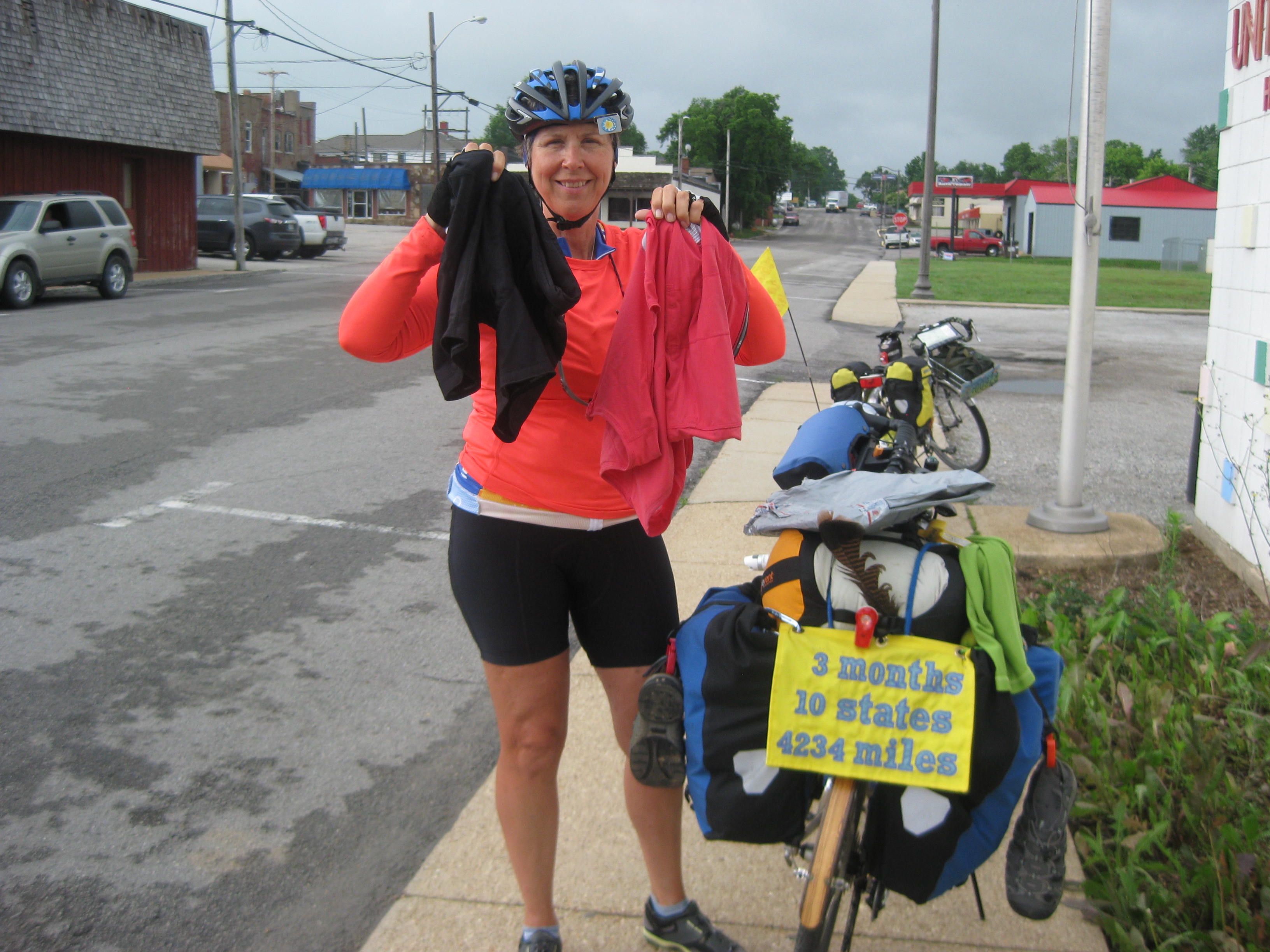
Because we had to wait for the post office to open at 8:15am, we packed up and went to McDonalds’ for breakfast then rode over to the post office. There we began our trek to Hartville.
The first half of the day gave us straights, small rollers, and the most beautiful landscape. Eastern Missouri, while it still has its rollers is much flatter and therefore much easier to ride. For most the day we enjoyed cattle grazed by perfectly shaped oak trees dotting the rolling hills. We began a slight uphill, and to our left was a herd of beef cattle. Two bulls were having a significant disagreement as the “girls” watched, most likely to see who the winner would be and then woo them as a mate.

The most memorable experience of the day was the multitude of wild flowers that lined the road including, white and yellow daisies, wild Echinacea, and corn flowers.

The gentle rollers turned into more challenging rollers toward the end of the day.

We arrived into Hartville, another small town, and found the courthouse lawn which was our official camping spot, or says the city.
Upon our arrival there was another cyclist heading east already set up on the grounds. We swapped stories and experiences. By the time we set up camp the town was rolling up, but not the young males displaying bravado in their trucks with no mufflers. The one main street, which we were in front of seemed to be the local drag strip where gunning engines for the girls was like the peacock fanning his tail.
…I’ll keep you posted.
SOME LOCAL HISTORY:


Sorry for the bad picture. Toward the bottom it talks about this area is near the original home of Laura Ingalls Wilder and her daughter Rose Wilder
Miles:42.80
Calories: 4,501
Top Speed: 36.3
Average speed : 8.8
We enjoyed our room at the Shady Lane in Eminence. We got a kick out of this sign as it sits next to the county jail. “Welcome, Stay a Day or a Lifetime”
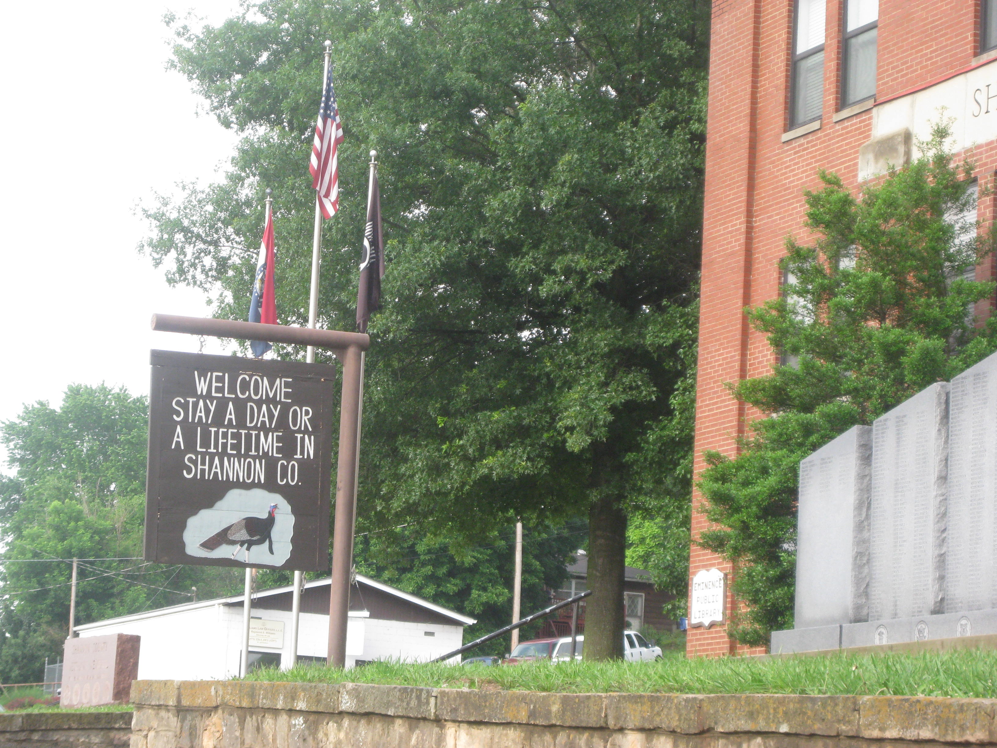
Breakfast was at a local diner. My cheese omelet had cheese, but it was 2 slices of processed on to. Oh well, it filled me up. Lisa and I have somehow gotten in the habit of eating breakfast out. It seems to work well. We get up between 5:30am and 6:00am and by the time we break camp it is 7am. If we ate breakfast in camp we would have to cook and then do dishes. It is so much easier to pack up and head to the local diner. Most often we have egg and hash browns. Sometimes Lisa has pancakes. We both enjoy multiple cups of coffee.
We climbed our way out of Eminence. There were plenty of long hills with grades to match. It is tough to tackle hills first thing in the morning as one’s legs are still tired and, as Lisa says, “not yet awake”.
We finished our climb out of the Ozarks, we missed the sign going in so here is “welcome” and “leaving” pictures.

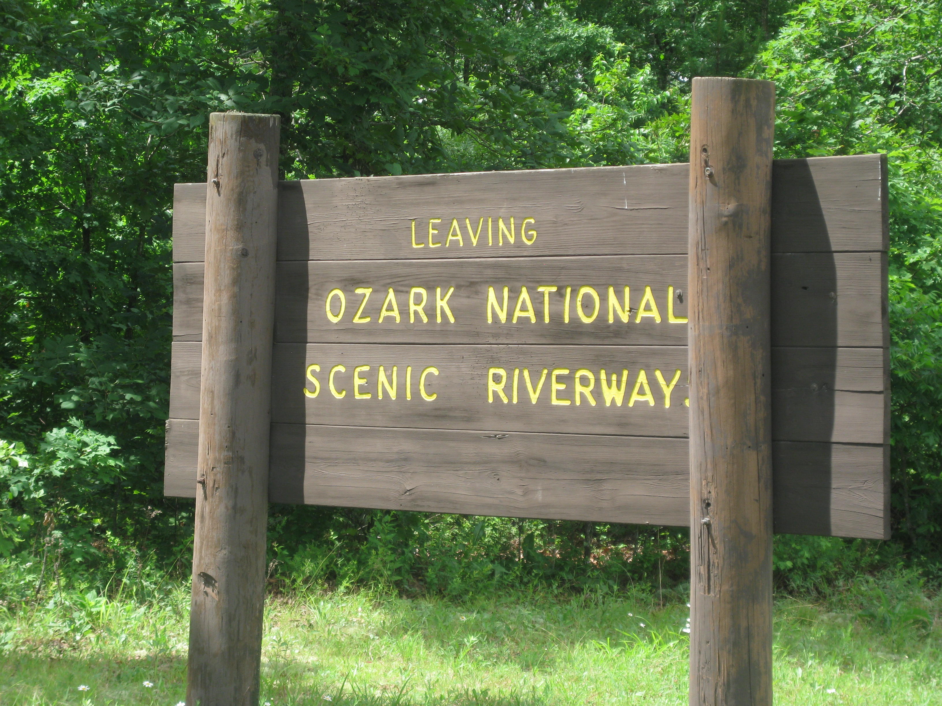
The thunderclouds were gathering and the skies began to “spit” but no downpours, yet. You know we have been saving turtles, how about a worm? At the top of a hill we spotted a very long worm that was half way across the road. It must have been 8 inches. It had recently rained and it didn’t make it across the road and would dry up soon so Lisa “took one for the team” and carried the worm to the weeds alongside the road. We then joked, “Yea, we rescue this long worm and then a robin swoops down and snags it”. As we rode butterflies pranced on the warming road drying out their wings from the earlier shower.
Worm saved, we continue our ride. The clouds continued to form and the “spitting” turned into a quick down pour. We were near a farm so I told Lisa, “I’m heading for cover”. I started to head into the barn but the horse seemed a little frightened of me pushing a bike so headed for the only other option, a small grain tank. Lisa joined me and we waited out the downpour. As it began to lighten up the owner got into his truck, “you can use the barn if you like” he hollered. “No thanks, don’t want to spook the horses”. He drove on out with us still huddled under his grain tank. I guess all the ruckus woke up the dogs, and here he came to check us out. What a lover!

The road was beginning to flatten out so riding was a breeze. There were so many wild flowers alongside the roads I had to stop and take pictures of all the flowers and butterflies.

We were approaching a state park and signs for the Alley Spring Mill. I was delayed by all my flower and butterfly shots so I met Lisa at the mill. This is an authentic grain mill. Water traveling through the mill is over 81 million gallons a day! Just to the right of the mill is a large pool and cave. We were told by the park ranger it is very deep and the bottom has not be found yet by divers.

I noted the water had a slight aqua color. The ranger said, “Yes, you are correct. The aqua color is from the limestone, calcium carbonate, and dolomite. He also stated the town, where the mill sits, contained about 200 people in the 1800’s and the town of West Eminence had a population of 3,000. There was a manufacturing company in West Eminence that made a white oak hubs for wagon wheels and was the only one in the country.
The rain started again just as we were leaving the state park so we waited it out for about 20 mins. We had a rough climb out to the park, about 1.5 miles of 8-14%. Once over the hill we had some downhills with matching uphillls. Because the week had been cloudy with rain and thunderstorms we didn’t have any good shots of the Ozarks, so here is a picture.
We stopped in Summerville for lunch. Two large storm fronts approached, one in the east and one in the west. We saw lightening and heard thunder, so we stayed put. At one point I looked up and said to Lisa, “I think those clouds are swirling”. With some concern in her voice, “AHHH, do you think we should be afraid?”

Not sure, we headed across the street to the local senior citizen community center. There we met a nice group of ladies playing cards. I told them about the Senior Retirement Project and they talked about their community center. After about an hour we noted the darkest clouds were heading east and the other front was west, we were headed north. I said to Lisa, “let’s go, let’s see if we can make it to Houston, my shorts are waiting for me!”. The roads were fairly flat with only a few steeper climbs, both storms seemed to stay put and we ran into little rain.
As we neared Houston we went through a very small town. I took this picture of a now deserted service station. I noted the gas price on the pump was 92 cents! In addition, we met two other cyclists also west-bound.
The road got steeper as we neared Houston, but the views were spectacular. The thunder storms were breaking up leaving beauty in their path. I also noted some long tailed swallows sitting on fences that lined the road.
We arrived in Houston. Hungry we stopped for fast food and took it with us to a park that allows cyclists sleep under a shelter, use the showers and restrooms. Lisa and I were the last to arrive due to our stop over to wait out the storm. It was a full house with 5 other cyclist that we had met on the road.
I’ll keep you posted.
Stats:
Miles:45.33
Calories:5,765
Top speed:34.5
Average speed:8.5
We had a good night’s sleep in the park in front of the courthouse. Lisa’s alarm clock chimed in at 5:30am. We were packed up and ready to walk over to the local diner at 7:00am. Breakfast was 2 eggs and hash browns with plenty of coffee.
Phil and Linda joined us. They rode in about 5pm last night and spent the night in the park as well. Breakfast completed, Lisa and I began our climb in the Ozarks. The first half was not too bad as we were in the Arcadia Valley, but by the afternoon the hills were nonstop and most were 12-16% grades.
For a breather, we stopped in Ellington to pick up a few supplies and I made a stop at the Pharmacy. The heat rash I have had on my right side for nearly 2 weeks has not gone away.
“A Reminder Pic”
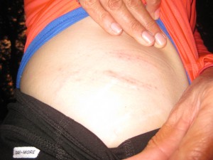
I discussed my problem with the sales person wondering if diaper rash cream would do the trick. She said, “Let me ask”. She went over and whispered my rash issue with the pharmacy tech. The pharmacy tech came over and asked to see it. I pulled down my waistband. “Hummm”, she said with a bit of a frown. She went over to the Pharmacist and whispered. “Hummm”, said the Pharmacist. The Pharmacist came over, “Tell me about that rash”. Well, “ It started as a heat rash and was welted for a week. Now it is just itchy and seems to be spreading. “I think this is fungal”, said the Pharmacist.
What!!!! Now I’m rotting?? I was sold some athlete’s foot/jock itch cream. I have used it for two days now and it seems to be working. Maybe I won’t rot after all.
As the afternoon progressed it began to mist, then sprinkle, then rain, then pour! There are a lot of things I can take in stride; cycling in the rain is not one of them. It becomes so challenging as most any rain jackets (even the “breathable” ones) sweat. Climbing hills a person is going to sweat anyway, add a rain jacket and rain pants…it’s no picnic.
I have no pictures for today as once the rain started it poured.
The hills were tough. It is said the hills between, Ellington and Eminence are the toughest on the whole TransAmerica. They were tough but, as Lisa and I were talking, I don’t think they were as tough as the hills in eastern Kentucky. Phil and Linda stopped at some cabins about 7 miles before Eminence, they decided to say at the cabins. We decided to continue on the last 7 miles into Eminence. The rain continued and the miles never seemed to end, it was one of those times when one must dig deep and keep on going.
We made it though and rode into Eminence looking like two drowned rats. We stopped at a local dairy queen and asked the locals for information about camping or hotels. Ice cream under our belts and armed with options we headed across the bridge. The first place with cabins to rent was too pricey and they suggested the Shady Lane down the road. It was a good option as they also had a laundry mat. They knocked off $10 dollars maybe because we looked so miserable and pathetic. The cabin room was large and we enjoyed a real bed and hot shower. By 10:30pm I could not keep my eyes open any longer and drifted off to sleep.
…I’ll keep you posted.
Stats Miles: 47.09 Calories: 4,193 Top Speed: 36.03 Average speed: 10.1
We enjoyed Al’s Place hostel very much but we knew we had miles to do today.We got up at 5:30 am and were ready to go at 6:25am. We went over to the Factory Diner for breakfast. I ordered an amazing omelet filled with feta cheese, spinach, chicken, mushroom with a side of hash browns. I couldn’t finished it.
We were back on our bikes and riding out of town at 7:30am. As we rode through town I spied a small family cemetery adjacent to a large prominent home. This is very common in all the states we have ridden through.

On our easy ride out of town Lisa spotted yet another turtle on the road, we stopped. I got off my bike to perform another rescue. Two cars were approaching. I had to wait for them to pass. The first, a truck, obviously knew we were performing a turtle rescue and purposely avoided the turtle. The second car hit and killed the turtle. From our vantage point it was on purpose!
May the “turtle gods smite you, you horrid person in the white car! Know you have been SMITED and you now have some really bad karma!”
As we rode to Johnson’s Shut-In State Park we got a good giggle over this sign at a bar along the road. Wouldn’t you say that was a bit of a contradiction?

We arrived at Johnson’s Shut-In State Park. A “Shut-in” is a constriction of a gorge or stream. We stopped to have lunch and visited with a nice lad who was monitoring visitors to the cascading stream. I walked down to the “shut-in” and found many boulder in the river bed which created pools and small cascading water.

In 2005 there was a breach in the reservoir that sent huge boulders crashing through the state park. Fortunately no one was injured or killed. The boulders lay where they landed.
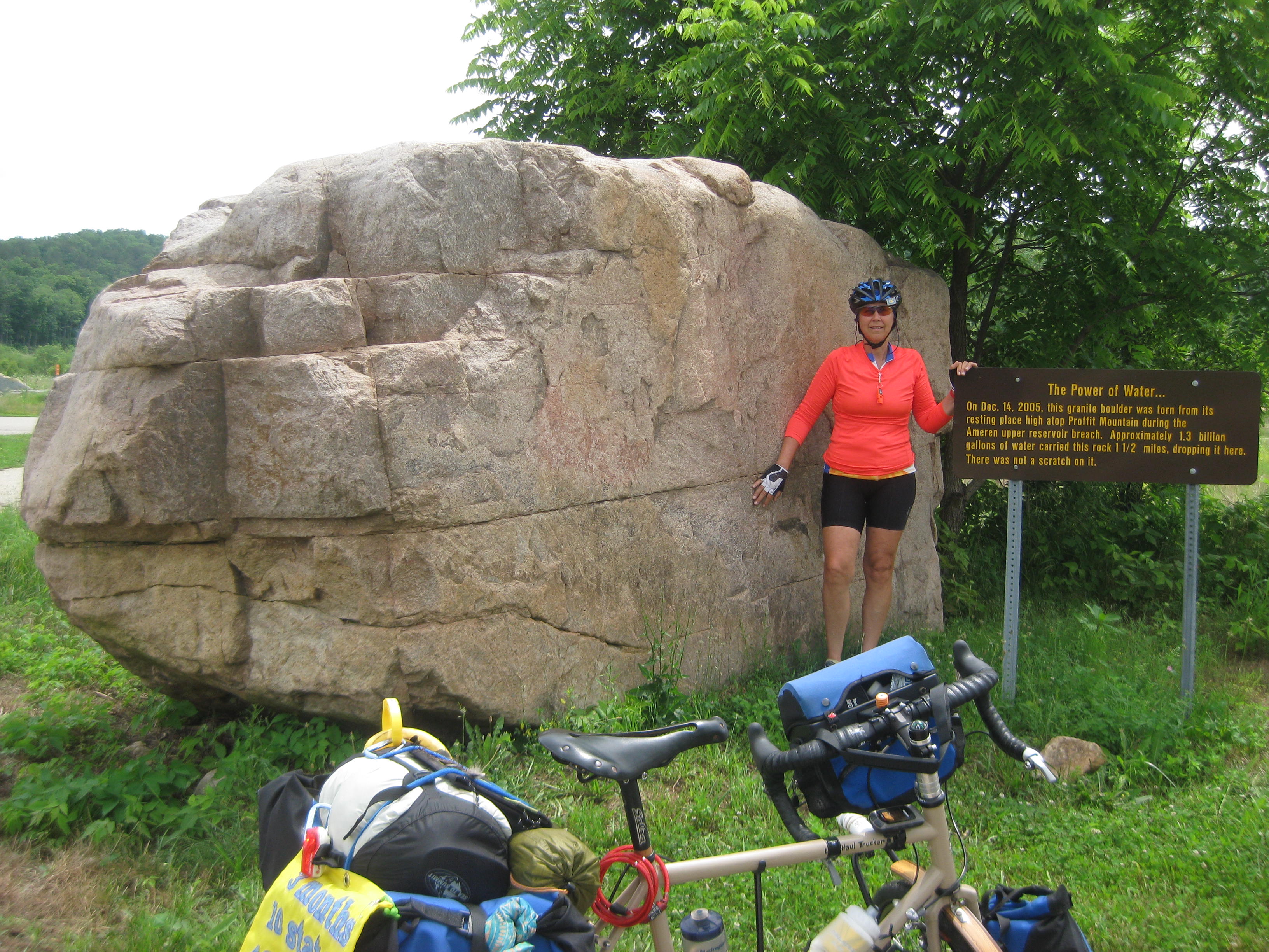

The ride out of the state park to Centerville was again, quite hilly, but we enjoyed one delightful hill that was much like a roller coaster.
A HOG ENCOUNTER
I was about a mile ahead of Lisa finishing a downhill as the road became flat. I was looking for a spot to wait for Lisa. I pulled alongside a mobile home with a long driveway. There, scarffing down what I can only presume was dog food on the porch were, what looked like, 2 large pot-belly pigs. “Aaahhhh! , how cute” they have pot-bellied pigs”. I retrieved my camera from my handle bar bag ready to take a picture. The animals turned when they saw me and I quickly realized, “These are not cute pot-bellied pigs, these huge hogs! The largest was probably 400 lbs and the juvenile 200 lbs. They ran off the porch and began to chase me. I threw my camera back in the bag, and screamed at the hogs as they barreling down on me. The adult hog chased me passed the driveway but the juvenile had more chase in him and chased me probably another 50 feet down the road. I pedaled soooo fast as all I could envision was being knocked off my bike by angry hogs and eaten on the spot! When I saw the hogs gave up the chase and moved to the opposite side of the road I cautiously waited for Lisa. I was ready to scream, “Don’t stop! They’re angry hogs! They’re not cute pot-bellies!
By the time Lisa got to the hogs they had meandered into the vegetation and trees. I later learned this area of Missouri has feral hogs, seems like I had a close encounter of the feral hog-kind.
Melinda’s Philosophizing”- It doesn’t take long, on a trip such as this, to gain more respect for the wildlife one encounters. I can’t tell you how many road kill possums, snakes, raccoons, squirrels, armadillos, foxes, deer, and turtles we have encounters. Yes, sometimes while driving a person inadvertently kills an animal, but to kill intentionally, for example a turtle, for kicks, to me, is inexcusable. It was explained to me the feral hogs were brought to this area years ago to hunt for sport they are now feral and are damaging the eco-system (and seems to have it out for cyclists as well.) On the TransAmerica trail cyclists are known for rescuing turtles on the road. Perhaps it is because the turtle and the cyclist share a connection-the pleasure and danger of the open road.
Relieved I was not devoured by the feral hogs I refocused on the road ahead. The next 7 miles into Centerville(population 191) included some tough rollers. Around 3pm we rolled into town and found the local diner, “21 Diner”. We had a soft-serve ice cream which was really ice milk but it didn’t really matter it was cold and sweet. The next order of business was to find the local park where we could set up camp. After I finished my ice milk I walked across the way to the courthouse/sheriff’s office which was in a park-like area. Even though today is Sunday the door to the Sheriff’s office was open and the dispatcher was working. I asked her about camping for cyclists and she said, “Camp right here by the station in front of the courthouse”.
One of the sheriff’s came over to chat. They serve 5 small town in the county. He was heading over to the diner to get food for the prisoners that will be arraigned in the courthouse we are camped in front .
So here we are, tents up, reliving our tales of the day, laughing about feral hogs, eating dinner, and relaxing before our tough ride through the Ozarks tomorrow.
… I’ll keep you posted.
I got up early due to my internal alarm clock and spent the morning blogging and teaching my class. Lisa found a small grocery store and picked up some eggs. I had a leisurely breakfast of eggs and corn tortillas a previous cyclist had left in the fridge. I had to wait until 10:30am before I could pick up my bike at the shop.
This weekend is Farmington’s Country Days, which included a parade and carnival. As I readied to go to the bike shop the parade started.

I think most every resident was in the parade and it continued until 11am. I found a break between the horses and the tractors and walked into the bike shop. My bike was ready. I rode it on some back streets and the shifting seems great. I ran upstairs to load my panniers, Lisa said, “look at the weather”. She showed me the radar and the forecast was 80% rain and thunderstorms. Just as the parade ended the rain started and it poured.

We knew we had 30 miles of hills and we were leaving late so we decided to stay at this awesome hostel for one more day.
In the afternoon we rode our bikes to the carnival and looked around, some people asked us about our bikes and we shared our story. We made our way back to the hostel and met Charlie who had just arrived. He is from Chicago and riding West to East. We spent the rest of the evening enjoying each others company.
The plaque on the side of the cycling hostel (the old county jail).

Below is the old county jail now refurbished (1870-1996).

Tomorrow we are heading to the Ozarks, early.
…I’ll keep you posted.
Day 35 Chester, Ill to Farmington, MO 6/6
Stats
Miles: 46.43
Calories: 4,756
Top Speed: 36.0
Average speed: 9.6
We left Chester at 8:30am had our morning ritual of a McDonald’s breakfast and we headed out to cross the mighty Mississippi. All downhill we sped our way to the bridge. There was no shoulder so we “took our lane” and pedaled quickly as not to hold up traffic for too long.
This picture is the bridge after we crossed.

We are now in Missouri! Our 4th state.

As we continued to ride across the flood plains a tear came to my eye. “I’m really doing this; I am really riding across the country!” It felt magnificent. Caught up in the moment I heard something, “TURN, TURN”. It was Lisa telling me I had missed a key turn. I turned around; back on course.
Acres and acres of corn fields, the corn about 4 feet tall. The swallows, in flocks, swooped and glided along the tops of the corn fields snacking on insects. Within a few miles there is was, another hill. We started the climb and it rose to 15%. I made the grade, powering up, noting how much stronger I have become.
More turtle saves, this little fellow is “Henry II”

Melinda’s Philosophizing”- Near the top of the hill a fellow on a bike flagged me down. He was not a cycle- tourer per se, more of a cycling vagabond. He wanted to know where we were going and was impressed when I said, “Oregon”. Most would ignore these cycling vagabonds maybe even be leery or fearful of them. They too are travelers; years ago they would be called hobos traveling to and fro scrapping out a living on the road. When we meet a cycling vagabond they are always kind and interested in our travels. It seems we are, in a way, kindred spirits, each finding our way across this expansive country exploring its nooks and crannies that only bike travel can reveal. As with most vagabond travelers there is a “code” which is, be kind and trusting of your fellow traveler. So I like these travelers, these modern-day hobos, they have a story and are trying to get through life like the rest of us, just in a different way.
Another hill-fest today in hot, humid, clammy weather, the kind that steals all one’s energy. Later in the afternoon we approached a Tiger Sanctuary, with lodging, and a restaurant, it was literally in the middle of nowhere. The grounds were beautiful and we needed a rest. We “pulled up” a big decorative rock and had a seat; the guide just took a group down to see the tigers so we were not able to get a refill on water. “Oh well, we’ll find something down the road”. We enjoyed the rest in the shade. A senior in the parking lot waiting for his wife and grandchildren took a fall. We rushed over to help. Fortunately he was ok. He and Lisa talked hip replacements then helped him to his feet after we made sure he had some water. I gave him a card to follow our journey, if you see this, we are glad you are fine and best wishes on your hip replacement!
We continued the drudgery of more rollers, no longer was our skin moist or glistening with sweat it was pouring with sweat. A few miles down the road we got our reward for all those hills, a long downhill. As we sped down hill the beads of sweat crystallized to salt and our bodies welcomed the cooling air.
Hunting for water I saw two men outside a small church mowing. I stopped asking for water. “I don’t feel a bit sorry for you all, but, you can have some water”, he declared. Not looking for pity I thanked him for the water. We began to talk and I warmed him up a bit. He told us of the upcoming climbs (gee, thanks) and the guy that was riding at night last year that got hit (gee, thanks). By the time we left they wanted to see our map and gave us lot of information about our destination in Farmington. One of the fellows left to go home and mow his lawn, we passed him later and he gave a big wave and smile.
Note: We are fine, the bikes are fine, but BOB (Lisa’s trailer, had a near death experience)
The roads were steep 10-15%. We are being smart, and when the hills with tight turns get steep we get off our bikes and walk on the white line or just over it to make room for any traffic. Cars and trucks tend to drive fast on these back roads, coming around a curve drivers are often surprised by our presence and have to immediately slow down and brake.
We had just completed a mile downhill and were climbing up the other side. The corner was tight; we had just made the turn. The grade quickly increased. Lisa got off her bike at about 10% and I bailed at 12% grade. (Note: climbing up a steep grade a loaded touring bike can be wobbly and slow at 2-3 mph. One does not want to be weaving all over the road when a truck or car barrels around the corner)
We heard a truck coming. Already off our bikes, hugging the edge of the asphalt, the dump truck, driving to fast barreled around the corner, we stopped as we knew he would not be expecting us on the road. Because he was driving too fast he swung wide around the corner. Just then a car came up over the crest of the hill. Because he swung wide he now had to over compensate. Seeing us, seeing the approaching car, he hit his breaks sending smoke everywhere. To avoid the car he over compensated and veered toward us. Immediately Lisa jumped into the ditch dragging her bike and trailer with her, seeing the event unfold and not knowing where the truck would end up I leaped to the ditch too. The trucks tires ran off the road near taking out “BOB” (the trailer). BOB escaped “death” by no more than 6 inches.
The truck drove to the top of the hill; the shaken driver jumped out and walked down the hill. “Did I hit her?”
“NO, but it was close” I said. He was relieved and I asked for his help to pull out bikes out of the ditch. We hope this scared him as much as it scared us. Before he left I gave him a stern but kind warning, “This is the TransAmerica trail filled with cyclists this time of year, you can’t barrel around these corners; you WILL kill someone”.
Lisa and I mentally processed what had occurred and I mentally thanked all the people we have met along the way parting with, “Have a safe trip” and “we will pray for your safe trip”.
Thanks, I think it worked!

Note tire marks and the trailer
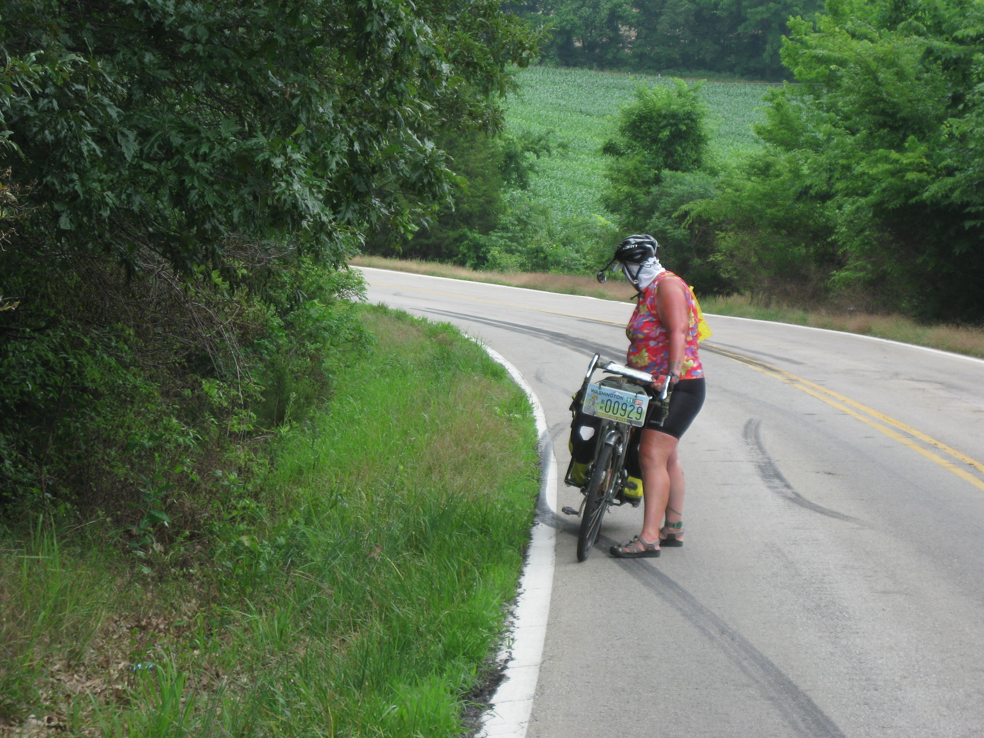
We ended up in Farmington, stopped at the local police station and spoke with their very handsome cops, and they escorted us to Al’s Hostel. This is the most amazing hostel. It holds up to 8 people, 2 showers, 2 toilets, large capacity washer and dryer, 2 leather sofas, dining table, and a place to store bikes (locked). It is like a full size apartment and best of all it is in the town’s old county jail. So, Lisa and I literally “spent the night in jail”. They ask for a $20 donation which we gladly gave. Tomorrow is a local parade and the best news of all, there was a bike shop just across the street, TRANSAM CYCLERY, they were still open when we arrived so I went in to check if they had one 9 speed bar end shifter. YES! He took my bike and will put it on in the morning.
It was an eventful day, to say the least… I’ll keep you posted.
Stats:
Miles: 52.06 (WOW)
Calories: 4,012
Top speed: 31.0
Average speed: 10.2
The day after a rest day, it’s tough to get moving. It would be great to lay around in bed but our internal alarm clock goes off at 5:45 -6am. Lisa hit the showers first and I struggled to get myself moving. The cup of coffee Lisa brought down from the hotel lobby helped. We were out of the hotel at 7:30am and on our way to McDonald’s for more coffee, breakfast then a run for groceries at the Wal-Mart across the street.
At 11am we started our ride out of Carbondale with my “gimpy” shifter but clean chain and brakes, thanks again Phoenix Cycles. Three or four miles out of town I spotted a Natural Foods market, I had to go in. I came out with some (GF) Peanut Butter and Coconut cookies, for “medicinal purposes only”.
The ride was amazingly flat and I can say was one of the best ride days so far. It was flat because we were on the Mississippi flood plain. Dark, rich soil and acres of corn, soybeans, and wheat.
We came to a “T” in the road, reviewed the map, and were ready to turn west when a mama raccoon with her two little babies scurried across the road about 20 yards away.
We made our turn but miles down the road we somehow got off the route as the road signs were a little confusing. We could tell from the map the road wound around and eventually came out where we needed to be but certainly added 3-4 miles. With corn growing all around us I felt lost in corn maze. On the road we met Jeremy from Germany. His English was quite good. He was riding from San Francisco to Wash DC.
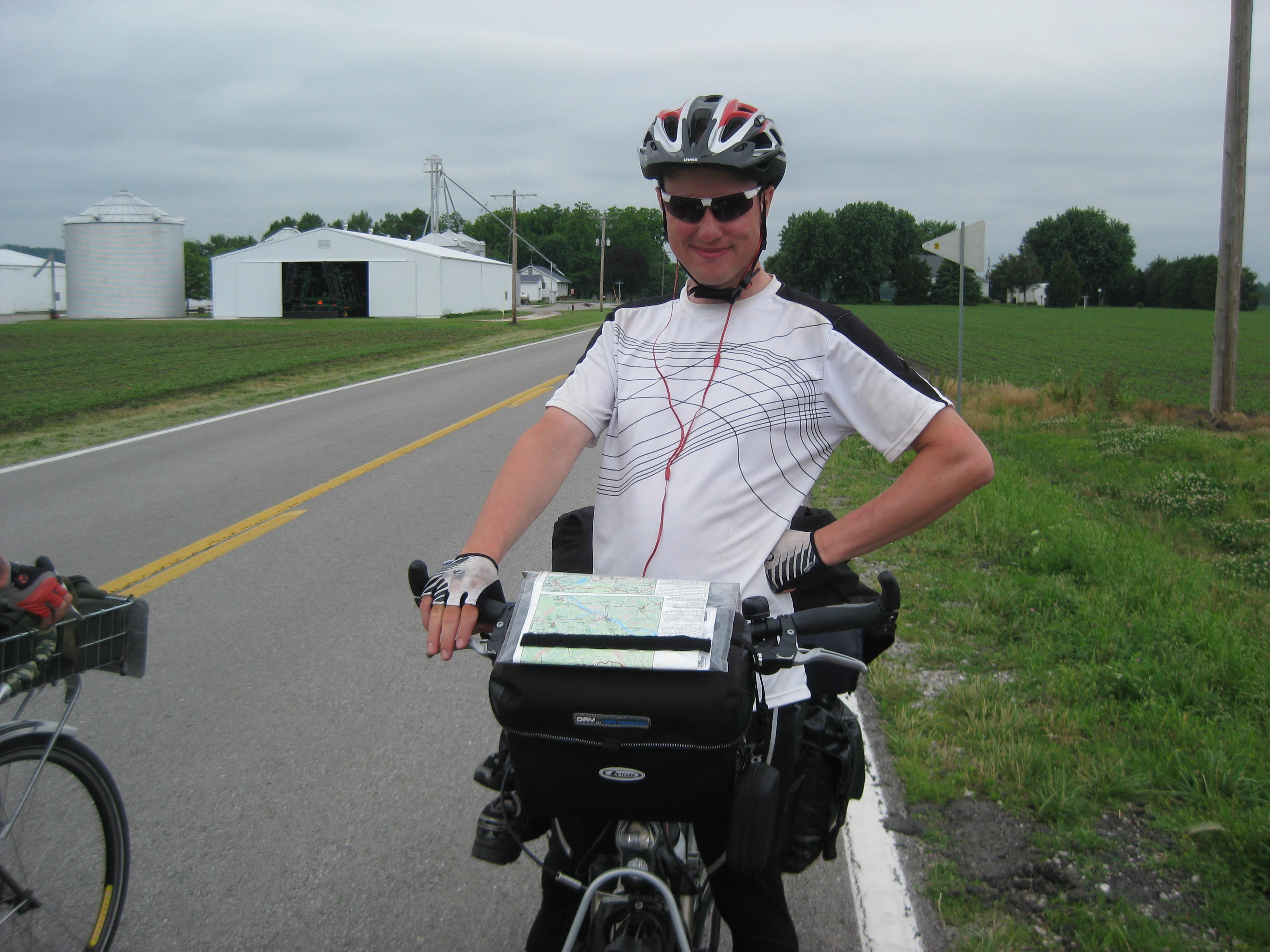
We passed by marshes with beautiful brown and white cranes focused on the water before them eager to catch a meal.
The wheat fields were dotted with black spots. A closer look revealed red-winged black birds perched on the strong stalks of wheat looking for insects to fill their bellies.
As we neared the Mississippi river we turned on to Levee Road, which was the levee for the great Mississippi. I estimate it was 30 feet high and there was a lush green belt between the river and the levee. The road was flat so we could see something on the road ahead. As we got closer we could see it was a very large mud turtle. I quickly named him “Yurtle”.

Yurtle possessed a sense of authority, he did not hide in his shell and I think he was a bit indignant that we were on his road bothering him while he was sunning himself. Not wanting to leave him exposed to a car or 4-wheeler I told Lisa to give him a nudge with her rear trailer wheel to see if he would scurry off into the weeds that lined the road.
Yurtle was not in the mood to be nudged; he scurried right up to Lisa’s rear bike tire and bit it! Yurtle was on a rampage!

He went between Lisa’s wheels heading right toward her left foot. She screamed but there was nothing she could do. Fortunately, he simmered down and Lisa was relieved she could pull away from him. I told Yurtle, “fine if that is the attitude you are going to have then we will just leave you to your road and sunbathing, and we will not be responsible if you get squished”. As we pulled away I’m sure I heard Yurtle mumble under his breath, “Damn tourists!”
Continuing on to Chester I was feeling Illinois was going to disappointment me as I had not yet found a feather and we would be in Missouri tomorrow. The road came to a junction and we turned west, Lisa was ahead of me, I was pedaling fast to catch up when, “There it is!” Obviously a turkey road kill as a closer look revealed a plethora of turkey feathers. I saw a fine-looking one down in the ditch but meandering down into the tall weeds means one thing ticks! I picked up two feathers and thanked the ‘ol bird for his feathers.

The last 10 miles to Chester we had to “share” with more coal trucks! We had to pull over often as coal trucks don’t share the road well and they were whizzing by about every 2 minutes. We crossed a bridge and looked at the big hill before us, “How would we get up that hill with coal trucks blowing by?”
I looked behind me at the river we just crossed, it was named St. Mary River so I said, “ok Saint Mary, keep us safe as we ride up this hill!” I’m not even Catholic but crossed myself anyway as a gesture of hope. I said to Lisa, “Well, we have to get up it, let’s go.”
Whether it was divine intervention, planet alignment, luck, or near quitting time (it was 4:50pm), not a single coal truck came up that hill while we were on it.
We rode into Chester and took a picture of Popeye. Chester is known for the creator (Elzie Segar) of the Popeye character who was supposedly a local named Frank “Rocky” Fiegel who was skilled with his fists. The creator sent him checks regularly until his death.
We found the park where we were to spend the night, a “bike barn” was toward the back which was basically an enclosed outbuilding with a small porch. There were already 7 cyclists there when we arrived, mostly young twenty-something’s. The park had a restaurant perched on the hill and tonight was a team volleyball tournament. Lisa went over to the restaurant for dinner and to listen to music. I was a “good girl” spending the evening grading papers.
OTHER NEWS:
The shorts are on the move again! I spoke to the postal worker in Farmington, Illinois explaining the story of the traveling cycling shorts. She forwarded them on to Houston, Missouri. They should be there this coming Monday. Cross you fingers!
I have a bad case of heat rash! Since I am down to one pair of shorts I often have to put on damp or wet shorts; add humidity and the heat and…..let just say next Walgreen’s I see, I am buying some diaper rash cream. Every day it welts up and is spreading. Today I noticed it on the back of my leg. I better not tell Lisa, she will think its rabies from when the raccoons got into my stuff at Breaks Interstate Park and will want to put me out of my misery ASAP!
….I’ll keep you posted !
Day 33 Carbondale Rest Day 6/4
We enjoyed breakfast with residents and then packed up. Just as we were about to leave it started raining. We waited about 30 mins and the rain stopped. We rode back into town to the bike shop as my shifting has be difficult for about 4 days. While we waited on the bikes a customer took us over to a small health food/deli store. I bought a small box of Sushi which really hit the spot.
Phoenix Cycles was great.
They cleaned up my bike, adjusted my breaks, and then I got the bad news, my shifting problems were not a stretched cable, my bar end shifter was broken. Nooooooo, it can’t be so! I can still shift but will have to do it by friction, moving the shifter a little at a time to change gears. I called the Newton Bike Shop in Kansas, they have them so I will get it replaced in Kansas about 3 weeks from now.
We got a hotel for the night as we were in need of a rest day and a storm was brewing. Dinner was a salad at Subway. We have been watching storms roll through all evening and glad we are not on the road, or in a tent. Tonight we are dry, blogging, watching some TV and enjoying a real bed.
The storms are suppose to diminished tomorrow as we head to the town of Chester.
Stats:
Miles: 38.7
Calories: 3, 287
Top speed; 35.6
Average speed: 8.7
We left the State Park campground about 7:15am and started our ride to Carbondale. Carbondale meant the bike shop for a tune up and visiting with and spending the night at a local retirement community.
First save of the day, a turtle I’ll call “Henry”. I haven’t yet found a new feather in Illinois to carry on my bike so I thought about using my bungees to strap Henry” on the back of my bike. He could sit tall on my sleeping bag and be my new totem. Ultimately, I decided against it. I think the Illinois Fish and Game would frown on that.

These rollers all look the same, but from my angle, they are TALL! That little dot on the road is Lisa.

We made it into Carbondale about 1:30pm. It was hot so we decided to stop at a McDonalds for lunch and soft serve ice cream. After lunch was found the retirement community, Prairie Living at Chautauqua. We were welcomed in and enjoyed meeting the residents.
After showering, so we were presentable, we gave a talk to residents about our trip and emphasized continued exercise. We joined residents for dinner. Here is a picture of Jake. He was a teacher, superintendent and served in WW II.
We turned in early, exhausted.

Stats:
Miles: 40.09
Calories: 4,294
Fastest speed: 33.0
Average speed:8.0
It began to rain about 6am so we were glad we chose to sleep in the garage at Connie’s house rather than outside. We knew we had some climbs to get to the next town of Eddyville so we left at 6:30am
There were 3 steep climbs and walked the top half of a few of them. Having had no breakfast, or coffee, we were not at our best. Eddyville is another one of those towns that is a few blocks long and has minimal services. We headed toward Main Street and Lisa declared, “I don’t think they have anything but a convenience store”. Oh no, I wasn’t going to accept that, my stomach was itching for an omelet! I saw an elderly gentleman with a walker heading for the small post office. “Good morning, is there a restaurant in town? “Second street, turn right” I waved to Lisa letting her know I had “scored”. We quickly found the restaurant and I ordered my omelet and coffee. Breakfast was good and we spoke to a few other patrons about our trip. After we had our fill, we started riding to Goreville. As you can see from the picture, we were inundated with rollers all day and we were keeping an eye on the thunderstorms building.

Later in the day I had a phone interview scheduled with another university to teach online. I had already rescheduled it once so I wanted to be sure to keep the appointment. It was scheduled for 3pm, plenty of time for us to get to Goreville, as it was only 30 miles away. Then it hit. The rain started and refused to let up. During one of the downpours I took shelter under a tree (I know, not the best location during a thunder storm. Lisa continued on down the road but I refused to budge until the thunder passed and the rain let up. The thunder passed but the rain was still coming in buckets. I dragged myself and my bike back onto the road. My waterproof rain jacket did not feel so waterproof and in minutes I was soaked from head to toe. As I turned a corner I heard someone call out. It was Lisa, she had taken shelter under a metal car port. Biking in the rain is not one of my favorite things to do but when travel across the country there are no options, “ya just deal with it”.
The clock said 2:30pm; I looked at 2 more huge climbs before me and knew I would not make it into Goreville by 3pm. The rain was still coming down in buckets. I stopped at a house on the side of the road and left a phone message that I would call the interviewer back shortly. About 15 minutes later the rain began to let up and finally stopped. I found a place off the road, an entrance to a cemetery, and called the interviewer.
I have never been interviewed for a job in the prairie of southern Illinois. Lisa was patient during the 45 min interview. I think it went well and he understood of my interesting situation. He said I would most likely have a second interview, I told him, “great, I’ll probably be in Kansas for that one”. I have been teaching online for about 7 years along with my other businesses. I love it as I can do it anywhere,.
We arrived in Goreville and found the state park. We picked a campsite and started to set up camp. There were showers so we took advantage of them and put on dry clothes. However, my 1 set of cycling clothes were now soaked and there was no way of drying them and they would not be dry by morning. I returned from the shower and I stated how I couldn’t wait to get my forwarded cycling clothes. “Lisa said, Ahhh, about that. I told you to forward them to Farmington, Illinois, that should have been Farmington Missouri” WHAT!! So my clothes are heading north and we are south? My clothes will be as well traveled as we are. So the saga continues. Now I need to call the post office in Farmington, Ill and sweet talk them into forwarding them to some other stop down the road. In the meantime just call me, “one-shorts Melinda”.
After the “great news” about my shorts the couple across the way invited me over for a gin and tonic, I didn’t refuse.
PICTURE TIME:
Below is a mud tower made by a Mud Crawdad. They borrow into the mud to get down into the water.
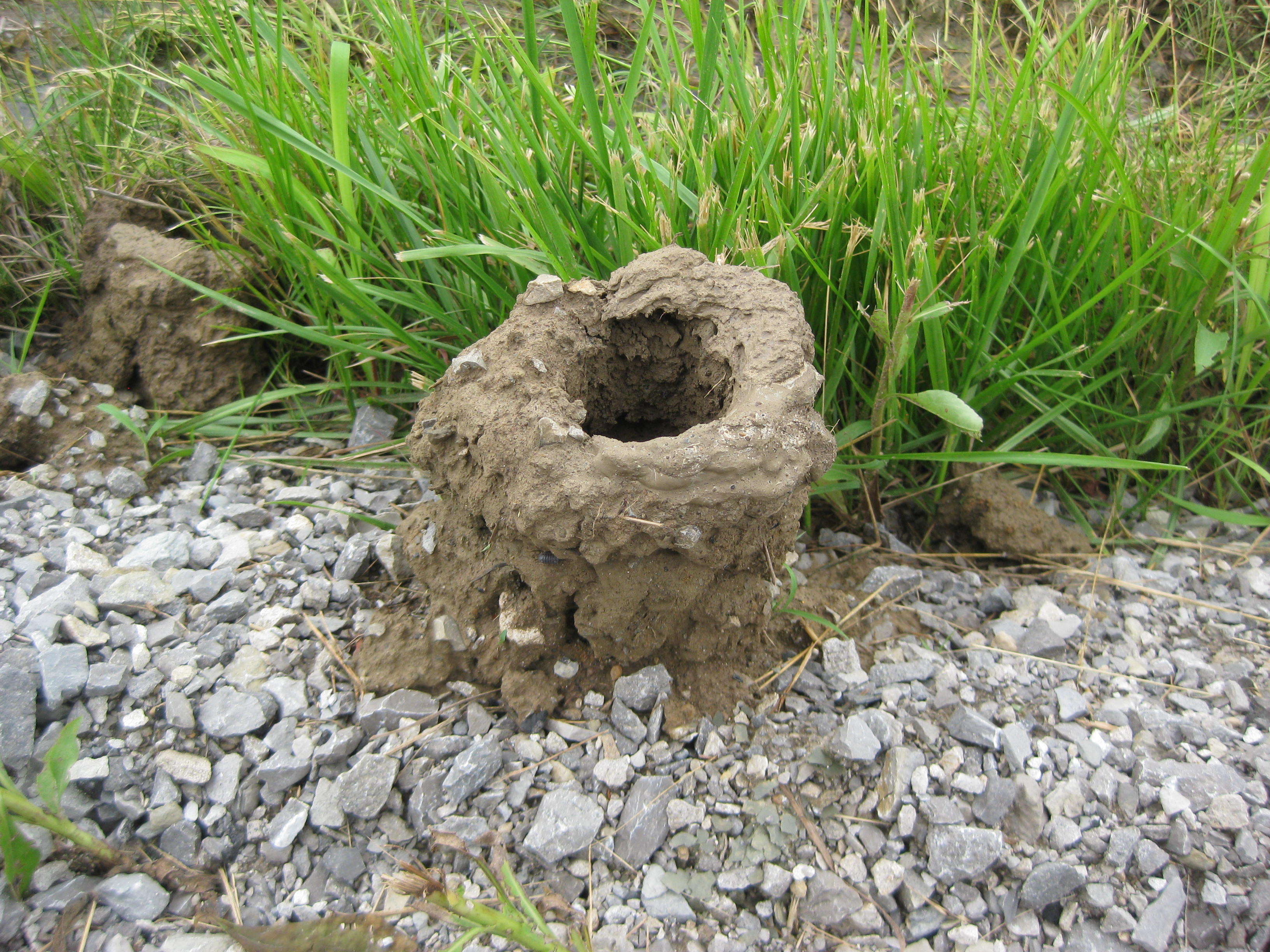
…I’ll keep you posted.
Stats:
Miles: 35.42
Calories: 3,633
Top speed: 32.5
Average speed: 8.5
We left the church hostel at 7:15am, perhaps a record for us. The only place to eat in Marion is McDonald’s. We were told the only other restaurant was closed, a familiar story in these small towns. Joining us was another cyclist from Minnesota. He was riding west to east. I order 2 scrambled eggs 2 hash browns and coffee. As we got ready to leave Lisa asked the cashier where she could fill her water bottles. It surprised her, and me, that the cashier said, “If I fill them I will have to charge you for a medium drink”. Seriously, for water? We chose the bathroom sink. There was a previous clue of their lack of generosity, a sign stated, “There is a charge for extra condiments”. Seeing the sign I ordered my coffee with 4 creams instead of 3, just in case. I thought it was rather appalling to even suggest that to fill a water bottle would cost about 2 bucks. But, if one is the only game in town, I guess one can do want every one want.
“Melinda Philosophizing”- As we continued down the road out of Marion, I couldn’t let the McDonald issue go, I found myself dwelling on the absurdity of charging for water, I wonder what the McDonald’s franchise board would think of that. Here is an interesting tid bit about human behavior. Often, but not always, when one gets irritated or upset by something, it is often a reflection of oneself. For example, the McDonald’s woman’s lack of generosity reminded me of my own lack of generosity at times, that is why it irritated me so.
We enjoyed a nice downhill and saw two deer scamper into the undergrowth. About 5 miles in my energies began to fade. I drank some water and ate a Luna bar. I reminded myself that I recently had breakfast. There are days when ones energies and up and days when they are down, this was a down day. I took some electrolyte capsules and began to feel better. Lisa reminded me to drink more water. Good advice.
After 12 miles we said goodbye to Kentucky.

We boarded a ferry-boat for a short ride across the Ohio River to the small town of “Cave in Rock” named after, yes, a big cave in a big rock.
From the ferry we rode less than a mile. We parked out bikes, locked them out of habit, and walked a short distance to see the cave. From what we were told, when the river runs high, one cannot get into the cave. The cave opens facing the Ohio River. Swallows dance round the high rock to and fro from their mud nests they have attached to the large high boulders.
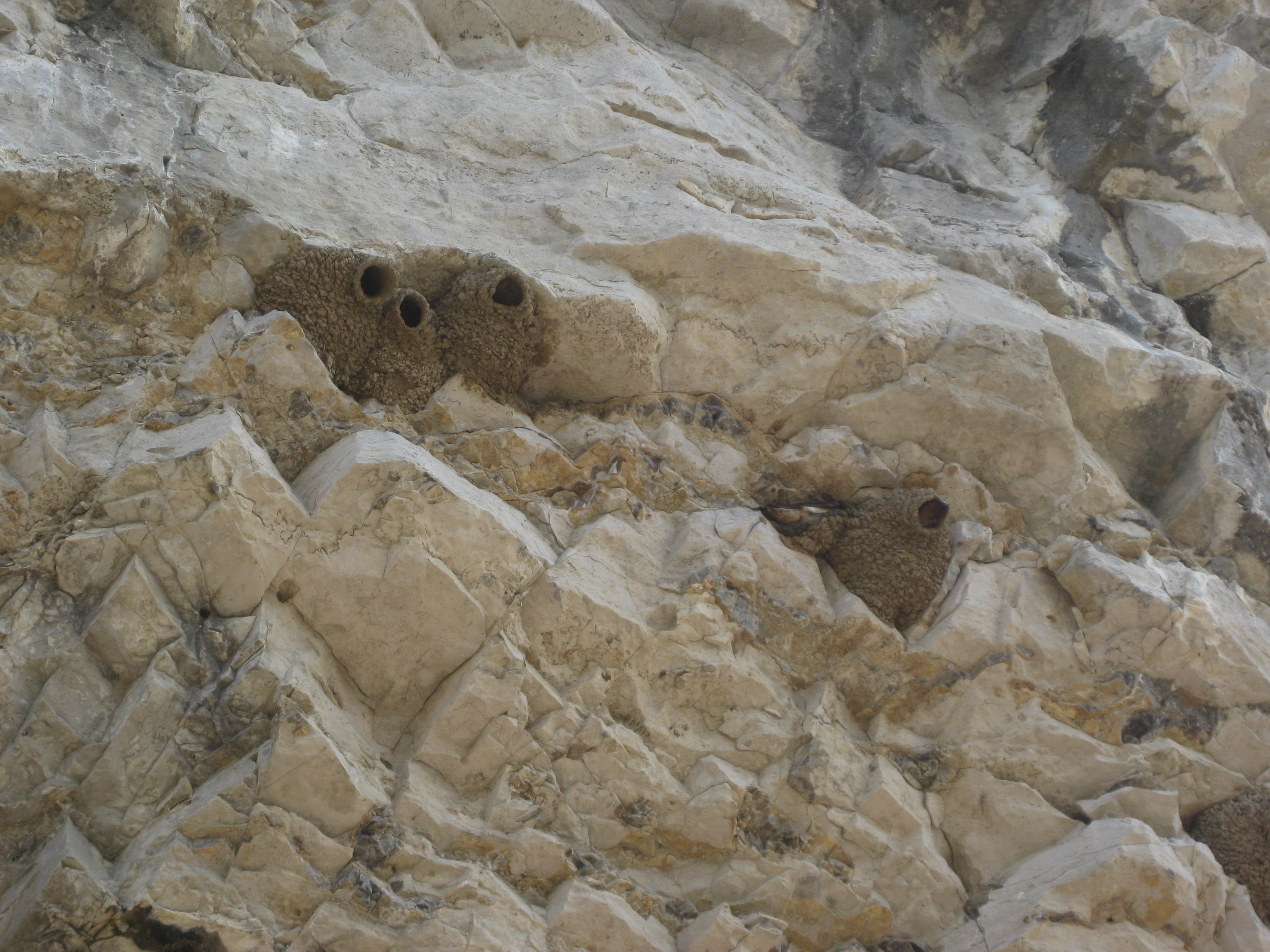
The cave was deep and had a magical quality. I wondered how the Native Americans had used the cave, for ceremonies or council. The cave must go back 200 feet. There is a split in the rock in the ceiling so the sun shines in eliminates a slice of the ground.

The sunlight shining on the floor of the cave
The day wore on; I never seemed to regain my energies. I increased my water which helped. About 11:30am we arrived in Elizabethtown which is on the bank of the Ohio River. This was the last stop for food so we decided to break early for lunch. There were not many options but decided on the Rivertown Café. They were offering an all you can eat Sunday Buffet. I gorged myself. I ate 5 pieces of fried chicken minus the fried coating, 2 large portions of mashed potatoes, some chicken and broccoli rice, a side salad, and some cherry cobbler minus the cobbler. We ate until we thought we would bust! As we ate we spoke with many of the patrons about our trip. They were interested in the Senior Retirement Project and, as always, wished us well on our journey. As we were getting ready to leave the waitress came by and told us the “Rosie” had paid for our lunch. We were surprised and very happy. Thank you Rosie for your generosity.
As we stepped outside to digest and noticed a storm moving in, within 15 minutes the skies darkened and it began to rain. As we spent at least 45 mins talking with diners coming in or out about our trip. We met the President of the Ohio River Scenic Byway. She gave us copy of their magazine highlighted local artisans and provides a history of the area. www.ohioriverscenicbyway.net
There was a lull in the rain so we decide to make a run for it, but within 10 mins it began to rain. We continued to travel west over many rollers making out way to Golconda. Our original destination was Eddyville but we spent so much time at the café we knew we would not make it. There was a state park in Golconda so we made that the new destination. We saw the sign for the state park but it looked more like a driveway. A woman “Connie” was out front. We asked Connie about the state park. “It’s closed and has not been maintained”. Oh great, now what! Connie quickly became our third trail angel. She said we could camp in her back yard. I suggest the newly completed garage in case it rained. She let us shower and wash clothes and we enjoyed visiting with her family and friends, what more could a touring cyclist want!
THANKS CONNIE!
Stats:
Miles: 42.73
Calories: 4.230
Top speed:34.6
Average speed: 9.6
My internal alarm clock seems to be permanently set for 5:45am, at least until this journey is over. While I set my phone alarm clock out of habit, it is not necessary as the birds start their morning declarations at 5am. I had a good night’s sleep which makes all the difference. Two twenty-something girls who also stayed at the hostel on a 2-week cycling trip, were packed up and gone by 7am.
We were able to lounge around a bit as the post office did not open until 9am and Lisa needed to either pick up her camping table or give them a new forwarding address. At 8am I called the post office in Berea to find out if my clothes had ever arrived. “Yes, I have them here” said the man. “Oh, they were to be forwarded to Sebree”. He explained that the postal worker we spoke with was working in another office so the instructions were never passed on. Wonderful, my clothes have been sitting in Berea a full week. I instructed him to send them on to Farmington, Ill. Will I ever get my clothes? The saga will obviously continue.
Lisa all packed up headed down to the post office while I finished packing and tidying up. As I rode out the driveway Lisa was returning with a big grin on her face. “My table came in!” We now have a light weight table for all our camping needs.
We climbed out of Sebree and enjoyed some easy rolling hills but after 3 miles I had to stop for a big drink of water and a Luna bar. The humidity was again sweltering, and the temperature rising. Finally the road flattened out as we passed through field of corn (about 4 to 12 inches high), and soybeans were also emerging. Wheat crops and grass filled the prairies. The fields were also dotted with hardwood trees and the birds continued to announce our presence. The crops are “dry crops”, they are not irrigated, if it rains they grow, if no rain, the crop fails.
We arrived in Dixon, a small town, around 11:30am and decided it was time for a soft-serve ice cream. (After this trip I may need to go to “soft-serve” rehab). The main street was 2 blocks long and half the buildings appeared closed. I imagined what it would have looked like decades ago with people bustling around, now, it’s a dying town. We asked a local if there was a place for Ice cream. “Yes, go down ½ mile to the Marathon (gas station) and there is a little restaurant on the side”. The diner was cute, a flashback to the 1950’s, clean and simple. I ordered a vanilla with chocolate swirl. We sat outside in a covered area, letting the coolness of the ice cream penetrate our overheated bodies.
We studied the map considering an off the route road. Ultimately, we decided to stay on route as the road we were on was not heavily trafficked and while there was no designated shoulder, the road was wide. We continued on to the next town of Clay, another small and dying town.

“Sun” Cloud
We met “CR” at the top of a climb; he was mowing his large yard. We later learned it takes him 6 hours to mow. We enjoyed our conversation with “CR”. He explained, as a kid, the towns of Clay and Dixon were bustling towns with car dealerships, and a Deere dealership. He mentioned it was sad to see these towns dry up and deteriorate. He is retired Air Force and know of Fairchild AF base in Spokane. Thanks CR for the conversation and history of the area.
Storms were building and we had been dodging them all day.

Our luck finally ran out. The stinging rain pelted my face. The salt from a day of sweat ran into my mouth. I quickly dug through my front left pannier (saddlebag) for my rain jacket to stop the impact of the stinging rain. I could only hope my waterproof panniers remained waterproof during the deluge.
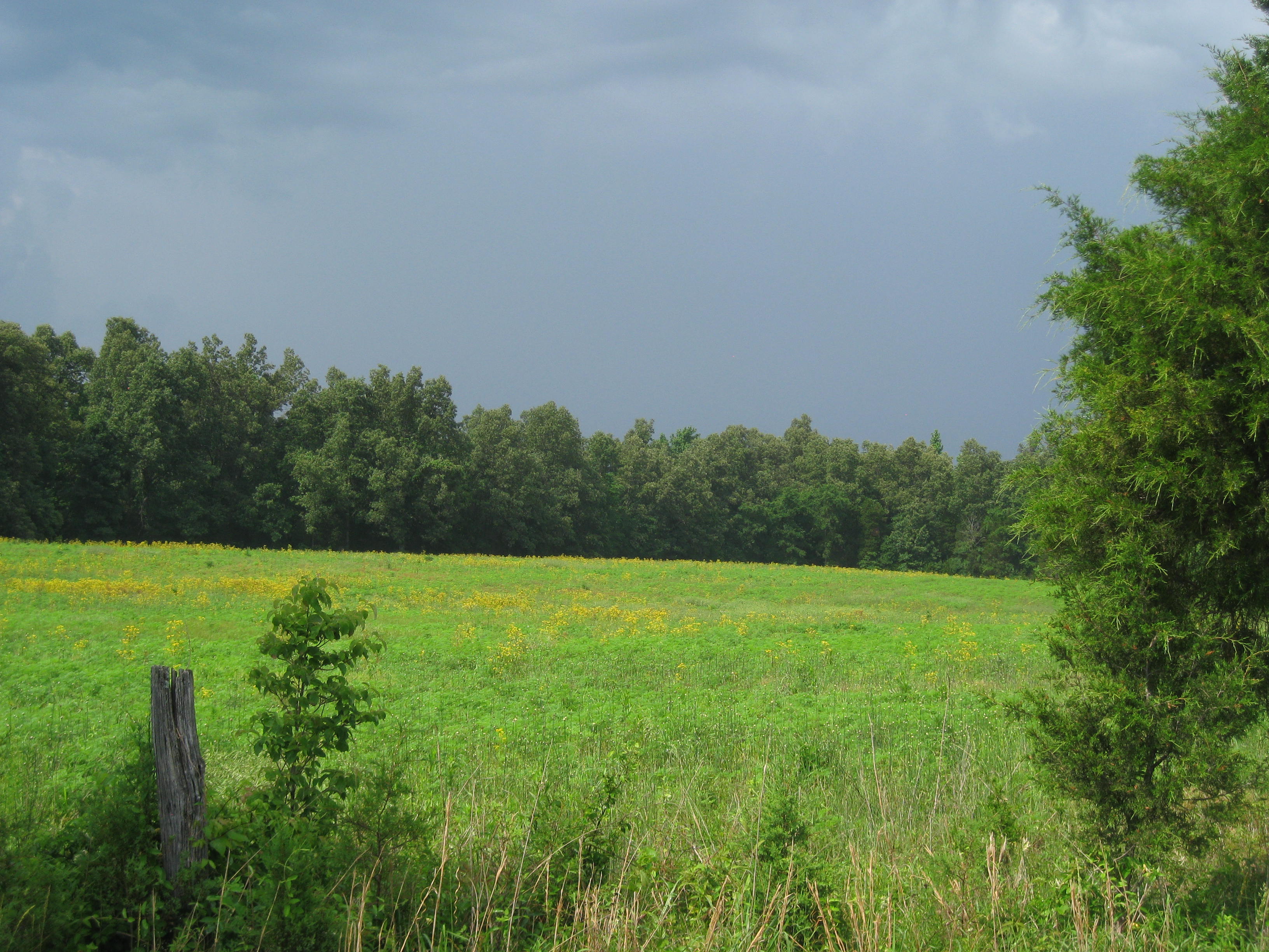
The rain finally subsided and the steam from the roads left an eerie presence. At one point I lost Lisa in a cloud of steam from the road. The next 10 miles to Marion were tough. We plowed over numerous rollers.
Since the storms passing the sun made its presence known. We found ourselves stopping every few miles to drink water and find a sliver of shade from a pasture or yard.
We thought at first it was a mirage. The sign read. Town of Marion. Could it be? Were we finally there? Yes. We found the Methodist Church that host cyclists. The pastor saw us ride up and escorted us to the basement recreation room. We were delighted to find a shower, mattresses we could use, couches, and a full kitchen. We spent the evening catching up on the computer and chatting with the two other cyclists.
Picture time:
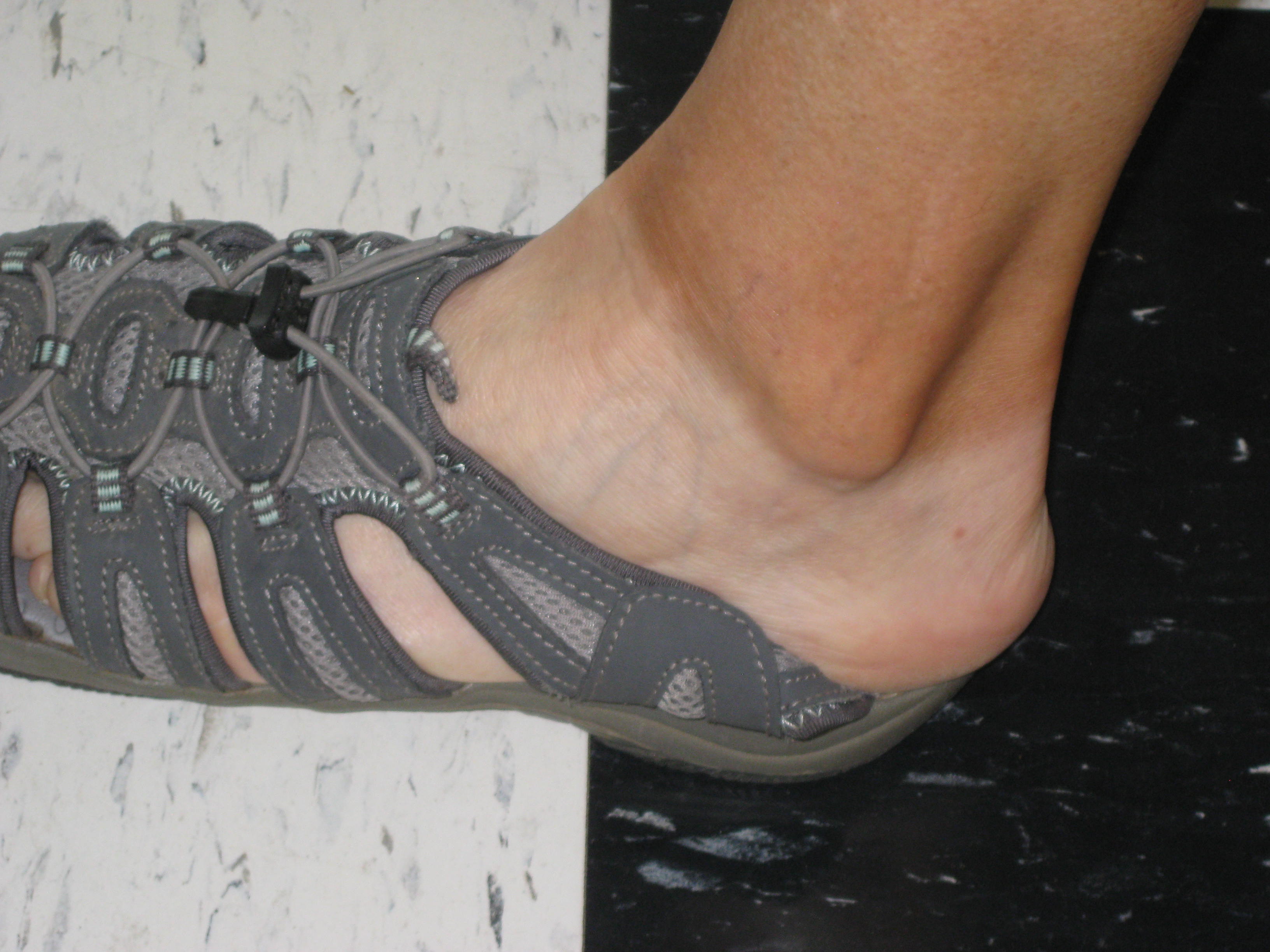

…I’ll keep you posted.
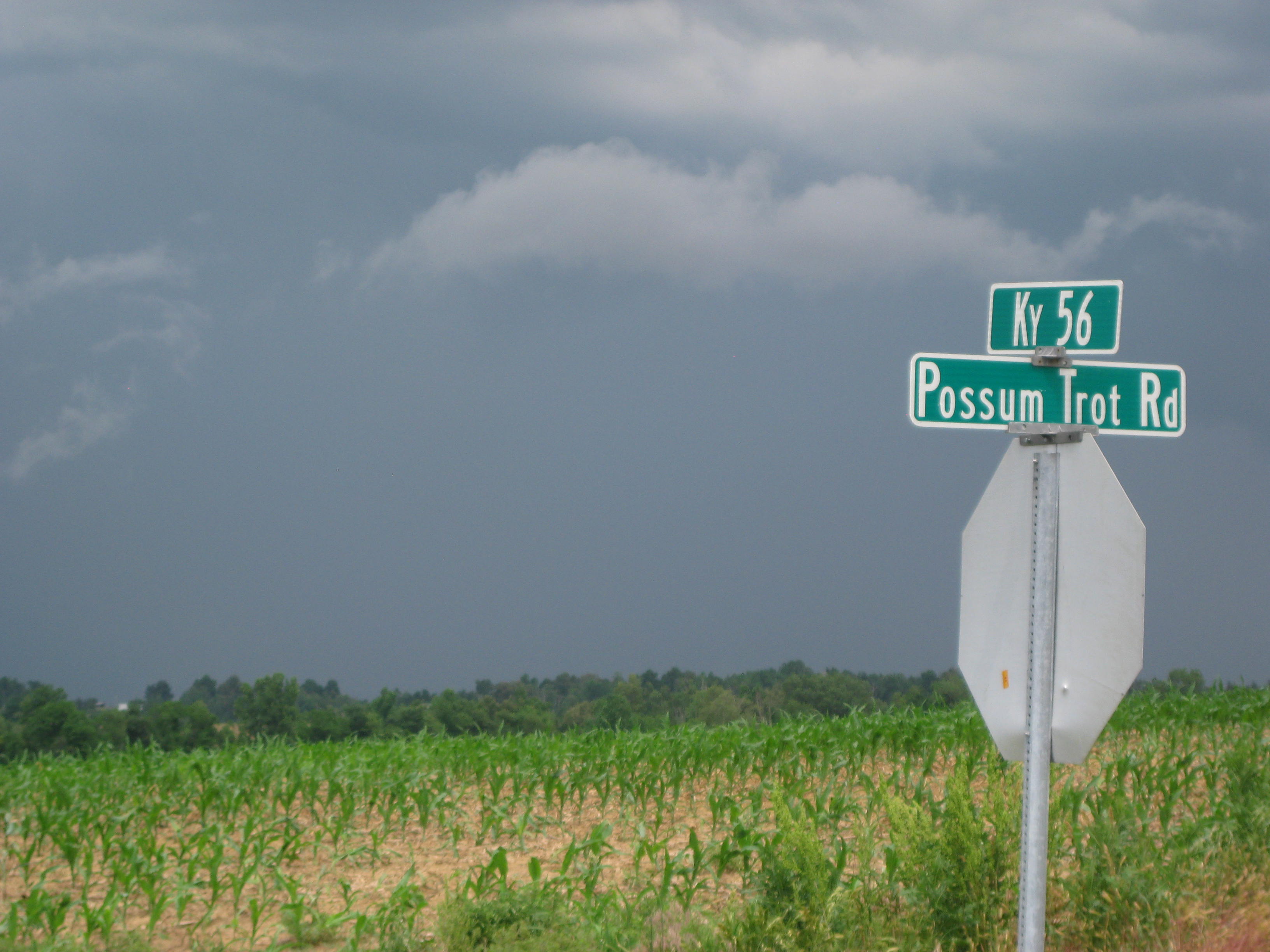
Stats:
Miles: 36.71
Calories: 3,133
Top Speed: 31.4
Average speed: 11.3 (that’s a tailwind!)
We got up at 6am and then went to the café/Starbucks to post our blogs and get some caffeine into our veins. We finally packed up and left about 10 am, a tad late, but we wanted to enjoy every moment of the Marriott. We felt like queens with scrubbed skin, clean clothes, washed hair, and a restful sleep.
We rode about 3 miles to Krogers/Fred Meyer to pick up supplies. Put me in a health food store, which Kroger has, and I am in my “happy place”. Since I had not had any breakfast I bought: 2 grapefruit cups, a Coconut milk yogurt, and 2 hard boiled eggs. I also bought 2 peaches and mini carrots to enjoy later. Other staples included more salmon and Luna bars.
We met Yvonne at Krogers, we shared about out trip and she made a donation. Thank you Yvonne!!
We were excited to head toward Sebree as that was where my second set of cycling clothes, that I had left in Lookout, KY, were to be forwarded and I was getting really eager to have a change of clothes.
We headed out of town about 11:45am. As we cruised through downtown the sirens blared. With thunder clouds on the horizon I was concerned it was a weather warning. A few miles down the road, at a stoplight, Lisa ask a driver, “Was that siren a warning?” I wasn’t, it was the noon hour siren that blares every Friday. Whew! I was glad to hear that.
The road heading west was nice and flat, a real delight after suffering through the hills of eastern KY. We made a pit stop at a gas station/diner for some OJ and Lisa picked up a burger. We only stayed about 20 mins as we were keeping an eye on the storm brewing just east of us.
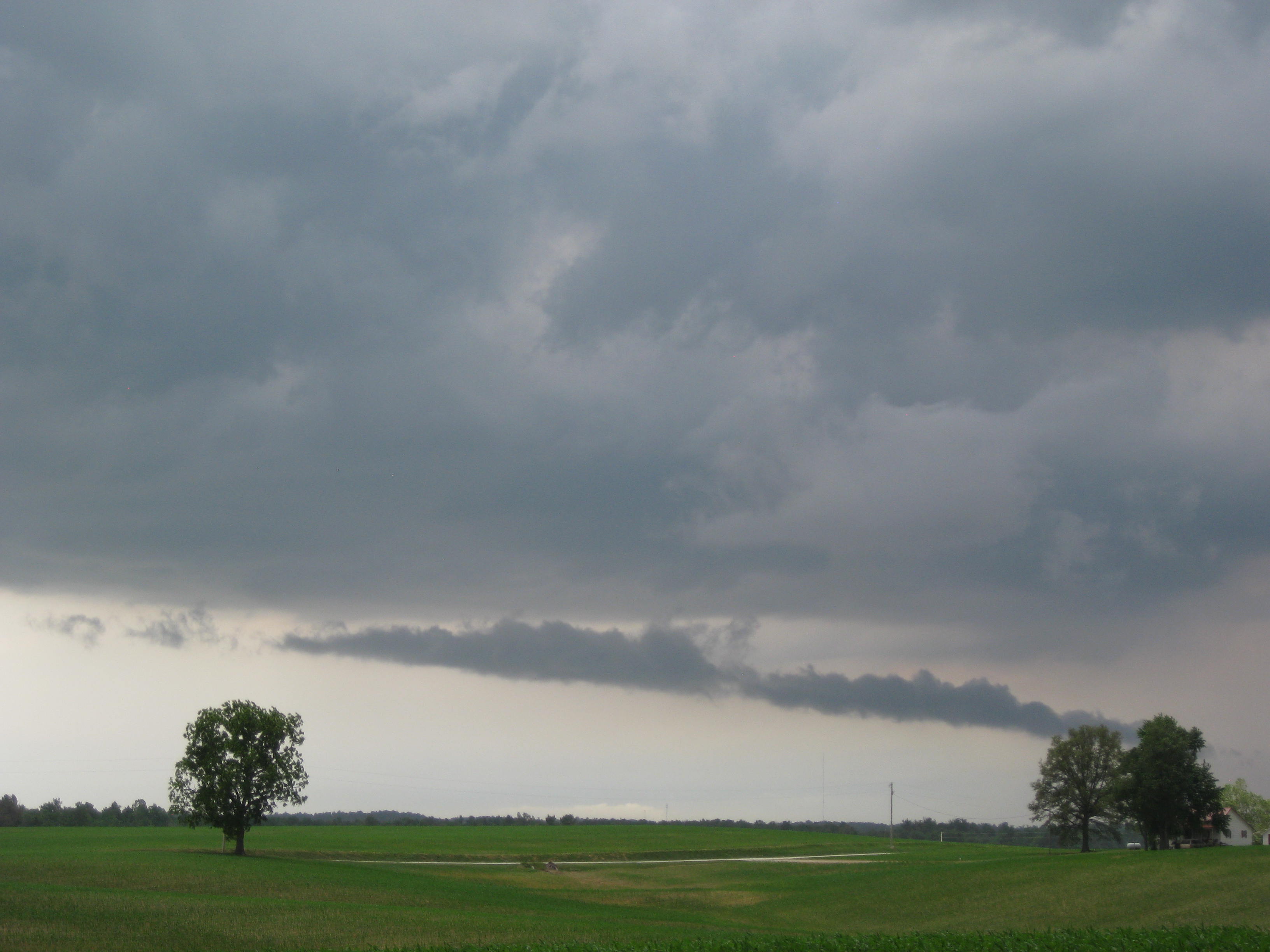
The storm was creating a tailwind so we took advantage and sailed along at 15-17mph. As usual we had more ups and downs as you can see from the picture the road is like a roller coaster. That little dot on the roller is Lisa.
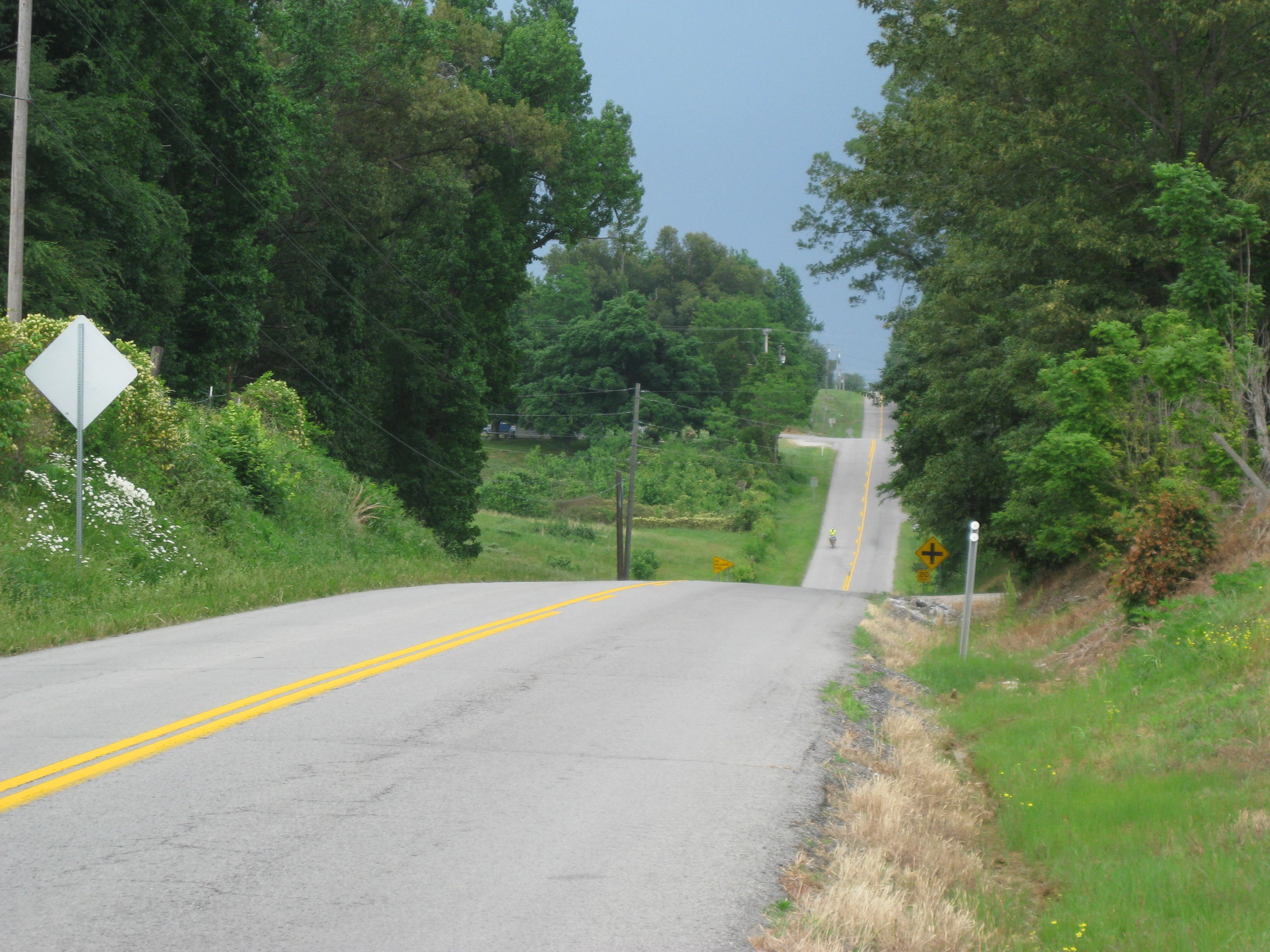
More miles down the road we met a very nice family at a Catholic Church; they had just had services for their mother /grandmother who had passed. They invited us to take shelter in the church if we needed to but the storm looked like it was starting to move away from us as we zigged and it zagged.
As we passed into Sebree I noted the coal barges and refinery in the distance.

The tailwind had followed us the whole way from Owensboro so we decided this was one of our best cycling days.
With the tailwind I hurled into Sebree searching for the post office. It was nearing 4pm and I desperately wanted my cycling clothes and Lisa wanted her super light weight table she had originally left in NC. She sent extra stuff home in Berea so she decided you could now have her table back. It is a very nice table (Helinox). We got to the post office at 5mins to 4pm. The bad news, none of our packages had arrived.
We were told they would continue to forward them on to us as needed. We headed to our hostel, the local Methodist Church. The church had a wonderful set up for cyclists with a shower and full kitchen.
I made a big plate of GF spaghetti with salmon for dinner, worked on my computer, and went to bed around 10:30pm.
Picture time:
“Sometimes ya just got to stand in a mud puddle”!
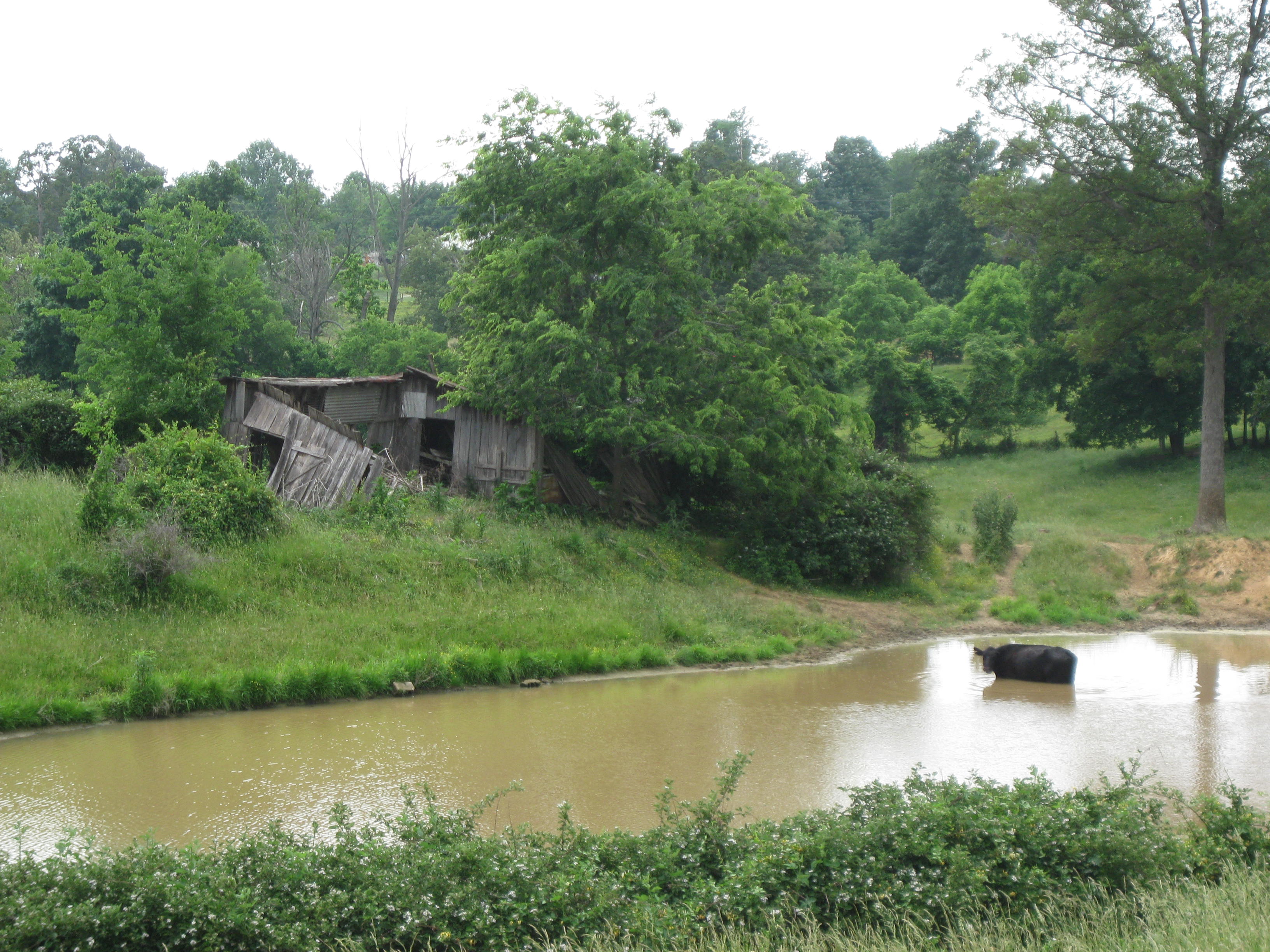
… I’ll keep you posted.


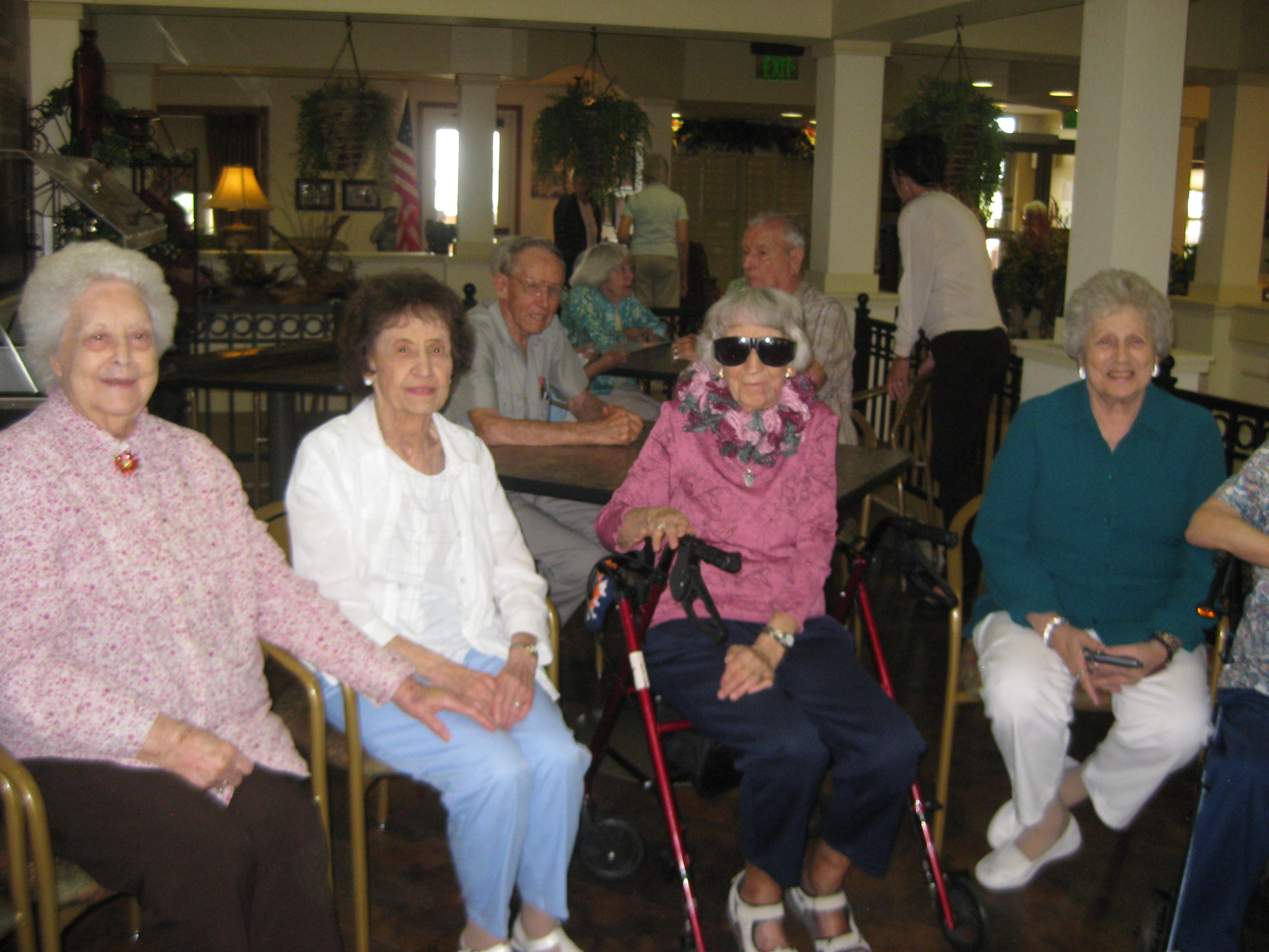
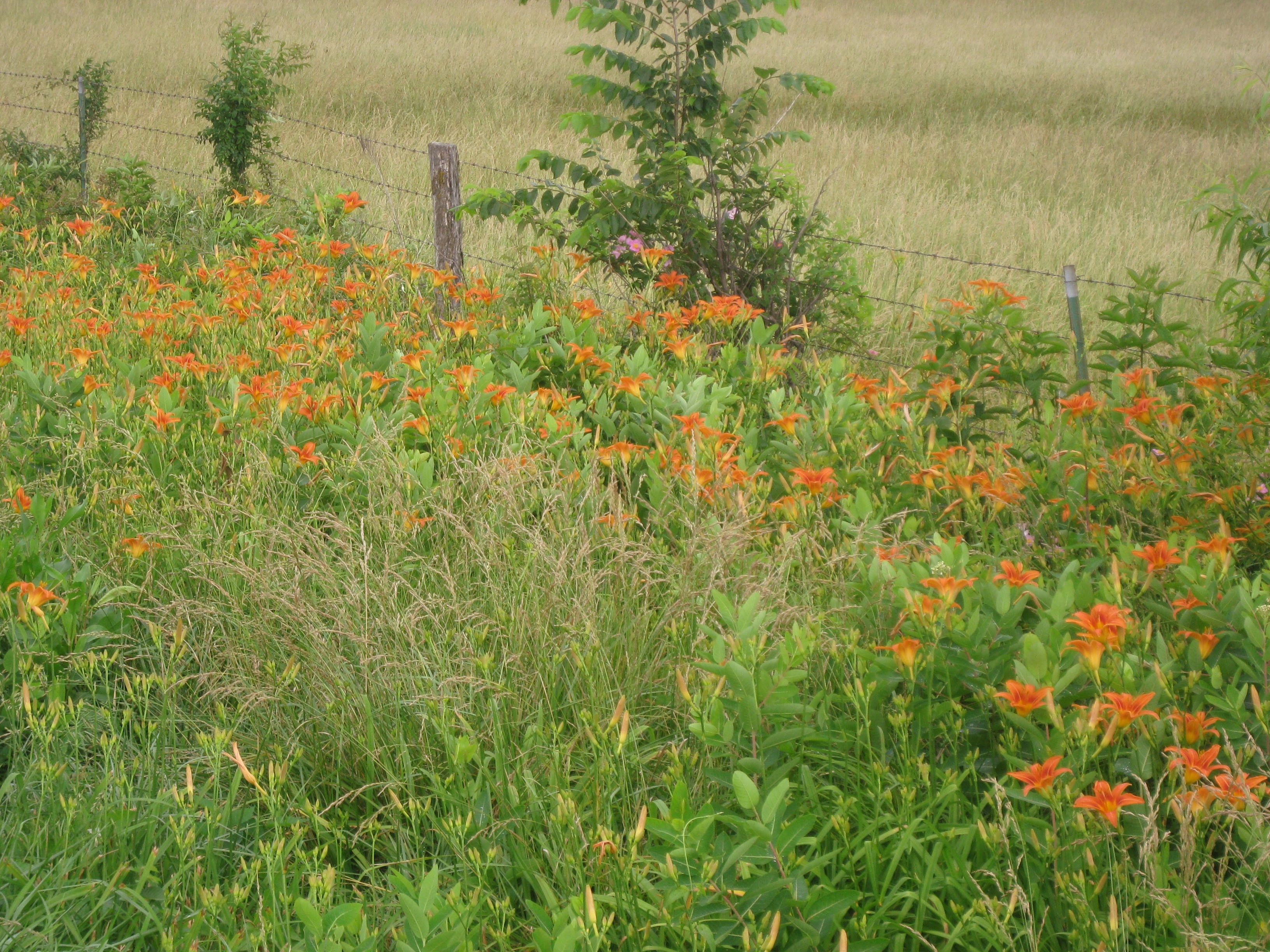